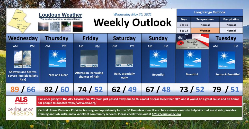
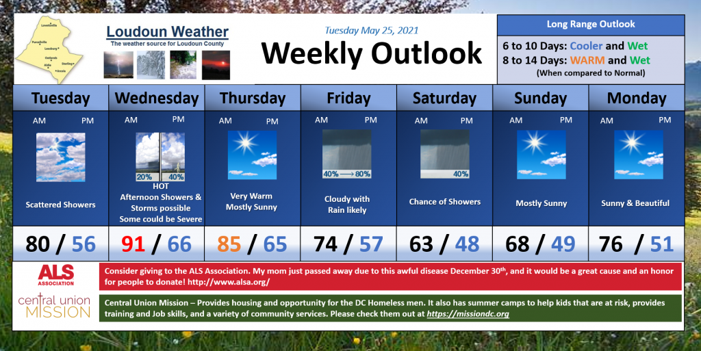
Short Term Outlook
Warmer today and pretty cloudy. Highs will get to near 80. About the same for Wednesday with a chance of a shower and MAYBE a Storm
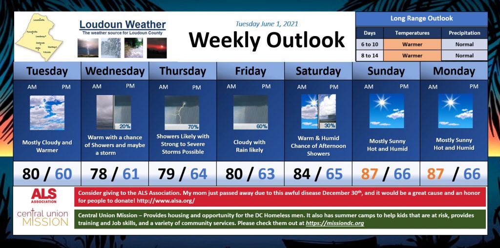
Mid Term Outlook
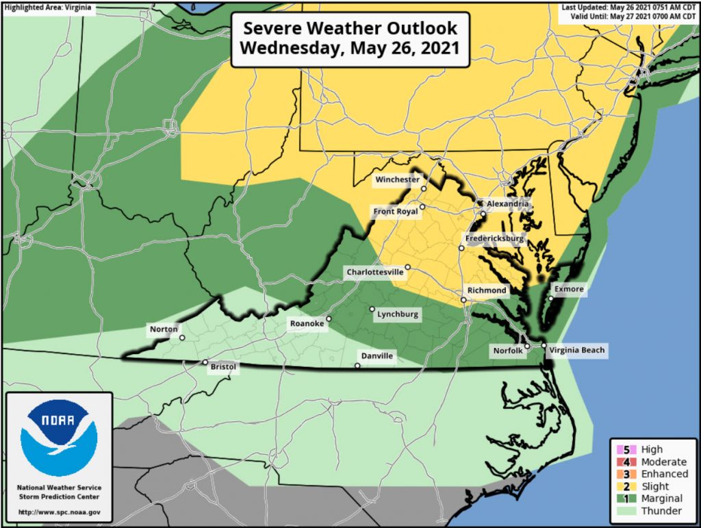
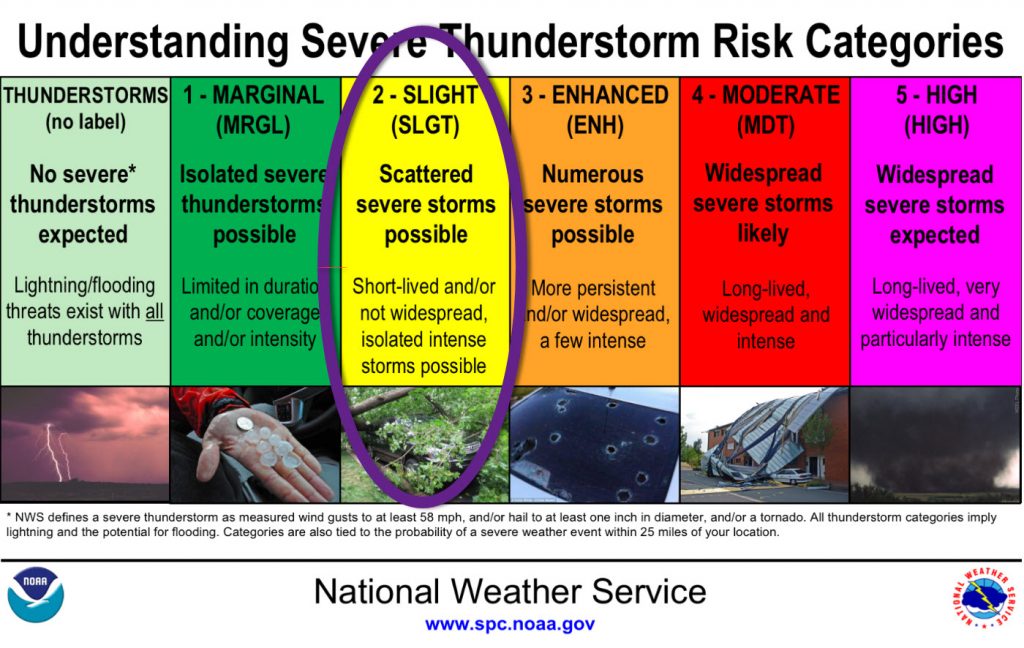
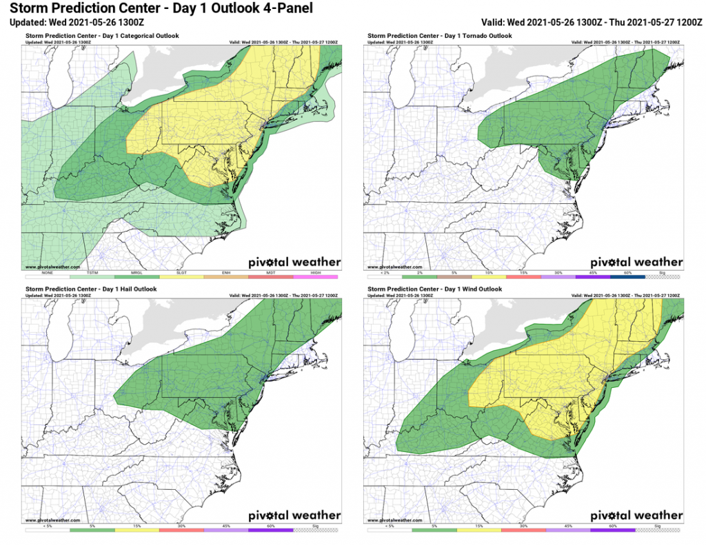
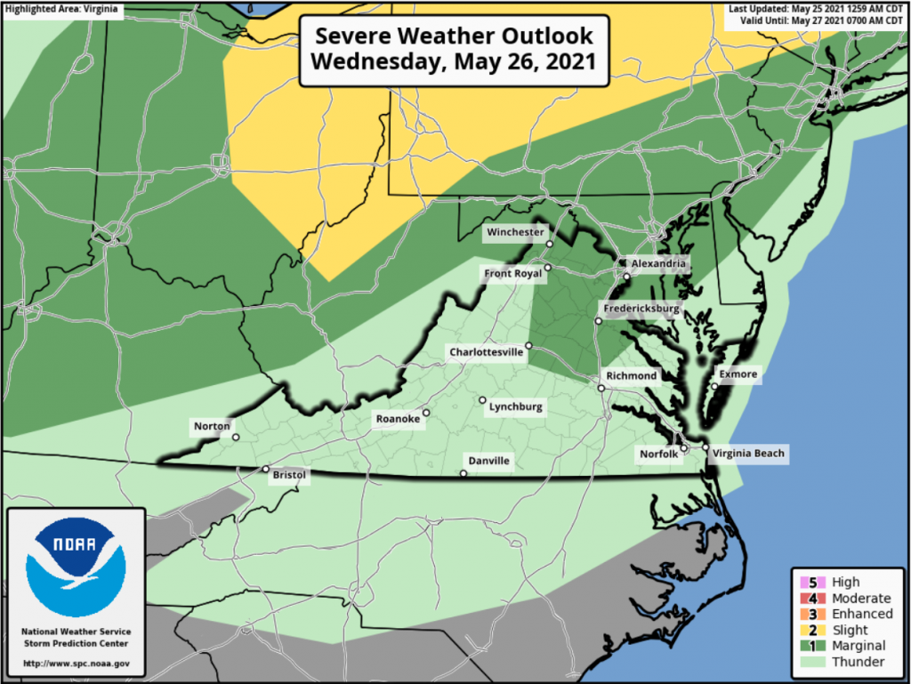
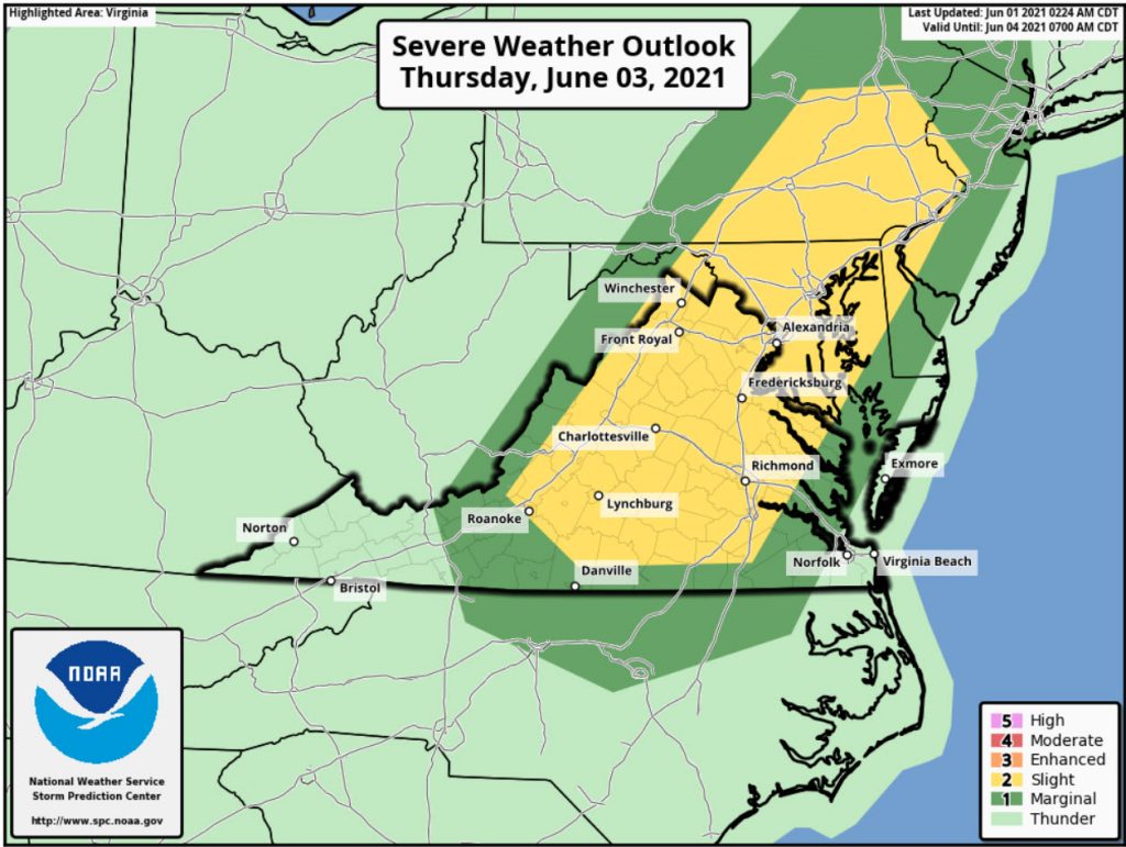
There is a good chance of showers and storms Thursday and Friday. Highs will be around 80 and the humidity will be higher. There is a chance that the Thursday storms could be severe! The Storm Prediction Center has outlined the area for a slight risk for severe storms
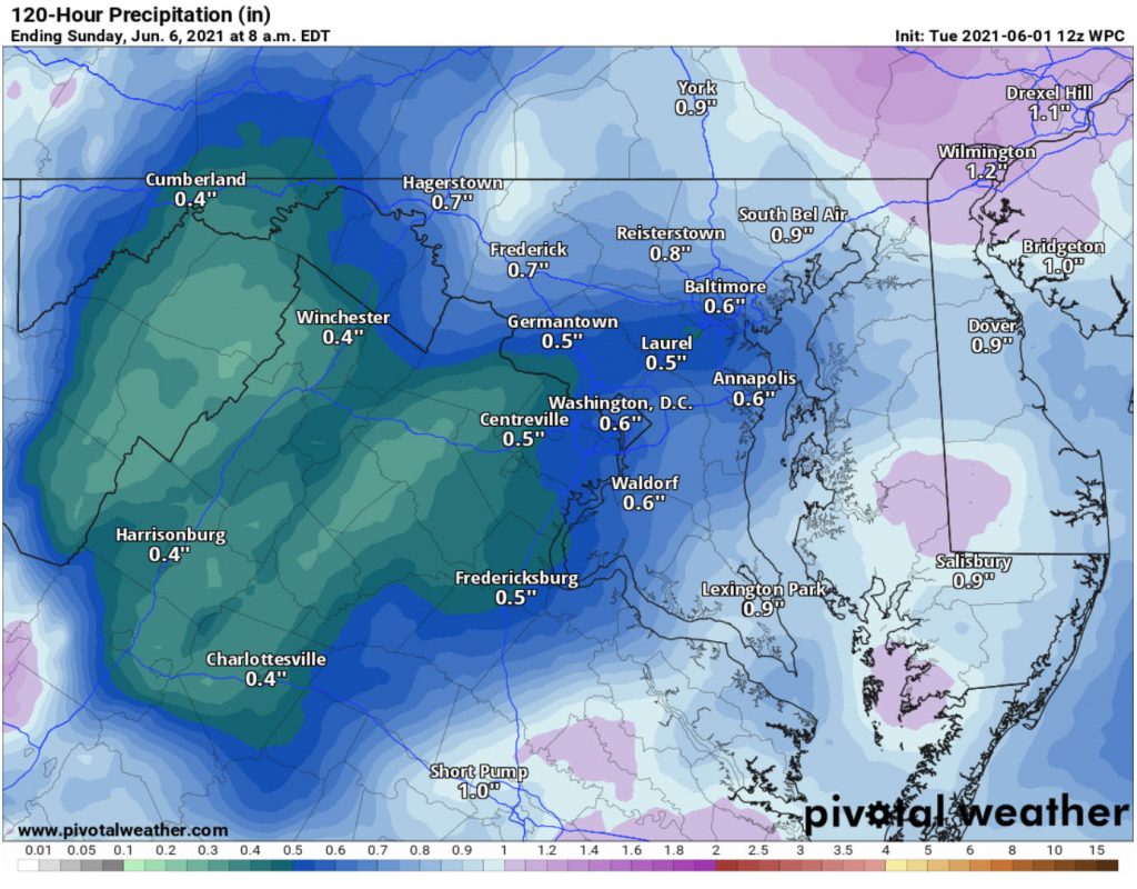
The Rain outlook through Sunday is not too much. This is from the Weather Prediction Center.
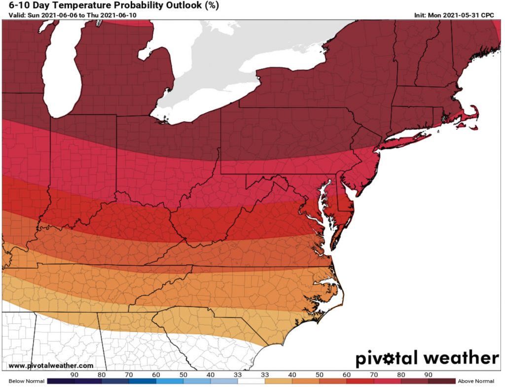
Longer Term Outlook
Things start looking summer-like with highs pushing into the Mid and upper 80s this weekend. The warmer/hotter trends look to continue into next week.