Super HOT TODAY! Strong Storms are possible tomorrow and Friday.
We could hit 100 as we are on track based on the time of day and current temperature near 90 at 11am.
* Today – Hi 99 Lo 71
* Thursday – Hi 95 Lo 68 – 50% Chance Storms – some strong possible
* Friday – Hi 89 Lo 66 – 60% Showers & Storms – some strong possible
* Saturday – Hi 85 Lo 66 – 70% Chance of showers and storms
* Sunday – Hi 80 Lo 66 – 50% chance of showers
* Monday – Hi 83 Lo 62 – Nice!
* Tuesday – Hi 82 Lo 60 – 30% chance of showers
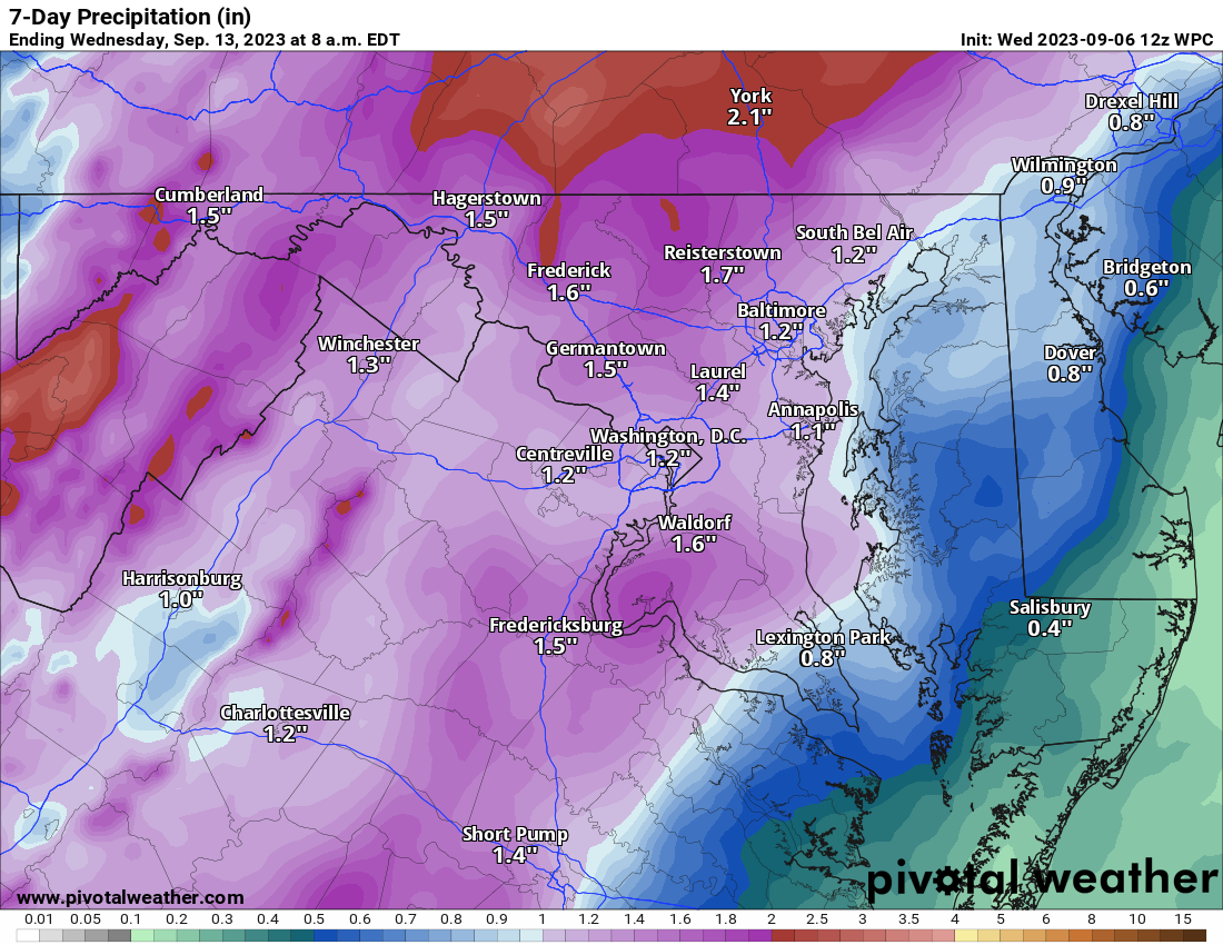
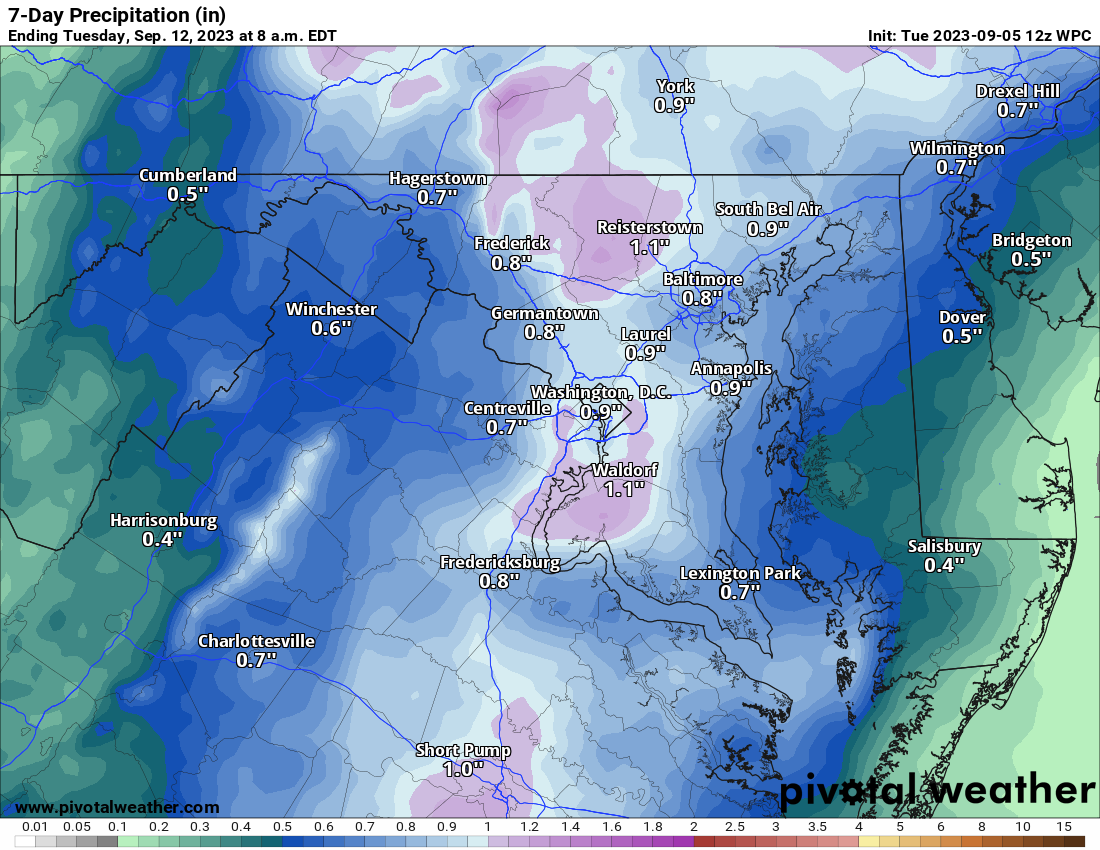
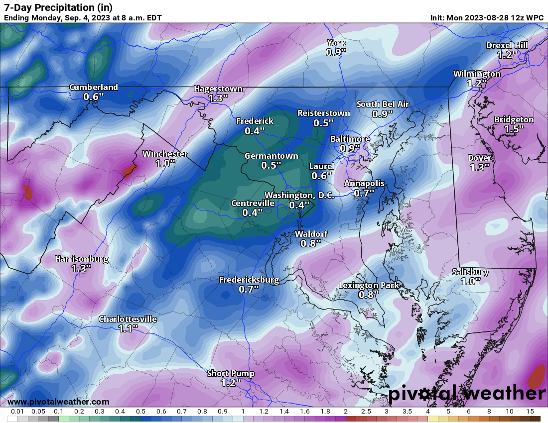
The amount of rain we get over the next 7 days is not certain. There were some drier trends on the models yesterday, but it seems we could see between 1 and 2 inches of rain, but thunderstorms could help locally.
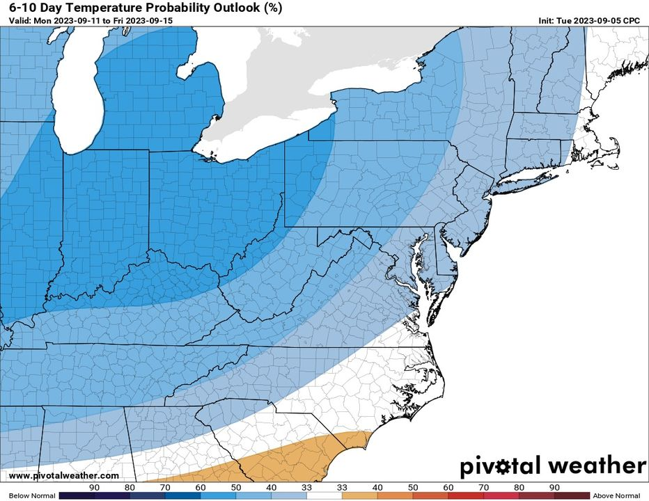
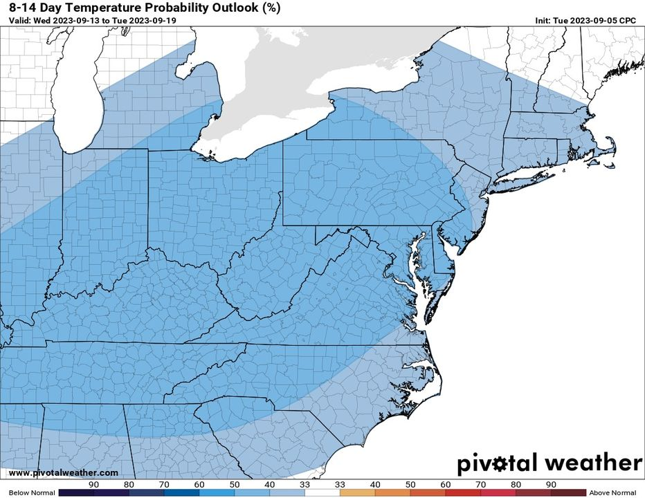
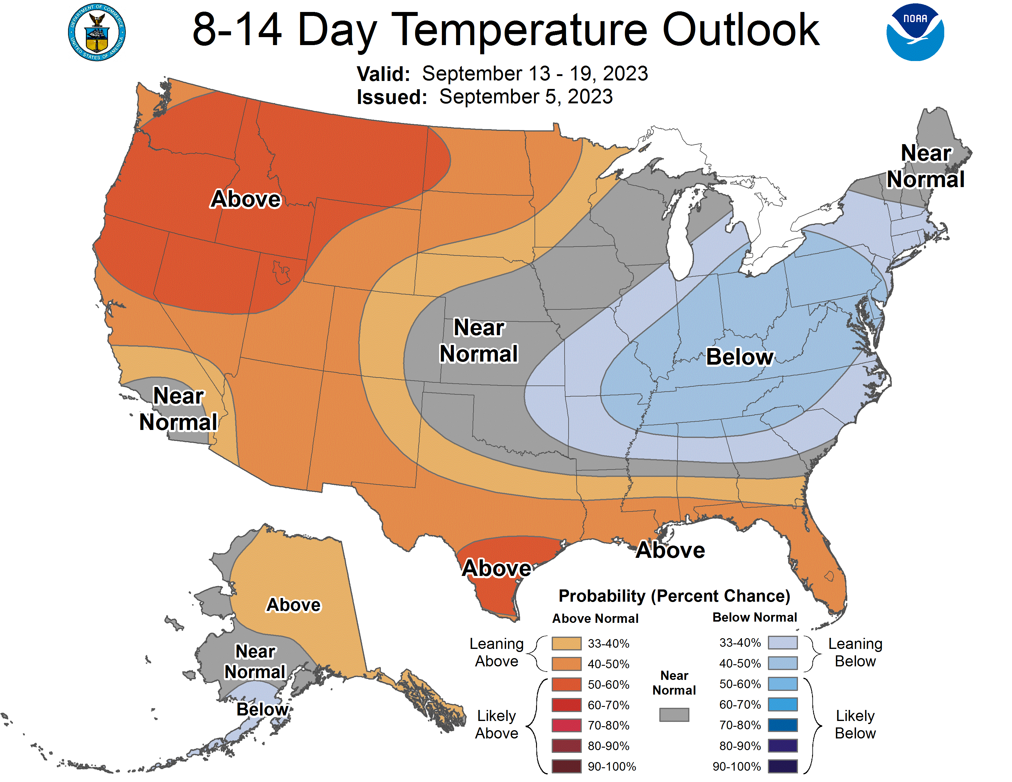
The trend in the longer range is better for rain chances and below-normal precipitation!
Attached
* Precip the next seven days
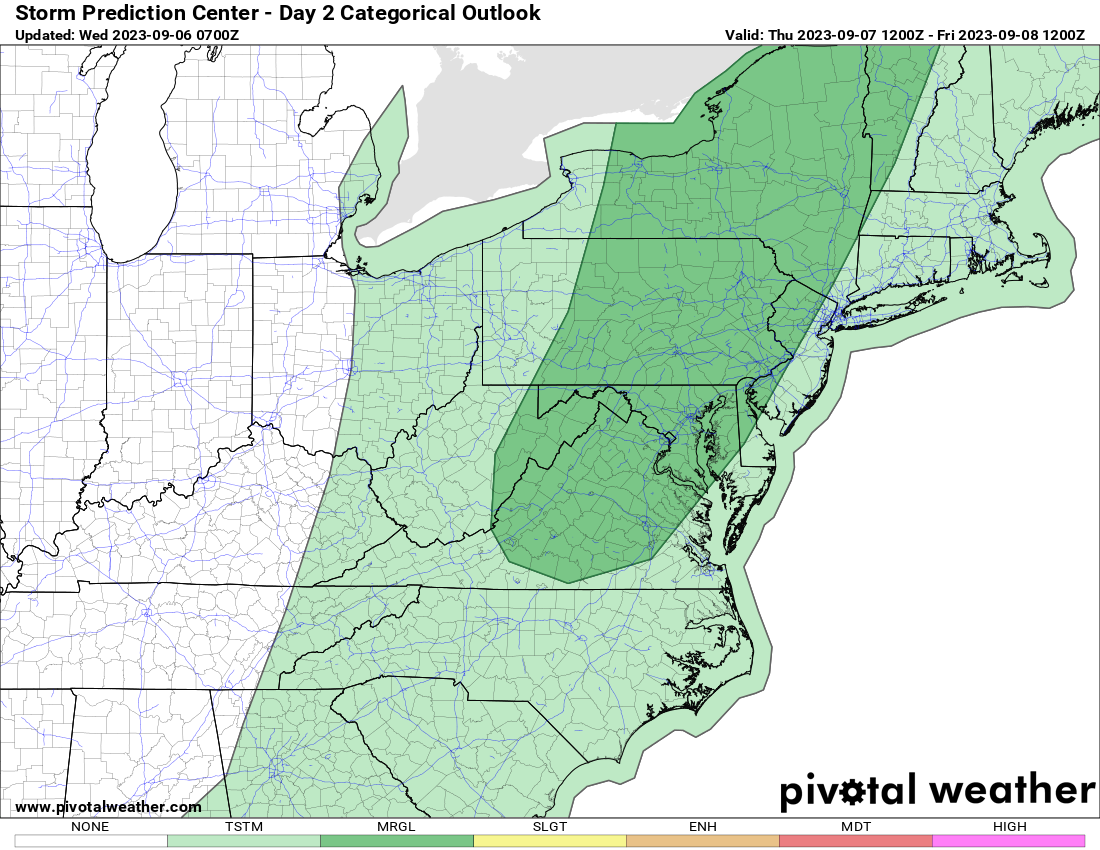
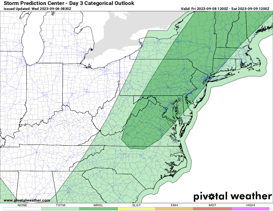
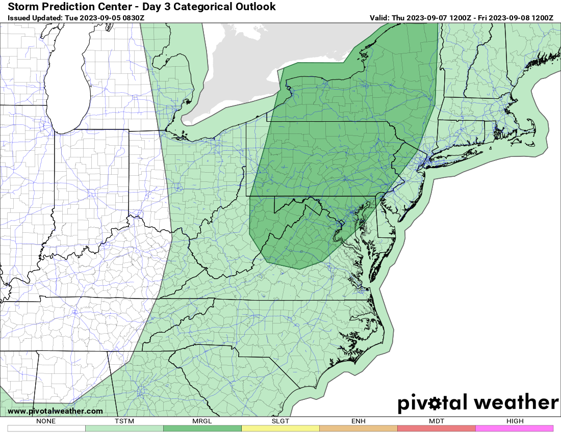
* Storm Prediction Center Storm Outlooks for Tomorrow and Friday
* Long Range temperatures for the 6 to 10 and 8 to 14-day periods