☁️ Unsettled Sunday, with a chance of showers and storms
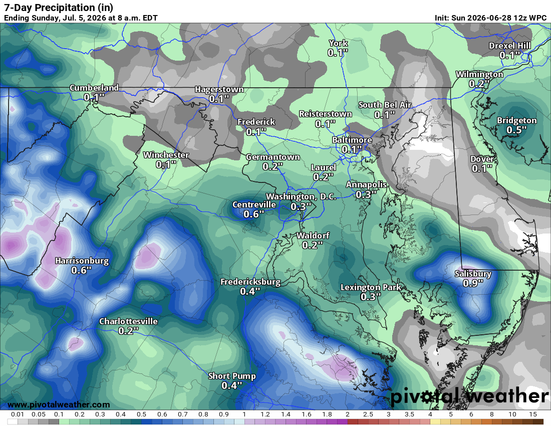
Clouds with scattered showers and a few storms are around today, with locally heavy rain possible in spots. Heading to fireworks tonight, like in Hillsboro? Watch the radar early evening. Find a show near you at https://nova4th.com
🌫️ Best Day of the Week Tomorrow
Patchy fog early, then clearing skies for a hot, humid afternoon. Honestly the nicest day coming up.
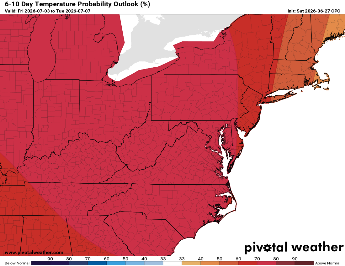
🥵 Heat Cranks Up Fast
Tuesday steps up the heat, and Wednesday through the Fourth of July brings a serious, dangerous heat stretch. Highs will push past 100, and with humidity factored in, Thursday and Friday will likely feel near 110 or higher. Expect heat advisories and possible extreme heat warnings. Limit afternoon sun, stay hydrated, and check on anyone without good shade or AC.
⛈️ Rough Pattern Late Week
A northwest flow (upper-level wind flow) sets up late week, a setup that can lend itself to gusty thunderstorms. Worth watching as we go through the week.
The forecast:
Today: Hi 80 🌦️50% Lo 66 🌙 – Chance of showers and thunderstorms, patchy fog possible in the morning and overnight
Monday: Hi 85 ⛅ Lo 66 🌙 – Dense fog early morning, otherwise partly sunny
Tuesday: Hi 90 ☀️ Lo 70 🌙 – Patchy fog before 8am, otherwise sunny
Wednesday: Hi 98 ☀️ Lo 74 🌙 🥵 Sunny and hot
Thursday: Hi 101 ☀️ Lo 76 🌙 🌡️ Sunny and hot
Friday: Hi 102 🌤️30% Lo 74 🌧️30% 🌡️ Sunny and hot with a chance of showers and thunderstorms, showers and storms possible overnight
Independence Day: Hi 97 🌤️30% Lo 71 🌧️ 🌡️ Mostly sunny and hot with a chance of showers and thunderstorms
#loudoun #loudouncountyva #vawx #loudounweather #loudounva #virginiaweather
Please support Tree of Life Ministries, an important organization to me! https://www.tolministries.org
Facebook: https://facebook.com/loudounwx
Twitter: https://twitter.com/loudounwx
Instagram: https://www.instagram.com/loudounweather/
On the Web @ https://loudounweather.com