This is the Loudoun County Weather Outlook for July 21, 2020
Another Hot day!

Weather forecasts and information for all of Loudoun County, Virginia. Including Leesburg, Aldie, Waterford, Ashburn, Sterling, Dulles, Hamilton, Purcellville, South Riding. Loudoun Weather is your source for Loudoun County weather forecasts, weather radar and more.
This is the Loudoun County Weather Outlook for July 21, 2020
Another Hot day!
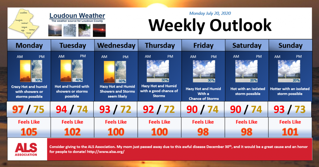
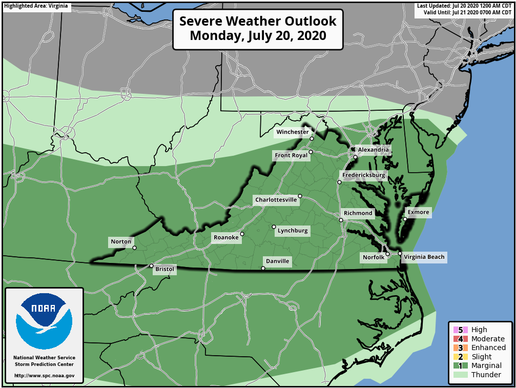
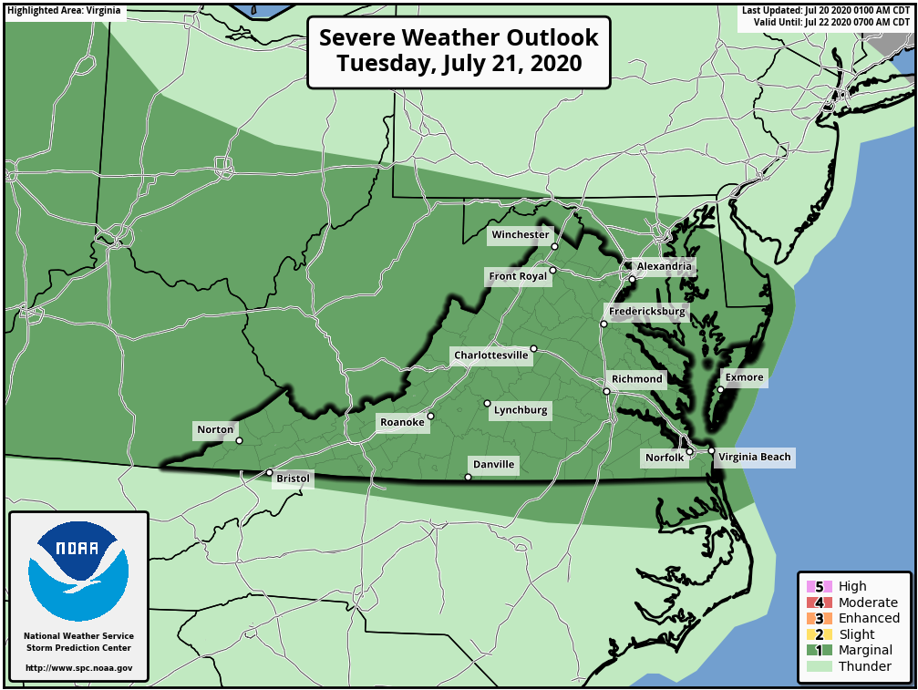
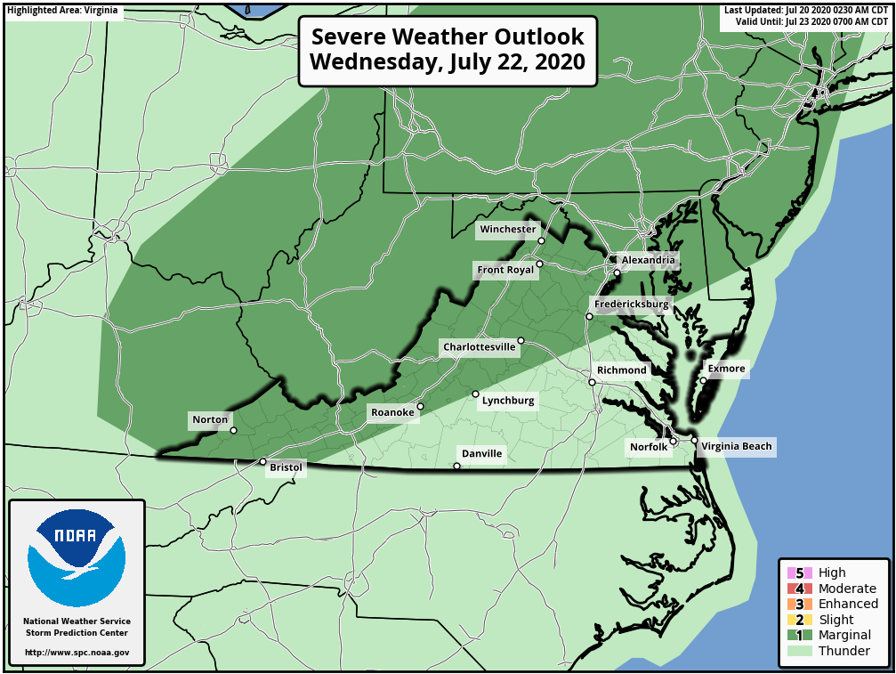
7/20/2020 – Just plain HOT! We have a chance of storms this afternoon, tomorrow afternoon, and a better chance on Wednesday! Strong storms are possible today through Wednesday. Super hot today but slowly getting somewhat cooler through the week. We could heat right back up next Sunday! Take it easy!
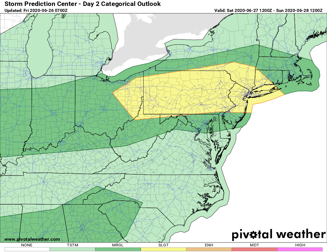
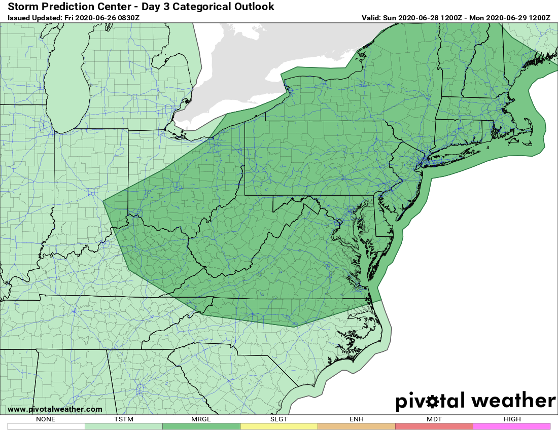
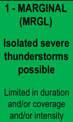
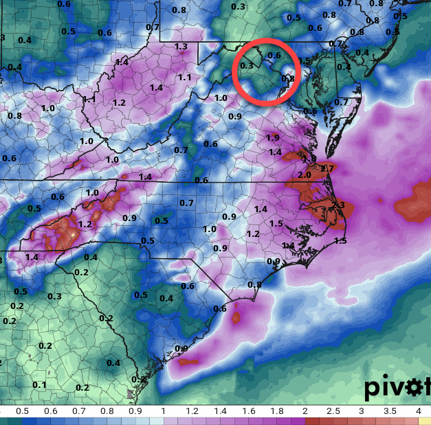
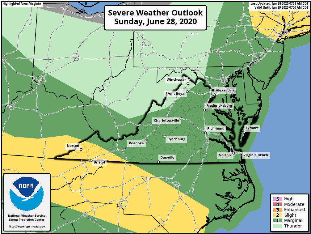
Below – Storm threat for the next three days shows a marginal threat of severe.
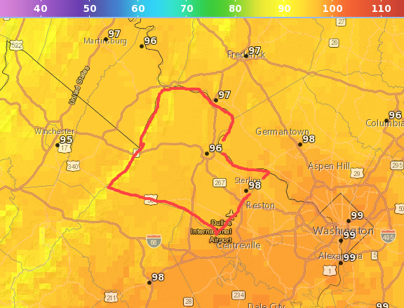
Today’s obvious hot temperatures
Precipitation outlook looks way too light for what we need. Remember that any storm may bring more rain than the outlook!.
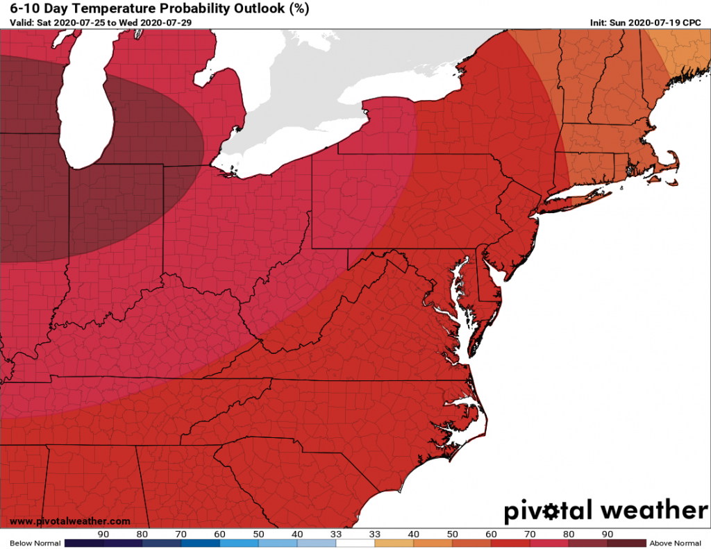
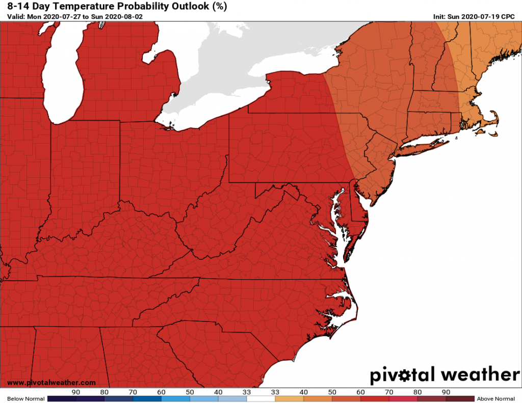
6 to 10 and 8 to 14-day outlook for temperatures showing still above normal seeing likely.
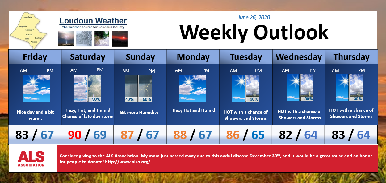
6/26/2020 – Nice and sunny day. Getting HOT tomorrow with a high near 90 and a chance of afternoon showers and storms., some could be strong to severe. A little cooler Sunday, but a better chance of showers and storms, again some could be strong. Hot Monday, and then a chance of Showers and Storms daily, but temps getting down into the low and mid-80s starting Tuesday. As best I can tell, the 4th looks like the 80s with a chance of showers and storms.
Thank you for the AMAZING pictures yesterday of the many rainbows and storm clouds as well as the hail! It was a busy day! I should have been a bit more vigilant in giving you a heads up about the severe threat!
If you missed them head over to https://facebook.com/loudounwx
One Note: There are pockets of west-central and Southwestern Loudoun getting pretty dry and in need of rain. The rain threats we have for the next week will again be hit or miss, so it is starting to be a strain. Meanwhile, areas in eastern and northern Loudoun are running well above normal in rainfall. We will see how this continues, but lawns and agriculture are probably experiencing some of the dryness or excessive wetness depending on location. It is a bit interesting.
Have an awesome weekend!