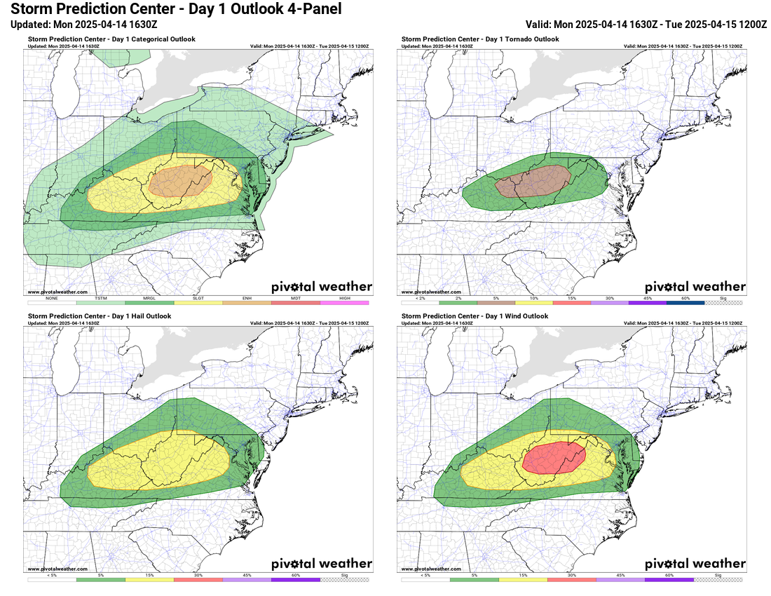
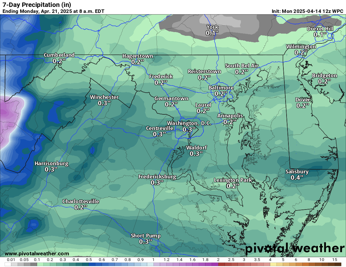
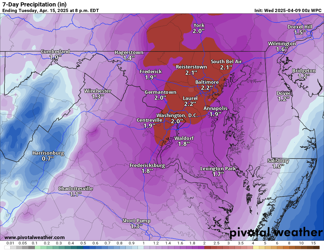
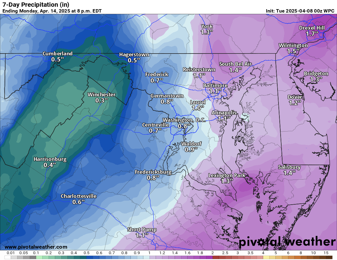
4/14/2025 – SEVERE RISK THIS EVENING—Showers and storms this evening could bring severe winds, hail, and even an isolated tornado. These storms would likely be between 8pm and midnight. The most significant risk from these storms will be wind. We need the rain, and the totals will be a quarter to a half inch, unless we can get some better thunderstorms. There is also a chance that no storms form, or they do not travel over your home, and you get some lighter showers. So this is a challenging forecast.
After this front comes through, we could still see a shower tomorrow, and we will definitely see winds. It will be cooler and feel much cooler than today.
It's a cool middle of the week, but it is starting to look like we could see a nice weekend, even with some showers possible on Saturday.
The longer range looks to turn warmer and we have a slightly higher chance of precipitation.
The forecast:
Today: Hi 70 🌤️ Lo 55 ⛈️ 80% – Partly sunny with a chance of thunderstorms and showers developing tonight, tapering off before dawn
Tuesday: Hi 62 🌦️30% Lo 41 🌙 – Partly sunny and breezy with a chance of showers through early afternoon, becoming partly cloudy and windy overnight
Wednesday: Hi 55 ☀️ Lo 36 🌙 – Mostly sunny and breezy, becoming mostly clear and chilly overnight
Thursday: Hi 61 ☀️ Lo 40 🌙 – Sunny skies continuing through the day, with a few clouds overnight
Friday: Hi 70 🌤️ Lo 57 ☁️ – Partly sunny during the day, becoming mostly cloudy by night
Saturday: Hi 80 🌦️40% Lo 52 ☁️ – Mostly cloudy with a chance of showers throughout the day and night
Easter Sunday: Hi 67 🌤️ Lo 44🌙 – Mostly sunny with pleasant conditions
#loudoun #loudouncountyva #vawx #loudounweather #loudounva #virginiaweather
Please support Tree of Life Ministries, an important organization to me! https://www.tolministries.org
Facebook: https://facebook.com/loudounwx
Twitter: https://twitter.com/loudounwx
Instagram: https://www.instagram.com/loudounweather/
On the Web @ https://loudounweather.com