1/14/2026
🌥️ Last Mild Day Before the Chill
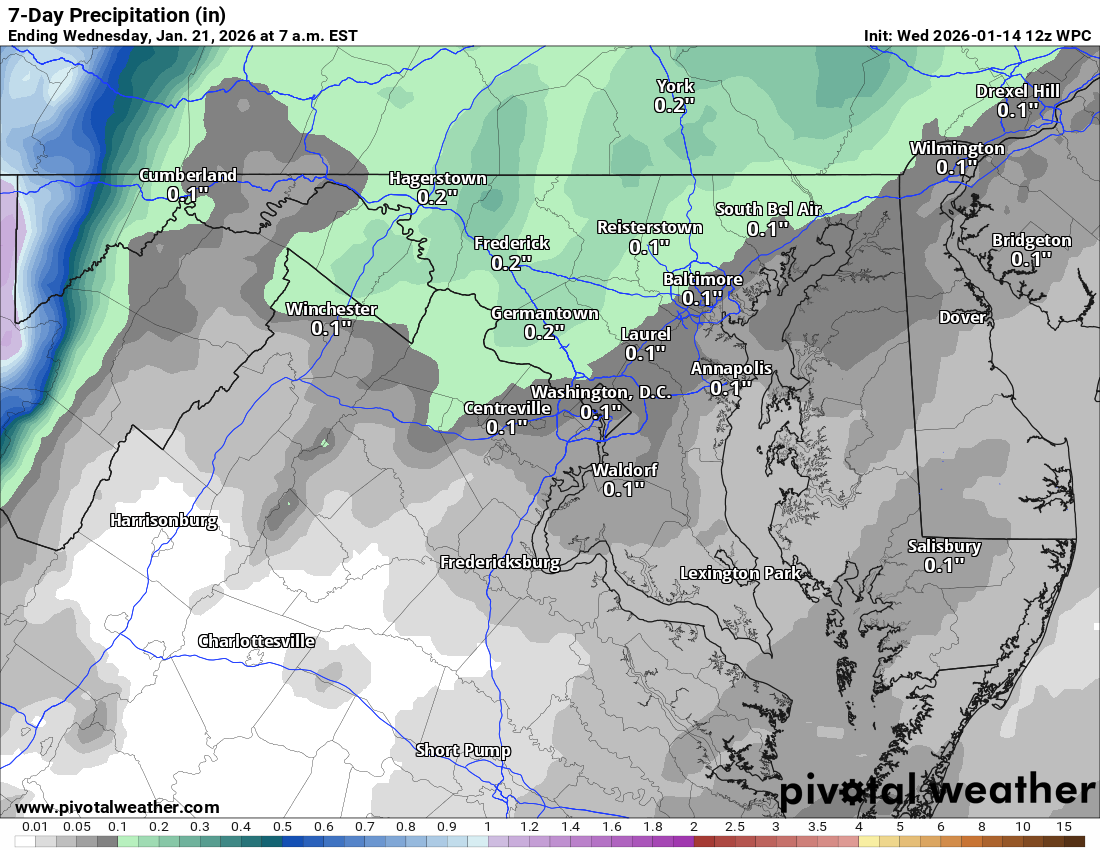
Today brings cloudy skies with highs near 51°F. A few morning showers are possible with steadier rain by afternoon and evening. By tonight, some light snow showers may mix in with just a dusting expected in spots.
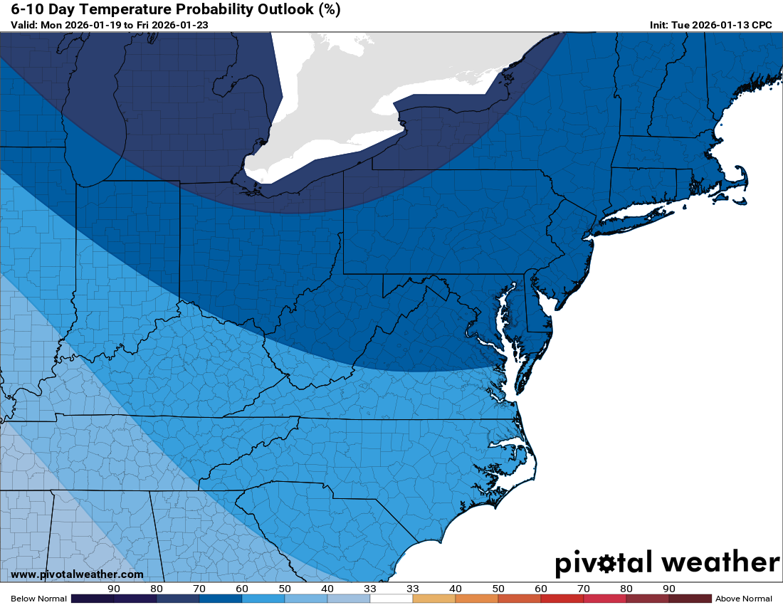
🌬️ Arctic Air Arrives Thursday
Brace yourself for a big drop in temps. Thursday will be blustery and cold with highs only in the upper 20s and lows dropping into the teens overnight. It’s going to feel bitter out there.
🌨️ Watching the Weekend
Friday rebounds slightly with highs in the 30s. Saturday and Sunday remain uncertain. Some models hint at snow Saturday, but the American model shows heavier snow possible Sunday, mainly southeast of our area. Stay tuned.
❄️ Cold Holds Strong Next Week
Next week continues the wintry pattern with highs in the 20s and daily freezing temps. Breezy conditions on Monday will make it feel even colder. Winter is back!
Today: Hi 51 🌦️40% Lo 24 🌧️70% – Cloudy with a chance of rain during the day, transitioning to likely rain and a chance of snow overnight, becoming windy
Thursday: Hi 28 🌤️ Lo 18 🌙 – Mostly sunny and blustery during the day, clear and cold overnight
Friday: Hi 35 🌤️ Lo 27 ☁️ – Mostly sunny, becoming partly cloudy at night
Saturday: Hi 42 🌦️30% Lo 22 ☁️ – Partly sunny with a chance of snow in the morning, becoming mostly cloudy overnight
Sunday: Hi 30 🌤️ Lo 17 🌙 – Mostly sunny and cold
M.L.King Day: Hi 32 🌤️ Lo 15 🌙 – Mostly sunny, remaining clear and very cold overnight
Tuesday: Hi 27 🌤️ Lo 12 🌙 – Mostly sunny, with a clear and frigid night
#loudoun #loudouncountyva #vawx #loudounweather #loudounva #virginiaweather
Please support Tree of Life Ministries, an important organization to me! https://www.tolministries.org
Facebook: https://facebook.com/loudounwx
Twitter: https://twitter.com/loudounwx
Instagram: https://www.instagram.com/loudounweather/
On the Web @ https://loudounweather.com