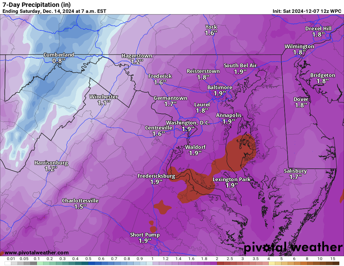
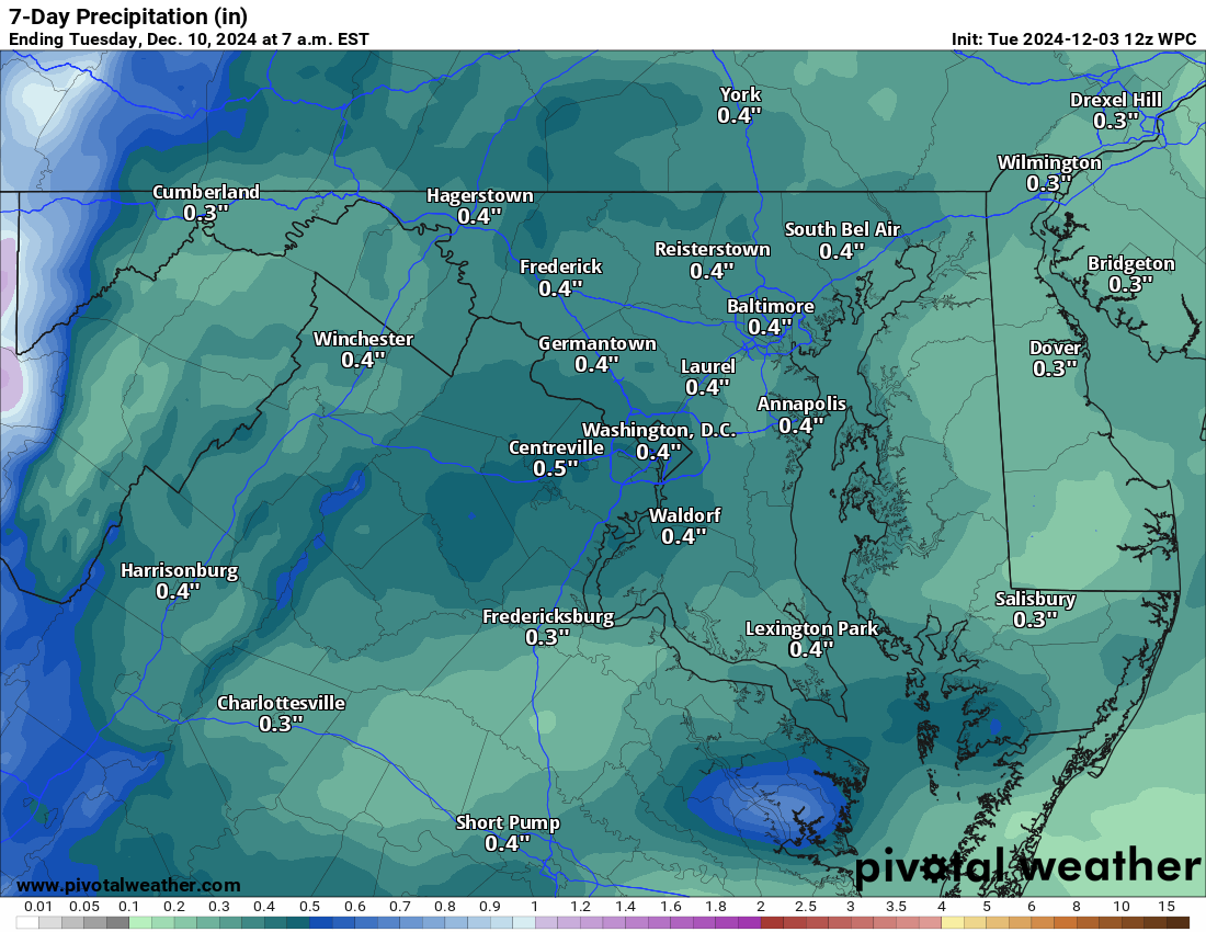
Skip to content
Loudoun Weather

Loudoun Weather

Weather forecasts and information for all of Loudoun County, Virginia. Including Leesburg, Aldie, Waterford, Ashburn, Sterling, Dulles, Hamilton, Purcellville, South Riding. Loudoun Weather is your source for Loudoun County weather forecasts, weather radar and more.

  • Home
  • OCC
  • Forecast
    • Aldie
    • Leesburg Virginia Weather
  • Radar
  • Severe
  • Precip
  • Conditions
  • Temps
  • Tropical
  • Winter
    • 2025 List of Winter Outlooks
    • Winter Impact Index
    • Snow Reports and Depth
    • Ice Impact
    • Ice
  • Articles of Interest
    • So why so hot? What causes heat in the Mid-Atlantic?
    • 10 ways to keep your home cool and save money!
    • June 29th, 2012 Derecho
  • Tweets
  • Toggle search form

Category: Uncategorized

January 27, 2021 – Winter Storm Outlook Discussion

Posted on January 27, 2021May 24, 2021 By admin No Comments on January 27, 2021 – Winter Storm Outlook Discussion

What is up with Sunday/Monday.

My current confidence levels:

  • 85% we see some snow
  • 75% we see an inch or more
  • 60% we see 4 inches or more
  • 55% we see 6 inches or more
  • 45% we see 8 inches or more
  • 30% we see 10 inches or more
  • 25% we see 12 inches or more

I am very torn on this system

The American Model shows about 4 to 8 inches.

The European still shows a big storm, especially for the western areas.

What is so different about these two models?

I will summarize.

To the north, we have some “blocking” occurring that is causing storms to slow down as they head north. The blocking stops the storminess and the energy of the storm from going further north when the storm is west of Virginia. The blocking also keeps colder air in place. If the storm gets too far north (like the American Model shows) then we get into southerly winds since the low is due west or northwest of our area, and the colder air is eroded out of the area when the precipitation comes. In this setup, on the American Model, we have had about 4 to 8 inches of snow. The point where the winds change from the north to the south is a warm front (Warm air advancing into colder air). Once the warm front is north of you, you will change to rain or a mix. We do have the added help of Cold Air Damming in the region, so the warm air can push overtop the colder air and we will mix with sleet and freezing rain before seeing just plain rain. One note, however, is that once the warm front pushed through the precipitation will often cut off as the main low is way west of the area. The moist air overrunning the warm front and being pushed into our area is not uncommon to cause snow. Our failure earlier this week was related to this setup. We would have had more snow if the ground temperatures were colder. We will have cold air in place as we head into this Sunday’s event, so we will not waste the precipitation on getting the air cold. So we get the warm front assisted snow. Since the low and energy cannot push further north, they transfer this energy to the coastal front that is along or near the East coast. This Low-pressure system death to our west and transfer is known as a Miller B type set up.

Finally I can explain the potential and the potential busts for this forecast.
THE KEY is “WHERE and when does that transfer take place?”

Scenarios that would cause a “bust”

  • IF the transfer is at our same latitude or further north, we may get the front end snow, but not the snow from the new low pressure that formed off the coast.
  • If the Primary low remain strong and transfers the energy slowly, we get into southerly winds and get too warm for snow
  • If the primary transfer is just slow and we stay between the heavier precipitation from the primary low, and too far west of the coastal low.
  • Another potential impact to lesser amounts of snow will be how close to the coast the new low-pressure tracks. IF it gets too far inland the warmer ocean water could turn the snow to sleet. This does have some possibility and will need to be watched (especially eastern areas)

Now, we do pretty well in the American Model setup on Sunday, and we get into the warmer sector of the storm, but we may not have too much precipitation after the warm front aided snow so we get some drizzle. Then the new storm takes over, but it is too far north to get us any of the coastal aided snow. THIS has been the setup on the GFS for days, but even now it has upped the totals to more than 6 inches from this front end snow!

BUT, THE EUROPEAN model is different! The Primary low on the European does not make it as far north to get us into southerly winds, and transfers the energy to a Low along the front down in North Carolina! The low begins to strengthen and organize which is sending precipitation over us in light to, to increasingly moderate, and then heavy snow. Because it is organizing, it slows down its forward speed for almost 12 hours.. so we are getting snow the entire time…then, as it strengthens and lifts northwards, we get in very cold and heavy snow. This is the snow on the Northwestward side of the system that has the moisture from the ocean, but is also pulling in the cold from the north! It is referred to as the Cold Conveyer Belt (or CCB). We get real heavy snow from this, and, sometimes, higher ratio fluffy snow which makes more snow with less moisture! We appear to get into this snow for a while on the European!

So now I will share the loops of the two models with the same system:

American (GFS):

European

So what does that mean for snow totals?

IF we trust the snow output, from the models, the totals are quite different!

American (GFS):

And now – the BIG DOG – European

SO WHICH ONE IS RIGHT?

It is all about the tracks, transfer of energy, timing.. etc!

I am leaning with a forecast of 6 to 12 inches, with the upside of 16 inches if all comes together correctly.

I will say, IF.. IF… IF the European is correct, the amount of snow may INCREASE for the region on the subsequent runs. It will also be windy!

That is the latest!

Uncategorized

January 27th, 2021 – Loudoun Weekly Weather Outlook

Posted on January 27, 2021January 27, 2021 By admin No Comments on January 27th, 2021 – Loudoun Weekly Weather Outlook

This is the same map I posted on https://facebook.com/loudounwx – Just wanted this here as well.

Weekly Outlook for January 21st – February 2nd, 2021

Uncategorized

January 26, 2021 Loudoun Weather Outlook

Posted on January 26, 2021January 26, 2021 By admin No Comments on January 26, 2021 Loudoun Weather Outlook
Weather Expected the next 7 days

2/26/2021 – What is next? Cold temps and then.. maybe.. a Snow Storm! After we clear up late today we now look to stay dry until Saturday Late through Monday when a winter system does look like it will visit the area. Unlike the system failure for Thursday, this system has a lot of support from all models! That gives me confidence that we will see some kind of weather. The question – How much and what types? I am leaning towards the idea that we get some snow and it will be enough to shovel. The upside potential is good, but we have been burned a lot by the setups this year. So, I will keep watching! Again, unanimous support of something happening from all models! Exactly what, when, and how much are all still a question! AND I HAD TO ADD.. Plenty of time for this to fail and become not a big deal.. or to become a REALLY big deal

Since this is on my Website – Here is the European model!

European Model Run Snow for Sunday – Monday January 31 and Feb 1 Storm

Compare that with the American Model

American Model Run Snow for Sunday – Monday January 31 and Feb 1 Storm
Uncategorized

1/17/2021 – Loudoun Weather Outlook

Posted on January 17, 2021January 17, 2021 By admin No Comments on 1/17/2021 – Loudoun Weather Outlook
Loudoun Weather Outlook for the week of January 18th

Colder conditions will be felt mid-week and next weekend. In general, the week looks dry. We will need to watch the longer range.

What about wintry weather?

One way to look into the possibility of wintry weather is by looking at weather models that blend a variety of possible outcomes. The next set of maps are that set up, but I will not be able to show these all the time as they belong to Weather Bell (if interested, check out https://weatherbell.com – too expensive for a hobby!) This is the European output for next Monday!

F0BAB623-6C83-42F0-96D0-FCF0801E510B.thumb.png.08f8567c37494662d77151a35d07423b.png

DO NOT GET SUPER EXCITED by the snow on the map as these show snow a lot and many times it does not come true! The thing that is interesting is the chance of at least 3 inches of snow in the next week is up to 60 to 70% – AGAIN, this can be incorrect, so we take it with a grain of salt, but I do like seeing the higher percentage.

449198C4-0027-4265-8AF7-24B45D77D380.png

The European is many times wrong, so lets not get ahead of ourselves.

We need to see this keep showing up. The thing that is a bit encouraging has been that both models show something around the same time. What is very discouraging is that both are SO VERY different in the may they get precipitation to fall! So I will keep watching!

All for now!

Uncategorized

12/7/2020 Loudoun Weather Outlook

Posted on December 7, 2020December 7, 2020 By admin No Comments on 12/7/2020 Loudoun Weather Outlook
image.png
Uncategorized

Posts pagination

Previous 1 … 64 65 66 … 84 Next
Latest Radar from the National Weather Service
National Weather Forecast from https://www.wpc.ncep.noaa.gov/#page=ovw
National Forecast from the Weather Prediction Center
Regional Precipitation
Precipitation Forecast from the National Weather Service
  • Instagram
  • YouTube
  • Facebook
  • Instagram
  • Facebook
  • YouTube

Join My Mailing List

Add My Alexa Skill

Loudoun Weather Outlook Alexa Skill

Listen To the Daily Outlook on Spotify

  • The Flood Warning has been cancelled.
  • The Severe Thunderstorm Watch has been cancelled.
  • The Severe Thunderstorm Warning has been cancelled.
  • Severe Thunderstorm Watch issued May 16 at 5:26PM EDT until May 16 at 10:00PM EDT by NWS Baltimore MD/Washington DC
  • Severe Thunderstorm Warning issued May 16 at 5:14PM EDT until May 16 at 6:30PM EDT by NWS Baltimore MD/Washington DC

Recent Posts

  • Loudoun County Weather Outlook for Tuesday, May 20, 2025
  • Loudoun County Weather Outlook for Monday, May 19, 2025
  • Loudoun County Weather Outlook for Sunday, May 18, 2025
  • Loudoun County Weather Outlook for Saturday, May 17, 2025
  • Loudoun County Weather Outlook for Friday, May 16, 2025

Recent Comments

    Archives

    • May 2025
    • April 2025
    • March 2025
    • February 2025
    • January 2025
    • December 2024
    • November 2024
    • October 2024
    • September 2024
    • August 2024
    • July 2024
    • June 2024
    • May 2024
    • December 2023
    • October 2023
    • September 2023
    • August 2023
    • June 2023
    • April 2023
    • March 2023
    • February 2023
    • January 2023
    • December 2022
    • November 2022
    • October 2022
    • September 2022
    • August 2022
    • July 2022
    • June 2022
    • April 2022
    • February 2022
    • January 2022
    • December 2021
    • November 2021
    • October 2021
    • September 2021
    • August 2021
    • July 2021
    • June 2021
    • May 2021
    • March 2021
    • February 2021
    • January 2021
    • December 2020
    • July 2020
    • June 2020
    • May 2020
    • January 2020
    • December 2019
    • November 2019
    • October 2019
    • September 2019
    • August 2019
    • July 2019
    • June 2019

    Categories

    • Alerts
    • Forecast
    • Uncategorized

    Meta

    • Log in
    • Entries feed
    • Comments feed
    • WordPress.org

    Current Advisories for Loudoun County

    Copyright © 2025 Loudoun Weather.

    Powered by PressBook WordPress theme