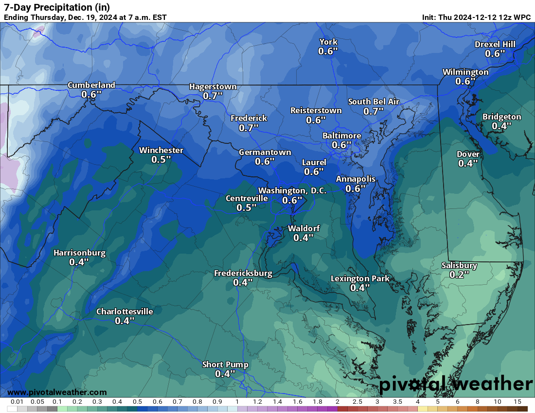
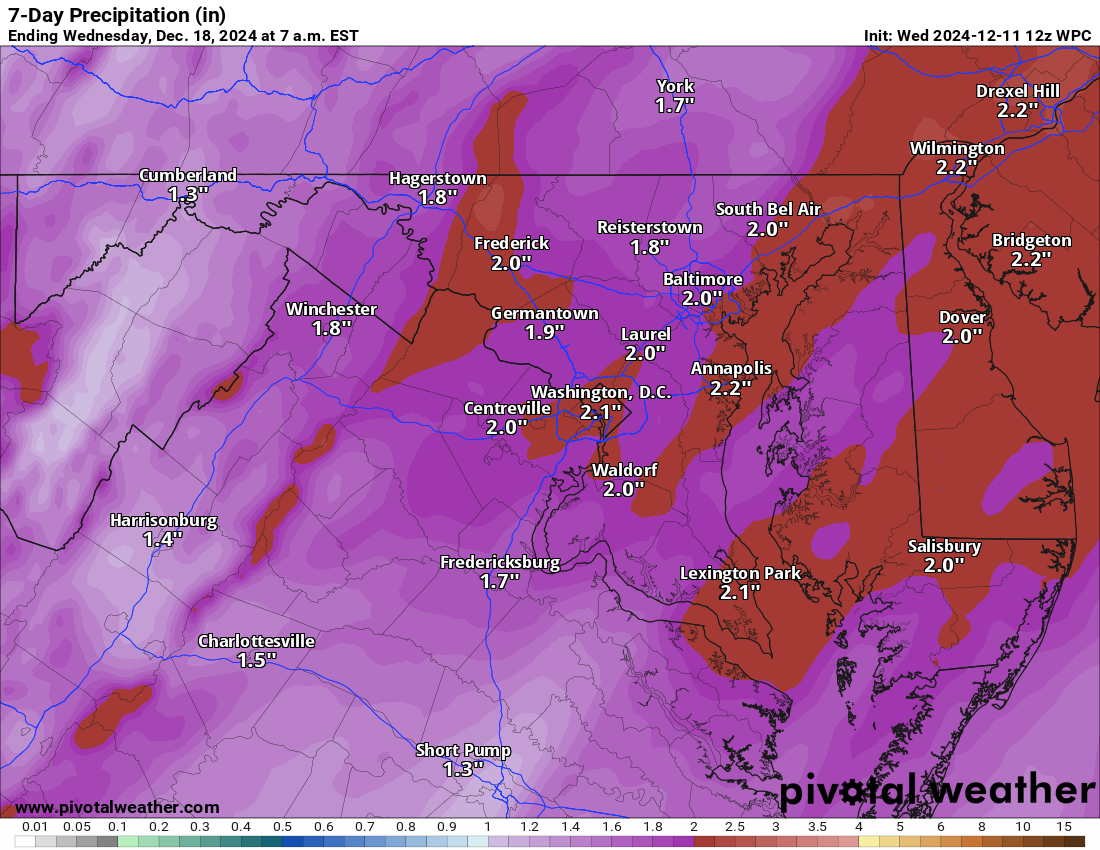
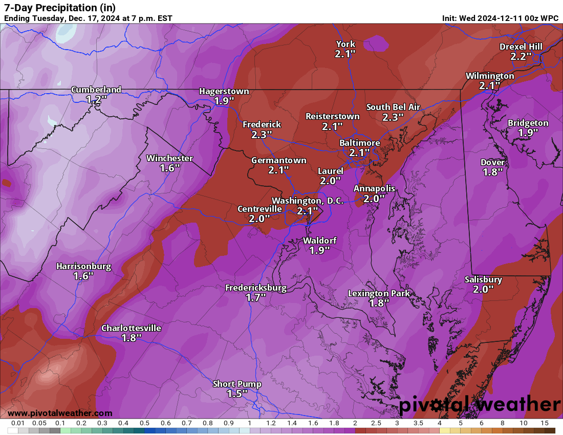
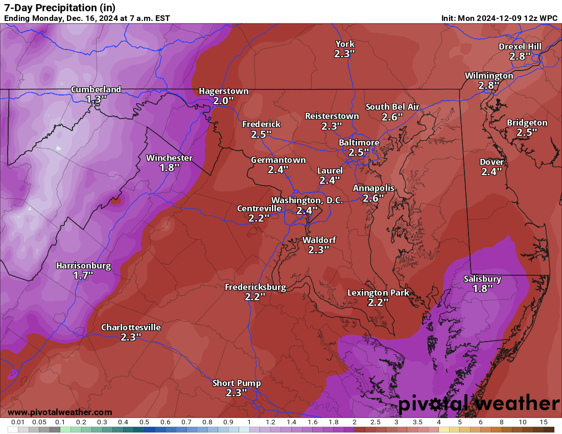
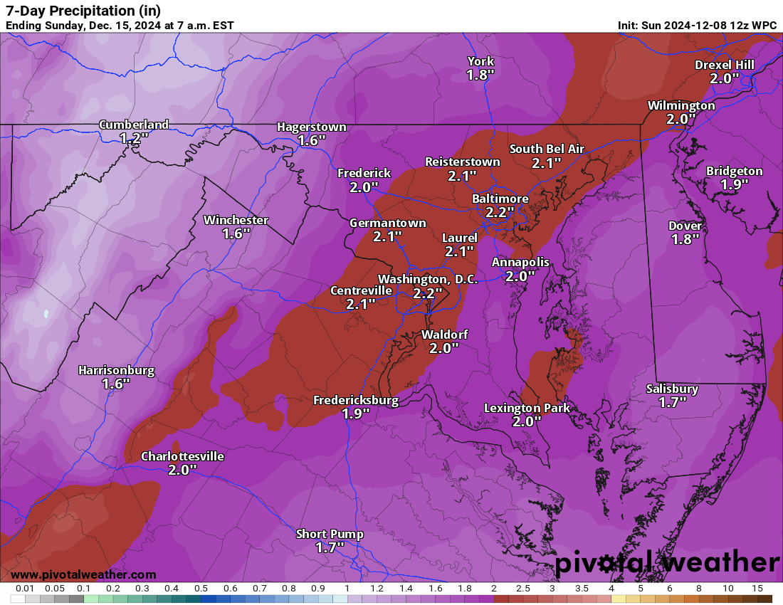
Skip to content
Loudoun Weather

Loudoun Weather

Weather forecasts and information for all of Loudoun County, Virginia. Including Leesburg, Aldie, Waterford, Ashburn, Sterling, Dulles, Hamilton, Purcellville, South Riding. Loudoun Weather is your source for Loudoun County weather forecasts, weather radar and more.

  • Home
  • OCC
  • Forecast
    • Aldie
    • Leesburg Virginia Weather
  • Radar
  • Severe
  • Precip
  • Conditions
  • Temps
  • Tropical
  • Winter
    • 2025 List of Winter Outlooks
    • Winter Impact Index
    • Snow Reports and Depth
    • Ice Impact
    • Ice
  • Articles of Interest
    • So why so hot? What causes heat in the Mid-Atlantic?
    • 10 ways to keep your home cool and save money!
    • June 29th, 2012 Derecho
  • Tweets
  • Toggle search form

Category: Uncategorized

Wednesday, February 3, 2021 Loudoun Weather Outlook

Posted on February 3, 2021February 3, 2021 By admin No Comments on Wednesday, February 3, 2021 Loudoun Weather Outlook

2/3/2021 – We did have some more snow showers overnight and it coated the ground. This was the last upper support for the storm that is finally leaving but causing some blowing snow! Cold and windy today with a high in the mid-30s. Milder tomorrow and Friday. We may see some wintry mix tomorrow night, but it should turn to all rain. Showers Friday and one of the mildest days in a long while. Colder air expected next week is starting to fade from the original look. This may come back. We have to watch Sunday and mid next week for the chance for some snow, but I am no longer counting on a snowstorm at either time (but Sunday bears watching)

May be an image of sky and text
February 3rd Loudoun Weather Outlook
Uncategorized

February 2, 2021 – Weekly Weather Outlook

Posted on February 2, 2021February 2, 2021 By admin No Comments on February 2, 2021 – Weekly Weather Outlook

2/2/2021 – Just super wintry! Another good chance of snow Thursday Night. Then another Sunday! Then the Arctic outbreak starts Monday! More wintry threats in the long-range!

February 2 – February 8, 2021 Loudoun Weather Outlook
Climate Prediction Center’s 6 to 10 Day Outlook
Uncategorized

Monday, February 1, 2021

Posted on February 1, 2021February 1, 2021 By admin No Comments on Monday, February 1, 2021

It will be a cold one with Snow showers off and on all day and into the night. We may see 1 to as much as 3 inches of snow. Breezy out there as well. Really wintry!

The below is the max snow we may see in this system based on models and then the National Weather Service’s outlook.

NAM (a short range model) – this is the Mid-day update

Euro From last night

Image may contain: text that says 'Euro 3 to 4 inches ter Germanto 3.2" 1 Wasl Centreville 2 3 5'
Expected Snowfall - Official NWS Forecast
Uncategorized

Friday, January 29, 2021, Loudoun Weather Outlook

Posted on January 29, 2021January 29, 2021 By admin No Comments on Friday, January 29, 2021, Loudoun Weather Outlook

Very cold weekend with a winter storm possible. Snow could be 3 to 5 inches Sunday and possibly 2 to 4 or more inches on Monday. Monday has some upside potential, but slowly this is looking like a moderate storm and not a big dog. Many things have changed on these maps the last few days.

A bigger write up this afternoon/evening.

Loudoun Weather Outlook for January 29 through February 4th
Loudoun Weekly Weather Outlook, January 29 – February 4th
Uncategorized

January 27, 2021 – Winter Storm Outlook Discussion

Posted on January 27, 2021May 24, 2021 By admin No Comments on January 27, 2021 – Winter Storm Outlook Discussion

What is up with Sunday/Monday.

My current confidence levels:

  • 85% we see some snow
  • 75% we see an inch or more
  • 60% we see 4 inches or more
  • 55% we see 6 inches or more
  • 45% we see 8 inches or more
  • 30% we see 10 inches or more
  • 25% we see 12 inches or more

I am very torn on this system

The American Model shows about 4 to 8 inches.

The European still shows a big storm, especially for the western areas.

What is so different about these two models?

I will summarize.

To the north, we have some “blocking” occurring that is causing storms to slow down as they head north. The blocking stops the storminess and the energy of the storm from going further north when the storm is west of Virginia. The blocking also keeps colder air in place. If the storm gets too far north (like the American Model shows) then we get into southerly winds since the low is due west or northwest of our area, and the colder air is eroded out of the area when the precipitation comes. In this setup, on the American Model, we have had about 4 to 8 inches of snow. The point where the winds change from the north to the south is a warm front (Warm air advancing into colder air). Once the warm front is north of you, you will change to rain or a mix. We do have the added help of Cold Air Damming in the region, so the warm air can push overtop the colder air and we will mix with sleet and freezing rain before seeing just plain rain. One note, however, is that once the warm front pushed through the precipitation will often cut off as the main low is way west of the area. The moist air overrunning the warm front and being pushed into our area is not uncommon to cause snow. Our failure earlier this week was related to this setup. We would have had more snow if the ground temperatures were colder. We will have cold air in place as we head into this Sunday’s event, so we will not waste the precipitation on getting the air cold. So we get the warm front assisted snow. Since the low and energy cannot push further north, they transfer this energy to the coastal front that is along or near the East coast. This Low-pressure system death to our west and transfer is known as a Miller B type set up.

Finally I can explain the potential and the potential busts for this forecast.
THE KEY is “WHERE and when does that transfer take place?”

Scenarios that would cause a “bust”

  • IF the transfer is at our same latitude or further north, we may get the front end snow, but not the snow from the new low pressure that formed off the coast.
  • If the Primary low remain strong and transfers the energy slowly, we get into southerly winds and get too warm for snow
  • If the primary transfer is just slow and we stay between the heavier precipitation from the primary low, and too far west of the coastal low.
  • Another potential impact to lesser amounts of snow will be how close to the coast the new low-pressure tracks. IF it gets too far inland the warmer ocean water could turn the snow to sleet. This does have some possibility and will need to be watched (especially eastern areas)

Now, we do pretty well in the American Model setup on Sunday, and we get into the warmer sector of the storm, but we may not have too much precipitation after the warm front aided snow so we get some drizzle. Then the new storm takes over, but it is too far north to get us any of the coastal aided snow. THIS has been the setup on the GFS for days, but even now it has upped the totals to more than 6 inches from this front end snow!

BUT, THE EUROPEAN model is different! The Primary low on the European does not make it as far north to get us into southerly winds, and transfers the energy to a Low along the front down in North Carolina! The low begins to strengthen and organize which is sending precipitation over us in light to, to increasingly moderate, and then heavy snow. Because it is organizing, it slows down its forward speed for almost 12 hours.. so we are getting snow the entire time…then, as it strengthens and lifts northwards, we get in very cold and heavy snow. This is the snow on the Northwestward side of the system that has the moisture from the ocean, but is also pulling in the cold from the north! It is referred to as the Cold Conveyer Belt (or CCB). We get real heavy snow from this, and, sometimes, higher ratio fluffy snow which makes more snow with less moisture! We appear to get into this snow for a while on the European!

So now I will share the loops of the two models with the same system:

American (GFS):

European

So what does that mean for snow totals?

IF we trust the snow output, from the models, the totals are quite different!

American (GFS):

And now – the BIG DOG – European

SO WHICH ONE IS RIGHT?

It is all about the tracks, transfer of energy, timing.. etc!

I am leaning with a forecast of 6 to 12 inches, with the upside of 16 inches if all comes together correctly.

I will say, IF.. IF… IF the European is correct, the amount of snow may INCREASE for the region on the subsequent runs. It will also be windy!

That is the latest!

Uncategorized

Posts pagination

Previous 1 … 63 64 65 … 84 Next
Latest Radar from the National Weather Service
National Weather Forecast from https://www.wpc.ncep.noaa.gov/#page=ovw
National Forecast from the Weather Prediction Center
Regional Precipitation
Precipitation Forecast from the National Weather Service
  • Instagram
  • YouTube
  • Facebook
  • Instagram
  • Facebook
  • YouTube

Join My Mailing List

Add My Alexa Skill

Loudoun Weather Outlook Alexa Skill

Listen To the Daily Outlook on Spotify

  • The Flood Warning has been cancelled.
  • The Severe Thunderstorm Watch has been cancelled.
  • The Severe Thunderstorm Warning has been cancelled.
  • Severe Thunderstorm Watch issued May 16 at 5:26PM EDT until May 16 at 10:00PM EDT by NWS Baltimore MD/Washington DC
  • Severe Thunderstorm Warning issued May 16 at 5:14PM EDT until May 16 at 6:30PM EDT by NWS Baltimore MD/Washington DC

Recent Posts

  • Loudoun County Weather Outlook for Monday, May 19, 2025
  • Loudoun County Weather Outlook for Sunday, May 18, 2025
  • Loudoun County Weather Outlook for Saturday, May 17, 2025
  • Loudoun County Weather Outlook for Friday, May 16, 2025
  • Loudoun County Weather Outlook for Thursday, May 15, 2025

Recent Comments

    Archives

    • May 2025
    • April 2025
    • March 2025
    • February 2025
    • January 2025
    • December 2024
    • November 2024
    • October 2024
    • September 2024
    • August 2024
    • July 2024
    • June 2024
    • May 2024
    • December 2023
    • October 2023
    • September 2023
    • August 2023
    • June 2023
    • April 2023
    • March 2023
    • February 2023
    • January 2023
    • December 2022
    • November 2022
    • October 2022
    • September 2022
    • August 2022
    • July 2022
    • June 2022
    • April 2022
    • February 2022
    • January 2022
    • December 2021
    • November 2021
    • October 2021
    • September 2021
    • August 2021
    • July 2021
    • June 2021
    • May 2021
    • March 2021
    • February 2021
    • January 2021
    • December 2020
    • July 2020
    • June 2020
    • May 2020
    • January 2020
    • December 2019
    • November 2019
    • October 2019
    • September 2019
    • August 2019
    • July 2019
    • June 2019

    Categories

    • Alerts
    • Forecast
    • Uncategorized

    Meta

    • Log in
    • Entries feed
    • Comments feed
    • WordPress.org

    Current Advisories for Loudoun County

    Copyright © 2025 Loudoun Weather.

    Powered by PressBook WordPress theme