Local weather. A little perspective.Loudoun County, VirginiaOfficial NWS alerts ↗
Loudoun County, Virginia

Category: Forecast

Winter Outlook Factor #2 – Polar Vortex Strength

The Polar Vortex is not something new and makes visits into the Lower 48 states every winter. The news media LOVES to over hype when it comes into play for the United States. Additional names to this Arctic region airmass could be the Polar Express (the streams of air that bring in the Vortex, or at least portions of it), or the circumpolar vortex.

What is it exactly?

The polar vortex is a large area of low pressure and cold air surrounding both of the Earth’s poles. (that comes straight from the NWS) In the winter it strengthens.

When it is very circular, it is considered stable and the jet stream is usually very strong. Storms likely will rip across the United States and the coldest air stays “locked” in Canada.
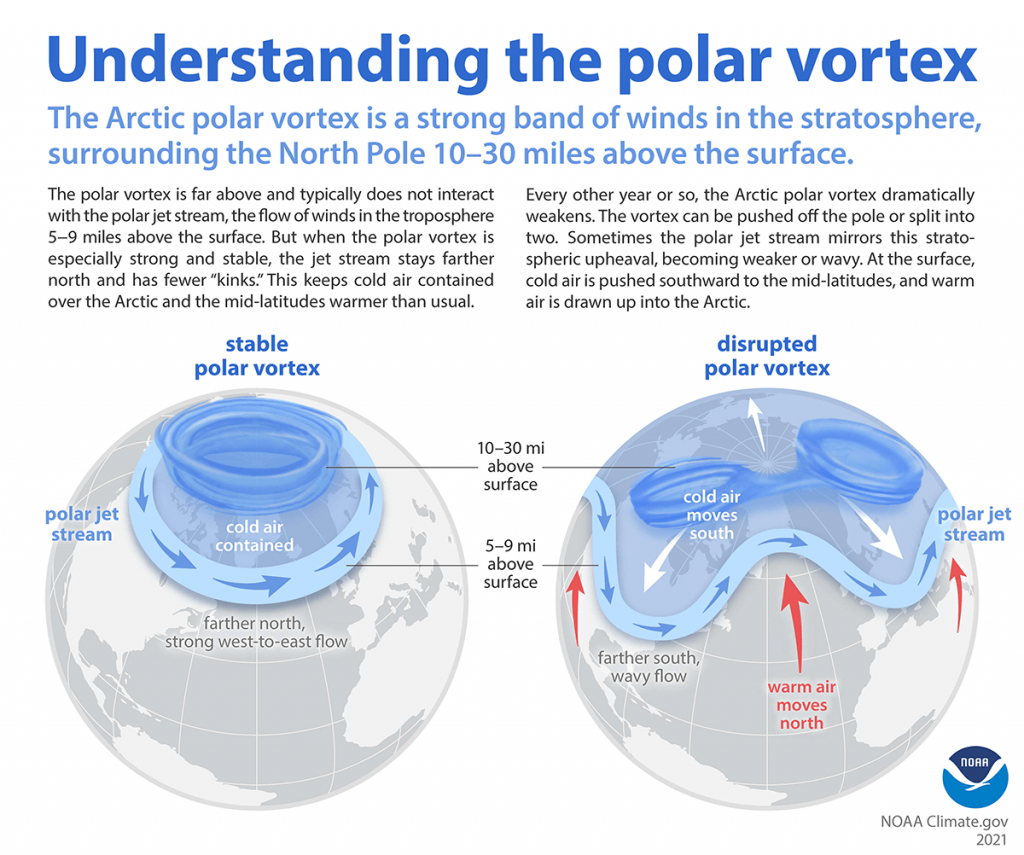
Polar vortex Information from Climate.gov

Disruptions

If you want there to be colder air masses in the United States, you would want the Polar Vortex to be weaker than normal so that storm systems can disrupt and dislodge the colder air into the United States. Another thing that can help to split and disrupt the Polar Vortex is something known as Sudden Stratospheric Warming. This is warming above the vortex that can “split” the vortex in some situations. When it splits, this also will bring colder air into the lower latitudes. This does not always mean the United States! The Warming and Splitting can take some time and air masses and weather patterns can take some time to respond.

SO WHAT!! What about our winter?

Two things I am noticing this fall! The first is that the Polar Vortex appears weaker! Remember, this will allow for the influence of storm systems that could dislodge the colder air and give us cooler weather. I am also ALREADY SEEING THIS HAPPENING!

If you have been following me on the My Facebook “Speculations” I mentioned some “signals” that we could see some cold early. It was SPECIFICALLY related to the disruptions being forecast by models for November. The disruptions started showing on models two weeks ago and are now happening. It looks like this disruption pattern could come in a few waves in November! Some is coming into play next week, and some other long-range speculations show the middle of the month. Just because we get disruptions does not mean we will get cold here. That mid-month intrusion seems pointed towards the middle part of the country, and maybe down into Texas! Remember, when you get past 5 to 7 days in forecasting, the forecasts become much more speculative as the models may be failing to pick up on some things. HOWEVER, these Polar Vortex disruptions do seem likely, again, because the vortex is so weak. And, while in this stage, we could see some below normal spells in November! Snowflakes would not surprise me at some time. However, sustained cold air may be a challenge, as it should be, since it is so early in the colder months.
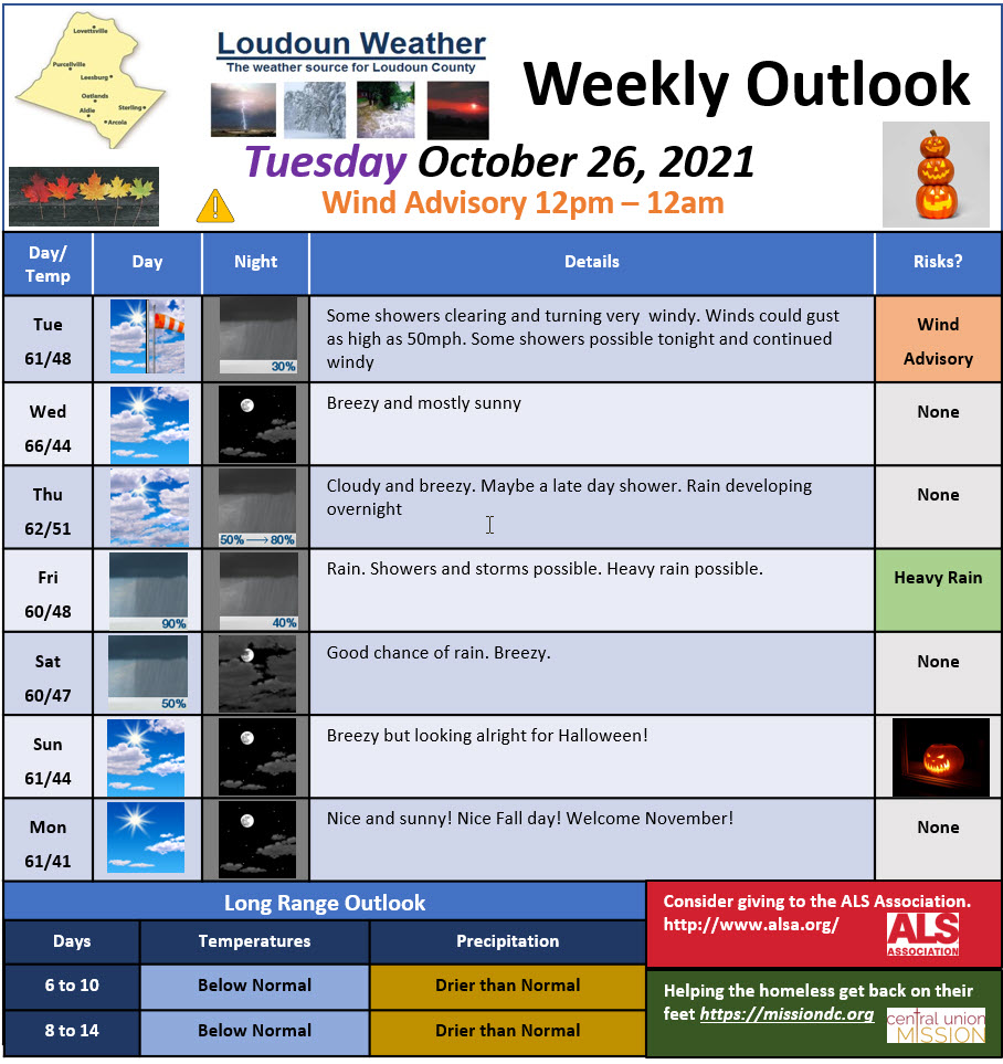
Loudoun County Weather Outlook for Tuesday, October 26, 2021

Summary

A very windy day ahead with wind advisories in effect from 12pm to midnight. Heavy rains are possible Friday. Halloween looks breezy but mostly sunny.

Loudoun County Weather Outlook for Tuesday, October 26, 2021

Short-Range Loudoun Weather Outlook

Looks sunny tomorrow. Cloudy Thursday and then rain Thursday Night through Friday with highs around 60. There is a chance of some flooding rains Friday.

Mid-Range Loudoun Weather

The weekend will have a good chance of rain Saturday. It looks dry and breezy for Halloween.

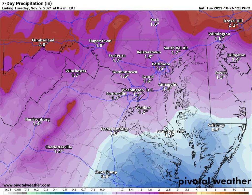
Weather Prediction Center Rain Forecast for the next 7 days

Long-Range Loudoun Weather Outlook
Description

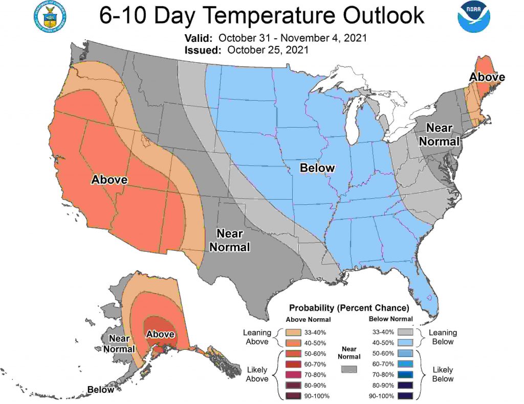
6 to 10 Day Temperature Outlook from the Climate Prediction Center
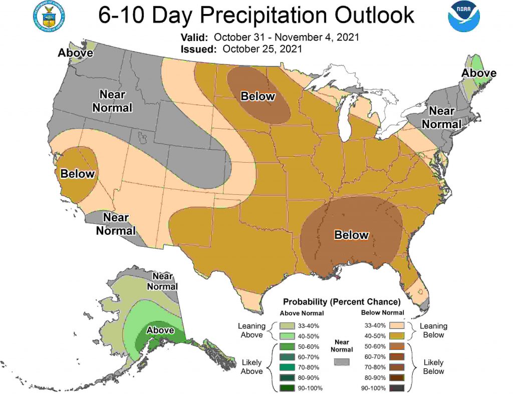
6 to 10 Day Precipitation Outlook from the Climate Prediction Center
6 to 10 Day Precipitation Outlook from the Climate Prediction Center
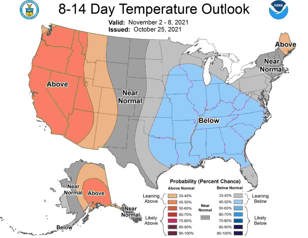
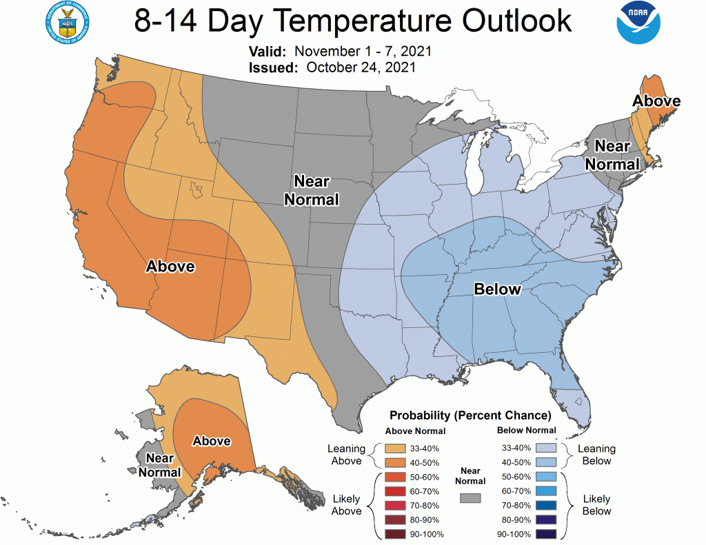
8 to 14 Day Temperature Outlook from the Climate Prediction Center
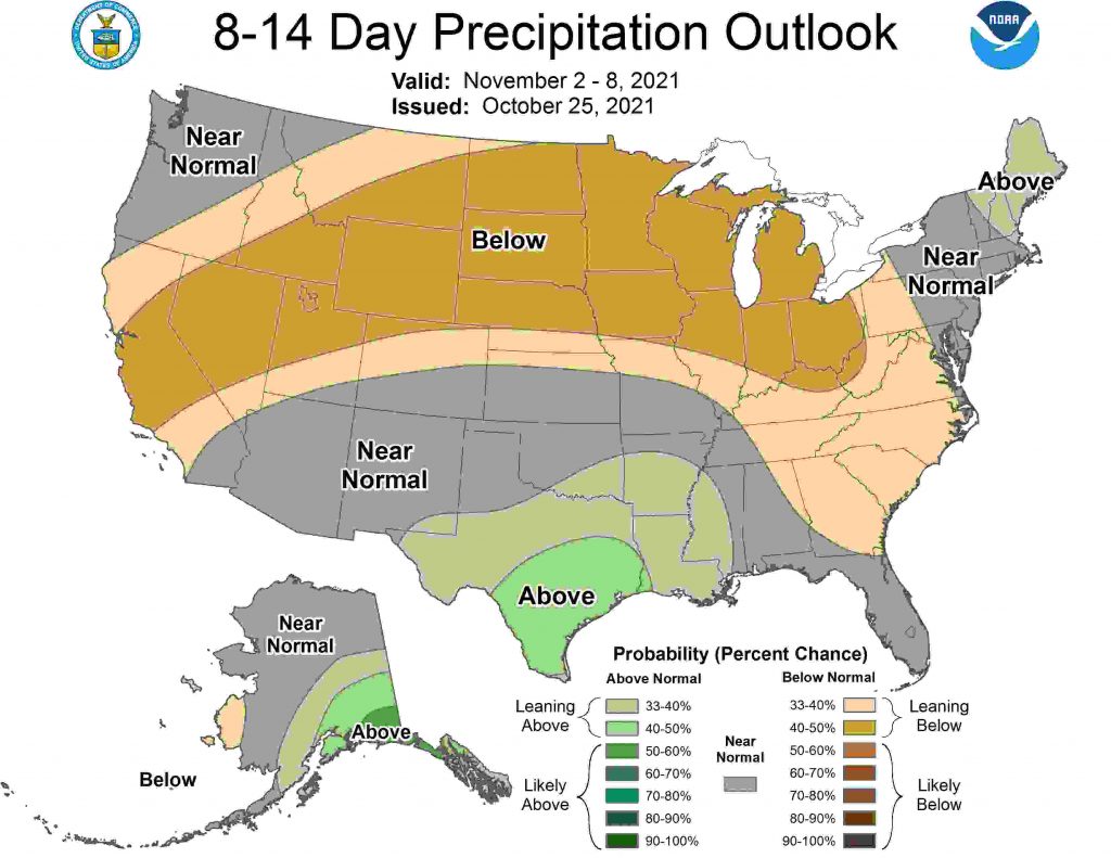
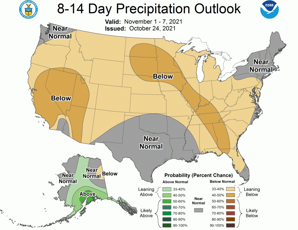
8 to 14 Day Precipitation Outlook from the Climate Prediction Center
8 to 14 Day Precipitation Outlook from the Climate Prediction Center

Winter Outlook 2021 – 2022 – FIRST FACTOR – La Niña

The BIGGEST concern I have for below-normal snow this year is the presence of La Niña

What is La Niña?

La Niña is a cold pool of water in the equatorial Pacific region. When the equatorial Pacific is Warm (El Niño) this region can supply a strong sub-tropical jet stream and usually a better chance of big snowstorms due to the amount of moisture. Although El Niño winters are not particularly cold, if the timing is right, we can get some whoppers! YES, 2016 was an El Niño year, and we got the last HUGE storm then.

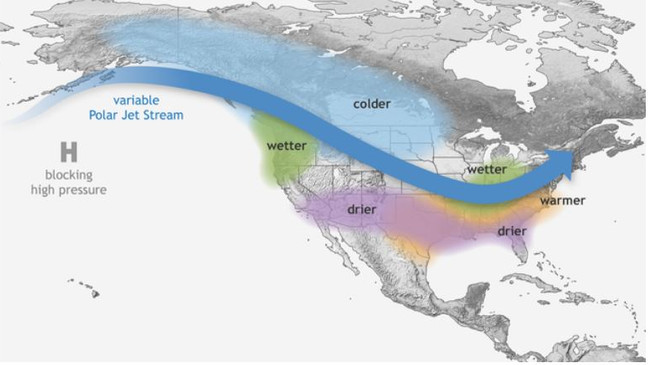
La Niña, on the other hand, tends to make the Jet to the north push milder air into our region. We are often in the Battle Zone between colder to the north and warmer to the south when storms come along. The storms tend to turn to a mix or rain if they have any wintry weather in them at all. In general, we end up being slightly above normal with temperatures. The Pacific Northwest tends to get blasted with rain and Mountain snows (Like the absolute bomb cyclone of a Low from this last weekend). That does not do us much favors for keeping it cold in the east, as we get a ridge of High Pressure (Southeastern US warmer high pressures) pumping warmer air here.

Typical La Niña Pattern:

Typical La Niña Weather Patterns

So this is Factor One for the 2021 – 2022 Winter weather outlook!

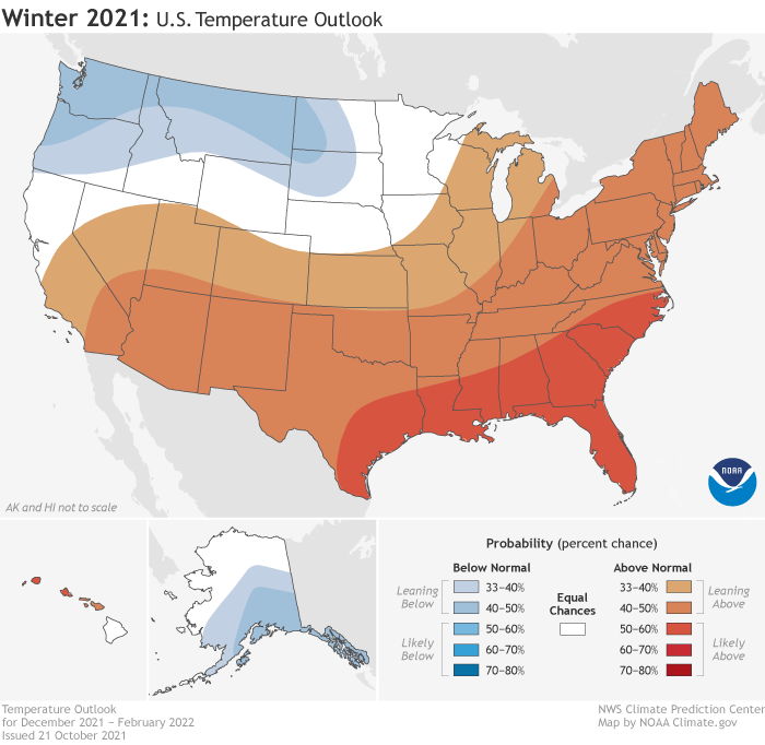
You can see in the National Weather Service’s Winter Outlook that they are weighing heavily on the La Niña pattern. If you have been watching the weather the last week or so, you can see that this is what the pattern has looked like!

2021 National Weather Service Winter Outlook (Temperatures)

And, I have to say, we have had a horrible set of winters when there is aLa Niña! I saw a meteorologist show that 60% produced below normal snow for the area.

My Thinking:

La Nina will have an early impact that will be offset by some other factors! So it WILL have an impact, especially through January.. but I think it will become less of a factor later in the year.

Also, there are a few reasons why we may see some early sneak peeks of winter in November and December, but they are unlikely to be long-lived.

That concludes part one of the Winter Weather impacts for 2021 – 2022 Loudoun Weather Winter!

Loudoun County Weather Outlook for Monday, October 25, 2021

Summary

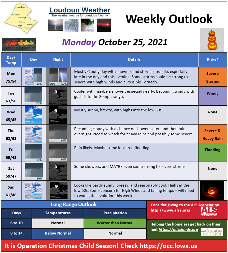
Severe Weather is possible this evening. It will be mild today with highs into the mid-70s. This evening will have a front approach and there could be strong enough winds that get mixed down to cause strong winds, but hail or even an isolated tornado is possible. Breezy winds tomorrow and then more rain Thursday Night through Saturday.

October 25,2021 Loudoun Weather outlook.

Short-Range Loudoun Weather Outlook

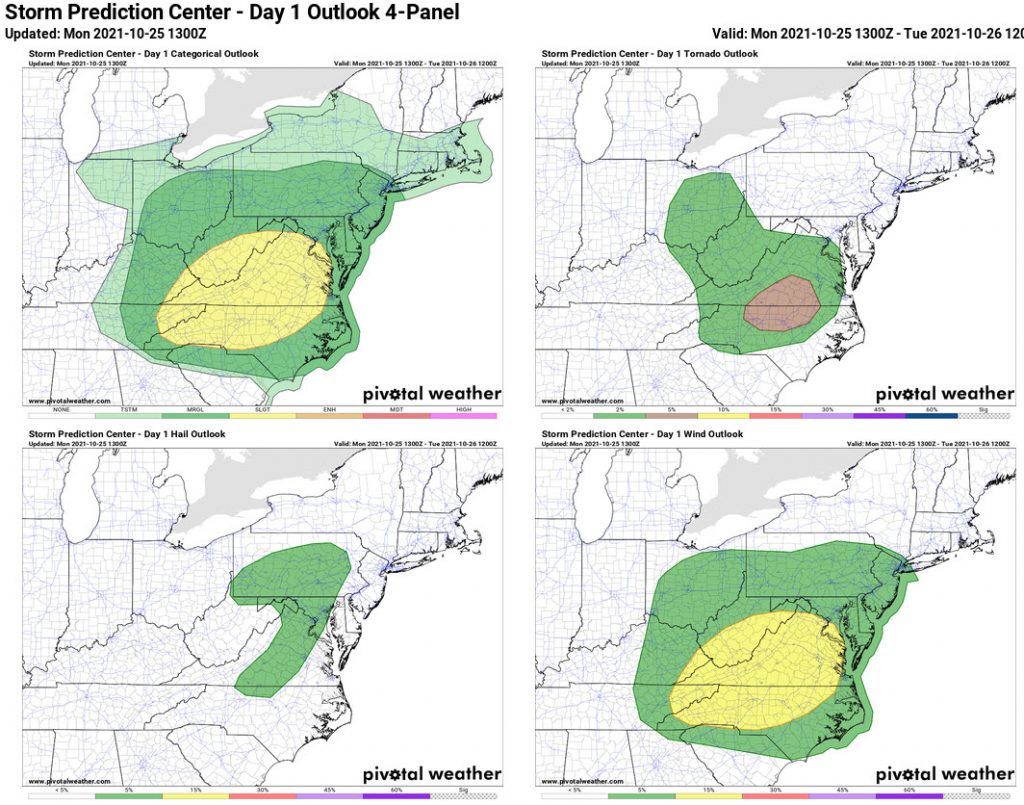
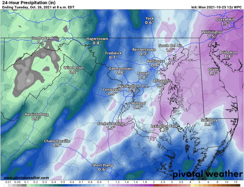
Here is the latest Severe Weather Outlook map for today as well as the rain expected in the next 24 hours.

Storm Prediction Center Outlook for today.
Storm Prediction Center Outlook for Severe Weather today.

The rain outlook for today and tomorrow.

Weather Prediction Center Rain Forecast through tomorrow

Mid-Range Loudoun Weather

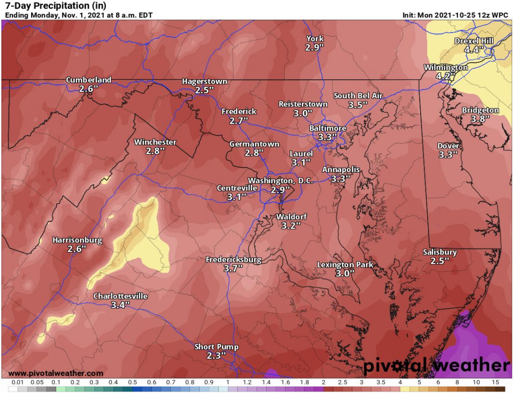
Rain is expected again for Thursday night through Saturday. Temps will also be around 60. As of now, Halloween looks like it will be partly cloudy with some breezes. I suspect it will feel very cool!

Rain Outlook for the next week!

Rain Outlook for the next week.
Weather Prediction Center Rain Forecast for the next 7 days

Long-Range Loudoun Weather

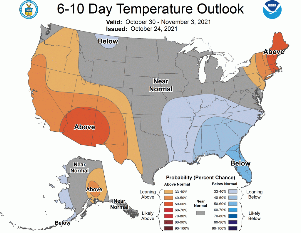
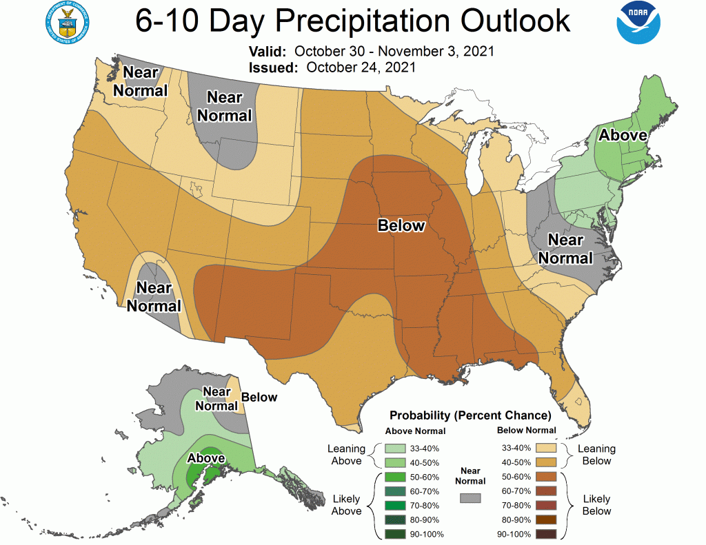
We are starting to see a switch in the pattern and I do expect we will see frost and freezes finally in parts of the area.

6 to 10 Day Temperature Outlook from the Climate Prediction Center
6 to 10 Day Temperature Outlook from the Climate Prediction Center
6 to 10 Day Precipitation Outlook from the Climate Prediction Center
8 to 14 Day Temperature Outlook from the Climate Prediction Center
8 to 14 Day Temperature Outlook from the Climate Prediction Center
8 to 14 Day Precipitation Outlook from the Climate Prediction Center

Loudoun County Weather Outlook for Wednesday, October 13, 2021

Summary

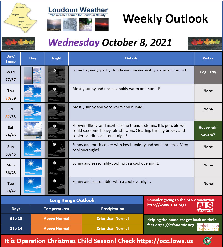
Remains warm and very wet with above normal temperatures today. Cooler weather sets in on Sunday.

Short-Range Loudoun Weather Outlook

Fog should break up later this morning and we turn partly sunny. Highs will reach the mid and upper 70s.

Wednesday, October 13, 2021, Loudoun Weather Outlook

Mid-Range Loudoun Weather

Saturday could have showers and maybe even some thunderstorms as a front will finally push out this warmer and humid airmass. Much cooler 60s to follow with 40s for nighttime lows.

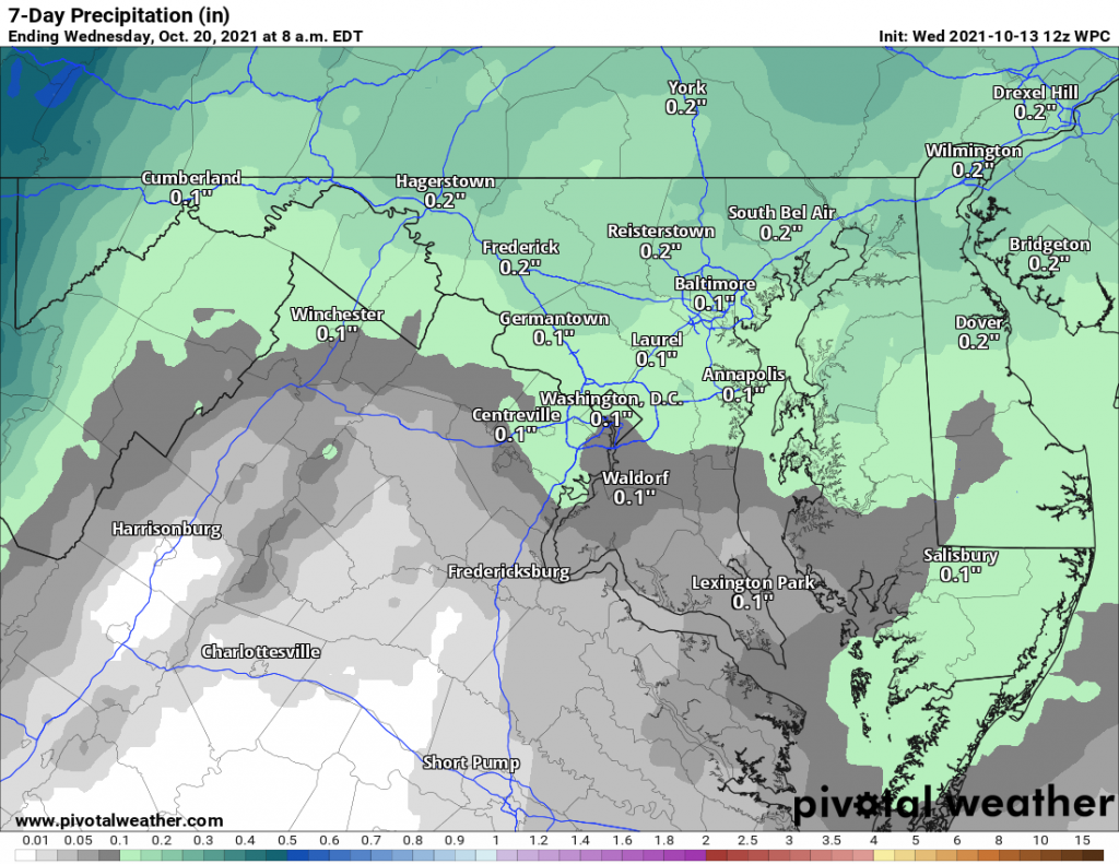
Wednesday, October 13, 2021 Loudoun Weather Outlook from the Weather Prediction Center
Rain Outlook for the Next 7 days from the Weather Prediction Center (Graphics from Pivotal Weather)

Long-Range Loudoun Weather Outlook

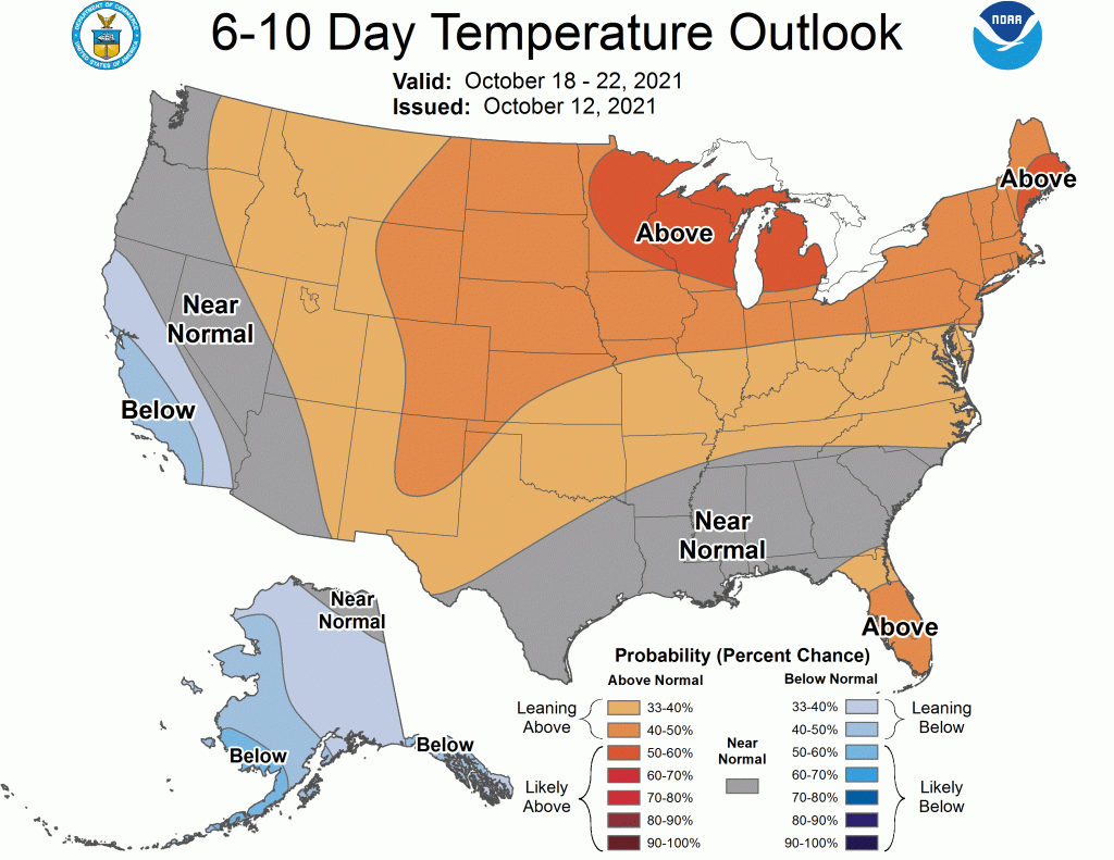
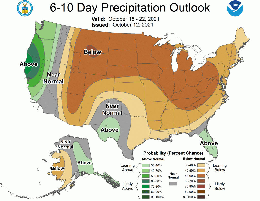
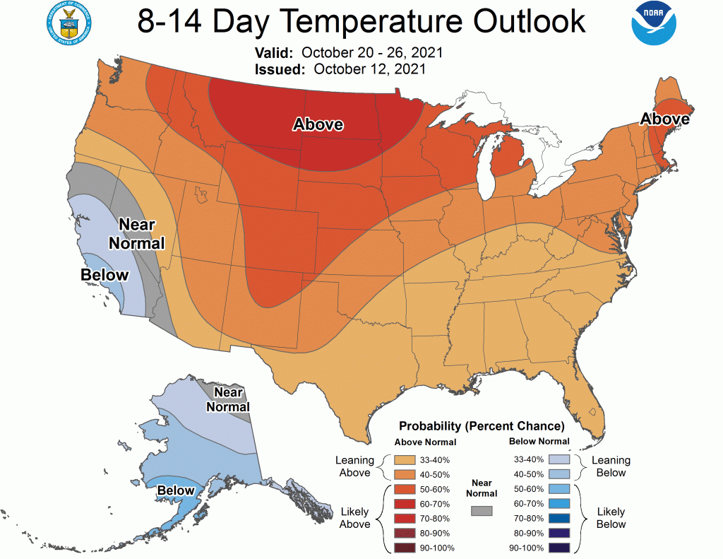
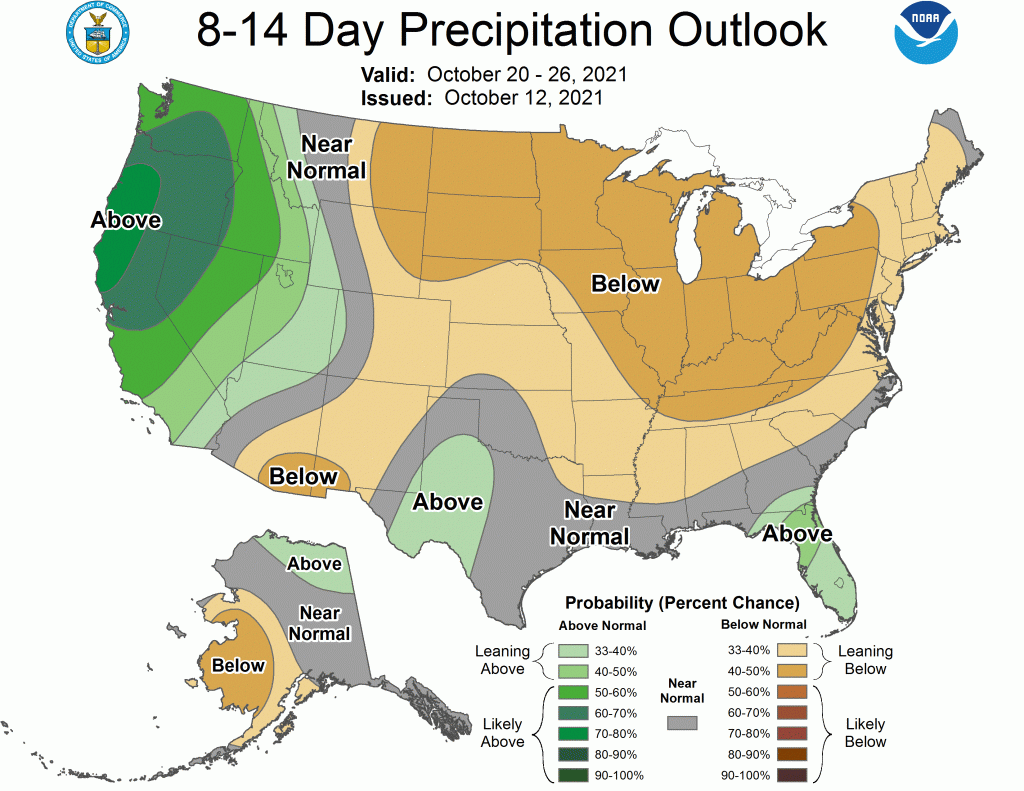
The long-range looks like it will remain above normal temperatures with dry conditions.

6 to 10 Day Temperature Outlook from the Climate Prediction Center
6 to 10 Day Precipitation Outlook from the Climate Prediction Center
6 to 10 Day Precipitation Outlook from the Climate Prediction Center
8 to 14 Day Temperature Outlook from the Climate Prediction Center
8 to 14 Day Precipitation Outlook from the Climate Prediction Center
8 to 14 Day Precipitation Outlook from the Climate Prediction Center