Local weather. A little perspective.Loudoun County, VirginiaOfficial NWS alerts ↗
Loudoun County, Virginia

The local outlook

Forecasts, updates and a little local perspective.

Loudoun County Weather Outlook for Tuesday, May 19, 2026

Good Tuesday morning, Loudoun County! 🌡️

🔥 Today: Peak of the Heat Wave
The hottest day of this heat wave is here. Highs climbing into the upper 90s, and it'll feel over 100° at times this afternoon. Just brutal out there. A slight chance of a thunderstorm late in the day, too.

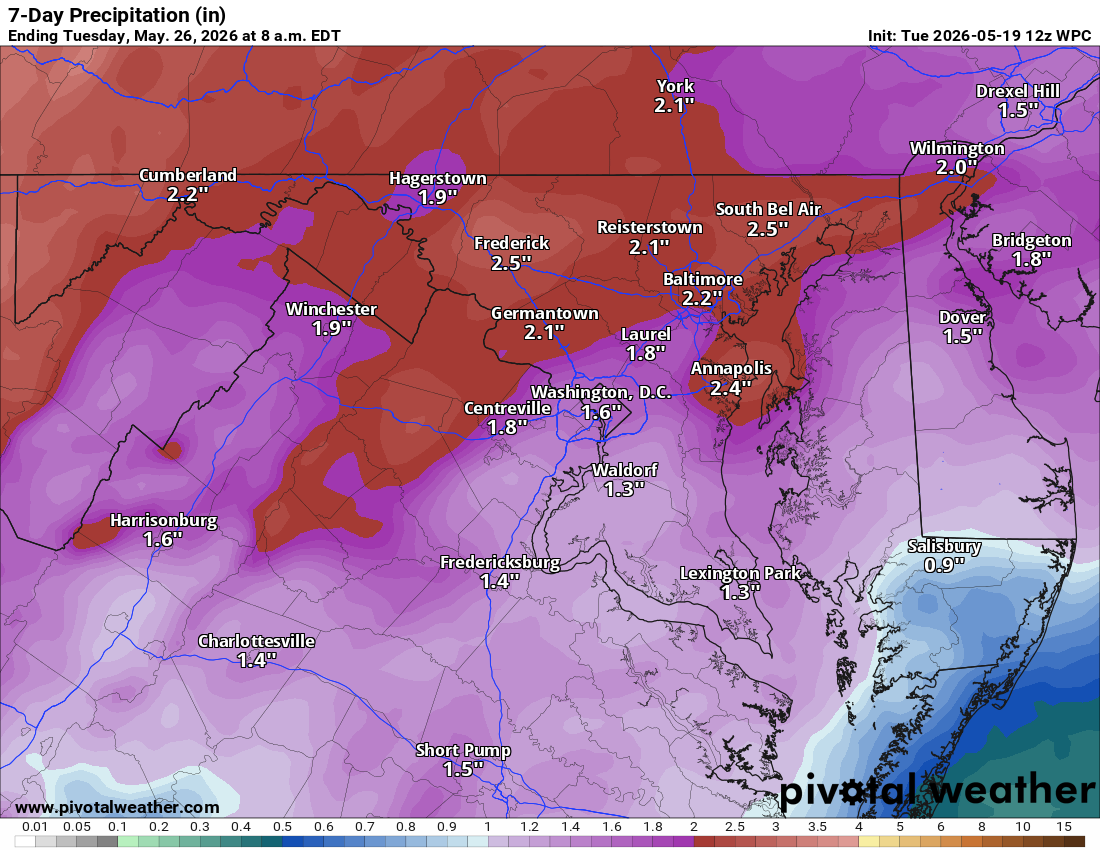
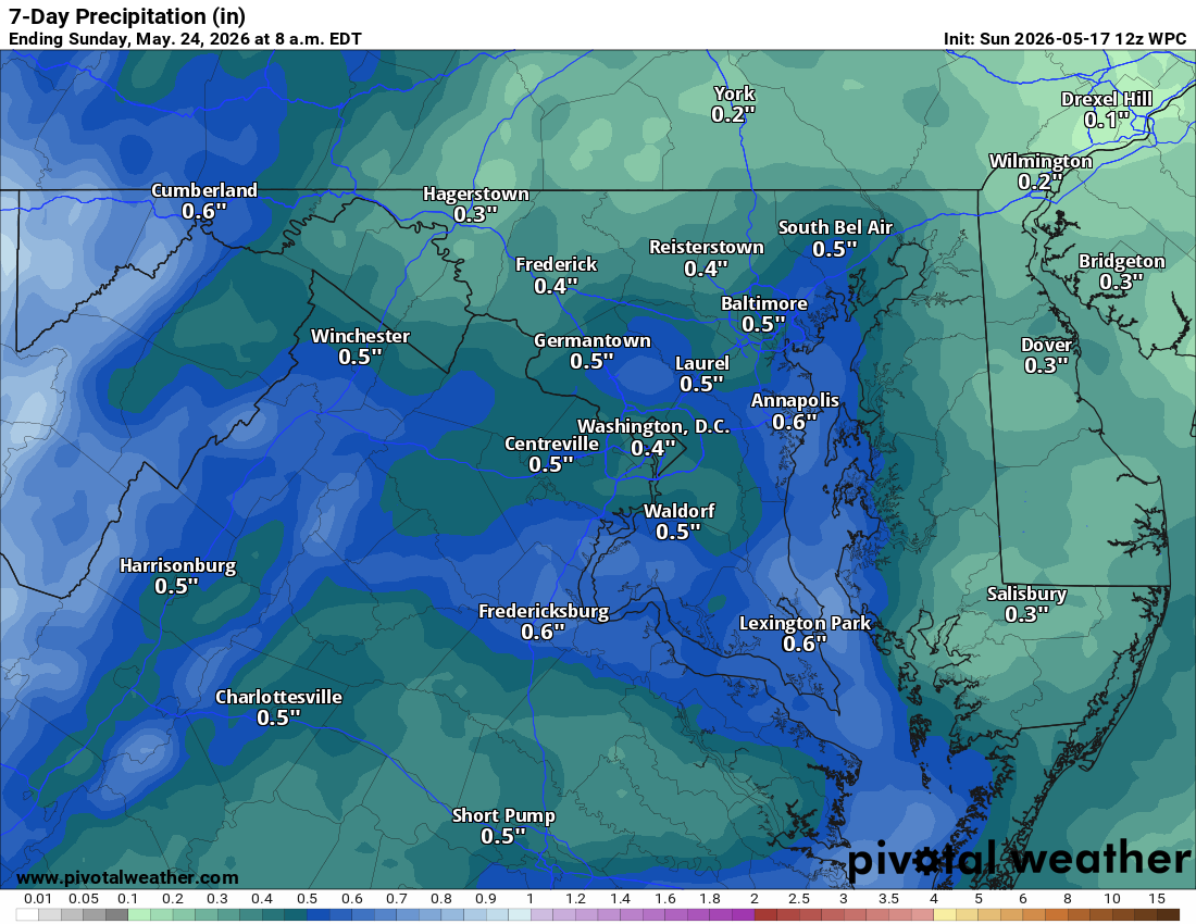
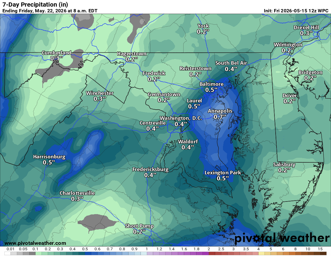
🌧️Signifiant rain!
The forecast is showing the possibility of over 2 inches the next 7 days! This is very good news for the drought!

⛈️ Wednesday: Still Hot, Storms Likely
Still really hot with highs in the mid 90s. A good chance of afternoon and evening showers and thunderstorms, and some of those could be strong to severe. That activity will usher in much cooler air behind it.

🌧️ Thursday and Friday: Big Cooldown
Highs only in the mid to upper 60s Thursday and Friday, with Friday being the coolest day of this next stretch. Showers are in the picture both days.

🏖️ Memorial Day Weekend: Unsettled
Saturday, Sunday, and Memorial Day all carry chances of showers and possibly a thunderstorm. Memorial Day could end up okay though. Highs up in the upper 70s, but pool weather is going to be a challenge.

Two more days of heat, with today being the worst of it. Please take care of yourselves out there!

The Forecast:
Today: Hi 96 🌤️ Lo 69 🌙 – 🥵 Mostly sunny, becoming partly cloudy tonight

Wednesday: Hi 94 🌦️80% Lo 56 🌧️80% – 🥵 Sun early then showers and
thunderstorms mainly after 2pm

Thursday: Hi 66 ☁️70% Lo 51 🌧️60% – Showers likely mainly before 2pm, then
chance of showers late night

Friday: Hi 62 🌧️80% Lo 50 ⛈️80% – Showers with thunderstorms possible after
2pm

Saturday: Hi 70 🌧️70% Lo 58 🌧️60% – Showers likely

Sunday: Hi 76 🌧️60% Lo 59 ⛈️60% – Showers likely and possibly thunderstorms

Memorial Day: Hi 77 🌦️40% – Chance of showers and thunderstorms

#loudoun #loudouncountyva #vawx #loudounweather #loudounva #virginiaweather

Please support Tree of Life Ministries, an important organization to me!

Loudoun County Weather Outlook for Monday, May 18, 2026

Good Monday morning, Loudoun County! It is going to be a hot one today. 🌡️

🔥 Today: Heat is On
Highs up in the low to mid 90s. If you're heading outside, make sure you've got sunscreen on, a hat, light and breathable clothing, and plenty of fluids. Get your breaks in during the day!

🥵 Tuesday: Even Hotter
Highs climbing into the mid to upper 90s. Going to feel close to 100°. Same drill, stay hydrated, stay sunscreened, and stay out of the sun as much as you can.

⛈️ Wednesday: Hot with Storms
Low to mid 90s again, but we'll see a chance of afternoon and evening thunderstorms. Some of those could be strong, so we'll have to watch how things play out. This will help usher in a cooler pattern.

🌧️ Thursday Through the Weekend: Cloudy and Cool
High pressure to our north sets up an easterly flow off the ocean that looks to hold all the way through the weekend. Daytime highs in the 70s, but mostly cloudy with chances of showers and possibly some thunderstorms. Some days could see showers likely. Still working out the details on exactly how much rain falls when.

Not the best Memorial Day weekend, but we need the rain and the cooler temperatures will be welcome after the heat we've got ahead of us.
Have an awesome Monday!

The forecast:
Today: Hi 93 🥵☀️ Lo 68 🌙 – HOT!

Tuesday: Hi 95 🥵☀️ Lo 69 🌙 – HOT!!

Wednesday: Hi 92 🥵🌦️80% Lo 55 🌧️80% – HOT! Showers and possibly thunderstorms after 2pm.

Thursday: Hi 67 ☁️50% Lo 51 ☁️40% – Chance of showers, mostly cloudy.

Friday: Hi 64 🌧️70% Lo 53 🌧️70% – Showers likely, mostly cloudy.

Saturday: Hi 73 ⛈️60% Lo 59 ⛈️60% – Showers likely and possibly
thunderstorms.

Sunday: Hi 77 ⛈️60% – Showers likely and possibly thunderstorms

#loudoun #loudouncountyva #vawx #loudounweather #loudounva #virginiaweather

Please support Tree of Life Ministries, an important organization to me!

image.png

image.png


Loudoun County Weather Outlook for Sunday, May 17, 2026

☁️ **Cloudy Sunday With Some Showers**

A little more cloud cover today than expected, with scattered showers this morning into early afternoon. A shower or thunderstorm is possible this afternoon as well. Highs near 90° with some humidity, making it feel pretty hot.

🌡️ **Heat Builds Monday and Tuesday**

Monday brings hot conditions with highs in the low to mid 90s. Tuesday is the hottest day of the week, with highs climbing into the mid to upper 90s.

⛈️ **Storms Likely Wednesday**

Highs back in the low to mid 90s, with showers and thunderstorms likely in the afternoon. Some could be strong to severe. Rain should taper off Wednesday night.

🌫️ **Big Pattern Change Thursday Onward**

An easterly flow off the ocean moves in, bringing daily chances of showers and drizzle, morning fog, and much cooler temperatures. Highs drop to the 60s to around 70° and that pattern could hold straight through the weekend and into Memorial Day.


The forecast:
Today: Hi 88 🌦️20% Lo 63 🌙 – Slight chance of showers before 11am, then
slight chance of showers and thunderstorms after 2pm, otherwise mostly sunny

Monday: Hi 93 ☀️ Lo 68 🌙 – Sunny, calm wind becoming south 5-9 mph in the
afternoon

Tuesday: Hi 95 ☀️ Lo 69 🌙 – 🥵 Sunny with light southwest wind increasing
to 5-9 mph in the afternoon

Wednesday: Hi 93 ⛈️80% Lo 57 🌧️80% – Showers and possibly thunderstorms
after 2pm, continuing before 8pm then chance of showers through 2am

Thursday: Hi 71 🌦️40% Lo 52 🌧️50% – Partly sunny with chance of showers
after 8am, chance of showers after 2am

Friday: Hi 66 🌧️60% Lo 52 🌧️40% – Showers likely, mostly cloudy with chance
of showers continuing

Saturday: Hi 70 🌧️40% Lo TBD 🌙 – Chance of showers, mostly cloudy

#loudoun #loudouncountyva #vawx #loudounweather #loudounva #virginiaweather

Please support Tree of Life Ministries, an important organization to me!

Loudoun County Weather Outlook for Saturday, May 16, 2026

☀️ Warm Saturday, Heat Building All Week
Good Saturday to you! Highs today will be in the low to mid 80s, the first day of a stretch pushing us well into the 80s and beyond. A shower or thunderstorm is possible this evening, though not guaranteed.

🌤️ Sunday
Mostly cloudy with highs in the upper 80s. Another chance of showers and thunderstorms in the afternoon and evening.

🔥 Monday and Tuesday: Peak Heat
Monday brings low to mid-90s under sunny skies. Tuesday looks to be the hottest day of the week, with highs possibly reaching the upper 90s. Heat index values could approach 100° on Tuesday.

⛈️ Wednesday: Heat Continues, Storms Possible
Highs hold in the low 90s with a good chance of showers and thunderstorms. Some could be strong to severe.

🌧️ Thursday into the Weekend: Cloudy and Murky
An easterly flow off the ocean takes over, bringing cloudy, showery, and drizzly conditions. Not rain all the time, but expect foggy mornings and murky skies. Highs drop to the 70s Thursday, near 70 Friday. That pattern could linger into next weekend before a warm-up returns in the long range.

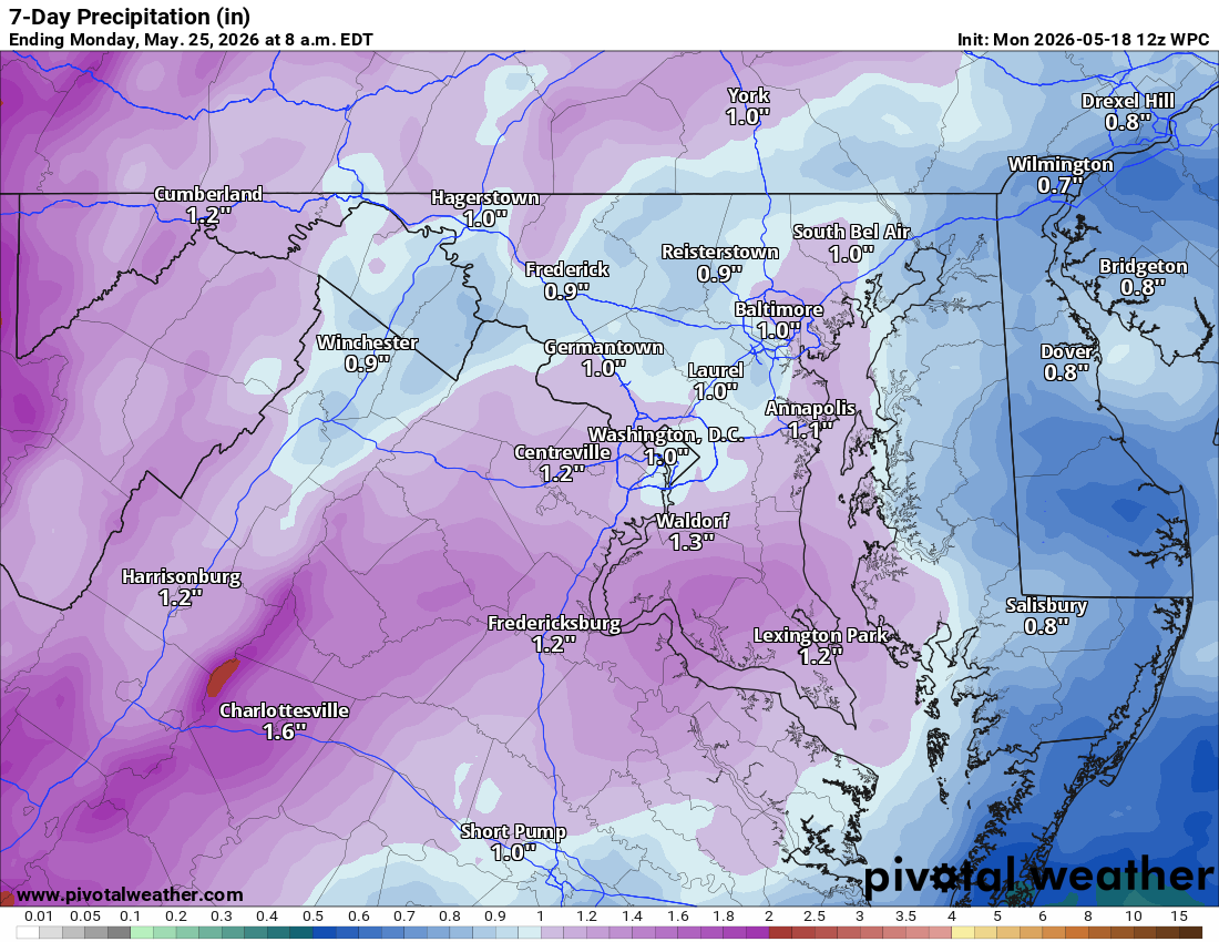
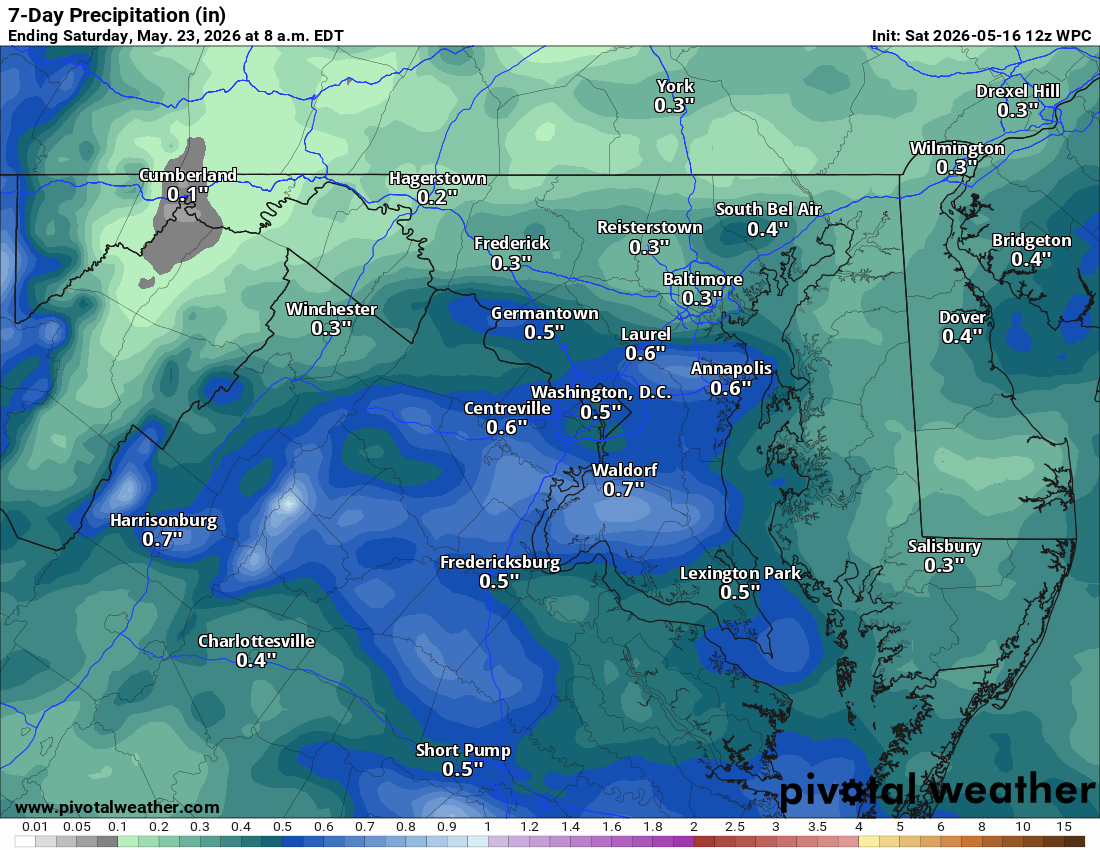
💧 Rainfall Totals
Only about a half to three-quarters of an inch is expected over the next seven days.

The forecast:
Today: Hi 82 🌤️ Lo 61 🌧️20% – Increasing clouds, slight chance of showers this evening

Sunday: Hi 87 🌦️20% Lo 63 🌙 – Partly sunny with slight chance of showers
and thunderstorms

Monday: Hi 93 ☀️ Lo 68 🌙 – 🥵Hot and Sunny

Tuesday: Hi 94 ☀️ Lo 69 🌙 – 🥵 Hot and Sunny

Wednesday: Hi 92 🌦️60% Lo 61 🌧️60% – Mostly sunny then showers and
thunderstorms

Thursday: Hi 74 🌦️40% Lo 52 🌧️30% – Partly sunny with chance of showers

Friday: Hi 70 🌦️30% Lo — 🌙 – Partly sunny with chance of showers

#loudoun #loudouncountyva #vawx #loudounweather #loudounva #virginiaweather

Please support Tree of Life Ministries, an important organization to me!

Loudoun County Weather Outlook for Friday, May 15, 2026

☀️ Gorgeous Friday!
Today and tomorrow look great with sunny, gorgeous skies. Today we stay in the 70s with some breezy conditions, and low 80s tomorrow.

🌤️ Warming Up This Weekend
Sunday, we’re pushing into the upper 80s. We'll have to watch for a few showers and storms Sunday afternoon as the humidity starts to creep up.

🔥 Mid-Week Heat Wave
The heat really arrives Monday and sticks around through Wednesday. We’re looking at highs in the 90s for the start of the week. Tuesday looks particularly intense, with temperatures potentially reaching the mid- to upper 90s in some spots. It's going to be crazy hot for this time of year!

⛈️ Storm Watch & Relief
Storms show up on Wednesday, and some of those could be strong to severe. We'll keep a close eye on how that pans out. By Thursday, those storms will knock the temperatures back down to around the 80 mark with a few lingering showers.

📅 Long Range Outlook
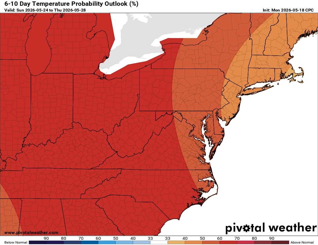
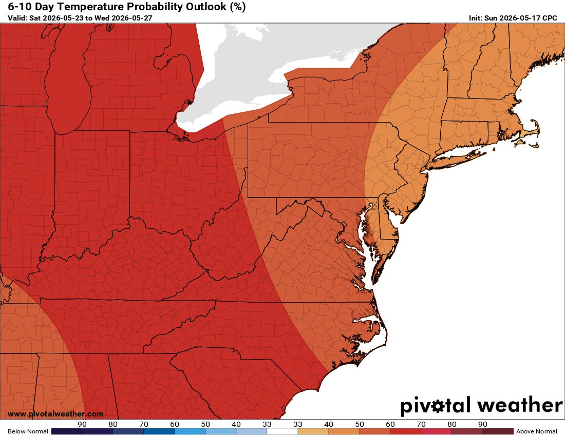
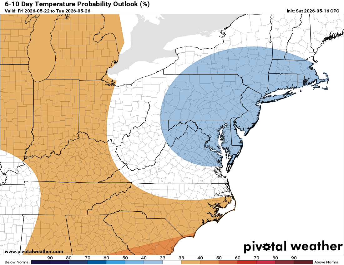
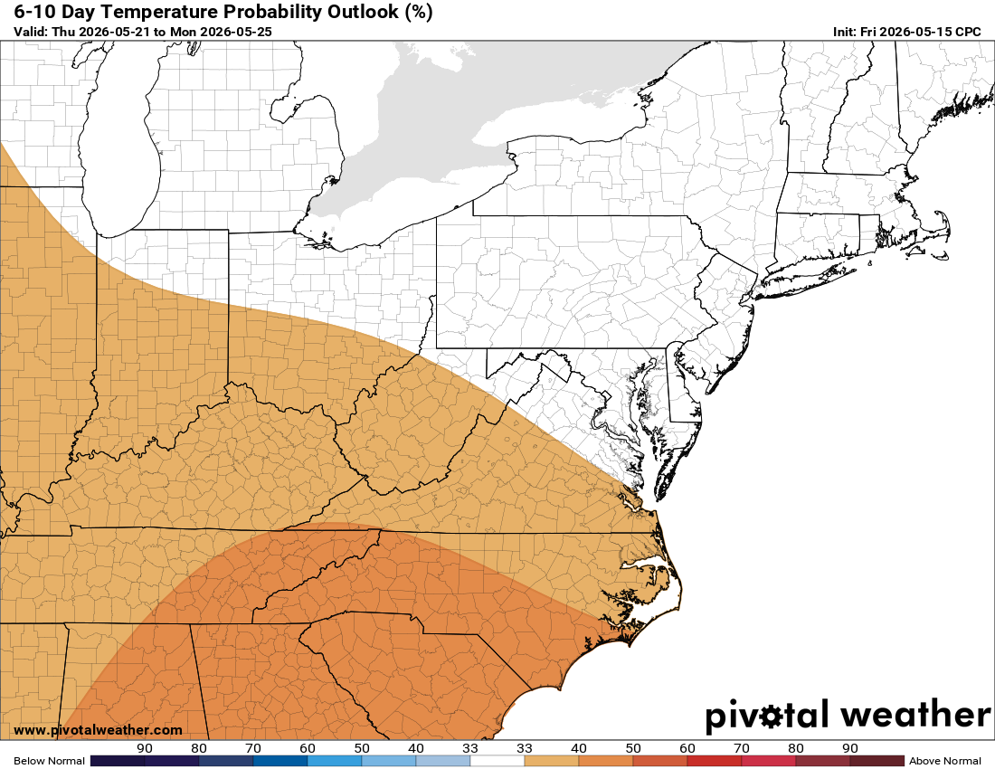
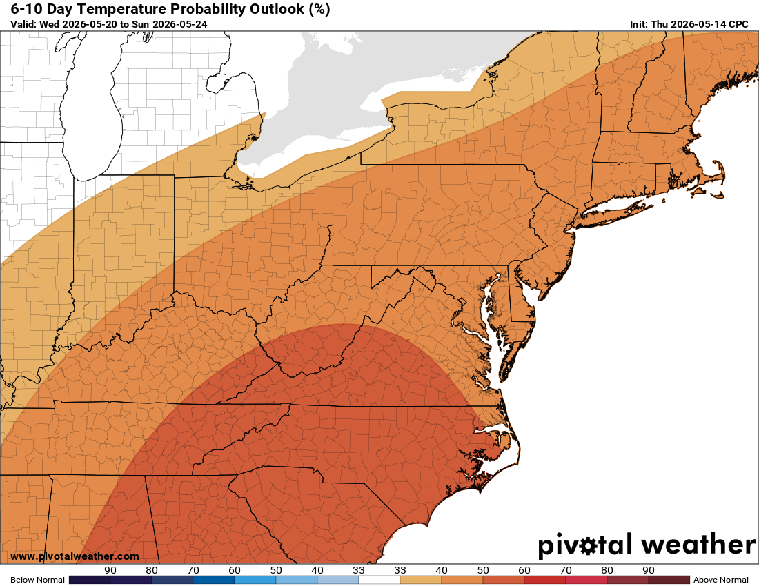
Temperatures should remain near or slightly above normal heading into the holiday. We are watching for potential rain for Memorial Day weekend, but since it’s so far off, we’ll see if the models hold up. We still need the rain, so hopefully we get some!

The forecast:
Today: Hi 71 🌤️ Lo 48 🌙 – Mostly sunny with wind 9-14 mph gusting to 24 mph

Saturday: Hi 82 ☀️ Lo 61 ☁️ – Sunny and warm

Sunday: Hi 88 🌦️30% Lo 63 🌙 – Hot, partly sunny with chance of showers and
thunderstorms

Monday: Hi 92 ☀️ Lo 67 🌙 – 🥵 Hot

Tuesday: Hi 94 ☀️ Lo 70 ⛅ – 🥵 VERY HOT!

Wednesday: Hi 90 🌦️50% Lo 63 🌧️40% – Mostly sunny with chance of showers
and thunderstorms

Thursday: Hi 80 🌦️50% – A chance of showers and
thunderstorms

#loudoun #loudouncountyva #vawx #loudounweather #loudounva #virginiaweather

Please support Tree of Life Ministries, an important organization to me!