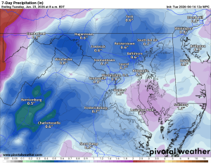
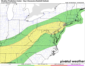
⚠️⚡️Severe and Heavy Rain possible tomorrow!
🌤️ Happy Father's Day on the longest day of the Year!
Today will be nice with highs in the mid to upper 80s
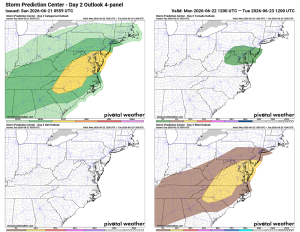
⛈️ Severe Threat Tomorrow
Monday brings a good chance of scattered showers and storms, with highs near 93. Some storms could become severe, with the potential for heavy downpours, strong winds, and even tornadoes.
🌤️ Quick Turnaround Tuesday
Maybe an isolated shower lingers into Tuesday, then highs settle into the low to mid 80s with a northerly breeze and lower humidity. Should be a really nice day.
🌦️ Rain Chances Return Late Week
Thursday brings rain chances back, around 50%, along with rising humidity again. Thursday, Friday, and Saturday all carry shower and storm chances, around 50% for Thursday and Friday, tapering off Saturday. Highs stay in the mid to upper 80s all three days.
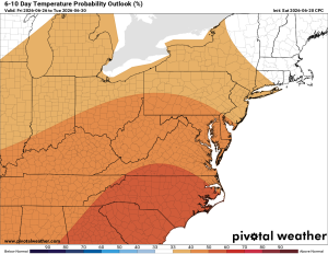
🔥 Heat Building Long Range
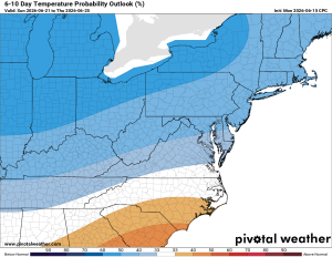
Looking further out, temperatures trend hotter than normal, so get ready for a return of summer heat.
The forecast:
Today: Hi 85 🌦️ 20% Lo 63 🌙 – Isolated morning showers, then sunny.
Increasing clouds overnight.
Monday: Hi 92 ⛈️ 90% Lo 64 🌧️ 80% – Scattered showers and thunderstorms
likely, becoming more widespread through the afternoon and evening.
Tuesday: Hi 82 🌦️ 20% Lo 59 🌙 – Isolated showers possible before 2pm
Wednesday: Hi 84 🌞 Lo 62 🌙 – Sunny and ncie.
Thursday: Hi 86 🌦️ 50% Lo 63 🌧️ 50% – Mostly sunny with a chance of
afternoon and evening showers and thunderstorms.
Friday: Hi 86 🌦️ 40% Lo 64 🌧️ 30% – Partly sunny with a chance of showers
and thunderstorms
Saturday: Hi 87 🌦️20% – Mostly sunny with a slight chance of showers.
Loudoun County Weather Outlook for Saturday, June 20, 2026
☀️ Gorgeous Saturday
Happy Saturday! Sunny skies, a nice breeze, and temperatures up in the mid-eighties today.
🌤️ Warmer Sunday
Tomorrow feels a touch warmer with highs in the upper eighties and a bit more humidity creeping in late in the day.
🌧️ Rain Moves In
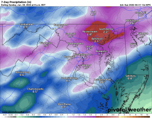
A stray shower is possible overnight into Sunday morning, then a good chance of rain arrives Monday. Rain continues Monday night before wrapping up.
🌦️ Midweek Lull
We settle back into the mid-eighties through the middle of the week with dry conditions for a stretch.
⛈️ Storms Return Late Week
Showers and storms make a comeback late Wednesday night and stick around for Thursday and Friday, with highs still in the mid-eighties.
Overall, a typical summertime week, with normal temps lasting a bit longer, a possible hot trend shows in the long range.
The forecast:
Today: Hi 84 🌞 Lo 61 🌙 – Sunny with a northwest wind 13-15 mph, gusts to
26 mph
Sunday: Hi 86 ☀️ Lo 65 🌧️ 30% – Sunny with west winds 7-14 mph, gusts to 25
mph; chance of showers after 2am
Monday: Hi 87 🌧️ 90% Lo 63 🌧️ 80% – Showers likely with possible
thunderstorms; showers and storms continue into the evening
Tuesday: Hi 83 🌤️ Lo 60 🌙 – Mostly sunny and pleasant
Wednesday: Hi 84 ☀️ Lo 62 🌧️ 30% – Sunny; slight chance of showers and
thunderstorms overnight
Thursday: Hi 84 🌦️ 40% Lo 62 🌧️ 30% – Chance of showers and thunderstorms
Friday: Hi 84 🌦️40% – Chance of showers and thunderstorms
Loudoun County Weather Outlook for Friday, June 19, 2026
☀️ Happy Juneteenth
Today's looking really nice. Morning clouds and any showers clear out quickly, and we'll climb into the low to mid 80s with breezy conditions and comfortable humidity.
🌤️ Beautiful Weekend Ahead
Saturday looks clear and beautiful again, still a bit breezy, with highs around 83 to 84. Sunday warms up a touch more into the upper 80s, with humidity staying in check until late evening.
🌧️ Rain is possible late Sunday Night and Monday
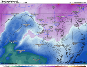
Showers arrive late Sunday night, setting up a good chance of showers and storms Monday, around 80%. We need every drop as our drought remains severe.
🌦️ Midweek Summer and a bit unsettled
Tuesday clears back out with highs in the low 80s, a really nice day. Wednesday brings a slight chance of showers and storms, with another chance Thursday as we head back into the mid 80s and slightly higher humidity, more of that summer feel.
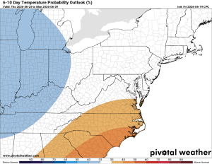
🔭 Looking further out, temperatures trend toward above normal, which this time of year can make for some uncomfortable stretches.
Have an awesome Friday and weekend, and Happy Father's Day to all the dads out there!
The forecast:
Today (Juneteenth): Hi 82 🌦️ 40% Lo 61 🌙 – Scattered morning showers,
then clearing and a bit breezy
Saturday: Hi 82 🌞 Lo 61 ⛅ – Sunny and pleasant
Sunday: Hi 86 ☀️ Lo 65 🌧️ 40% – Sunny skies during the day; chance of
showers and thunderstorms late at night
Monday: Hi 85 🌦️ 80% Lo 63 🌧️ 50% – Showers and thunderstorms likely
Tuesday: Hi 82 🌤️ Lo 60 ⛅ – Mostly sunny and pleasant
Wednesday: Hi 84 🌦️ 20% Lo 62 🌧️ 20% – Mostly sunny with a slight
chance of showers and thunderstorms
Thursday: Hi 85 🌦️ 30% – Mostly sunny with a chance of showers and
thunderstorms
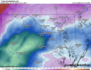
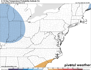
Loudoun County Weather Outlook for Wednesday, June 17, 2026
☀️ Sunny and Hot Today
Today's looking sunny with highs heating up into the mid and upper 80s. It'll feel a touch more humid as well.
🌧️ Scattered Storms Tomorrow, Some Could Be Severe
More humidity and increasing winds move in tonight and tomorrow, bringing a chance of scattered showers and storms, along with hot temperatures. We're under a slight risk, with damaging wind the main concern since strong winds aloft could mix down to the surface even with a strong shower.
🌤️ Nice Weekend on the Way
That system clears out, setting up a beautiful weekend. Friday could see a few early showers before clearing, then 80s for Friday and through the weekend with lower humidity.
🌦️ Rain Chances Return Late Sunday Into Next Week
Late Sunday night into Monday, another chance of showers and storms moves in. Temperatures will be at or below normal with continued rain chances Monday and Tuesday, possibly extending further into next week.
Also worth noting, Tropical Storm Arthur did form in the Gulf. The added moisture may have some indirect influence on our weather, but no major direct impact is expected here.
The forecast:
Today: Hi 86 🌤️ Lo 68 ☁️ – Mostly sunny
Thursday: Hi 90 🌦️ 50% Lo 65 🌧️ 20% – Chance of showers and thunderstorms in the morning and midday
Juneteenth (Fri): Hi 84 🌞 Lo 60 🌙 – Mostly and breezy
Saturday: Hi 82 🌞 Lo 60 🌙 – Sunny
Sunday: Hi 86 🌤️ Lo 62 🌧️ 40% – Sunny during the day; chance of showers
and thunderstorms overnight
Monday: Hi 84 ☁️ 70% Lo 62 🌧️ 50% – Showers likely with a possible
thunderstorm; chance of showers and thunderstorms continuing overnight
Tuesday: Hi 83 🌤️ 20% – Mostly sunny with a slight chance of showers
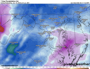
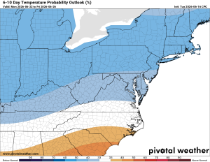
Loudoun County Weather Outlook for Tuesday, June 16, 2026
☀️ A Beautiful Tuesday
Today is just lovely.
🌡️ Warming Up Wednesday
Humidity nudges back up, and highs climb into the mid-80s.
⛈️ Thursday is the Day to Watch
Hot, humid, and windy, with highs in the low to mid-90s. There is a 40% chance of storms. Severe weather is possible with strong winds aloft. I believe wind direction (from the west) and modeled storm movement are not super robust for widespread severe weather, but any storm that fires could be severe (including a tornado risk), so I will continue to monitor.
🌦️ Friday: Getting better
A few lingering showers are possible, but temperatures fall back into the 80s. A decent recovery day.
😎 A Pleasant Weekend
Low to mid-80s both Saturday and Sunday. Humidity creeps back up late Sunday, but overall a nice stretch.
🌧️ Next Week: Rain Returns
Showers and storms look likely Monday and Tuesday, with temperatures staying in the 80s.
🌀 Wildcard: Potential Tropical Storm Arthur?
A developing system in the far western Gulf is worth tracking (Maybe the first Atlantic basin Tropical Storm of the season). It is possible that tropical moisture could enhance rainfall totals for our area, though not a direct impact. Something to watch.
The forecast:
Today:Hi 78 🌞 Lo 60 ⛅ – Sunny
Wednesday: Hi 86 🌤️ Lo 65 ⛅ – Mostly sunny
Thursday: Hi 93 🌦️ 40% Lo 65 🌧️ 40% – Partly sunny with a chance of
showers and thunderstorms, breezy with gusts up to 30 mph
Juneteenth (Friday): Hi 81 🌦️ 40% Lo 60 🌙 – A chance of showers in the
morning
Saturday: Hi 82 🌞 Lo 59 🌙 – Sunny
**Sunday:** Hi 84 🌞 Lo 62 🌧️ 20% – Sunny during the day, slight chance of
showers overnight
Monday: Hi 85 🌦️ 50% – Partly sunny with a chance of
showers and thunderstorms