🥵 Hot and Hazy Today
Clouds mix with sun as highs push toward 91°F. Heat index near 100°F, so stay hydrated.
🔥 Heat Wave Peaks Tomorrow
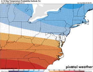
Monday is the hottest day of this stretch, with highs in the mid-90s and heat index into the low 100s. A heat advisory wouldn't be surprising, mainly east of us.
⛈️ Storm Chances Return Tuesday
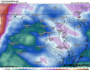
Increased risk of showers and thunderstorms Tuesday should keep highs a bit lower than they'd otherwise be.
⚠️ Wednesday Could Get Interesting
A storm complex may move through midweek, bringing gusty winds and a real pattern change.
🌡️ Still Warm Thursday
Highs stay in the upper 80s.
😌 Relief by Friday
Temperatures ease into the low 80s with just a slight chance of storms.
☀️ Beautiful Weekend Ahead
Highs in the low 80s Saturday with a good shot at staying dry into Sunday. Great weekend to get outside.
Stay cool today and tomorrow, and watch for severe weather midweek. Have a good one!
The forecast:
Sunday: Hi 91 🌤️ Lo 69. Mostly cloudy, clearing to sunny, then clear overnight.
Monday: Hi 93 ⛅30% Lo 72 🌧️30%. Increasing clouds, chance of afternoon storms continuing overnight.
Tuesday: Hi 89 🌦️60% Lo 69 🌧️60%. Storms likely in the afternoon and evening, chance of showers overnight.
Wednesday: Hi 86 🌦️40% Lo 68 🌧️50%. Slight chance of showers, then afternoon storms, chance overnight too.
Thursday: Hi 86 🌦️30% Lo 67 🌧️30%. Chance of afternoon storms lingering into early evening.
Friday: Hi 83 🌞20% Lo 63. Slight chance of storms, otherwise partly sunny.
Saturday: Hi 82 🌞 Lo 59. Mostly sunny.
Please support Tree of Life Ministries, an important organization to me! https://www.tolministries.org
Find something fun to do @ https://summer.joyinnova.com
Facebook: https://facebook.com/loudounwx
Twitter: https://twitter.com/loudounwx
Instagram: https://www.instagram.com/loudounweather/
On the Web @ https://loudounweather.com