Local weather. A little perspective.Loudoun County, VirginiaOfficial NWS alerts ↗
Loudoun County, Virginia

Category: Uncategorized

Loudoun County Weather Outlook for Saturday, June 27, 2026

☁️ Cloudy Saturday with Showers and Storms
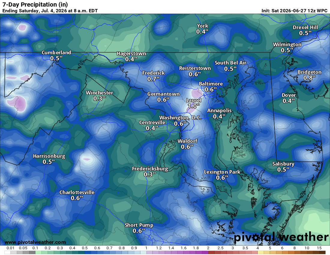
Happy Saturday! It's gonna be a cloudy one with periods of showers and storms around. This morning isn't looking too impressive rain wise, so the Purcellville Parade coming up in about an hour should be just fine. Tonight we've got a chance of more showers and storms into the evening and overnight.

🌧️ Drying Out a Bit Tomorrow
Sunday still carries a decent chance of showers and storms. We could use all the rain we can get.

😎 Monday Looks Like the Pick of the Week
Highs in the upper 80s and easily the nicest day coming up.

🔥 Heat Cranks Up Tuesday Through the Weekend
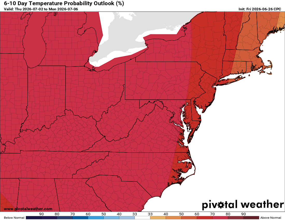
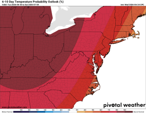
Things heat up fast after Monday, low 90s Tuesday, upper 90s Wednesday, and low 100s Thursday and Friday. Some showers and storms could mix in, helping knock temps down a bit, but any that form could be on the stronger side, so something to watch. The heat eases up a touch into next weekend, with upper 90s expected and maybe a bit more unsettled weather helping take the edge off.

🎆 Fourth of July Hot as a Firecracker
Mid and upper 90s on the Fourth, though some showers and storms could help take the edge off.

The forecast:

Today: Hi 80 🌧️80% Lo 65 🌧️60% – Showers likely through the day with a chance of a thunderstorm, continuing into the evening

Sunday: Hi 83 🌦️30% Lo 65 🌧️30% – Partly sunny with a chance of showers and storms in the afternoon, lingering into the night

Monday: Hi 87 ☀️ Lo 67 – Sunny and easily the nicest day of the week

Tuesday: Hi 93 ☀️ Lo 71 – 🥵 Sunny and hot

Wednesday: Hi 98 🌡️☀️ Lo 73 🌧️20% – 🥵 Sunny and hot, slight chance of showers overnight

Thursday: Hi 102 🌡️☀️ Lo 77 – 🥵 Sunny and hot

Friday: Hi 101 🌡️🌦️ Lo 74 – 🥵 Hot. Maybe a shower or storm

#loudoun #loudouncountyva #vawx #loudounweather #loudounva #virginiaweather

Please support Tree of Life Ministries, an important organization to me! https://www.tolministries.org

Loudoun County Weather Outlook for Friday, June 26, 2026

☁️ Cloudy and Hot Today
We've got a cloudy, warm one on tap with highs near 90. Showers look likely later today, especially heading into the evening, with showers and storms continuing overnight.

🌧️ More Showers and Storms Tomorrow
Saturday brings more showers and storms, with highs cooling off a bit into the 80s.

⛅ Less Widespread Showers/Storms Sunday
Showers and storms look less widespread on Sunday, with around a 30% chance. Highs climb into the mid 80s.

🥵 Heat Wave Arrives Next Week
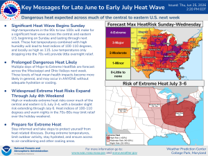
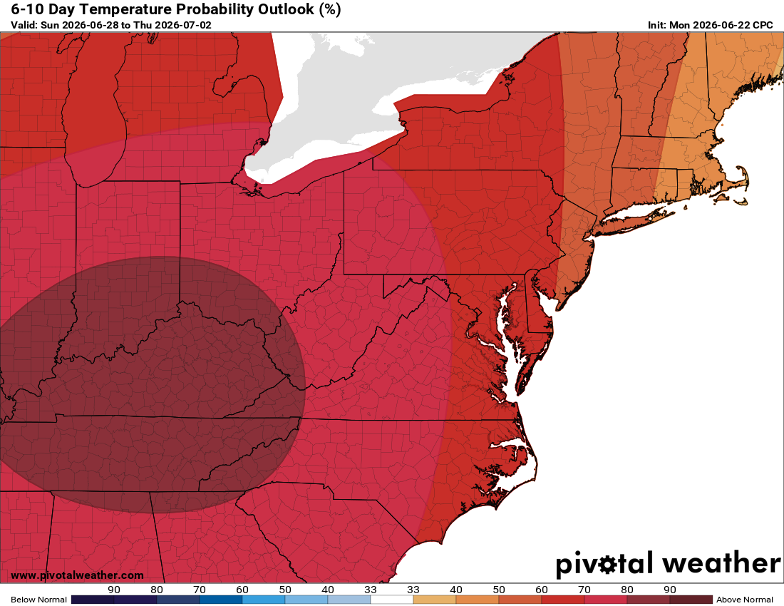
Monday brings mid to upper 80s, then temperatures take off as we climb into the mid 90s by Tuesday, and up near 100 both Wednesday and Thursday. This brutal heat looks likely to continue right on through the 4th of July, so outdoor plans later next week will need some proper planning.

Now's a good time to get your AC checked (if you have not) and filters changed before the worst of the heat hits!

The forecast:

Today: Hi 88 🌦️40% Lo 64 🌧️80% – Mostly sunny becoming cloudy with showers and storms developing, continuing overnight

Saturday: Hi 80 🌧️80% Lo 65 🌧️60% – Showers likely with a chance of thunderstorms through the day and into the night

Sunday: Hi 83 🌦️30% Lo 65 🌙 – Partly sunny with a chance of showers and storms, clearing overnight

Monday: Hi 87 ☀️ Lo 67 🌙 – Sunny

Tuesday: Hi 93 ☀️ Lo 71 🌙 – 🥵 Sunny

Wednesday: Hi 98 🌡️ Lo 73 🌧️20% – 🥵🔥 Sunny and hot, slight chance of showers and storms overnight

Thursday: Hi 100 🌡️ Lo 73 – 🥵🔥Sunny and hot

#loudoun #loudouncountyva #vawx #loudounweather #loudounva #virginiaweather

Please support Tree of Life Ministries, an important organization to me! https://www.tolministries.org


Loudoun County Weather Outlook for Thursday, June 25, 2026

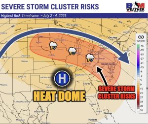
⚠️ Welcome rain and then, 🥵 A Heat wave on the way next week! 🌡️ Ring of fire pattern can bring clusters of storms on its edges, but that edge may shift north of what we see in the image ( BAM Weather – BAMWX.com on X created this great graphic)

🌞 Nice Day
Today's a decent day before the pattern shifts, warm with highs in the mid to upper 80s and a bit more humidity, bringing in some clouds. A late-day or overnight shower is possible but not widespread.

🌧️ Showers and Storms Move In
Friday turns hot with highs near 88 and showers and storms

🌦️ Welcome Rain Saturday
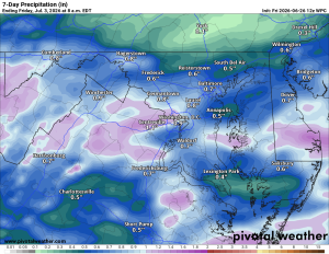
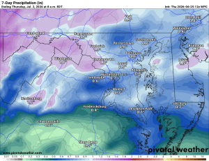
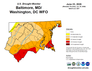
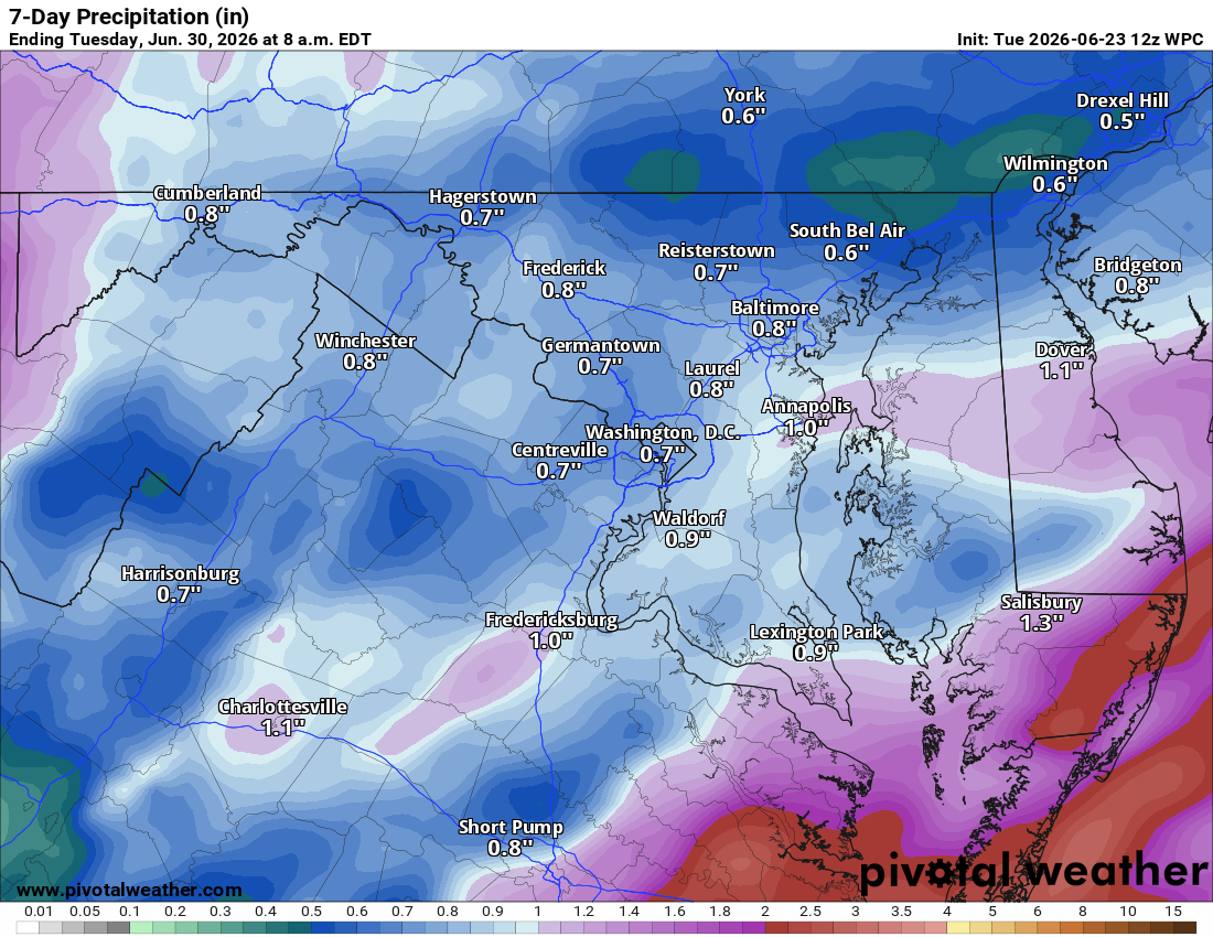
Saturday looks wet, which will be a big help for the ongoing drought.

☁️ Sunday Break
Sunday brings a chance of showers with highs in the low to mid 80s.

🔥 Heat Builds Next Week
The heat starts building Monday with highs near 90, then mid-90s Tuesday and upper-90s Wednesday, with heat index values exceeding 100. We're heading into a ring of fire pattern, and we'll be watching for severe thunderstorms to fire up along the edges of that heat late next week.

The forecast:
Today: Hi 87 🌦️ 20% Lo 65 🌧️ 20% – Mostly sunny with a slight chance of
afternoon showers

Friday: Hi 88 🌦️ 60% Lo 66 🌧️ 90% – Chance of showers and thunderstorms afternoon and night

Saturday: Hi 81 🌧️ 80% Lo 65 🌧️ 60% – Showers and possible thunderstorms

Sunday: Hi 84 🌦️ 20% Lo 65 – Mostly a partly sunny day with a slight chance
of afternoon showers and thunderstorms

Monday: Hi 88 ☀️ Lo 67 – Mostly sunny and getting hotter

Tuesday: Hi 95🌤️ Lo 71 – 🥵 Mostly sunny and hot!

Wednesday: Hi 98 🌡️ ☀️ – 🌡️ 🥵 Sunny and hot

#loudoun #loudouncountyva #vawx #loudounweather #loudounva #virginiaweather

Please support Tree of Life Ministries, an important organization to me!


Loudoun County Weather Outlook for Tuesday, June 23, 2026

🌧️ Rain Through the Midday, Then Clearing
Today looks cool with rain moving through the middle part of the day before clearing later on. Highs only in the mid and upper 70s.

☀️ Best Day of the Week Tomorrow
Wednesday turns beautiful with highs in the low 80s.

🌥️ Humidity Builds Thursday into Friday
Highs climb into the mid and upper 80s with more humidity. Friday brings a good chance of showers and storms.

🌦️ Showers Linger This Weekend
Saturday looks for some showers with highs in the low 80s. Sunday eases up a bit, with just an isolated chance of a shower or storm and highs in the mid and upper 80s.

🔥 Warm Up Begins Monday
Highs near 90° kick off the warmup. Next week, temperatures could approach 100° as a real heat wave builds in, with some potential for severe weather we'll need to watch closely.

The forecast:
Today: Hi 76 🌧️80% Lo 58 ☁️ – Showers and thunderstorms likely, mainly
before 2pm with scattered storms returning in the afternoon. Clearing
overnight.

Wednesday: Hi 81 🌞 Lo 59 – Sunny and pleasant.

Thursday: Hi 85 🌤️ Lo 65 🌧️20% – Mostly sunny during the day, slight chance
of storms overnight.

Friday: Hi 86 🌦️60% Lo 66 🌧️70% – Partly sunny with likely showers and
possible thunderstorms in the afternoon, storms continuing overnight.

Saturday: Hi 81 🌧️60% Lo 66 🌧️30% – Mostly cloudy with likely showers and
possible afternoon thunderstorms, chance of storms continuing overnight.

Sunday: Hi 85 🌤️20% Lo 66 – Mostly sunny with a slight chance of showers
and thunderstorms.

Monday: Hi 88 🌤️ – Mostly sunny.

#loudoun #loudouncountyva #vawx #loudounweather #loudounva #virginiaweather

Please support Tree of Life Ministries, an important organization to me!

Loudoun County Weather Outlook for Monday, June 22, 2026

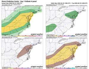
⚠️⚡️ Severe Weather Possible today!

🥵 Hot and Humid Today ⚠️ Severe Risk This Afternoon/Evening
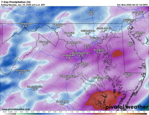
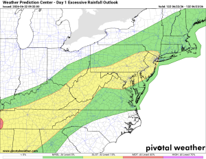
We're in for a hot one, with highs near 90°F and muggy conditions. Showers and storms are likely through the early and mid-afternoon, with another round possible this evening. Some storms could turn severe with damaging winds, hail, and an isolated tornado or two. Nothing widespread expected, and any tornadoes would likely be brief and weak, but stay weather aware.

🌧️ Flooding Possible
Rain could be heavy, bringing a slight risk of flash flooding. If you've got drainage areas that tend to clog, now's a good time to clear them out.

😌 Relief Midweek
Tuesday starts with isolated showers into midday before clearing up, with highs in the low 80s. Wednesday looks like the pick of the week: mid 80s and lower humidity.

🌦️ Humidity Returns Late Week
Thursday through Saturday brings the humidity back along with afternoon and evening shower and storm chances, highs in the mid to upper 80s. Sunday settles into the mid 80s.

🔥 Heat Wave Possible
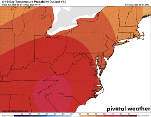
Long range guidance hints at a heat wave developing as we start next week. This will need to be monitored.

The forecast:
Today: Hi 87 ⛈️ 90% Lo 64 🌧️ 80% – Scattered showers and thunderstorms, some could be severe

Tuesday: Hi 80 🌦️ 20% Lo 58 🌙 – Isolated showers possible before
afternoon

Wednesday: Hi 83 🌞 Lo 61 🌙 – Sunny and pleasant

Thursday: Hi 88 🌦️ 40% Lo 65 🌧️ 30% – Chance of showers and thunderstorms
in the afternoon

Friday: Hi 87 🌦️ 50% Lo 64 🌧️ 30% – Chance of showers and thunderstorms

Saturday: Hi 84 🌦️ 30% Lo 64 🌧️ 30% – Chance of showers and thunderstorms

Sunday: Hi 85 ☀️ – Mostly sunny