Local weather. A little perspective.Loudoun County, VirginiaOfficial NWS alerts ↗
Loudoun County, Virginia

Category: Uncategorized

Loudoun County Weather Outlook for Monday, July 13, 2026

☀️ Cooler Start, Beautiful Day We started off cooler than we've seen in a while, dropping into the low 60s and even upper 50s in spots overnight. Today's high near 85°F with plenty of sunshine, the nicest day of the week. Get outside and enjoy it if you can!

🔥 Heat Wave Building Temps start climbing tomorrow with highs in the low 90s. By Wednesday we're in the upper 90s, with heat indexes pushing into the low 100s. It'll be a bit less humid than our last heat wave, but still plenty hot.

🥵 Heat Continues Into the Week Thursday brings more of the same with highs in the mid to upper 90s. Friday remains hot with highs in the low 90s.

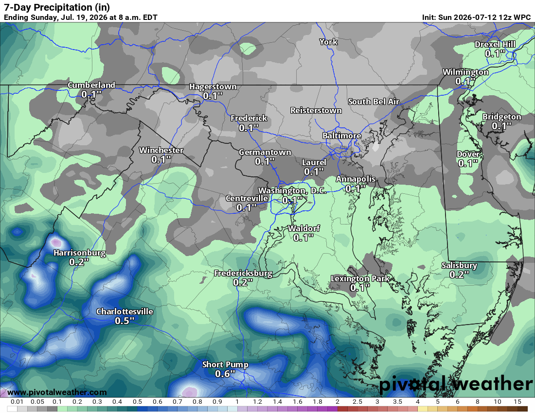
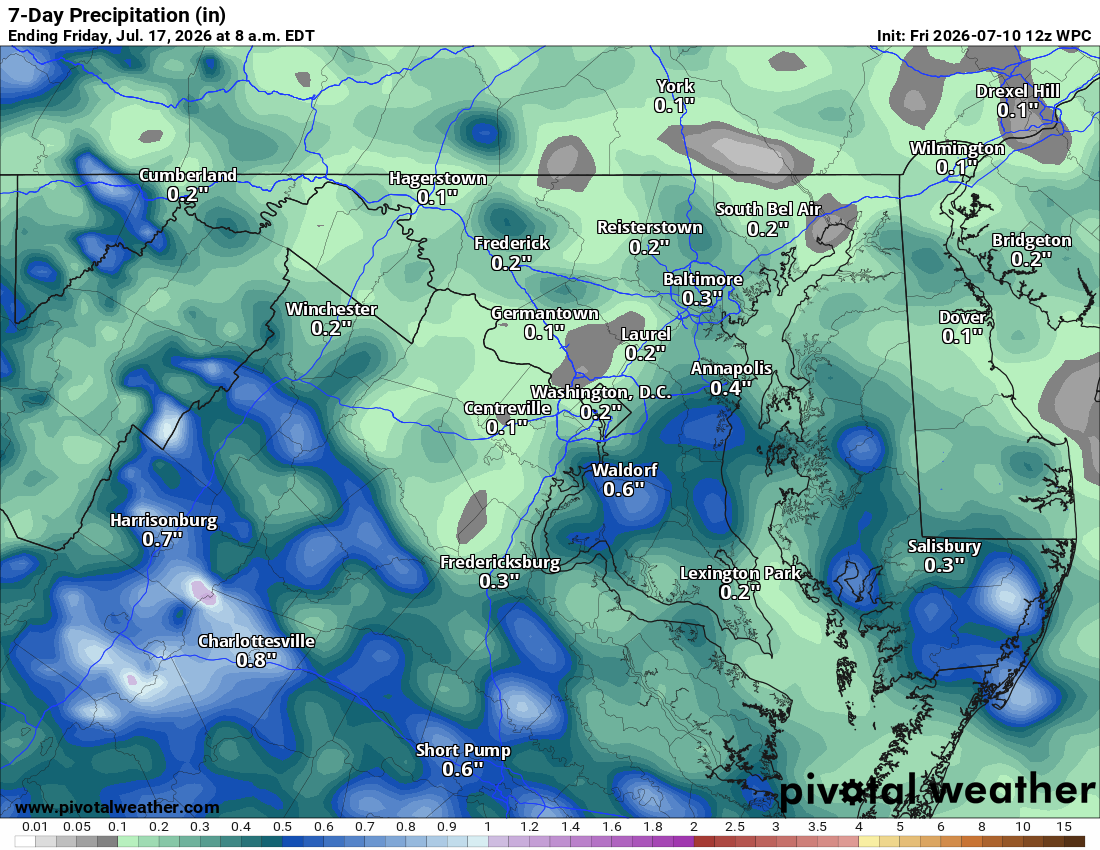
⛈️ Weekend Storm Chances As we head into the weekend, we may see chances of showers and storms return, with some uncertainty on whether any could turn severe. The Storm Prediction Center had placed a slight risk on this weekend but has since pulled it, likely due to uncertainty in timing and location.

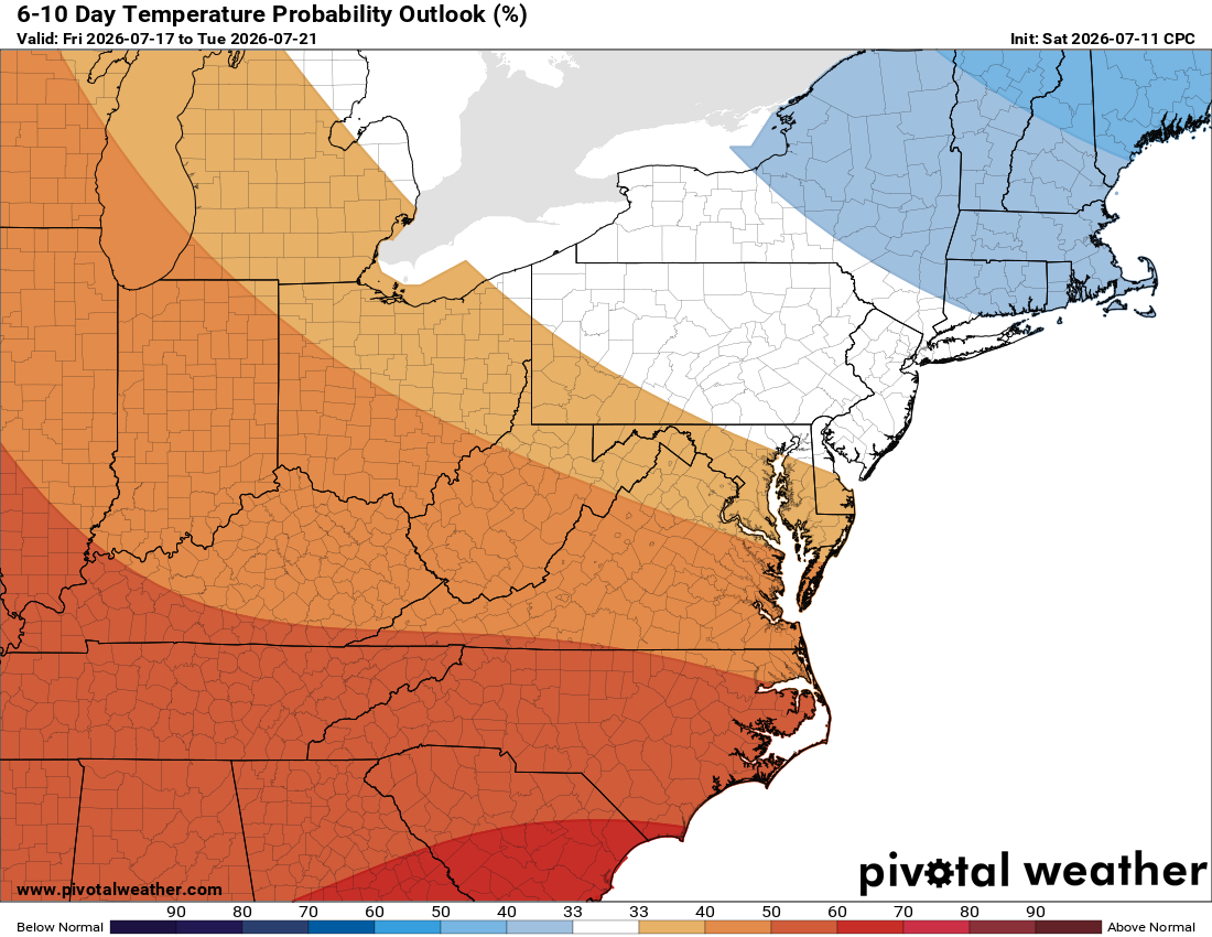
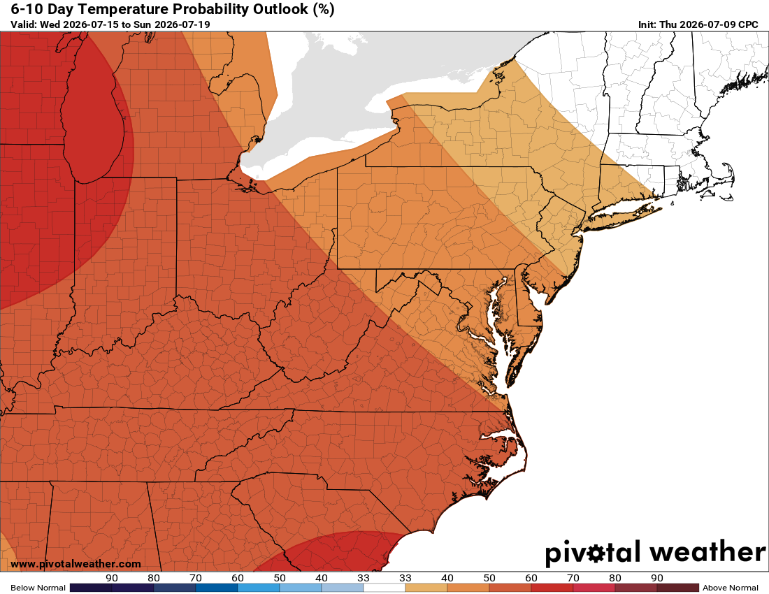
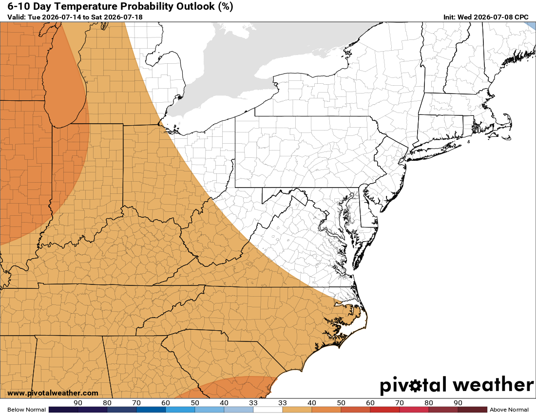
Above normal temperatures look to continue into next week as well.

The forecast:

Today: Hi 85 ☀️ Lo 63 – Patchy fog early morning, then sunny

Tuesday: Hi 91 🥵 ☀️ Lo 69 – Sunny

Wednesday: Hi 97 🌡️ ☀️ Lo 73 – Sunny and hot

Thursday: Hi 95 🥵 🌤️ Lo 71 – Mostly sunny

Friday: Hi 93 🥵 ☀️ Lo 70 – Sunny

Saturday: Hi 92 🥵 🌦️30% Lo 70 🌧️40% – Mostly sunny with a chance of showers and thunderstorms, continuing overnight

Sunday: Hi 90 🌦️30% Lo 69 – Mostly sunny with a chance of showers and thunderstorms

#loudoun #loudouncountyva #vawx #loudounweather #loudounva #virginiaweather

Please support Tree of Life Ministries, an important organization to me! https://www.tolministries.org

Facebook: https://facebook.com/loudounwx Twitter: https://twitter.com/loudounwx Instagram: https://www.instagram.com/loudounweather/ On the Web @ https://loudounweather.com TikTok: https://www.tiktok.com/@loudounweather
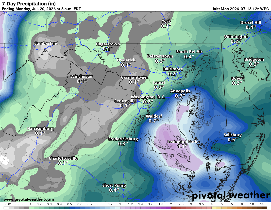
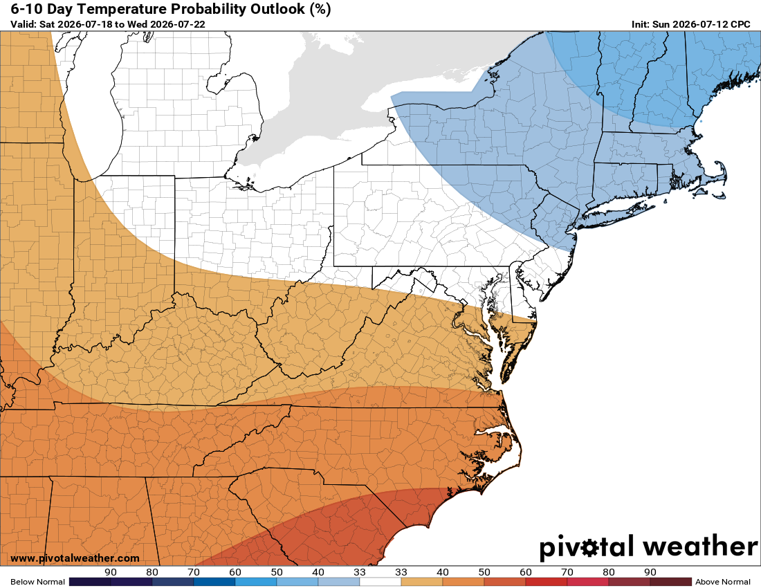
image.png
image.png

Loudoun County Weather Outlook for Sunday, July 12, 2026

🌦️ Humid With a Few Storms Today
Today's muggy thanks to an easterly fetch off the ocean, keeping us cloudy and sticky. A shower or storm is possible later in the day.

☀️ Tomorrow's the Pick of the Week
Drier air pushes in from the north Monday, making it the most comfortable day around, with highs in the low 80s.

🔥 Heat Cranks Up Midweek
Tuesday brings highs near 90, then Wednesday looks like the hottest day of the week with mid to upper 90s. Thursday and Friday stay in the low 90s.

⛈️ Heat and Storms Return Next Weekend
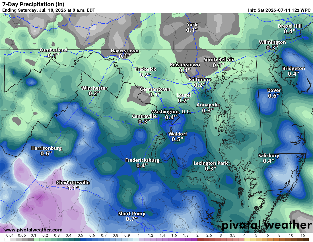
Low 90s continue into next weekend, with another shot at showers and storms. The Storm Prediction Center has already flagged next Saturday as a potential severe weather day at 15%, which is unusually high this far out. Exactly where storms fire is still uncertain, but confidence is growing that severe weather will show up somewhere in the region.

🌡️ Bottom Line
Look for a dry stretch most of the week after today's isolated storm chance, with above normal heat sticking around into next weekend and beyond.

The forecast:

Today: Hi 82 🌦️30% Lo 63 ☁️ – Showers or a thunderstorm possible this afternoon, clearing to partly cloudy overnight

Monday: Hi 81 🌞 Lo 61 – Mostly sunny and pleasant

Tuesday: Hi 87 ☀️ Lo 68 – Sunny and clear

Wednesday: Hi 95 🥵 Lo 71 – Hot and sunny

Thursday: Hi 92 🥵 Lo 69 ☁️ – Sunny, turning partly cloudy overnight

Friday: Hi 90 🌤️ Lo 68 🌧️20% – Mostly sunny, slight chance of showers and storms overnight

Saturday: Hi 90 🌦️30% Lo 68 🌧️ – Chance of showers and thunderstorms, otherwise mostly sunny

#loudoun #loudouncountyva #vawx #loudounweather #loudounva #virginiaweather
Please support Tree of Life Ministries, an important organization to me!

Loudoun County Weather Outlook for Saturday, July 11, 2026

☀️ Sunny and Humid Today
We've got sunshine and a bit of humidity with about a fifty percent chance of a shower or storm this afternoon and evening. A marginal risk for a strong storm and heavy downpours is in play, though coverage should stay scattered.

🌤️ Nice Stretch Sunday and Monday
We dry out and turn partly sunny both Sunday and Monday. Humidity sticks around thanks to an east wind, but overall it'll be a pretty nice couple of days.

🥵 Heat Wave Builds Tuesday
Temperatures start climbing Tuesday and keep going as a heat dome settles in, with the hottest stretch hitting midweek before backing off some by Friday. This qualifies as a heat wave, running Tuesday through at least Friday.

👀 Watching the Long Range
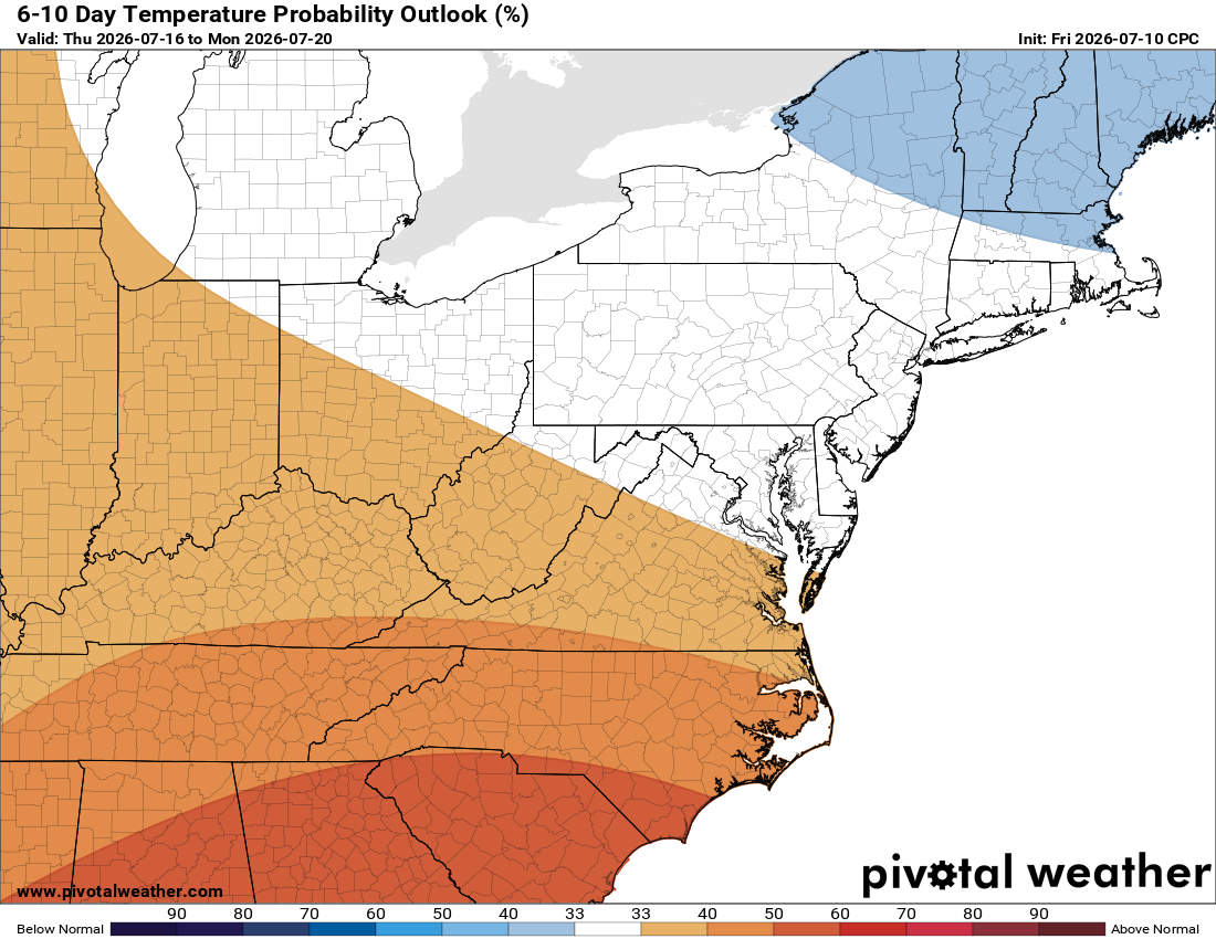
There's some debate in the long range on what happens next weekend. Some signals point to a pattern change bringing more seasonal conditions, while others suggest the heat could stick around. We'll be watching to see whether temperatures cool off or stay warm heading into the following week.

The forecast:

Today: Hi 84 🌦️50% Lo 65 🌧️40% – Patchy morning fog, then a chance of afternoon/evening showers and thunderstorms

Sunday: Hi 81 ⛅ Lo 62 ☁️ – Partly sunny with mostly cloudy skies overnight

Monday: Hi 82 ⛅ Lo 63 – Partly sunny, pleasant conditions

Tuesday: Hi 88 ☀️ Lo 68 – Sunny and clear

Wednesday: Hi 96 🥵☀️ Lo 72 – Sunny and hot

Thursday: Hi 93 🥵☀️ Lo 69 ☁️ – Sunny with partly cloudy skies overnight

Friday: Hi 90 🌦️20% Lo 74 – Mostly sunny with a slight chance of showers and thunderstorms

#loudoun #loudouncountyva #vawx #loudounweather #loudounva #virginiaweather

Please support Tree of Life Ministries, an important organization to me!

Loudoun County Weather Outlook for Friday, July 10, 2026

⛈️ Happy Friday, Loudoun!
It's gonna be an okay day, humid but not too hot, with a chance of showers and storms. Some could be isolated, strong to severe, but not as widespread as yesterday.

🌦️ Storm Chances Continue Saturday
Tomorrow brings a fifty percent chance of showers and storms, a pretty good chance we'll see something in the area. Not sure yet how much rain we'll get. Highs in the low 80s.

☁️ Drier Sunday
Sunday turns drier with highs in the lower 80s, but cloudy skies and still humid.
☀️ Nicest Day Monday

Monday looks like the pick of the week with highs only in the low 80s and sunny skies.

🥵 Heating Up Midweek
Temperatures warm up fast Tuesday, nearing 90, then mid 90s Wednesday and Thursday.

🌩️ Looking Ahead
By next weekend we could be talking some interesting weather, maybe severe storms, or a turn toward cooler temps. Still too far out on the models to know for sure.

The forecast:
Friday: Hi 87 🌦️40% Lo 68 🌧️30%, patchy morning fog, then partly sunny with showers and thunderstorms possible mainly after 3PM, chance of storms continuing into the evening

Saturday: Hi 83 🌦️60% Lo 64 🌧️30%, showers and thunderstorms likely through the afternoon, chance of storms lingering into the overnight hours

Sunday: Hi 82 ⛅ Lo 63, partly sunny

Monday: Hi 83 🌤️ Lo 63, mostly sunny

Tuesday: Hi 89 ☀️ Lo 68, sunny

Wednesday: Hi 95 🥵☀️ Lo 71, sunny, turning hot

Thursday: Hi 93 🌤️ Lo 76, mostly sunny

#loudoun #loudouncountyva #vawx #loudounweather #loudounva #virginiaweather
Please support Tree of Life Ministries, an important organization to me!

Loudoun County Weather Outlook for Thursday, July 9, 2026

⚠️ Flood Watch Today
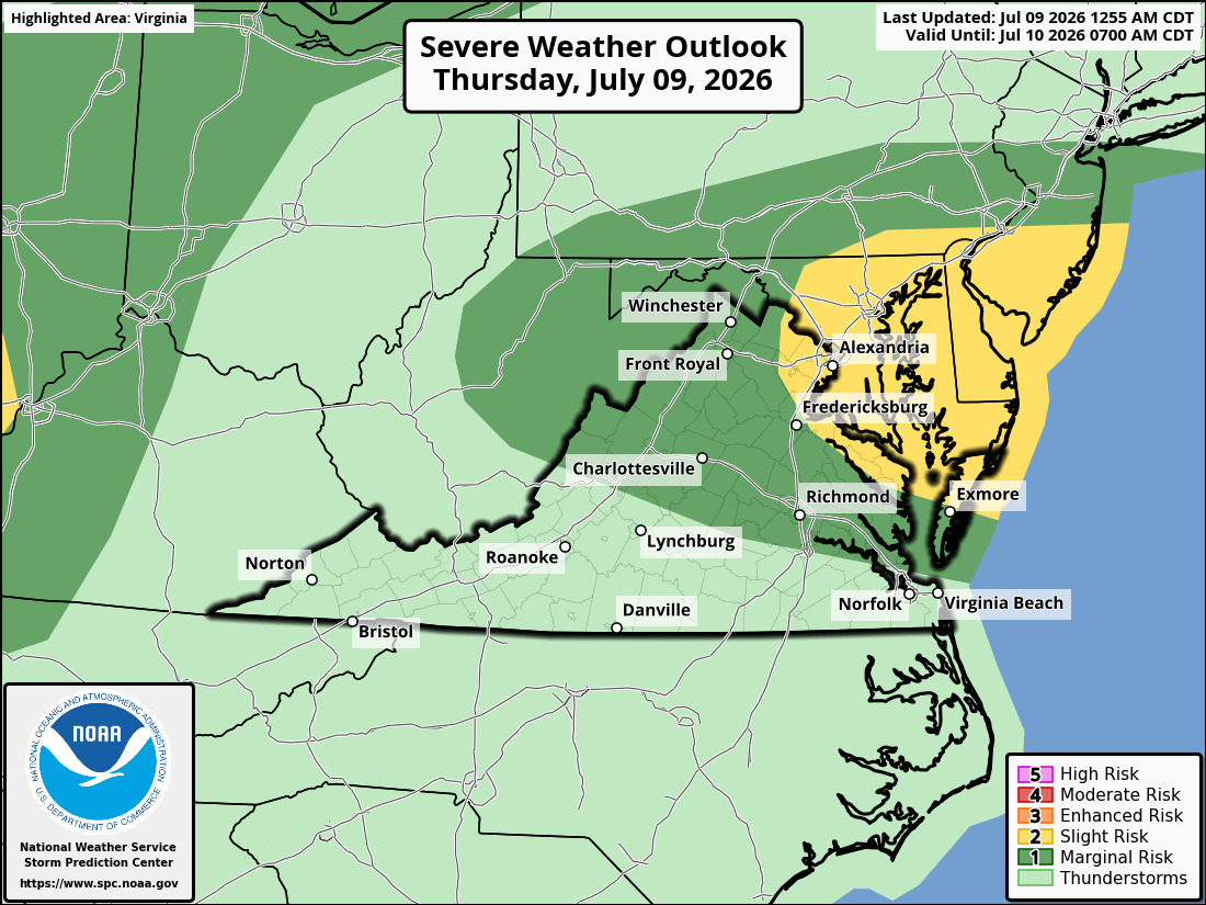
⚠️⚡ Some Storms Could Be Strong to Severe

🌧️ Muggy and Stormy Today
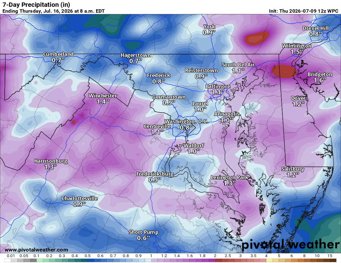
Another muggy day, highs in the mid to upper 80s with a good chance of showers and storms this afternoon and evening. Some storms could be strong to severe with heavy rain, so a flood watch is up. Showers clear late tonight.

🌦️ Similar Tomorrow
Friday looks similar, highs near 88, still humid with afternoon and evening showers and storms possible.

🌦️ More of the Same Saturday
Saturday looks similar too, showers likely with highs in the low 80s.

☀️ A Bit of a Break Sunday
Sunday brings just a 30% chance of showers, highs in the low 80s, a little better than the days before.

🌞 Beautiful Monday
Monday looks beautiful, highs in the low 80s and rain chances decreasing.

🔥 Warm Up Building Next Week
A stepping stone to a bigger warm up, highs near 90 Tuesday and mid 90s Wednesday. Heat returns later next week too, so the long range outlook could update today. We may see triple digit heat by week's end as a heat dome builds and flattens, bringing more heat, humidity, and maybe severe weather.

💧 Drought Monitor Update
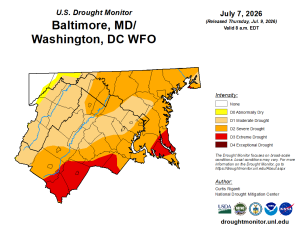
NW Loudoun is back into severe drought, eastern Loudoun remains moderate.

The forecast:

Today: Hi 85 ⛈️80% Lo 68 🌧️60% – Showers and storms through the day and evening, clearing overnight

Friday: Hi 87 🌦️60% Lo 67 🌧️30% – Isolated showers early, then scattered showers and storms afternoon and evening, continuing overnight

Saturday: Hi 82 🌦️60% Lo 63 🌧️60% – Showers likely with possible storms afternoon and evening

Sunday: Hi 82 ⛅30% Lo 62 🌧️30% – Chance of showers afternoon and evening

Monday: Hi 82 🌞 – Mostly sunny and pleasant

Tuesday: Hi 88 ☀️ – Sunny

Wednesday: Hi 94 🥵☀️ – Hot

Please support Tree of Life Ministries, an important organization to me!
image.png