Local weather. A little perspective.Loudoun County, VirginiaOfficial NWS alerts ↗
Loudoun County, Virginia

Category: Uncategorized

Loudoun County Weather Outlook for Friday, July 17, 2026

⚠️ Air Quality Alert

🌫️ Smoky and Hazy Today
Wildfire smoke pushed our air quality into hazardous levels, so stay indoors if you can, skip strenuous outdoor activity, and limit your time outside. Smoke sticks around into tonight.

⚡ Severe Weather Watch for Tomorrow
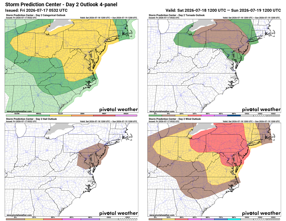
Storms tomorrow could bring severe weather with high winds, isolated hail, and even possibly a tornado, though it's a low chance. Morning showers could rob some energy, and smoke may limit instability, lowering the threat.

☀️ Gorgeous Sunday Ahead
Sunday turns beautiful with lower humidity, a northerly breeze, and wall-to-wall sunshine. Monday keeps that same great feel.

🔥 Midweek Warm Up, Smoke Returns
Temperatures climb back up on Tuesday, and some smoke may return. A shower and storm threat arrives Tuesday evening, so we'll watch that closely. Cooler air follows for Wednesday with maybe a stray shower, and Thursday looks great too.

🔭 Looking Further Out
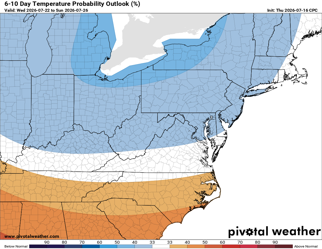
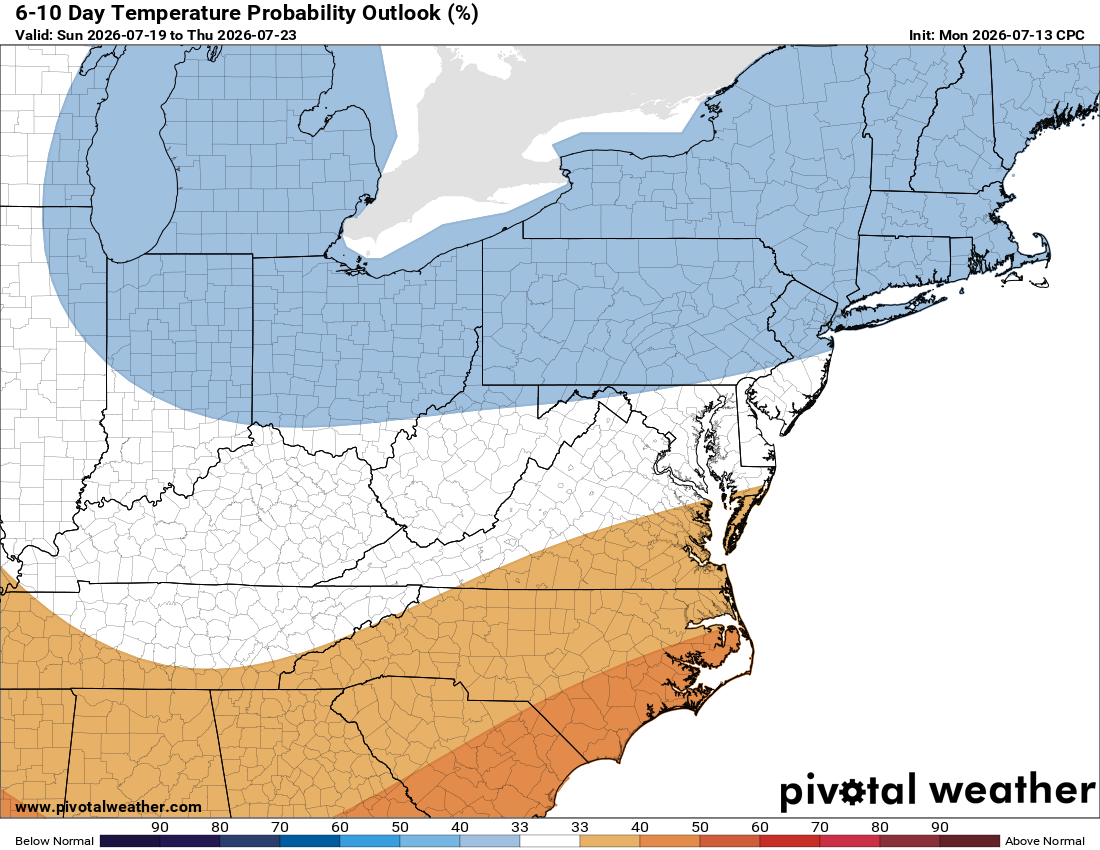
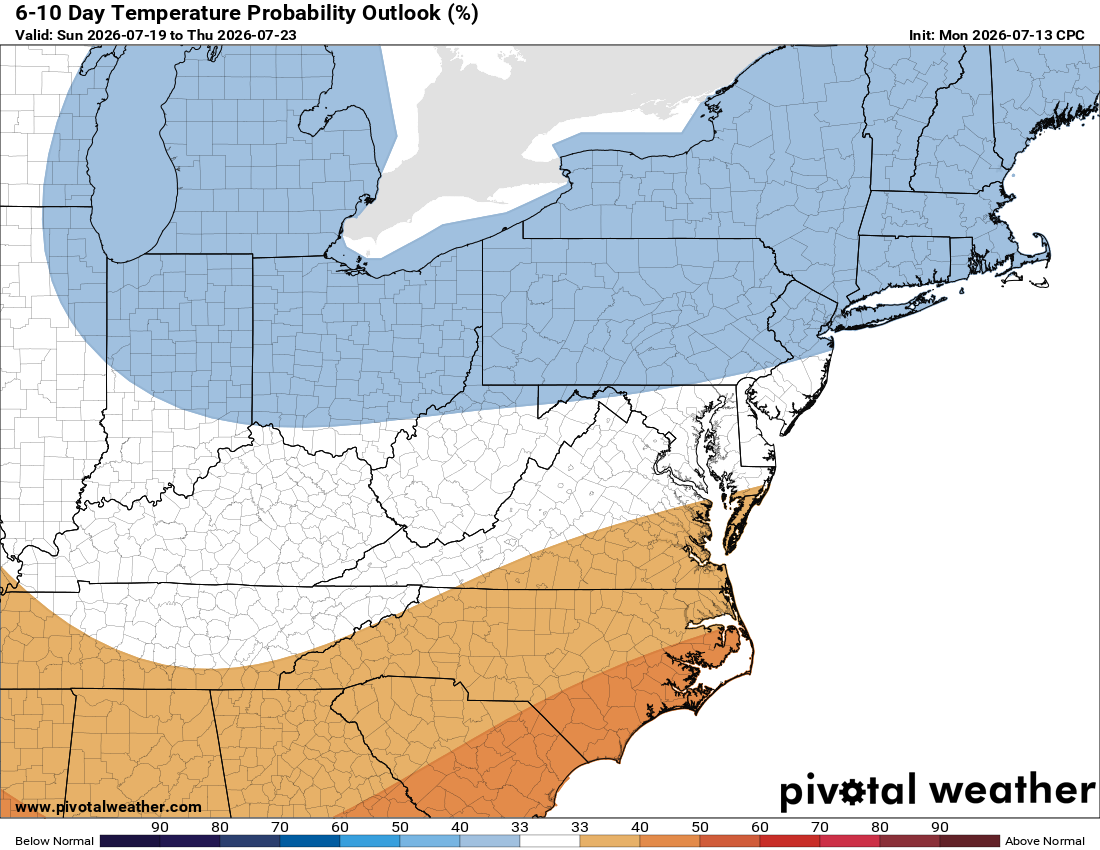
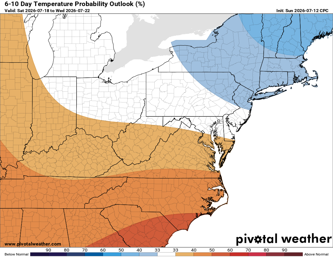
Temps look to trend a bit below normal heading into next weekend, and it's shaping up to be a potentially beautiful one.

This time of year, anything below normal feels like a win. Have a great day and we'll keep you posted!

The forecast:

Friday: Hi 88 ⛅ Lo 71 ☁️ – Widespread smoke, mostly cloudy overnight

Saturday: Hi 90 🌦️90% Lo 71 🌧️60% – Widespread smoke early, showers and thunderstorms likely

Sunday: Hi 85 🌤️ Lo 63 – Mostly sunny and pleasant

Monday: Hi 85 🌤️ Lo 68 ☁️ – Mostly sunny, becoming mostly cloudy overnight

Tuesday: Hi 89 🌦️30% Lo 70 🌧️60% – Chance of afternoon showers and thunderstorms, increasing into the evening

Wednesday: Hi 85 🌦️30% Lo 62 – Chance of showers, mostly sunny otherwise

Thursday: Hi 82 🌞 Lo 60 – Sunny and beautiful

#loudoun #loudouncountyva #vawx #loudounweather #loudounva #virginiaweather

Please support Tree of Life Ministries, an important organization to me! https://www.tolministries.org

Loudoun County Weather Outlook for Thursday, July 16, 2026

🔥 Another Hot One Today We're topping out near 100° again today, with the heat index climbing into the low 100s. It's still a drier heat, so no heat advisory yet, but one could be issued. Stay smart if you're out in it.

🌫️ Hazy Skies Friday A slight chance of some thunderstorms overnight Thursday into Friday. Wildfire smoke drifting down from Canada will also make for a hazy day Friday.

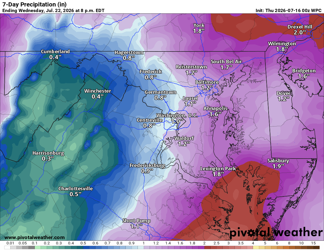
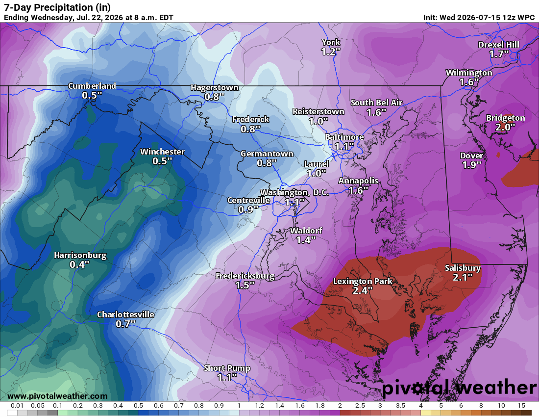
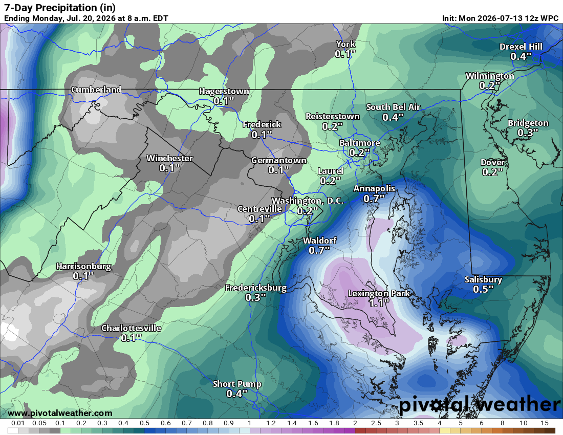
🌧️ Rain Chances Climb This Weekend Friday night into Saturday is when things really change, with an 80% chance of rain Saturday. We'll be monitoring for any severe weather potential that day. Temps ease back into the mid to upper 80s both Saturday and Sunday, with showers and storms still possible Sunday too.

☀️ Clearing Monday, Warming Tuesday Monday looks clear with highs in the mid to upper 80s. Tuesday brings another shower/storm chance with a high near 90.

🍃 Cooler Trend by Wednesday Wednesday drops back into the mid to upper 80s, with a slight chance of a shower or storm. Could be the start of a cooler stretch, more low 80s instead of the upper 80s/low 90s we've had.

The forecast:

Thursday: Hi 98 🌡️ Lo 71 🌧️20% – Hot with heat index up to 103; slight chance of thunderstorms overnight into Friday, then patchy smoke

Friday: Hi 92 🥵 Lo 71 🌧️40% – Areas of smoke; shower/storm chance returns after 2am

Saturday: Hi 87 🌧️80% Lo 70 🌧️80% – Showers and storms likely, will monitor for severe potential

Sunday: Hi 87 🌧️30% Lo 65 🌧️30% – Partly sunny with a shower/storm chance

Monday: Hi 87 Lo 69 🌧️20% – Mostly sunny, slight overnight shower chance

Tuesday: Hi 90 🌧️40% Lo 68 🌧️40% – Showers and storms possible day and night

Wednesday: Hi 86 🌧️20% Lo 63 – Slight chance of showers

https://www.tolministries.org

Facebook: facebook.com/loudounweather Twitter: twitter.com/loudounwx Instagram: instagram.com/loudounweather Web: loudounweather.com TikTok: tiktok.com/@loudounweather

image.pngimage.png

Loudoun County Weather Outlook for Wednesday, July 15, 2026

⚠️🔥 Heat Advisory in Effect

🥵 Scorching Hot Today and Tomorrow
Highs near 99 today and 98 tomorrow with a drier heat, keeping heat index values manageable. Feels better once the sun sets. Another heat advisory wouldn't surprise.

🌫️ Smoke in the Sky
Canadian wildfire smoke brings haze today and tomorrow, possibly easing the heat slightly.

🌦️ Relief Arrives Friday
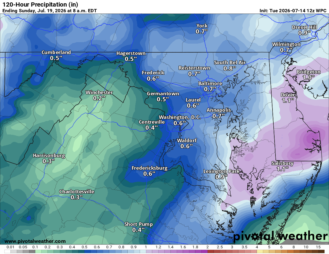
Humidity rises and highs ease to the low 90s Friday, with a shower or storm possible late day or overnight. Showers and storms look likely Saturday as a northwest flow sets up.

☀️ Near Normal Into Next Week
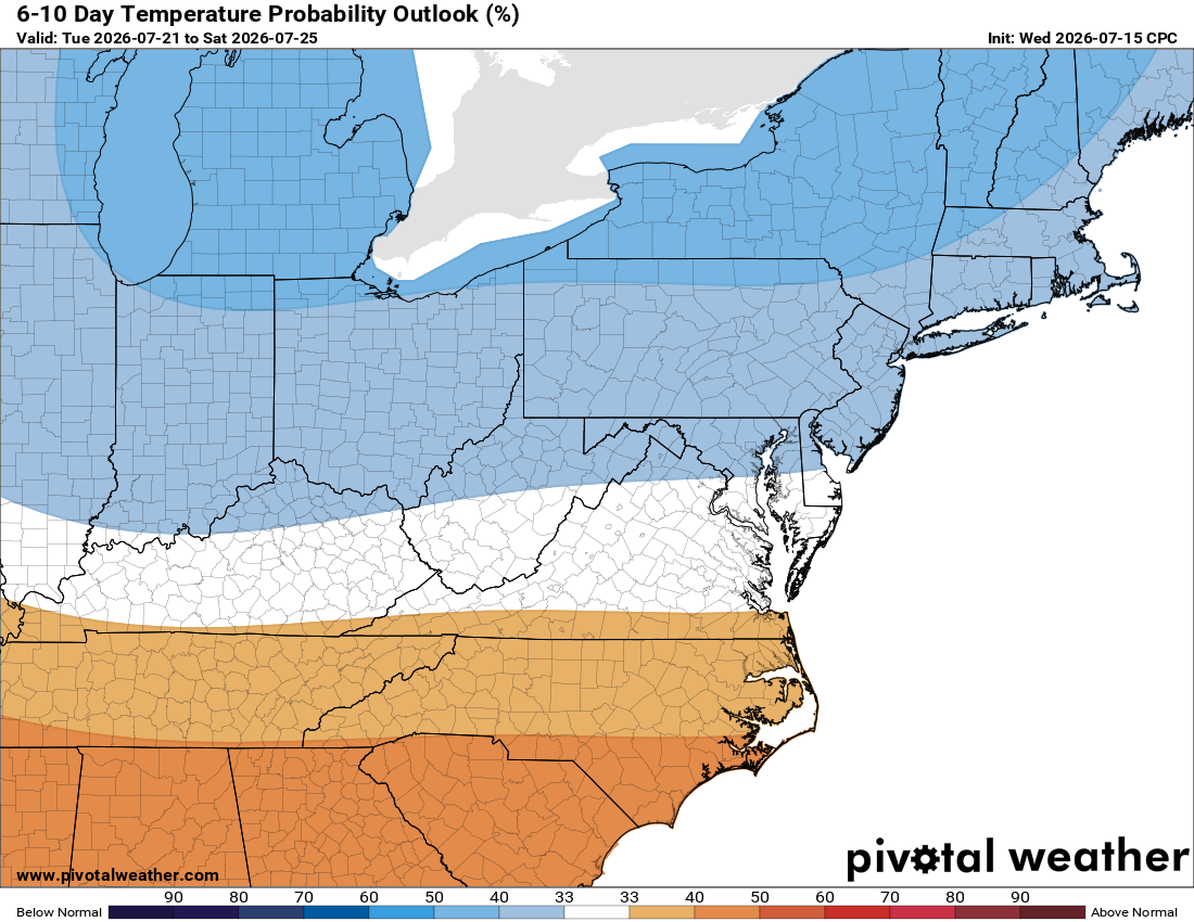
Sunday's mostly dry, then Monday looks sunny before better storm chances return Monday night into Tuesday. We're near the peak of summer heat, so upper 80s is actually normal, a nice break. Long range, temps trend normal or even below normal, with above normal rain chances, good news for the drought.

Stay cool!

The forecast:

Wednesday: Hi 99 🌡️☀️ Lo 75 ☁️ – Scorching hot and sunny, heat index up to 102. Partly cloudy overnight with a light west wind.

Thursday: Hi 98 🌡️☀️ Lo 72 ☁️ – Mostly sunny and dangerously hot, heat index up to 103. Partly cloudy overnight.

Friday: Hi 92 🥵🌦️ 20% Lo 71 🌧️ 50% – Mostly sunny with a slight chance of afternoon and evening showers and thunderstorms overnight.

Saturday: Hi 87 🌧️ 80% Lo 70 🌧️ 80% – Showers and possible thunderstorms likely through the day and into the overnight hours.

Sunday: Hi 88 🌦️ 30% Lo 67 🌧️ 30% – Mostly sunny with a chance of afternoon showers and thunderstorms, lingering storm chance in the evening.

Monday: Hi 88 ☀️ Lo 70 🌧️ 30% – Mostly sunny with a chance of overnight showers and thunderstorms.

Tuesday: Hi 89 ⛅ 50% Lo 68 – Partly sunny with a chance of showers and thunderstorms.

Please support Tree of Life Ministries, an important organization to me!

Loudoun County Weather Outlook for Tuesday, July 14, 2026

🥵 Heat Building Today
Highs climb into the low 90s today, just a bit above normal for mid July.

🌡️ Heat Wave Arrives Wednesday
Wednesday brings the real heat, with highs near 100 and heat index values up to 105. Not quite as humid as our last heat wave, but still use caution outside.

🔥 Hot Pattern Sticks Around
Thursday stays hot with highs near 98 to 100. A little relief Friday with highs in the low 90s.

⛈️ Weekend Storm Watch
Highs ease into the upper 80s to around 90 Saturday through Monday, with showers and storms becoming likely Saturday night. We'll be watching for severe weather this weekend, with high wind the most likely threat.

🌦️ Better Rain Chances Ahead
Beyond the weekend, temps trend near normal with an unsettled pattern bringing better rain chances, good news as we deal with drought conditions.

Have an awesome Tuesday, and get ready for that heat!

The forecast:

Tuesday: Hi 91 ☀️ Lo 71 – Sunny skies throughout the day

Wednesday: Hi 99 🌡️ Lo 75 – Dangerous heat with sunny skies, heat index up to 105°

Thursday: Hi 98 🌡️ Lo 72 – Mostly sunny and hot

Friday: Hi 93 🌤️ Lo 70 🌧️30% – Mostly sunny during the day, showers and storms possible late night

Saturday: Hi 87 🌦️50% Lo 70 🌧️60% – Showers with possible thunderstorms, likely continuing overnight

Sunday: Hi 88 🌦️50% Lo 68 🌧️30% – Showers and thunderstorms continuing overnight

Monday: Hi 87 🌦️30% Lo 70 🌧️ – Chance of showers and thunderstorms

#loudoun #loudouncountyva #vawx #loudounweather #loudounva #virginiaweather

Please support Tree of Life Ministries, an important organization to me!

Loudoun County Weather Outlook for Monday, July 13, 2026

☀️ Cooler Start, Beautiful Day We started off cooler than we've seen in a while, dropping into the low 60s and even upper 50s in spots overnight. Today's high near 85°F with plenty of sunshine, the nicest day of the week. Get outside and enjoy it if you can!

🔥 Heat Wave Building Temps start climbing tomorrow with highs in the low 90s. By Wednesday we're in the upper 90s, with heat indexes pushing into the low 100s. It'll be a bit less humid than our last heat wave, but still plenty hot.

🥵 Heat Continues Into the Week Thursday brings more of the same with highs in the mid to upper 90s. Friday remains hot with highs in the low 90s.

⛈️ Weekend Storm Chances As we head into the weekend, we may see chances of showers and storms return, with some uncertainty on whether any could turn severe. The Storm Prediction Center had placed a slight risk on this weekend but has since pulled it, likely due to uncertainty in timing and location.

Above normal temperatures look to continue into next week as well.

The forecast:

Today: Hi 85 ☀️ Lo 63 – Patchy fog early morning, then sunny

Tuesday: Hi 91 🥵 ☀️ Lo 69 – Sunny

Wednesday: Hi 97 🌡️ ☀️ Lo 73 – Sunny and hot

Thursday: Hi 95 🥵 🌤️ Lo 71 – Mostly sunny

Friday: Hi 93 🥵 ☀️ Lo 70 – Sunny

Saturday: Hi 92 🥵 🌦️30% Lo 70 🌧️40% – Mostly sunny with a chance of showers and thunderstorms, continuing overnight

Sunday: Hi 90 🌦️30% Lo 69 – Mostly sunny with a chance of showers and thunderstorms

#loudoun #loudouncountyva #vawx #loudounweather #loudounva #virginiaweather

Please support Tree of Life Ministries, an important organization to me! https://www.tolministries.org

Facebook: https://facebook.com/loudounwx Twitter: https://twitter.com/loudounwx Instagram: https://www.instagram.com/loudounweather/ On the Web @ https://loudounweather.com TikTok: https://www.tiktok.com/@loudounweather
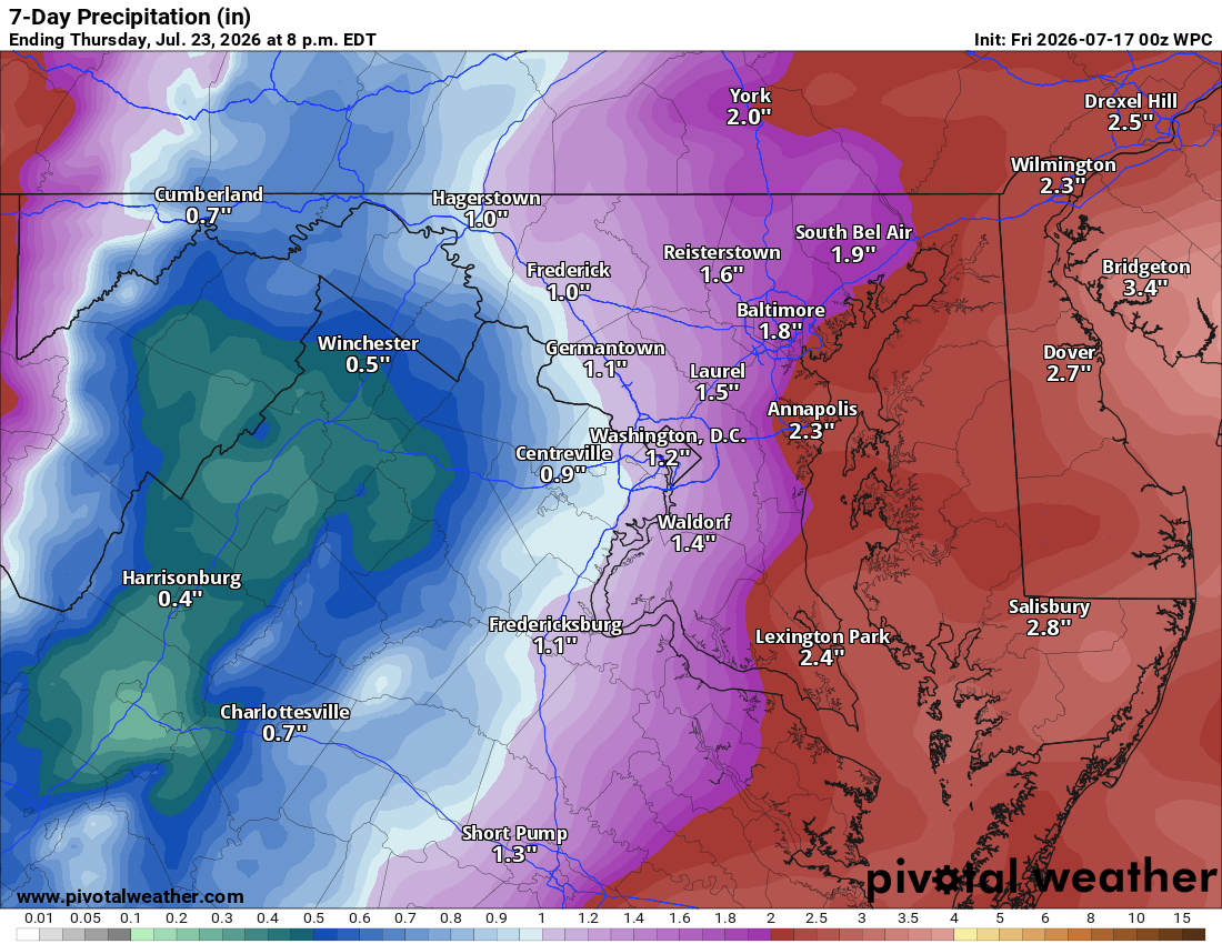
image.png
image.png