🌥️ Hotter Sunday With Storm Chances
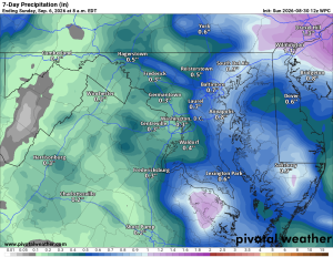
Clouds will be around today with highs near 88°F. There’s about a 30% chance of showers and thunderstorms, especially later this afternoon and evening.
🥵 Serious Heat Arrives This Week
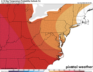
Monday climbs into the low 90s before the bigger heat arrives Tuesday through Thursday. Highs reach the mid 90s Tuesday and Wednesday, with Thursday remaining hot in the low to mid 90s. Tuesday has about a 20% chance of showers and thunderstorms, with storm chances increasing Thursday.
⛈️ Cooler Weather By Next Weekend
Friday drops back into the upper 80s with a 40% chance of showers and thunderstorms. By Saturday, highs should only reach the mid 80s with another chance of showers and thunderstorms.
🌡️ Looking Longer Range
The cooler 80s should stick around next weekend, but there are signs the 90s could make another run at us the following week. We’ll see how that pans out.
The Forecast:
Sunday: Hi 88 🌦️30% Lo 69 🌧️30% Partly sunny with scattered showers and thunderstorms possible
Monday: Hi 90 🌦️20% Lo 71 Mostly sunny with isolated showers and thunderstorms possible in the afternoon
Tuesday: Hi 95 🥵🌦️20% Lo 74 Mostly sunny and hot with a slight chance of afternoon showers and thunderstorms
Wednesday: Hi 95 🥵🌤️ Lo 73 🌧️20% Mostly sunny and hot with a slight chance of overnight showers and thunderstorms
Thursday: Hi 93 🌦️30% Lo 71 🌧️30% Mostly sunny with a chance of showers and thunderstorms during the day and overnight
Friday: Hi 88 🌦️40% Lo 66 🌧️30% A chance of showers and thunderstorms
Saturday: Hi 84 🌦️30% Lo 68 A chance of showers and thunderstorms
#loudoun #loudouncountyva #vawx #loudounweather #loudounva #virginiaweather
Please support Tree of Life Ministries, an important organization to me! https://www.tolministries.org
Facebook: https://facebook.com/loudounwx
Twitter: https://twitter.com/loudounwx
Instagram: https://www.instagram.com/loudounweather/
On the Web @ https://loudounweather.com
Summer Events in the area: https://summer.joyinnova.com
Fall events in the area: https://fall.joyinnova.com