Local weather. A little perspective.Loudoun County, VirginiaOfficial NWS alerts ↗
Loudoun County, Virginia

The local outlook

Forecasts, updates and a little local perspective.

January 26, 2021 Loudoun Weather Outlook

Weather Expected the next 7 days

2/26/2021 – What is next? Cold temps and then.. maybe.. a Snow Storm! After we clear up late today we now look to stay dry until Saturday Late through Monday when a winter system does look like it will visit the area. Unlike the system failure for Thursday, this system has a lot of support from all models! That gives me confidence that we will see some kind of weather. The question – How much and what types? I am leaning towards the idea that we get some snow and it will be enough to shovel. The upside potential is good, but we have been burned a lot by the setups this year. So, I will keep watching! Again, unanimous support of something happening from all models! Exactly what, when, and how much are all still a question! AND I HAD TO ADD.. Plenty of time for this to fail and become not a big deal.. or to become a REALLY big deal

Since this is on my Website – Here is the European model!

European Model Run Snow for Sunday – Monday January 31 and Feb 1 Storm

Compare that with the American Model
American Model Run Snow for Sunday – Monday January 31 and Feb 1 Storm

1/17/2021 – Loudoun Weather Outlook

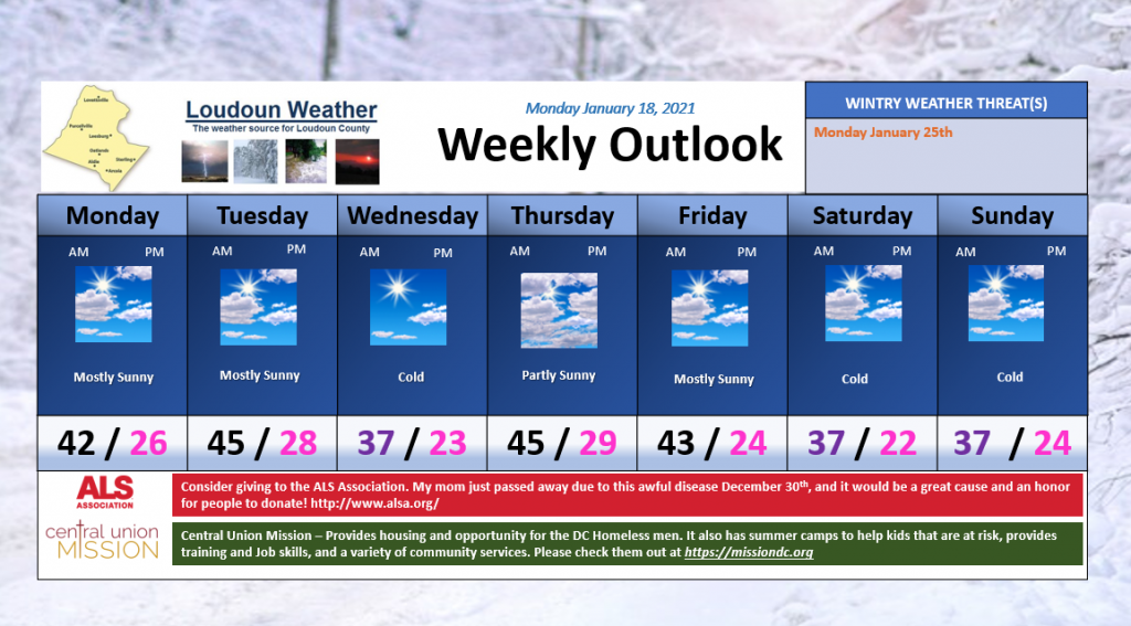
Loudoun Weather Outlook for the week of January 18th

Colder conditions will be felt mid-week and next weekend. In general, the week looks dry. We will need to watch the longer range.

What about wintry weather?

One way to look into the possibility of wintry weather is by looking at weather models that blend a variety of possible outcomes. The next set of maps are that set up, but I will not be able to show these all the time as they belong to Weather Bell (if interested, check out https://weatherbell.com – too expensive for a hobby!) This is the European output for next Monday!

F0BAB623-6C83-42F0-96D0-FCF0801E510B.thumb.png.08f8567c37494662d77151a35d07423b.png

DO NOT GET SUPER EXCITED by the snow on the map as these show snow a lot and many times it does not come true! The thing that is interesting is the chance of at least 3 inches of snow in the next week is up to 60 to 70% – AGAIN, this can be incorrect, so we take it with a grain of salt, but I do like seeing the higher percentage.

449198C4-0027-4265-8AF7-24B45D77D380.png

The European is many times wrong, so lets not get ahead of ourselves.

We need to see this keep showing up. The thing that is a bit encouraging has been that both models show something around the same time. What is very discouraging is that both are SO VERY different in the may they get precipitation to fall! So I will keep watching!

All for now!

7/27/2020 Weather Outlook

image.png
7/27/2020 – HOT TODAY! But it MAY be the last day we see this high temperature for a while! Tomorrow will see a chance of showers and storms. Maybe some of the showers and storms will be strong to severe and contain heavy rain. Remains hot Wednesday and Thursday, but a MUCH cooler weekend! Have a Great Week!
Attached:
* Weekly Outlook
* Storm Prediction Center showing a Marginal Risk for severe tomorrow
* The Weather Prediction Center says we have a marginal risk for flash flooding rains tomorrow  
image.png
image.png