Local weather. A little perspective.Loudoun County, VirginiaOfficial NWS alerts ↗
Loudoun County, Virginia

Category: Uncategorized

Loudoun County Weather Outlook for Saturday, February 7, 2026

2/7/2026 WINDS AND COLD – WATCHING NEXT WEEKEND
💨 **Windy Day Winds Down**
It has been a gusty one, but luckily, while there are scattered outages, we dodged the widespread issues we were concerned about. Expect the wind to finally calm down late tonight into tomorrow morning.

🥶 **Frigid Night Ahead**
Current temperatures in the upper teens are expected to drop into the single digits tonight. With the wind, it’s going to feel like 10 degrees below zero or even colder at times.

☀️ **Sunny Sunday and getting Milder through the middle of next week**
Tomorrow looks like a decent day with plenty of sunshine. By Monday, temps reach freezing, then mid-40s on Tuesday and Wednesday. Temps will be back in the 30s by next weekend.

❄️ **Eyes on Next Weekend**
The outlook for next weekend is still a bit fuzzy. The forecast says scattered clouds, but it could get wintry or wet!

Hopefully, the wind didn't cause you too much trouble today. That's all for now!

The forecast:
Today: Hi 18 ☀️ Lo 8 🌙 – 🥶 Sunny, remaining mostly clear and very cold at night

Sunday: Hi 23 ☀️ Lo 6 🌙 – 🥶 Sunny and cold, remaining mostly clear and frigid at night

Monday: Hi 32 ⛅ Lo 19 ☁️ – Mostly sunny, becoming mostly cloudy overnight

Tuesday: Hi 45 ⛅ Lo 32 🌙 – Partly sunny, becoming mostly clear by evening

Wednesday: Hi 45 ☁️ Lo 26 ☁️ – Mostly cloudy throughout the day and night

Thursday: Hi 39 ☁️ Lo 25 ☁️ – Mostly cloudy throughout the day and night

Friday: Hi 36 ⛅ Lo 23 🌙 – Partly sunny, becoming mostly clear overnight (watching for storminess)

Saturday: Hi 38 ⛅ Lo 21 🌙 – Mostly sunny, remaining mostly clear and cold at night (watching for storminess)

#loudoun #loudouncountyva #vawx #loudounweather #loudounva #virginiaweather

Please support Tree of Life Ministries, an important organization to me! https://www.tolministries.org

Loudoun County Weather Outlook for Friday, February 6, 2026

2/6/2026 – ⚠️⚠️⚠️EXTREME COLD AND HIGH WIND WARNING⚠️⚠️⚠️
❄️ Brutal Cold and High Winds Arrive Tonight!
An Arctic front moves in after 1 a.m. tonight, bringing a dangerous blast of cold. Temperatures will plummet while winds ramp up after midnight, peaking between 3 and 4 a.m. High Wind and Extreme Cold Warnings are in effect as wind chills drop below -10°F and gusts reach up to 60 mph.

❄️ Snow Showers and Arctic Air
Snow showers are possible through this afternoon and evening, which could make the rush hour commute slippery. Tomorrow stays freezing with highs only in the teens and wind chills 10 to 15 degrees below zero.

🏈 Super Bowl Sunday and Beyond
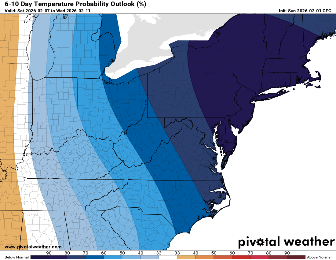
It remains cold all day Sunday for the big game, though winds will finally start to calm down. Looking ahead to next week, we’ll see a slow warming trend. There is a chance for light freezing rain late Tuesday night with temperatures in the 30s. The Climate Prediction Center is signaling a shift toward above-normal temperatures soon, offering a brief break in this pattern.

The forecast:
Today: Hi 31 ❄️50% Lo 9 ❄️30% – 🥶 A chance of snow throughout the day and early evening, followed by gradual clearing and dangerous wind chills as low as -4

Saturday: Hi 16 ☀️ Lo 9 🌙 – 🥶 Bitterly cold and sunny with extreme wind chills as low as -13 and wind gusts up to 60 mph

Sunday: Hi 22 🌤️ Lo 11 ☁️ – 🥶 Mostly sunny and cold, becoming mostly cloudy overnight

Monday: Hi 31 ☁️ Lo 19 ☁️ – 🥶 Mostly cloudy through the day and night

Tuesday: Hi 42 🌤️ Lo 29 🌧️30% – Mostly sunny, then becoming mostly cloudy with a chance of freezing rain after midnight

Wednesday: Hi 46 🌦️40% Lo 28 ☁️ – Mostly cloudy with a chance of rain

Thursday: Hi 38 ☁️ Lo 23 ☁️ – Mostly cloudy for the duration

#loudoun #loudouncountyva #vawx #loudounweather #loudounva #virginiaweather

Please support Tree of Life Ministries, an important organization to me! https://www.tolministries.org

Loudoun County Weather Outlook for Thursday, February 5, 2026

2/5/2026 – Cold weekend! The Arctic air looks to retreat next week!
☀️ Chilly Thursday Ahead!
We’re looking at an okay day today with highs hovering around the freezing mark. Temperatures will drop tonight as we dip into the teens.

❄️ Snow Showers Possible
Tomorrow brings a 30% to 40% chance of snow showers in the afternoon. It will turn blustery later in the day, with strong winds picking up tomorrow night.

🌬️ Brutal Wind Chills
Saturday remains very windy with highs potentially staying in the teens. Wind chills will be tough Saturday night with lows near 7 degrees. Expect another cold weather advisory for that period.

🏈 Super Bowl Sunday & Beyond
For the big game, expect temperatures in the low to mid 20s. We stay cold on Monday though we should finally get above freezing. By Tuesday and Wednesday, we warm up into the mid 40s.

📉 Watching the Horizon
We are tracking a possible storm system for the end of next week that could bring rain, snow, or a mix. As we head toward the middle of the month, the polar air should retreat and bring us back to more normal temperatures.

The forecast:
Today: Hi 31 🌞 Lo 17 🥶 – Sunny and cold, becoming mostly cloudy overnight

Friday: Hi 33 ❄️40% Lo 13 ❄️30% 🥶 – Increasing clouds with a chance of snow in the afternoon, followed by a chance of snow and windy conditions before midnight then clearing

Saturday: Hi 20 🌞 Lo 7 🥶 – Windy and sunny, remaining mostly clear and very cold at night

Sunday: Hi 23 ⛅ Lo 12 🥶 – Partly sunny and cold, turning mostly cloudy overnight

Monday: Hi 36 ⛅ Lo 22 – Partly sunny, becoming mostly cloudy

Tuesday: Hi 45 🌤️ Lo 28 – Milder with mostly sunny skies, turning mostly cloudy by evening

Wednesday: Hi 44 ☁️ Lo 30 ☁️ – Mostly cloudy throughout the day and night

#loudoun #loudouncountyva #vawx #loudounweather #loudounva #virginiaweather

Please support Tree of Life Ministries, an important organization to me! https://www.tolministries.org


image.png

image.png

Loudoun County Weather Outlook for Tuesday, February 3, 2026

2/3/2026 – Few snow showers but milder today! Cold weekend
❄️ Cloudy and Milder Today
Clouds hang tough with highs near 40°F this afternoon, with a few snow showers possible

🌨️ Snow Showers Tonight
A few snow showers are possible this evening, tapering off just after midnight. Temps drop quickly to around 20°F overnight.

🌫️ Fog Early Wednesday
Watch out for some patchy fog on Wednesday morning. Otherwise, just cloudy with highs near freezing. Wednesday night stays dry but overcast.

🌨️ Snow Chances Return Friday
Thursday brings quiet but chilly conditions with highs near 30°F. A shot of light snow returns Friday morning with highs in the mid-30s.

🥶 Frigid Weekend Ahead
Saturday will be a cold one with highs only in the 20s and biting wind chills, much like last Sunday. Super Bowl Sunday stays cold, with temps stuck in the mid-20s.

☀️ Slight Warmup Next Week
Monday rebounds slightly with sunny skies and highs near 30°F.

Looking beyond that, signs point to moderating temps around Valentine’s Day, maybe even above normal for a few days. A storm may form around then, but snow may be in question.

The forecast:

Today: Hi 40 ☁️ Lo 20 ❄️70% – Mostly cloudy with scattered flurries and isolated snow showers, snow likely at night with patchy fog developing

Wednesday: Hi 31 🌤️ Lo 15 🌙 – Patchy morning fog, then mostly sunny, becoming mostly clear overnight

Thursday: Hi 30 ☀️ Lo 15🌙 – Sunny

Friday: Hi 36 ❄️40% Lo 17 🌙 – Mostly cloudy with a chance of snow early, clearing out overnight

Saturday: Hi 26 ☀️ Lo 12 🌙 – Sunny and windy, becoming mostly clear and blustery overnight

Sunday: Hi 26 🌤️ Lo 9 🌙 – Mostly sunny and cold, remaining clear overnight

Monday: Hi 28 🌤️ Lo 12 🌙 – Mostly sunny during the day, clear skies overnight

#loudoun #loudouncountyva #vawx #loudounweather #loudounva #virginiaweather

Please support Tree of Life Ministries, an important organization to me! https://www.tolministries.org


image.png
image.png

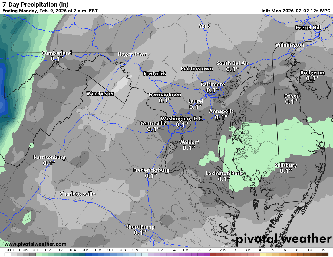
Loudoun County Weather Outlook for Monday, February 2, 2026

2/2/2026 – Ground Hog Saw his shadow! A bit “milder” week before a cold weekend!

🌤️ February Starts Mild
Happy Groundhog Day! Today will be quite warm compared to recent days with highs in the low to mid-30s. That’s right, we’re above freezing!

🌙 Chilly Tonight, Warmer Tuesday
Temps drop into the 20s overnight, but we bounce right back tomorrow with mid-30s expected.

🌨️ Light Snow Possible Late Tuesday
A few flurries or snow showers could pop up tomorrow afternoon and evening. There's about a 50% chance of light snow before 1 AM.

🌬️ Cooler Midweek
Wednesday and Thursday cool down a bit with highs in the low 30s, still better than last week!

🌡️ Milder Friday Before the Freeze
Friday climbs back into the mid-30s and maybe a touch of snow, but brace yourself as the weekend turns sharply colder with temps stuck in the teens and gusty winds making it feel even worse.

💘 Valentine's Week Tease
There's some early buzz about a potential warm-up… and maybe a snowstorm mid-month. Stay tuned!

🌫️ Six More Weeks?
The Groundhog saw his shadow today, and it looks like we’ll be hanging onto winter a bit longer.

The forecast:
Today: Hi 33 🌞 Lo 16 🌙 – Sunny and cold, becoming partly cloudy overnight

Tuesday: Hi 39 ⛅❄️20% Lo 23 ❄️50% – Increasing clouds with a slight chance of late‑day rain/snow, better chance of snow overnight

Wednesday: Hi 32 🌤️ Lo 14 🌙 – Mostly sunny and cold, clear night

Thursday: Hi 29 ☀️ Lo 14 🌙 – Sunny and very cold, clear night

Friday: Hi 36 ❄️30% Lo 12 🌙 – Mostly cloudy with a chance of morning snow, clearing overnight

Saturday: Hi 22 ☀️ Lo 9 🌙 – Sunny and blustery, very cold night

Sunday: Hi 24 ⛅ Lo 11 🌙 – Partly sunny and cold, clear night

#loudoun #loudouncountyva #vawx #loudounweather #loudounva #virginiaweather

Please support Tree of Life Ministries, an important organization to me! https://www.tolministries.org


image.png
image.png