Local weather. A little perspective.Loudoun County, VirginiaOfficial NWS alerts ↗
Loudoun County, Virginia

Category: Uncategorized

Loudoun County Weather Outlook for Thursday, June 11, 2026

🌡️ Hot and Potentially Stormy Thursday
Heat index values climb into the low 100s today. Take it easy. A 30% chance of thunderstorms, and any that develop could be strong or severe with wind as the main threat. We're also watching a storm complex tracking from Iowa that could reach us this evening. June complexes can travel long distances, so stay tuned.

⛈️ Friday: More of the Same
Heat index values back in the low 100s. Better storm chances tomorrow, with afternoon and evening thunderstorms likely. Some could be severe. Wind is again the biggest threat.

🌤️ Weekend Rundown
Saturday brings a slight break with highs in the upper 80s to near 90°F and a touch less humidity. Sunday the heat returns, low 90s, with late day and overnight storm chances.

🌧️ Cooler Pattern Arriving Next Week
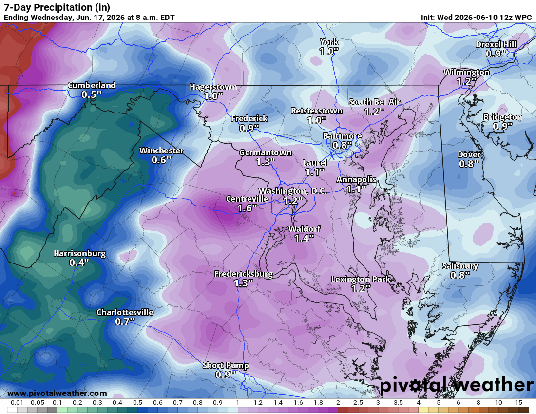
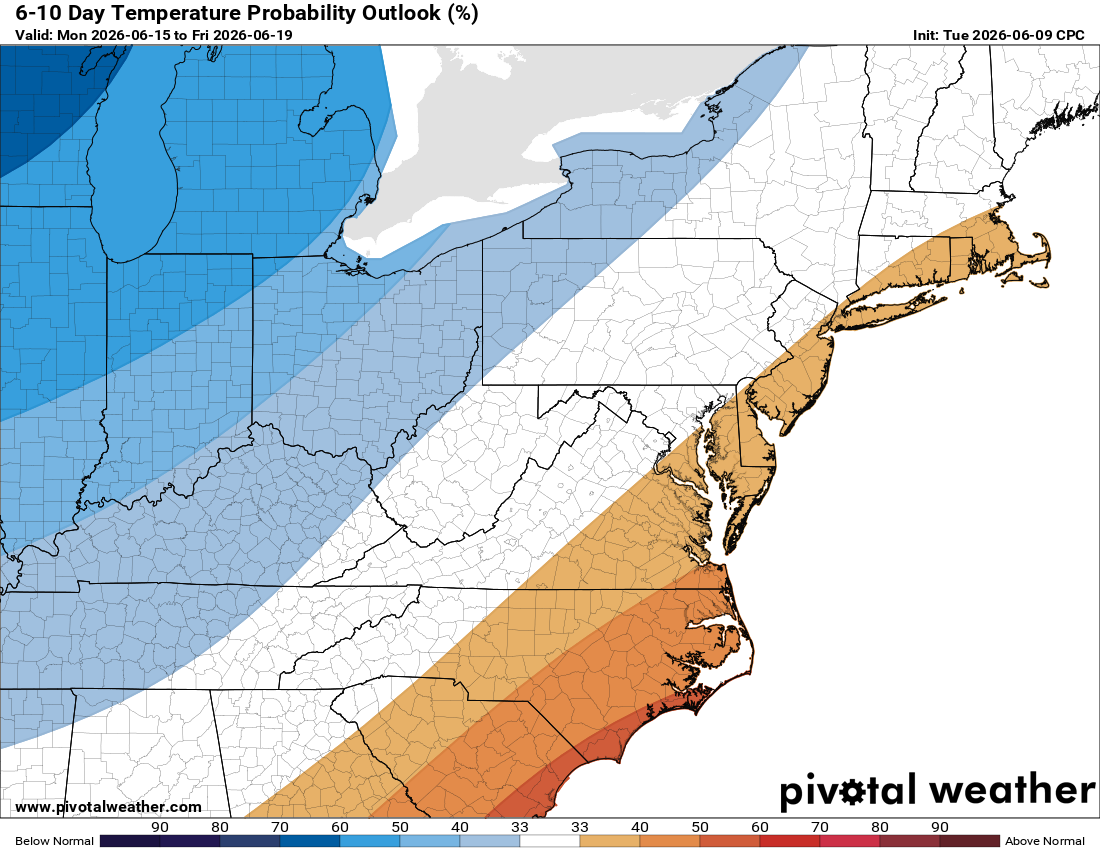
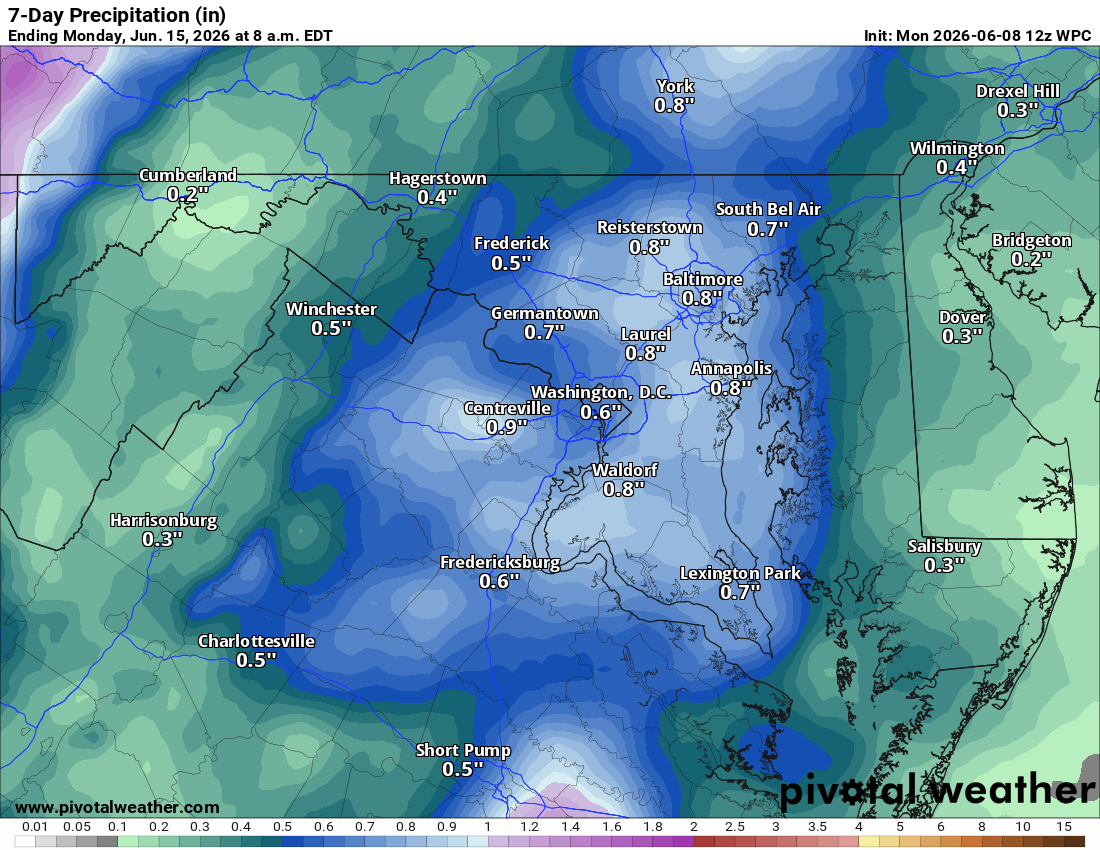
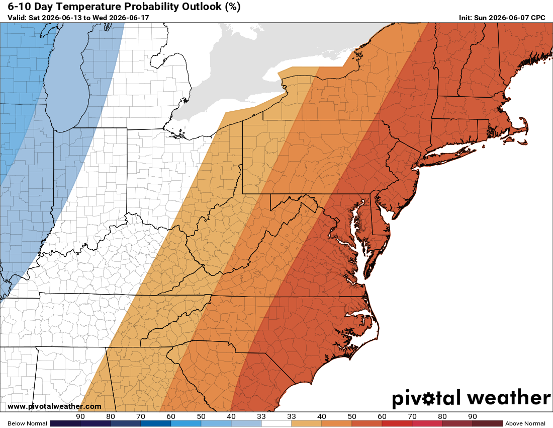
Two frontal systems will push temperatures down next week, possibly below normal for a stretch, with increased rain chances. We need both the cooler air and the rainfall.

The forecast:
Today: Hi 93 🌦️30% Lo 70 🌧️30% – 🥵 HOT with scattered showers and thunderstorms late today.

Friday: Hi 94 🌦️70% Lo 64 🌧️60% – 🌡️ 🥵 Increasing clouds with afternoon showers likely and thunderstorms

Saturday: Hi 87 ☀️ Lo 64 ⛅ – Sunny and pleasant with partly cloudy night.

Sunday: Hi 91 🌦️ 40% Lo 63 🌧️50% – Partly sunny with chance of afternoon and
evening showers and thunderstorms.

Monday: Hi 81 🌦️ 20% Lo 59 🌧️30% – Mostly sunny with slight chance of showers

Tuesday: Hi 79 🌦️30% Lo 59 ⛈️20% – Partly sunny with chance of showers and
thunderstorms.

Wednesday: Hi 83 🌦️20% – Mostly sunny with slight chance of showers and
thunderstorms.

#loudoun #loudouncountyva #vawx #loudounweather #loudounva #virginiaweather

Please support Tree of Life Ministries, an important organization to me!


**Loudoun County Weather Outlook for Wednesday, June 10, 2026**

🌦️ Humid Wednesday With Storm Chances
 
Good Wednesday! You can definitely feel the humidity out there. We had some good showers, and thunderstorms are possible throughout the day. There’s a chance of a stronger storm with gusty winds.
 
🥵 Dangerously Hot Thursday
 
Tomorrow will be very, very hot with heat index values that make it feel like the low 100s. A chance of afternoon and evening showers and storms exists, and any that develop could be potentially severe. The Storm Prediction Center has outlined Thursday with a slight risk for severe weather.
 
⛈️ Better Storm Chances Friday
 
Friday highs reach the mid 90s with heat index values at or above 100°F. Showers and storms are likely, and severe weather will need to be watched.
 
☀️ Weekend Stays Hot
 
After Friday night’s storms clear things out, highs drop back to around 90°F on Saturday with less humidity. A shower or storm is possible Sunday as temps climb back into the low 90s and humidity creeps back up.
 
🌡️ Next Week Brings Some Relief
 
Showers and storms arrive early next week, knocking temperatures back to the low to mid 80s.
 
The forecast:
Today: Hi 85 🌦️100% Lo 70 🌧️ 30% – Showers and thunderstorms
 
Thursday: Hi 93 🌤️30% Lo 71 🌧️ 20% – 🥵 Hot with a chance of showers and storms Heat index values as high as 101.
 
Friday: Hi 94 🌦️60% Lo 68 🌧️60% – 🥵 Hot with showers and storms
 
Saturday: Hi 89 ☀️ Lo 64 🌙 – Sunny with mostly clear skies at night.
 
Sunday: Hi 92 🌦️ 30% Lo 64 🌧️40% – Hot with a chance of showers and
thunderstorms
 
Monday: Hi 83 🌦️ 40% Lo 62 🌧️30% – Partly sunny with a chance of showers and
thunderstorms.
 
Tuesday: Hi 83 🌧️ 30% – Partly sunny with a chance of showers.
 
#loudoun #loudouncountyva #vawx #loudounweather #loudounva #virginiaweather
 
Please support Tree of Life Ministries, an important organization to me!
 

**Loudoun County Weather Outlook for Tuesday, June 9, 2026**

🌤️ Not a Bad Tuesday

A decent day to start. Highs will reach the low 80s, a touch cooler than expected due to cloud cover keeping temperatures in check.

🌧️ Shower Chance Tonight Into Wednesday

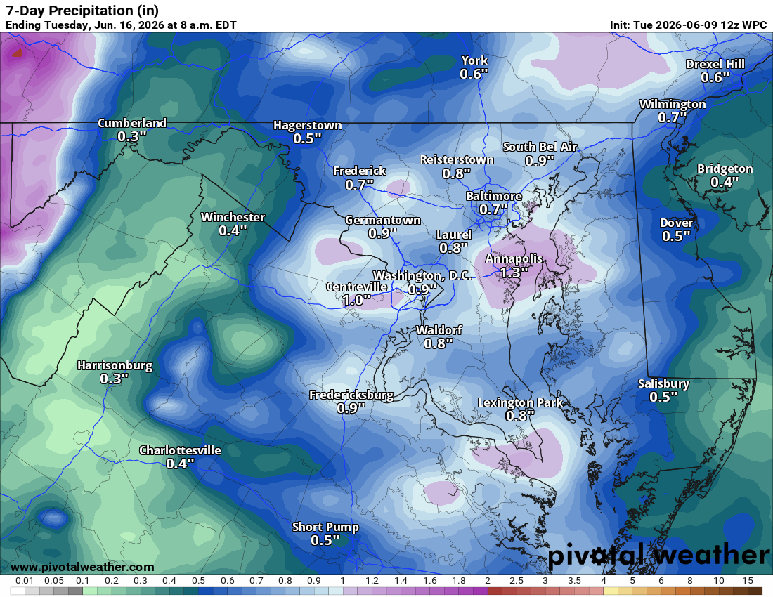
A warm front moves through overnight, bringing a chance of showers. Wednesday highs climb near 90°F, and there's a chance of showers and thunderstorms, though not as strong as previously thought. We really need these storms to come through as the drought continues.

🔥 Heat Builds Thursday Through Friday
Thursday kicks off the serious heat with mid 90s and humidity surging. Heat index values could hit 100°F or higher. Friday looks like the peak of the heat wave, with mid to upper 90s and heat indexes potentially touching 105°F. A chance of showers and storms on Friday could help break things up.

☀️ Hot Weekend
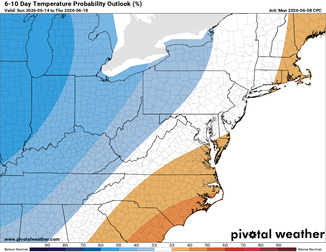
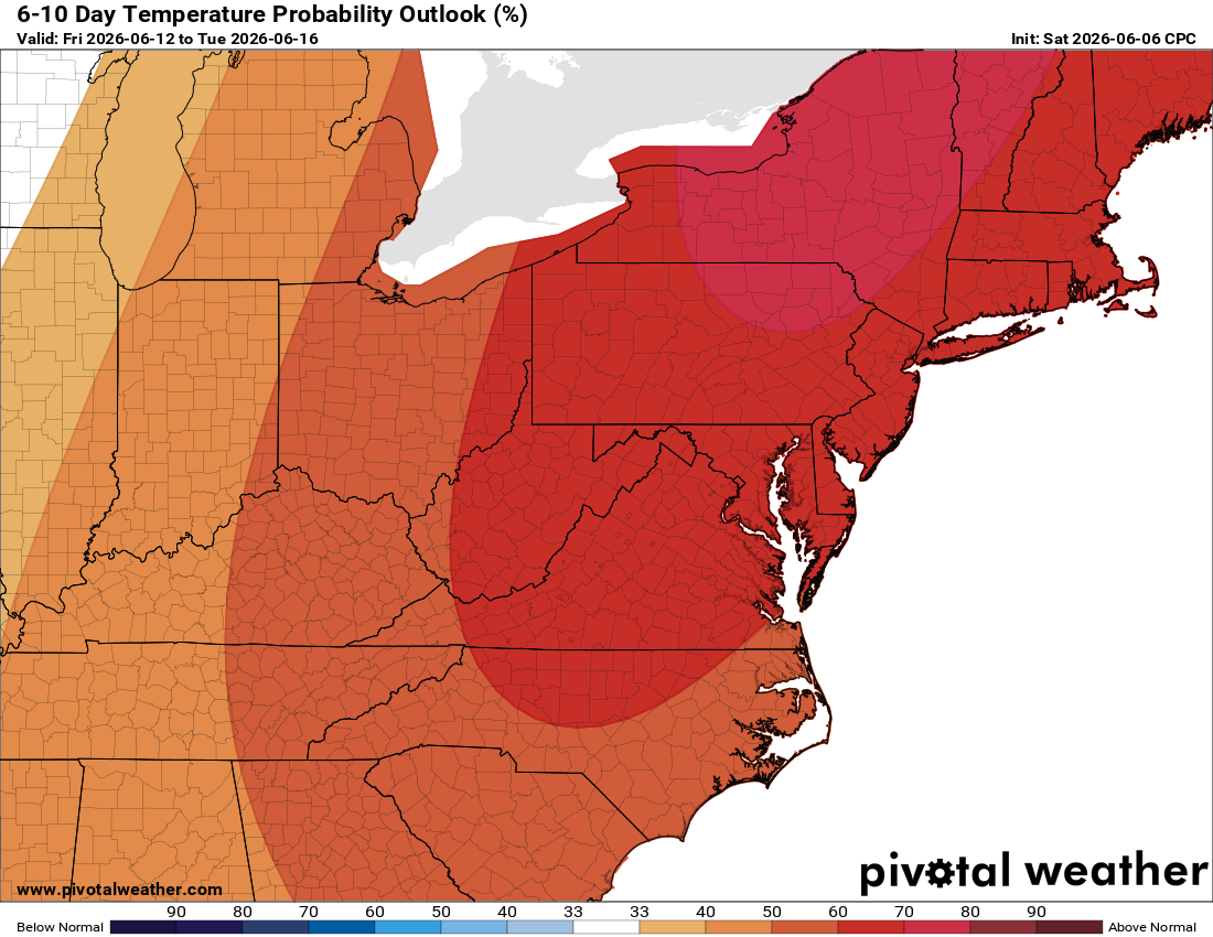
Saturday and Sunday both feature sunshine and highs near 90°F and slightly less humid air. A chance of showers and storms returns Monday, with perhaps a slight cooldown to close out next week.

The forecast:
Today: Hi 81 🌤️ Lo 67 🌧️40% – Mostly cloudy, then chance of showers and
thunderstorms after 5am

Wednesday: Hi 88 🌦️50% Lo 70 ⛈️30% – Chance of showers and thunderstorms

Thursday: Hi 94 🌤️40% Lo 71 🌧️30% – 🥵 Hot and sunny, then chance of afternoon showers and thunderstorms

Friday: Hi 95 🥵🌦️50% Lo 68 🌧️40% – Hot and mostly sunny, then chance of showers and thunderstorms

Saturday: Hi 89 ☀️ Lo 64 🌙 – Mostly sunny

Sunday: Hi 90 ☀️ Lo 64 🌧️30% – Mostly sunny, then chance of showers

Monday: Hi 86 🌦️40% – Chance of showers and thunderstorms

#loudoun #loudouncountyva #vawx #loudounweather #loudounva #virginiaweather

Please support Tree of Life Ministries, an important organization to me!

TikTok: https://www.tiktok.com/@loudounweather
image.png


image.png

Weather Outlook

Loudoun County Weather Outlook for Monday, June 8, 2026

☀️ A Nice Start to the Week
Good Monday morning! Highs today climb into the mid 80s, a bit of a breather before the heat cranks up. Some clouds around but overall a pretty good day.

🌡️ Heat Builds Tuesday Through Thursday
Tuesday we're already pushing into the upper 80s. By Wednesday, highs reach the low 90s with showers and thunderstorms now looking likely. Thursday is the peak of the heat with highs possibly touching the upper 90s, and with the humidity factored in, it will feel like 100 to 105 degrees. Please take that seriously.

⛈️ Rain Chances Wednesday Through the Weekend
Wednesday kicks off a stretch of daily shower and thunderstorm chances that carries through Thursday, Friday, Saturday, and Sunday. Friday and Saturday highs stay around 93, with the weekend settling into the low 90s. It stays hot and humid all the way through.

💧 Drought Update
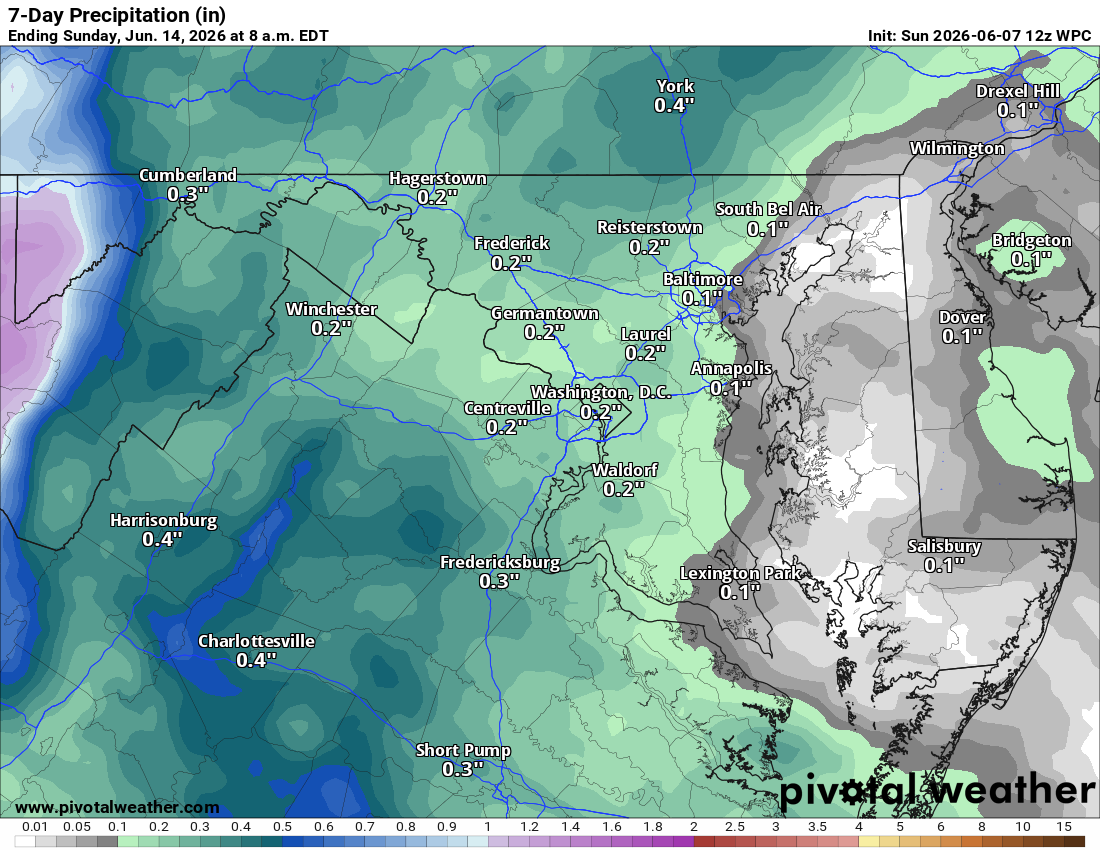
The rain chances this week are very welcome news. We need every drop we can get as the drought continues. Here's hoping Wednesday delivers.

The forecast:

Today: Hi 84 🌞 Lo 57 🌙 – Sunny becoming partly cloudy tonight with
northeast winds shifting east

Tuesday: Hi 86 ⛅ Lo 67 🌙 – Partly sunny with south winds and gusts up to
18 mph

Wednesday: Hi 91 🌦️70% Lo 70 🌧️60% – Chance of morning showers and
thunderstorms, then showers likely and possibly thunderstorms afternoon

Thursday: Hi 96 🌤️30% Lo 72 ⛈️30% – 🥵 Partly sunny with chance of
afternoon showers and thunderstorms

Friday: Hi 93 🌞50% Lo 67 🌧️30% – Mostly sunny with chance of afternoon
showers and thunderstorms, chance continuing into evening

Saturday: Hi 90 ☀️ Lo 68 🌙 – Mostly sunny and partly cloudy

Sunday: Hi 91 🌦️40% Lo 68 🌙 – Mostly sunny with chance of showers and
thunderstorms

#loudoun #loudouncountyva #vawx #loudounweather #loudounva #virginiaweather

Please support Tree of Life Ministries, an important organization to me!

Loudoun County Weather Outlook for Sunday, June 7, 2026

☀️ A Drier Day Before the Heat Arrives
Good Sunday morning! Highs near 90° today with a north wind keeping humidity in check for now. A very isolated shower is possible this morning, but most stay dry.

🌤️ Monday and Tuesday
A brief step back with highs in the low to mid 80s Monday, climbing to the mid and upper 80s Tuesday.

🌡️ Heat Builds Wednesday Through the Weekend
Wednesday the humidity pumps up fast. Highs in the low 90s with heat indexes pushing into the mid to upper 90s, possibly 100°. Thursday is the peak with highs near 95° and heat indexes potentially in the low 100s. Friday stays in the low to mid 90s, feeling close to 100°. Saturday offers a slight break with highs near 90°, but still hot and humid.

⛈️ Daily Storm Chances Wednesday Through the Weekend
Afternoon and evening showers and thunderstorms each day through the weekend.

Have a great Sunday, Loudoun!
The forecast:

Today: Hi 90 🌦️20% Lo 62 🌙 – Isolated showers between 10am and 1pm, then
mostly clear tonight

Monday: Hi 84 ☀️ Lo 59 🌙 – Sunny

Tuesday: Hi 86 ☀️ Lo 65 ⛅ – Sunny

Wednesday: Hi 91 🌦️40% Lo 71 🌧️30% – Partly sunny with chance of showers
and thunderstorms after 2pm

Thursday: Hi 95 🌦️40% Lo 72 🌧️30% 🥵 – Mostly sunny with chance of showers
and thunderstorms after 2pm

Friday: Hi 93 🌦️40% Lo 70 🌧️30% – Mostly sunny with chance of showers and
thunderstorms

Saturday: Hi 89 🌦️40% – Mostly sunny with chance of showers and storms

#loudoun #loudouncountyva #vawx #loudounweather #loudounva #virginiaweather

Please support Tree of Life Ministries, an important organization to me!