⚠️ Severe Storms Possible Today
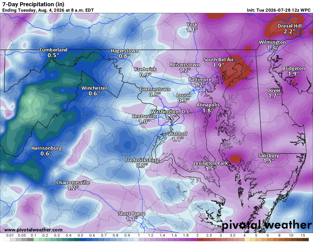
🌧️ Showers and maybe a Storm This Morning
Showers and possibly a few storms move through this morning, tapering off by midday.
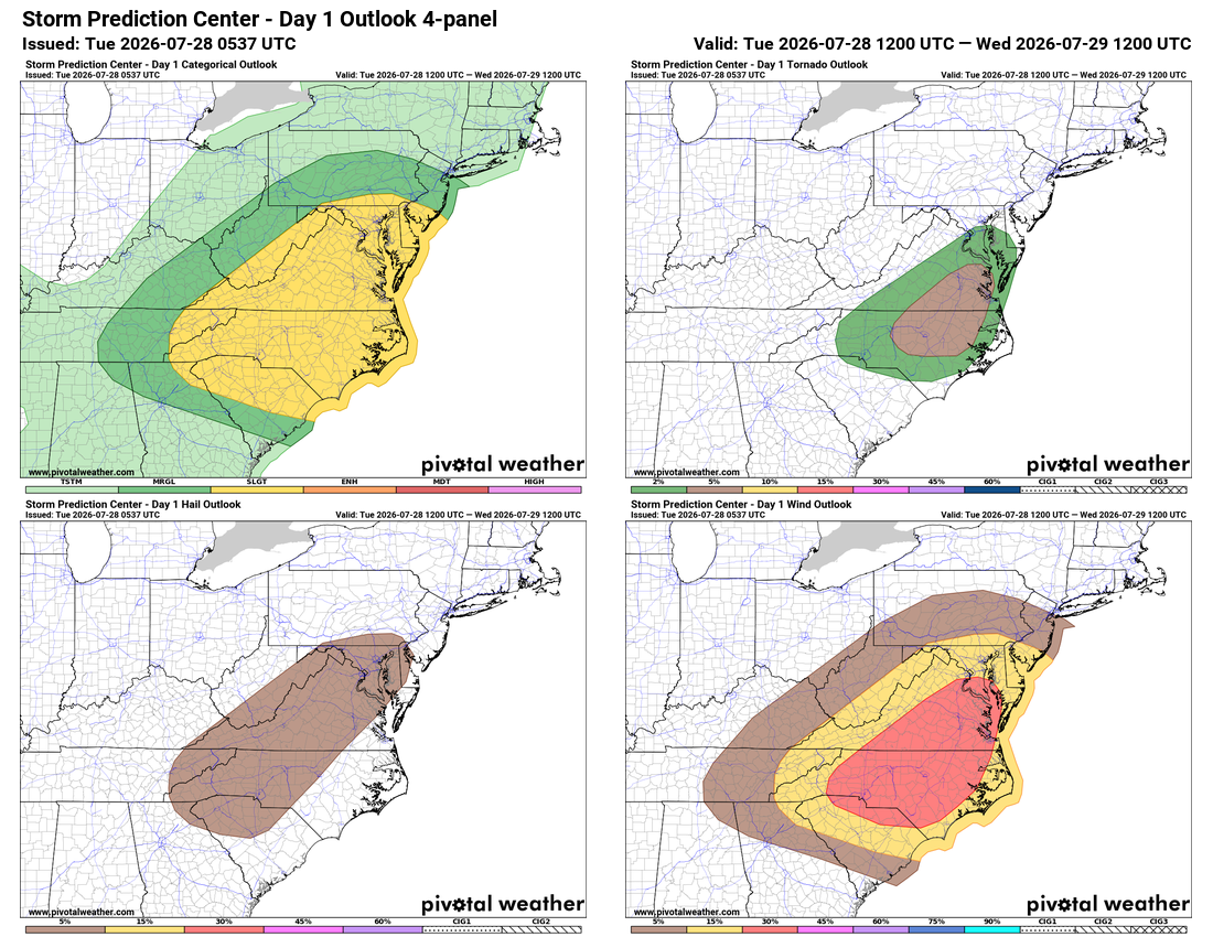
⚡ Strong to Severe Storms Possible This Afternoon
A front moves through this afternoon, and strong to severe storms are possible, though morning clouds may limit how widespread they get. Main risks are gusty winds and hail, with an isolated tornado not ruled out, mainly south and east.
🌬️ Drying Out and Turning Breezy Wednesday and Thursday
Skies clear behind the front, but winds turn breezy out of the northwest as a noreaster spins up off the coast. Highs reach around 80 to the low 80s Thursday, a nice combo of wind and cooler dry air for this time of year.
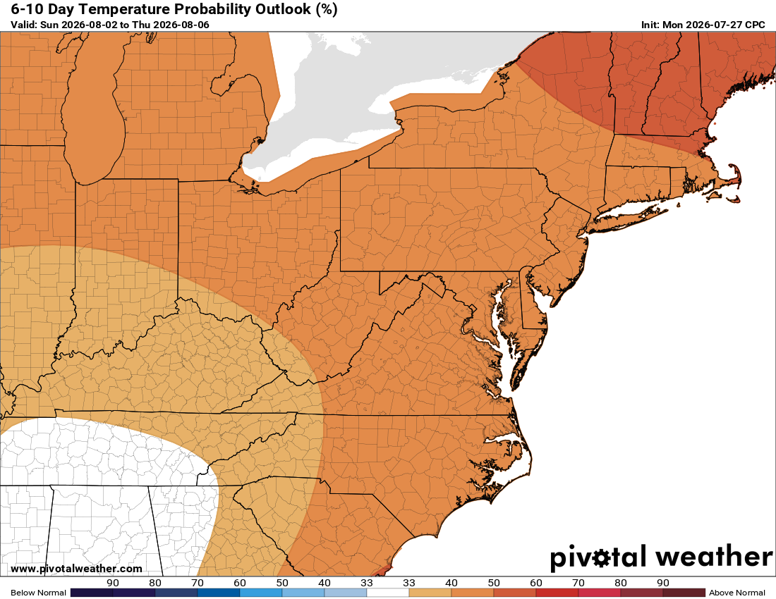
☀️ Heating Up for the Weekend
We warm back up into the weekend, with another chance for showers and storms and highs back to normal, mid to upper 80s. Next week could trend above normal for temps and rain, so enjoy this cooler stretch.
The forecast:
Today: Hi 84 ⛈️90% Lo 66 🌧️60% – Showers and storms likely through the day, tapering off in the evening. Winds becoming westerly, gusting up to 18 mph.
Wednesday: Hi 82 🌞 Lo 65 – Sunny and pleasant with breezy northwest winds gusting up to 28 mph.
Thursday: Hi 82 🌞 Lo 64 – Mostly sunny with northwest winds gusting up to 25 mph.
Friday: Hi 85 ☀️ Lo 65 ☁️ – Sunny with partly cloudy skies overnight.
Saturday: Hi 87 ⛅ Lo 68 🌧️30% – Partly sunny with showers and storms possible late at night.
Sunday: Hi 86 🌧️50% Lo 68 🌧️50% – Mostly cloudy with showers and storms possible day and night.
Monday: Hi 86 🌦️20% Lo 69 🌧️ – Partly sunny with a slight chance of showers, continuing into the night.
#loudoun #loudouncountyva #vawx #loudounweather #loudounva #virginiaweather
Please support Tree of Life Ministries, an important organization to me! https://www.tolministries.org
Facebook: https://facebook.com/loudounwx
Twitter: https://twitter.com/loudounwx
Instagram: https://www.instagram.com/loudounweather/
On the Web @ https://loudounweather.com