Local weather. A little perspective.Loudoun County, VirginiaOfficial NWS alerts β†—
Loudoun County, Virginia

Category: Uncategorized

Loudoun County Weather Outlook for Sunday, August 23, 2026

🌀️ Beautiful, Breezy Sunday
Today's a stunner. Winds will be gusty, up to around 20 mph, but humidity stays nice and low. If you're hitting the pool today, be ready for a chill when you step out since that dry air evaporates fast off your skin. Tonight stays comfortable with low dew points.

β˜€οΈ Stretch of Summer Continues
Monday and Tuesday bring more of the same great weather, sunny, warm afternoons and comfortable nights.

🌀️ Warming Up Midweek
Wednesday ticks up a notch and still feels pretty nice through the day, but showers move in late Wednesday night.

β›ˆοΈ Best Rain Chance Thursday
Thursday looks like our best shot for rain, with a likely chance of showers and storms. Friday's chance drops way down to 20%, and Saturday looks dry. Highs stay in the mid eighties all three days.

Get outside and enjoy it while it lasts!

The forecast:

Sunday: Hi 81 🌞 Lo 58 – Pleasant and comfortable with a mostly sunny afternoon, breezy at times with west winds gusting to 21 mph

Monday: Hi 80 🌞 Lo 57 – Sunny and lovely with light west winds, gusts up to 20 mph

Tuesday: Hi 82 🌞 Lo 59 – Sunny and pleasant with light northwest winds

Wednesday: Hi 85 β˜€οΈ Lo 65 🌧️20% – Mostly sunny during the day, slight chance of showers and thunderstorms overnight after 2am

Thursday: Hi 85 🌦️60% Lo 65 🌧️60% – Chance of showers and thunderstorms throughout the day and into the evening

Friday: Hi 86 🌀️20% Lo 65 – Mostly sunny with a slight chance of showers and thunderstorms

Saturday: Hi 84 🌀️ Lo 64 – Mostly sunny and pleasant

#loudoun #loudouncountyva #vawx #loudounweather #loudounva #virginiaweather

Please support Tree of Life Ministries, an important organization to me! https://www.tolministries.org


Loudoun County Weather Outlook for Saturday, August 22, 2026

🌧️ Scattered Showers Today
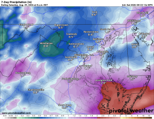
Scattered showers throughout the day, and even a stray thunderstorm, with highs in the upper 70s. Most of the heavier rain looks to stay east of us, but expect a damp, humid feel all day long.

β˜€οΈ Beautiful Stretch Ahead
Sunday, Monday, and Tuesday look very nice, with highs around 80 and nighttime lows dipping into the upper 50s around 60 degrees.

🌀️ Warming Up Midweek
Warmer conditions arrive by Wednesday with highs in the 80s and sunny skies.

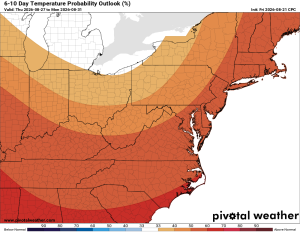
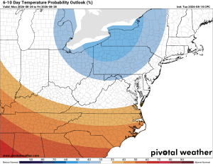
πŸ”­ The longer range is showing a warm-up with continued above-normal rain chances.

β›ˆοΈ Storm Chances Late Week
Chances of showers and thunderstorms return Thursday and Friday, with highs both days in the mid 80s.

Have an awesome Saturday and an excellent weekend!

The forecast:

Today: Hi 78 β›ˆοΈ60% Lo 64 🌧️70% – Scattered showers and thunderstorms likely throughout the day and into the evening, tapering off after midnight

Sunday: Hi 81 🌞 Lo 59 – Sunny and pleasant

Monday: Hi 79 🌞 Lo 57 – Sunny and pleasant

Tuesday: Hi 81 🌞 Lo 60 – Sunny and pleasant

Wednesday: Hi 84 β˜€οΈ Lo 66 🌧️20% – Mostly sunny, with a slight chance of showers overnight

Thursday: Hi 84 β›ˆοΈ50% Lo 67 🌧️40% – Chance of showers and thunderstorms day and night

Friday: Hi 85 β›ˆοΈ30% Lo 65 🌧️ – Chance of showers and thunderstorms

#loudoun #loudouncountyva #vawx #loudounweather #loudounva #virginiaweather

Please support Tree of Life Ministries, an important organization to me! https://www.tolministries.org


Loudoun County Weather Outlook for Friday, August 21, 2026

🌀️ Beautiful Friday

Today's shaping up to be a beautiful one with highs in the low 80s, might be tough to stay focused at work with weather like this. Tonight clouds increase with showers and thunderstorms possible by daybreak Saturday.

🌧️ Locally Heavy Rain Possible Saturday
Saturday brings highs in the upper 70s to near 80Β°, with a chance of showers and storms, including the potential for locally heavy rain and an isolated stronger, potentially severe storm. Rain clears out Saturday night.

β˜€οΈ Sunshine Returns Sunday Through Tuesday
Sunday and Monday look beautiful with highs in the low 80s, and Tuesday stays sunny with highs around 80Β°.

🌩️ Midweek Storm Chances Return
Chances of showers and storms return midweek, with highs in the low to mid 80s. Around 20% Wednesday building to 50% by Thursday.

The forecast:

Today: Hi 81 🌞 Lo 64 🌧️30% – Mostly sunny, showers and thunderstorms possible overnight with patchy fog

Saturday: Hi 78 β›ˆοΈ80% Lo 64 🌧️40% – Showers and thunderstorms likely with patchy fog in the morning, storm chance lingering into the evening

Sunday: Hi 82 🌞 Lo 60 – Mostly sunny and pleasant

Monday: Hi 81 β˜€οΈ Lo 59 – Sunny

Tuesday: Hi 79 β˜€οΈ Lo 62 – Sunny

Wednesday: Hi 83 🌦️20% Lo 66 🌧️40% – Mostly sunny with a slight storm chance, storm chances increasing overnight

Thursday: Hi 82 β›ˆοΈ50% Lo 63 – Partly sunny with a chance of showers and thunderstorms

#loudoun #loudouncountyva #vawx #loudounweather #loudounva #virginiaweather

Please support Tree of Life Ministries, an important organization to me! https://www.tolministries.org

Facebook: https://facebook.com/loudounwx
Twitter: https://twitter.com/loudounwx
Instagram: https://www.instagram.com/loudounweather/
On the Web @ https://loudounweather.com
TikTok: https://www.tiktok.com/@loudounweather


Loudoun County Weather Outlook for Thursday, August 20, 2026

⚠️⚑ Severe Storms Possible

🌧️ Local Heavy Rain Possible

🌧️ Cloudy and Stormy Today
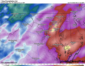
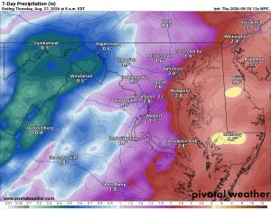
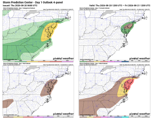
Good Thursday to you! Cloudy with showers and thunderstorms likely, a few could turn strong to severe. Locally heavy rain is possible too. Cloudy with a chance of showers continuing tonight.

🌦️ Lingering Chances Tomorrow
Friday still carries a continued chance of showers and storms, especially later in the day and into the overnight.

β›ˆοΈ Stormy Saturday
Saturday looks stormy too, with showers and thunderstorms possible throughout the day.

β˜€οΈ Nicer Sunday
Sunday backs off with just a slight chance of a shower or storm and a much nicer feel, highs in the low eighties.

β˜€οΈ Great Start to the Week
Monday and Tuesday look really nice with sunny skies and low eighties.

🌦️ Midweek Return
Wednesday warms into the mid eighties with a return chance of a shower or thunderstorm.

πŸ”­ Looking Further Out
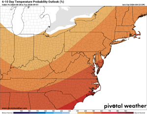
Extended outlook shows temps near or slightly above normal, with an above normal chance of rain.

Have an awesome Thursday!

The forecast:

Today: Hi 82 β›ˆοΈ90% Lo 64 🌧️60% – Showers and thunderstorms throughout the day, tapering to isolated showers overnight with patchy fog developing

Friday: Hi 79 🌦️20% Lo 66 🌧️60% – Mostly sunny with a slight chance of showers, then showers and thunderstorms likely overnight

Saturday: Hi 81 🌧️60% Lo 65 🌧️60% – Cloudy with showers and thunderstorms likely through the day and continuing into the evening

Sunday: Hi 81 🌀️20% Lo 61 – Mostly sunny with a slight chance of afternoon thunderstorms, clearing overnight

Monday: Hi 80 β˜€οΈ Lo 60 – Sunny and pleasant

Tuesday: Hi 81 β˜€οΈ Lo 63 – Sunny

Wednesday: Hi 83 🌦️30% Lo 63 – Mostly sunny with a chance of showers and thunderstorms

Please support Tree of Life Ministries, an important organization to me! https://www.tolministries.org

Facebook: https://facebook.com/loudounwx
Twitter: https://twitter.com/loudounwx
Instagram: https://www.instagram.com/loudounweather/
On the Web @ https://loudounweather.com
TikTok: https://www.tiktok.com/@loudounweather


Loudoun County Weather Outlook for Wednesday, August 19, 2026

🌞 Somewhat Hot Wednesday
Good Wednesday to you! We're halfway through the week, and it's a pretty hot one, with highs pushing near 90Β° and humidity building through the day. Skies turn cloudy tonight.

🌩️ Storm Chances Return
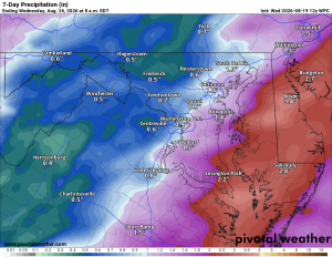
Thursday brings a chance of showers and thunderstorms, especially in the afternoon and evening, before clearing out a bit overnight. Friday keeps a 30 to 40% chance of more showers and storms under cloudy skies.

🌦️ Cooler for the Weekend
Saturday's chance ticks up to around 50% for showers and thunderstorms, with highs easing into the low to mid 80s Thursday through Saturday. Sunday only carries a slight 20% storm chance with highs in the mid 80s.

πŸ”­ Looking Further Out
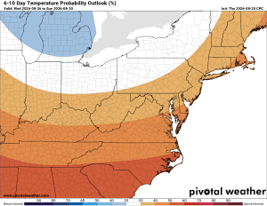
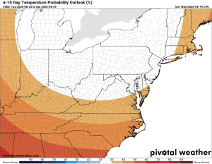
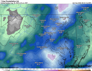
Monday and Tuesday look sunny with highs in the low to mid 80s. Longer range signals show temperatures near or slightly below normal, with precipitation running slightly above normal.

Have an awesome Wednesday!

The forecast:

Today: Hi 87 β˜€οΈ Lo 68 – Patchy fog early, then sunny

Thursday: Hi 82 β›ˆοΈ80% Lo 63 🌧️30% – Showers and storms increasing in the afternoon, lingering into the evening

Friday: Hi 81 🌦️30% Lo 64 🌧️40% – Afternoon storm chance, showers possible overnight

Saturday: Hi 82 🌦️50% Lo 65 🌧️30% – Showers and storms possible through the day, lingering early

Sunday: Hi 83 🌞20% Lo 62 – Mostly sunny with a slight afternoon storm chance

Monday: Hi 83 🌞 Lo 61 – Sunny and pleasant

Tuesday: Hi 83 🌞 Lo 62 – Sunny

#loudoun #loudouncountyva #vawx #loudounweather #loudounva #virginiaweather

Please support Tree of Life Ministries, an important organization to me! https://www.tolministries.org