Local weather. A little perspective.Loudoun County, VirginiaOfficial NWS alerts ↗
Loudoun County, Virginia

The local outlook

Forecasts, updates and a little local perspective.

Loudoun County Weather Outlook for Monday, July 14, 2025

7/14/2025
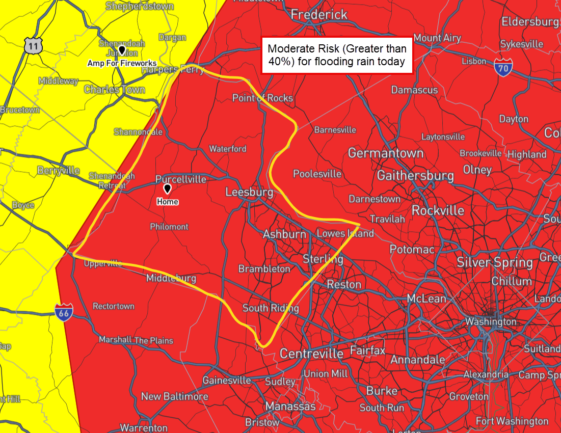
🌧️ Flood Watch This Afternoon
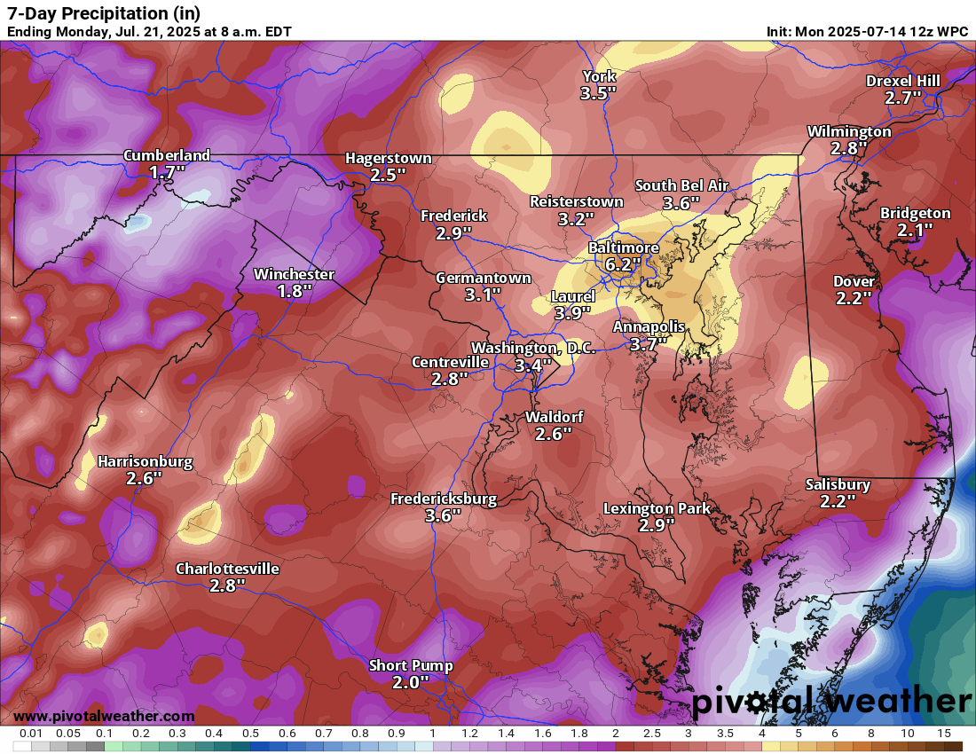
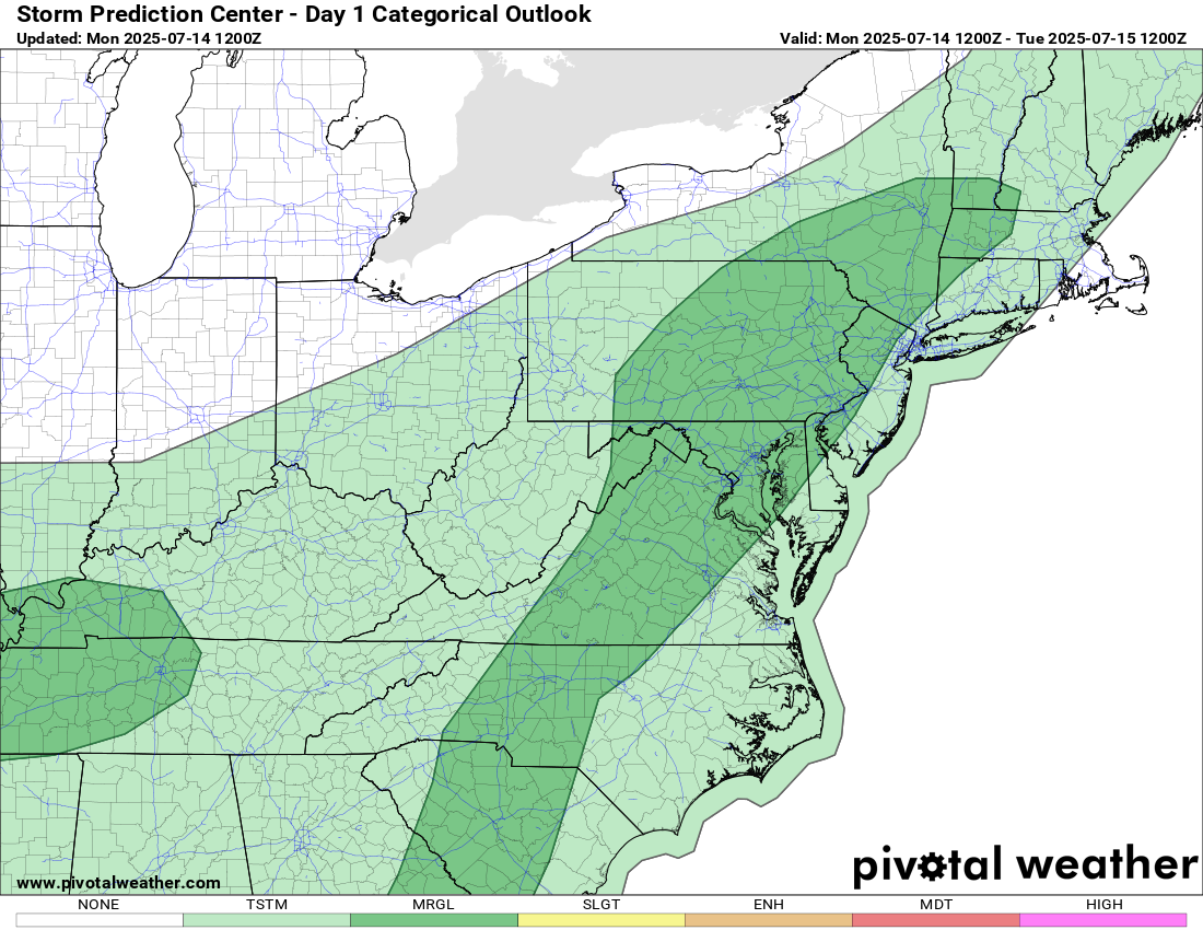
A Flood Watch is in effect from 2 PM to Midnight today. A much better chance of widespread rain today, with the potential for very heavy rainfall that could lead to localized flooding. Check those basement drains and keep them clear! Never drive through flooded roadways—turn around, don’t drown!

🌦️ Daily Storm Chances Continue tomorrow and through the weekend

🌡️🥵 Potentially dangerous heat Thursday and Friday
By Thursday and Friday, temperatures could soar into the low to mid-90s, with heat index values reaching 105–110°F. This may lead to heat advisories being issued, so stay cool and hydrated!

📈 Looking Ahead
The extended outlook keeps things warmer and wetter than average, so keep those umbrellas and fans handy!

The forecast:
Today: Hi 87 ⛈️60% Lo 70 🌧️80% ‑ Showers and storms likely. Storms could be strong and contain heavy rain.

Tuesday: Hi 87 ⛈️70% Lo 72 🌧️60% ‑ Showers and storms likely. Storms could be strong and contain heavy rain.

Wednesday: Hi 88 ⛈️70% Lo 72 🌧️60% ‑ Showers and storms likely

Thursday: Hi 93 🌦️50% Lo 73 🌧️30% ‑ 🥵 Hot with a chance of showers and storms

Friday: Hi 91 🌦️50% Lo 72 🌧️30% ‑ 🥵 Hot with a chance of showers and storms

Saturday: Hi 89 🌦️40% Lo 71 🌧️30% ‑ A chance of showers and storms

Sunday: Hi 89 🌦️50% Lo 70 🌧️ ‑ A chance of showers and storms

#loudoun #loudouncountyva #vawx #loudounweather #loudounva #virginiaweather

Please support Tree of Life Ministries, an important organization to me! https://www.tolministries.org


Please support Tree of Life Ministries, an important organization to me! https://www.tolministries.org

image.png

image.png

image.png

Loudoun County Weather Outlook for Sunday, July 13, 2025

7/13/2025
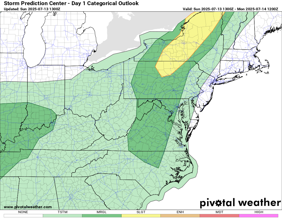
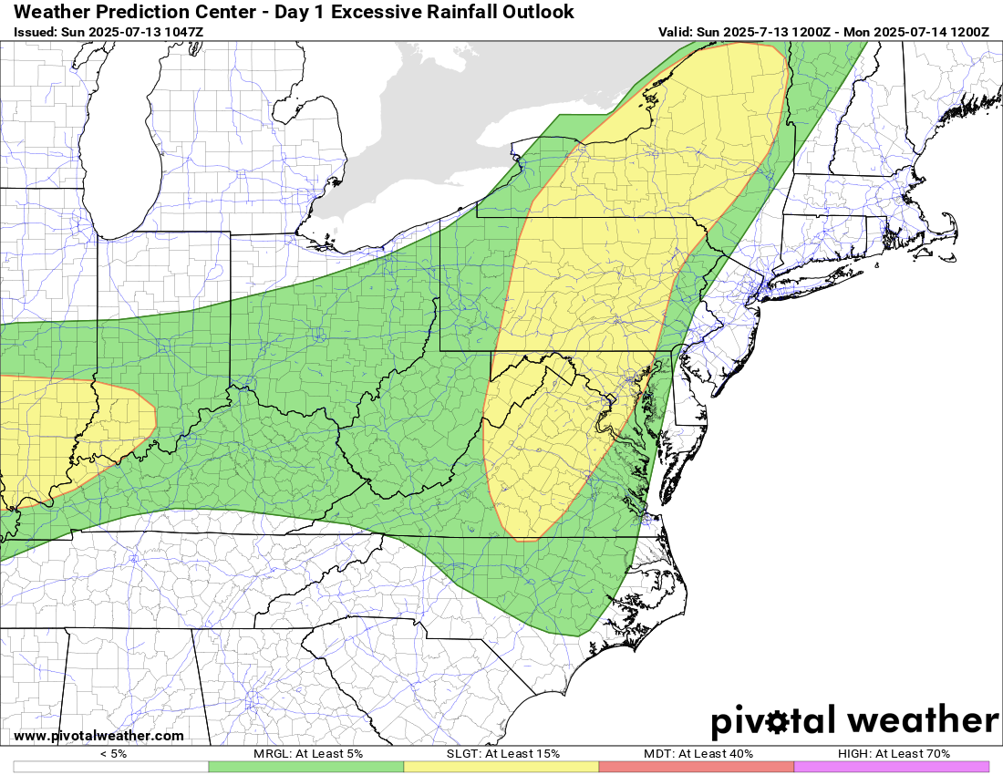
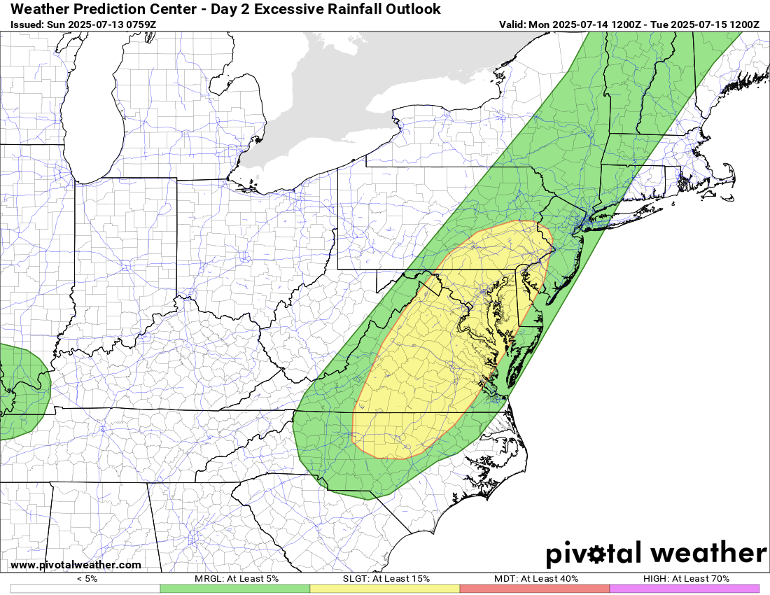
⚠️We do have a marginal risk for a severe storm today, and a slight risk for excessive rainfall today and tomorrow! ⚠

🌡️ Hot & Humid With Late Storm Threat
Today stays mostly dry until this evening, with highs pushing near 90°F. Some strong to severe storms are possible, with a chance of localized flooding due to the moisture-rich atmosphere.

🌧️ Hot & Muggy, with Daily chances of showers and storms
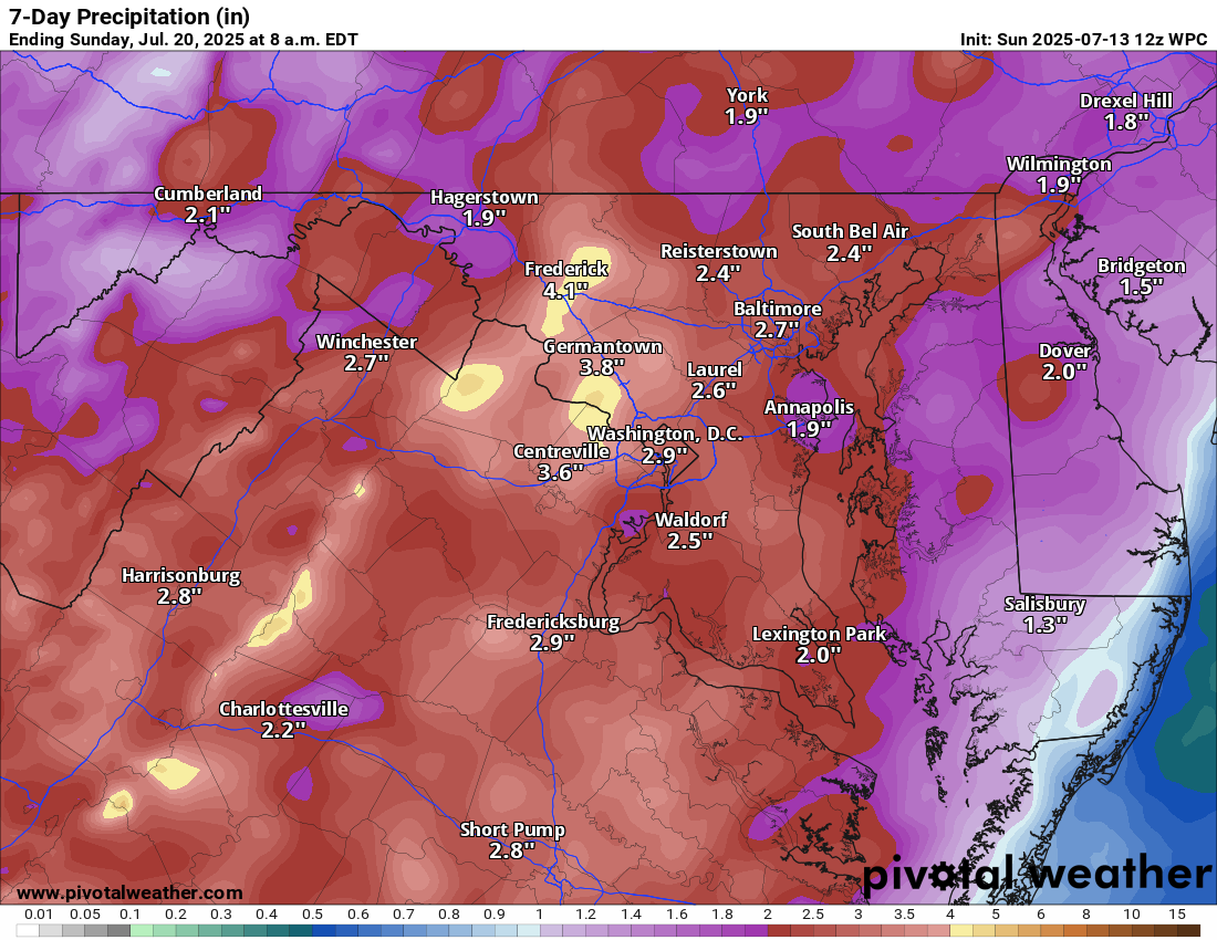
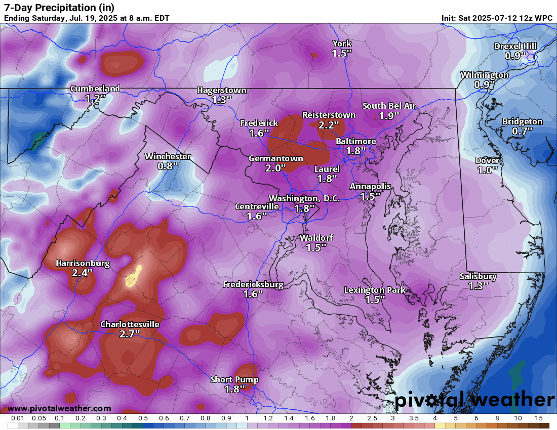
Storms will be most likely during the afternoon and evening. Temps in the upper 80s to around 90°F. It’ll feel more like 95–100°F+ at times! We will need to watch for heavy rain as well, causing localized flooding.

🌤️ Lower chances of rain by the Weekend, but the same story!
There’s hope for a break from the storms by Friday into Saturday as chances for rain dip a bit. But it will stay humid with showers and storms possible.

📈 Long Range: More of the Same
The extended outlook keeps temps at or above normal with a repeating pattern of daily thunderstorm chances.

The forecast: (groundhog day movie vibes due toit repeating!)

Today: Hi 88 🌦️60% Lo 71 🌧️60% – Showers and storms are likely

Monday: Hi 89 🌦️70% Lo 71 🌧️60% – Showers and storms are likely

Tuesday: Hi 86 🌦️70% Lo 72 🌧️60% – Showers and storms are likely

Wednesday: Hi 89 🌦️70% Lo 73 🌧️60% – Showers and storms are likely

Thursday: Hi 91 🌦️60% Lo 72 🌧️60% – Showers and storms are likely

Friday: Hi 90 🌦️50% Lo 71 🌧️30% – A chance of showers and storms

Saturday: Hi 87 🌦️40% Lo 69 🌧️ – A chance of showers and storms

#loudoun #loudouncountyva #vawx #loudounweather #loudounva #virginiaweather

Please support Tree of Life Ministries, an important organization to me! https://www.tolministries.org


Please support Tree of Life Ministries, an important organization to me! https://www.tolministries.org

image.png
image.png

image.png
image.png

Loudoun County Weather Outlook for Saturday, July 12, 2025

7/12/2025 –
🔥 Hot & Steamy Saturday
Today will be another hot and muggy one with highs in the low 90s. Only a slight 20% chance of a stray shower or storm late today or tonight. Any storm could be strong with heavy rain.

🌩️ Stormy Sunday Setup
Sunday brings a much higher chance (around 80%) of showers and thunderstorms, mainly in the afternoon and evening. Highs will push near 90°F and it’ll stay quite humid. Any storm could be strong with heavy rain.

🌧️ Storm Chances Continue Monday & Tuesday
Both days will stay unsettled with highs in the upper 80s and a good chance of showers and thunderstorms on Monday. Any storm could be strong with heavy rain.

🔥 Heat Builds Mid to Late Week
From Wednesday through Friday, expect temperatures to return to the low 90s°F, with heat indices exceeding 100°F. Typical summer pattern with daily afternoon storm chances

The forecast:
Today: Hi 91 🌦️20% Lo 71 🌧️20% – Hot. Mostly sunny with a slight chance of showers and storms.

Sunday: Hi 88 ⛈️80% Lo 70 🌧️80% – Showers and storms likely.

Monday: Hi 88 🌦️60% Lo 69 🌧️60% – Showers and storms likely.

Tuesday: Hi 89 🌦️30% Lo 70 🌧️30% – Mostly sunny with isolated showers.

Wednesday: Hi 90 🌦️40% Lo 73 🌧️30% – Hot. Partly sunny with a chance of showers and storms.

Thursday: Hi 91 🌦️50% Lo 73 🌧️30% – Continued hot. Scattered showers and storms.

Friday: Hi 91 🌧️60% Lo 70 🌧️ – Continued hot. Showers and storms are likely.

#loudoun #loudouncountyva #vawx #loudounweather #loudounva #virginiaweather

Please support Tree of Life Ministries, an important organization to me! https://www.tolministries.org


Please support Tree of Life Ministries, an important organization to me! https://www.tolministries.org

image.png

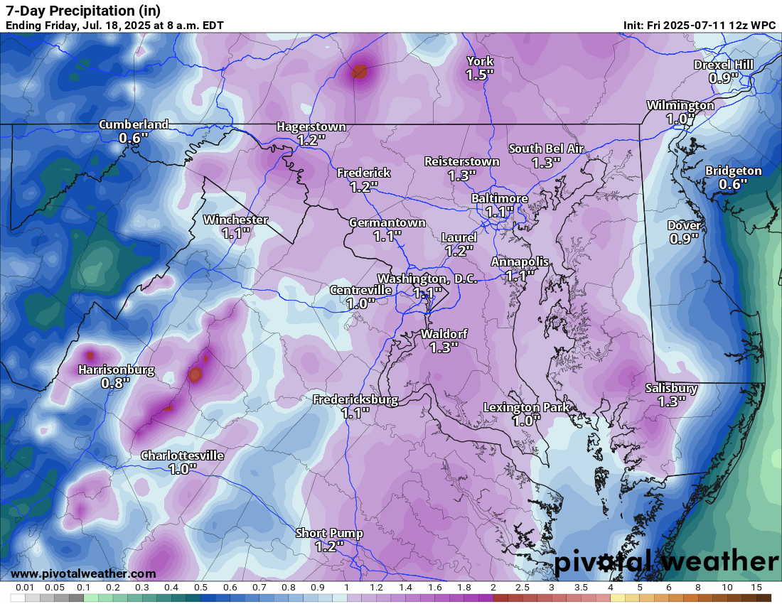
Loudoun County Weather Outlook for Friday, July 11, 2025

7/11/2025
☀️ Typical Summertime Pattern Setting Up!
We're settling into that classic July groove—hot, humid, and stormy at times!

🌡️ Heat & Humidity Continue
Expect daily highs near 90°F, with heat index values closer to 100°F. Monday and Tuesday may be a touch “cooler” with highs in the upper 80s, but still muggy.

🌦️ Daily Storm Chances
Today and Saturday bring about a 30% chance of pop-up showers or storms, mainly in the afternoon and evening hours. Things ramp up by Sunday afternoon into Monday, where storms become more likely and widespread.

⛈️ Heavy Rain & Severe Threat
With so much moisture in the air, any storm that develops could dump heavy rain, so keep an eye out for localized flooding and a few stronger storms.

📉 A Break in Sight?
With so much moisture in the air, any storm that develops could dump heavy rain, so watch for localized flooding and a few stronger storms.

The forecast:
Today: Hi 89 🌦️30% Lo 71 🌧️30% – Mostly sunny with a chance of late afternoon and evening storms

Saturday: Hi 91 🌦️40% Lo 72 🌧️30% – Mostly sunny with a chance of late afternoon and evening storms.

Sunday: Hi 89 🌧️80% Lo 70 🌧️80% – Showers and thunderstorms

Monday: Hi 86 🌦️60% Lo 70 🌧️60% – Partly sunny with afternoon showers and storms.

Tuesday: Hi 87 🌦️30% Lo 70 🌧️30% – Mostly sunny with a chance of afternoon showers and storms.

Wednesday: Hi 90 🌦️30% Lo 72 🌧️30% – Partial sun, with a chance of showers and storms.

Thursday: Hi 91 🌦️40% Lo 70 🌧️30% – Partly sunny with a chance of showers and thunderstorms.

#loudoun #loudouncountyva #vawx #loudounweather #loudounva #virginiaweather

Please support Tree of Life Ministries, an important organization to me! https://www.tolministries.org


Please support Tree of Life Ministries, an important organization to me! https://www.tolministries.org

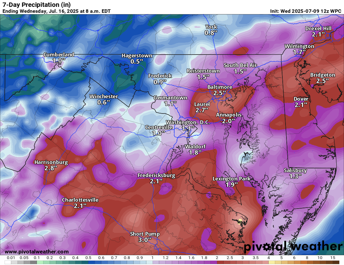
Loudoun County Weather Outlook for Wednesday, July 9, 2025

7/9/2025
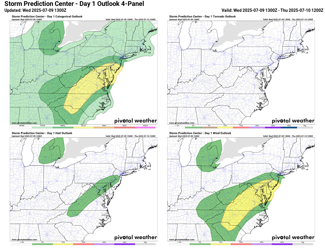
Flood Watch and Slight Risk for Severe Storms today

⛈️ Hot, Steamy, and Stormy Today
Another day with highs near 90°F and high humidity. Expect showers and thunderstorms to develop this afternoon and evening, which could be strong to severe, with gusty winds and isolated hail. A flood watch is up for heavy rainfall, with rates possibly exceeding 2 inches per hour.

🌡️ Muggy Pattern Continues
The very warm and humid weather sticks around, carrying a marginal risk for severe storms and the potential for locally heavy rainfall.

🌦️ Unsettled Into the Weekend
More storm chances linger into the weekend with hot and humid conditions.

🔥 Heat Surge Next Week
Looking ahead, the heat will rebound again next week. With high humidity still in place, it will feel quite oppressive. However, a potential cool-down could arrive mid to late month, so stay tuned!

The forecast:
Today: Hi 89 ⛈️60% Lo 69 🌧️60% – Partly sunny early, with showers and thunderstorms likely. Some could be severe with heavy rain.

Thursday: Hi 85 ⛈️70% Lo 70 🌧️60% – Mostly cloudy with storms likely

Friday: Hi 87 ⛈️60% Lo 70 🌧️60% – Partly sunny with showers and storms likely by afternoon; lingering storms into the night

Saturday: Hi 89 🌧️40% Lo 71 🌧️30% – Mostly sunny turning to scattered afternoon and evening storms

Sunday: Hi 89 🌧️50% Lo 69 🌧️40% – Partly sunny with showers and storms after 2 pm

Monday: Hi 87 🌧️50% Lo 69 🌧️30% – Mostly sunny with a chance of showers and storms

Tuesday: Hi 89 🌧️40% Lo 68 🌧️30% – Mostly sunny with a chance of showers and storms

#loudoun #loudouncountyva #vawx #loudounweather #loudounva #virginiaweather

Please support Tree of Life Ministries, an important organization to me! https://www.tolministries.org


Please support Tree of Life Ministries, an important organization to me! https://www.tolministries.org