7/13/2025
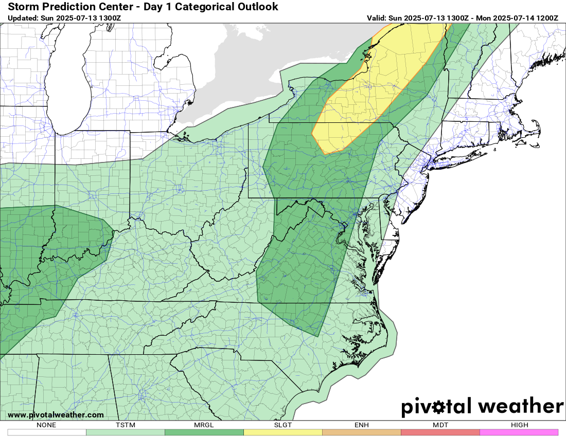
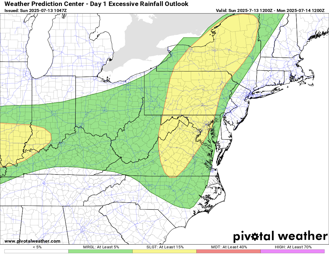
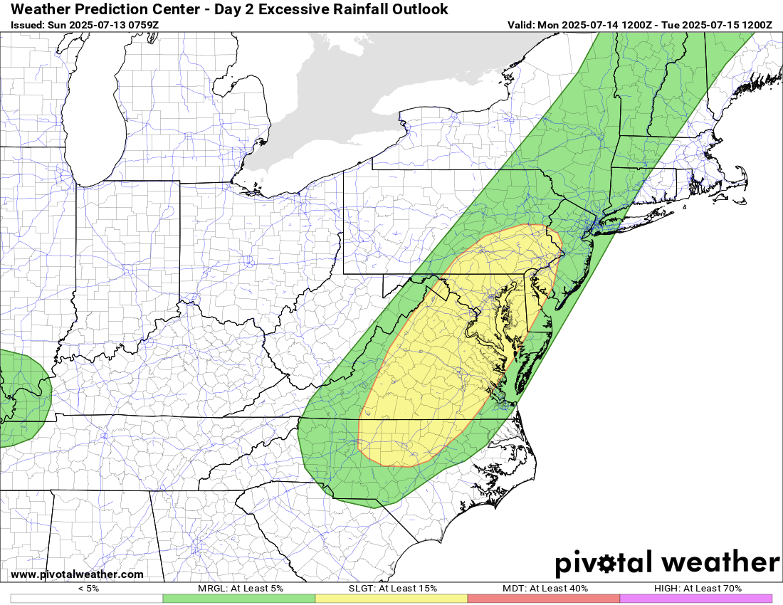
⚠️We do have a marginal risk for a severe storm today, and a slight risk for excessive rainfall today and tomorrow! ⚠
🌡️ Hot & Humid With Late Storm Threat
Today stays mostly dry until this evening, with highs pushing near 90°F. Some strong to severe storms are possible, with a chance of localized flooding due to the moisture-rich atmosphere.
🌧️ Hot & Muggy, with Daily chances of showers and storms
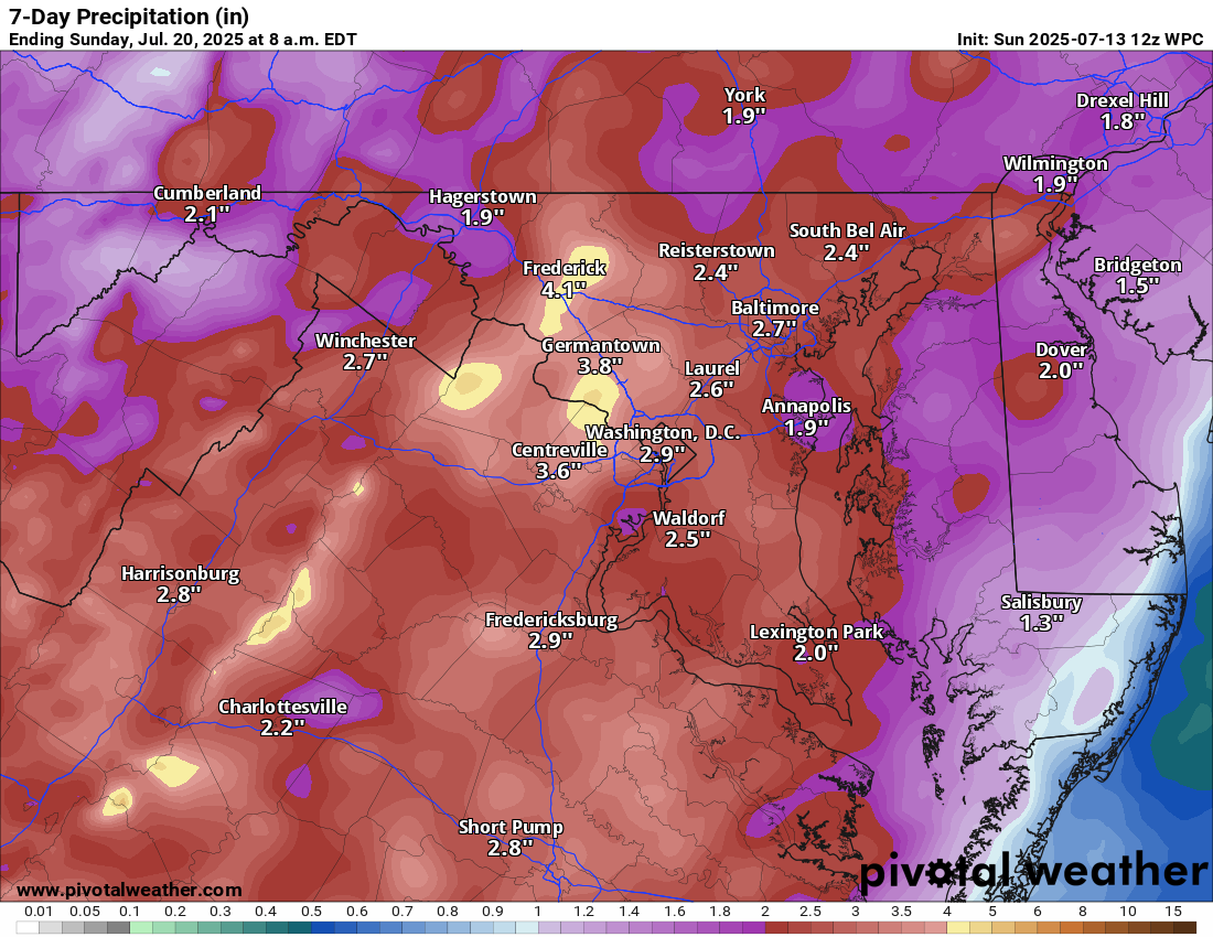
Storms will be most likely during the afternoon and evening. Temps in the upper 80s to around 90°F. It’ll feel more like 95–100°F+ at times! We will need to watch for heavy rain as well, causing localized flooding.
🌤️ Lower chances of rain by the Weekend, but the same story!
There’s hope for a break from the storms by Friday into Saturday as chances for rain dip a bit. But it will stay humid with showers and storms possible.
📈 Long Range: More of the Same
The extended outlook keeps temps at or above normal with a repeating pattern of daily thunderstorm chances.
The forecast: (groundhog day movie vibes due toit repeating!)
Today: Hi 88 🌦️60% Lo 71 🌧️60% – Showers and storms are likely
Monday: Hi 89 🌦️70% Lo 71 🌧️60% – Showers and storms are likely
Tuesday: Hi 86 🌦️70% Lo 72 🌧️60% – Showers and storms are likely
Wednesday: Hi 89 🌦️70% Lo 73 🌧️60% – Showers and storms are likely
Thursday: Hi 91 🌦️60% Lo 72 🌧️60% – Showers and storms are likely
Friday: Hi 90 🌦️50% Lo 71 🌧️30% – A chance of showers and storms
Saturday: Hi 87 🌦️40% Lo 69 🌧️ – A chance of showers and storms
#loudoun #loudouncountyva #vawx #loudounweather #loudounva #virginiaweather
Please support Tree of Life Ministries, an important organization to me! https://www.tolministries.org
Facebook: https://facebook.com/loudounwx
Twitter: https://twitter.com/loudounwx
Instagram: https://www.instagram.com/loudounweather/
On the Web @ https://loudounweather.com
Please support Tree of Life Ministries, an important organization to me! https://www.tolministries.org
Facebook: https://facebook.com/loudounwx
Twitter: https://twitter.com/loudounwx
Instagram: https://www.instagram.com/loudounweather/
On the Web @ https://loudounweather.com