Local weather. A little perspective.Loudoun County, VirginiaOfficial NWS alerts ↗
Loudoun County, Virginia

The local outlook

Forecasts, updates and a little local perspective.

Loudoun County Weather Outlook for Wednesday, April 8, 2026


❄️ Cold Night, Another Freeze Possible Tonight
Many spots dropped into the upper 20s overnight, so hard freezes did occur. Anything left uncovered was likely impacted. Today we rebound a bit with highs in the low to mid 50s, but that's still cold enough to dip below freezing again tonight. A freeze watch may be upgraded to a freeze warning later today, especially for western Loudoun County.

🌤️ Warming Trend Takes Hold
Tomorrow we climb into the lower 60s with overnight lows near 40. Friday brings us close to 70, and this weekend we're looking at the low 70s.

🌡️ Heat Building Next Week
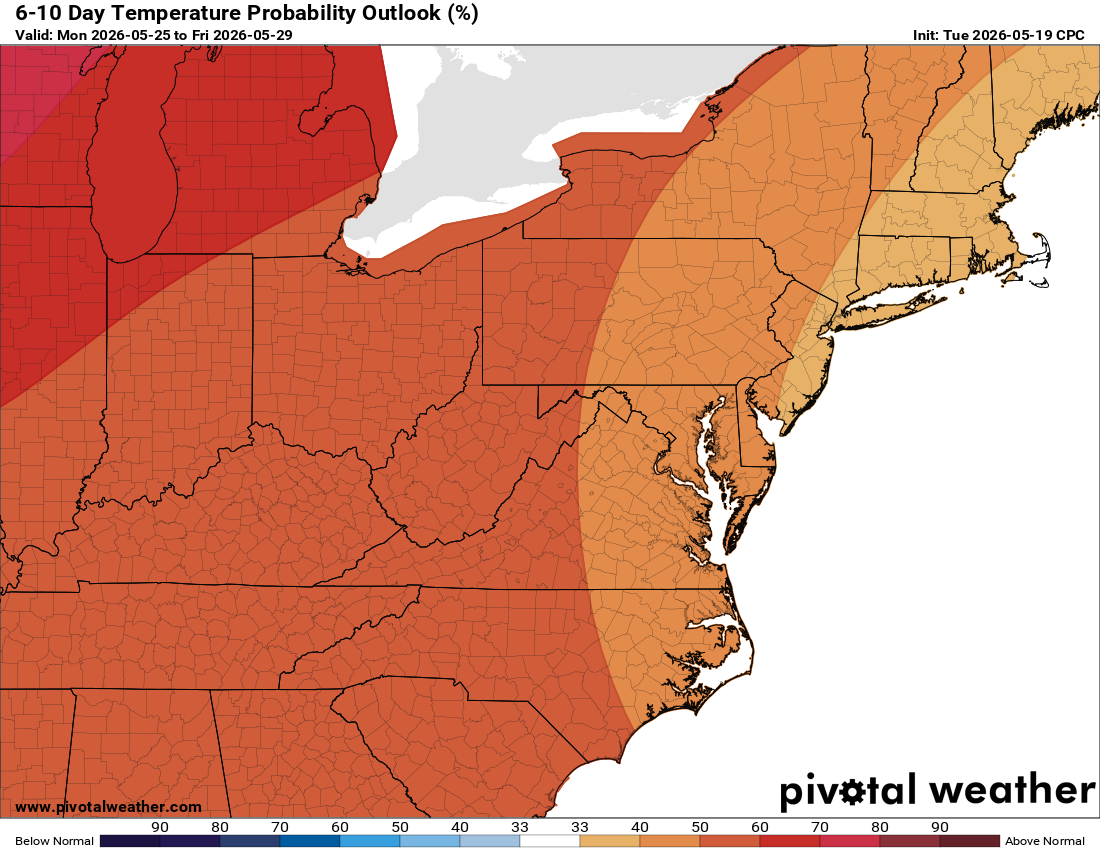
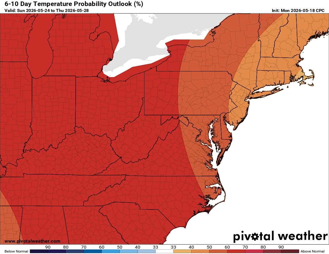
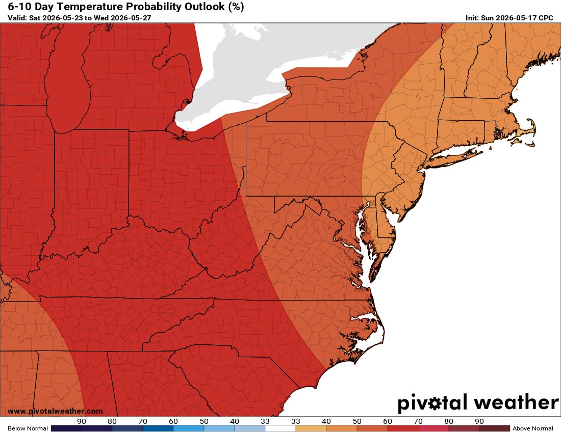
Temperatures head into the 80s next week with a possible run at 90° mid-week if conditions line up. This will be a true early-season warm stretch.

🔥 Dry Conditions, Fire Danger Worth Watching
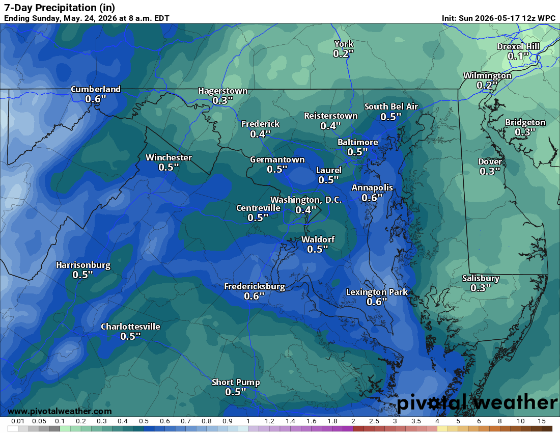
This is a dry trend. With low humidity, warm temps, and dry ground, brush fire risk will be something to keep an eye on.

📉 Drought Concerns Continue
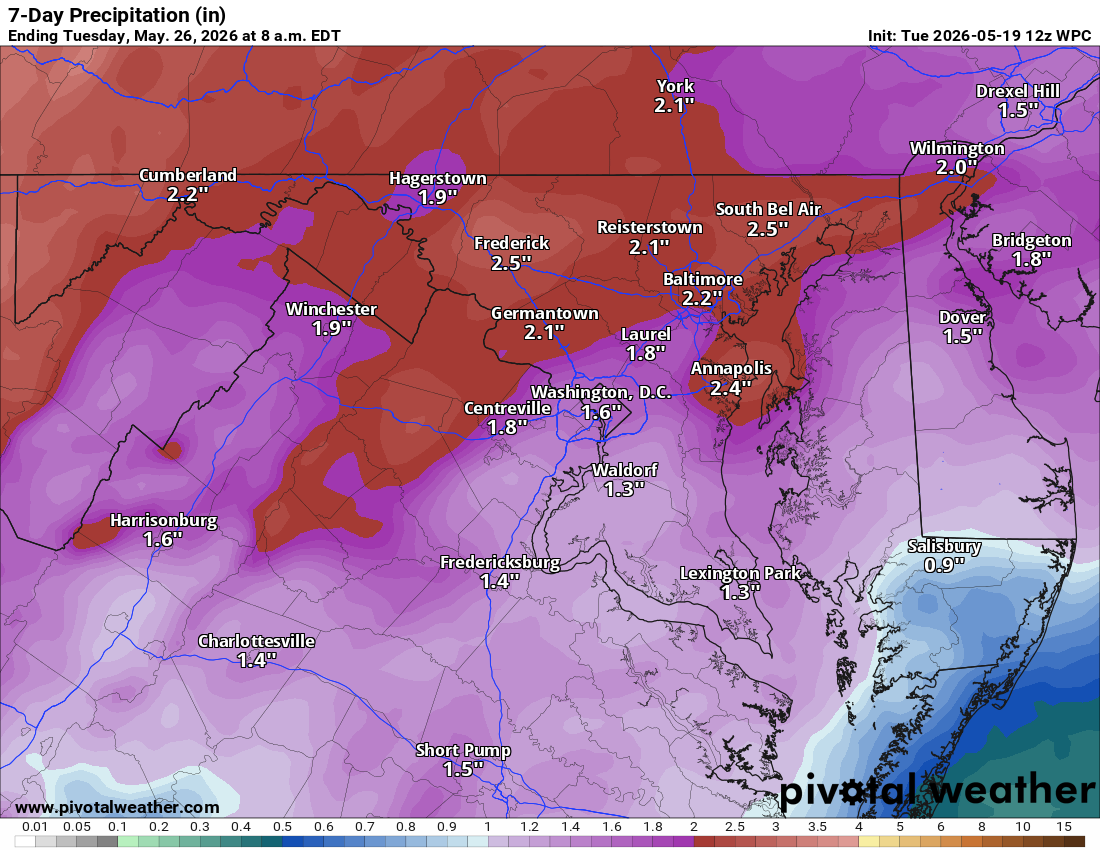
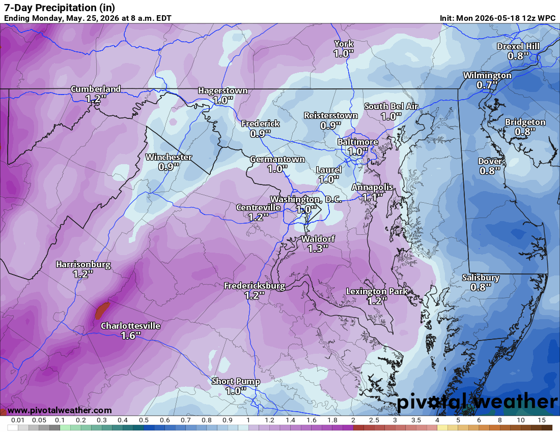
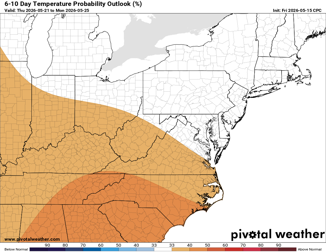
The longer range keeps us warmer than normal and below normal on precipitation. We had started to make some progress on drought conditions, but this stretch is going to set us back.

Today: Hi 53 ☀️ Lo 31 🌙 – Sunny becoming light southeast wind, then mostly
clear with widespread frost after 3am

Thursday: Hi 61 ☀️ Lo 38 🌙 – Widespread frost before 8am then mostly
sunny, mostly clear tonight

Friday: Hi 74 ☀️ Lo 52 🌙20% – Sunny with light south wind increasing, then
partly cloudy with slight chance of showers

Saturday: Hi 68 🌞 Lo 45 🌙 – Mostly sunny, mostly clear night

Sunday: Hi 71 🌞 Lo 55 🌙 – Mostly sunny, partly cloudy night

Monday: Hi 81 ⛅ Lo 63 ☁️ – Partly sunny, mostly cloudy night

Tuesday: Hi 86 🌞 – Mostly sunny

#loudoun #loudouncountyva #vawx #loudounweather #loudounva #virginiaweather

Please support Tree of Life Ministries, an important organization to me!

Loudoun County Weather Outlook for Tuesday, April 7, 2026

**WEATHER ALERTS:**
🚨 Freeze Warning
🚨 Freeze Watch

🥼 Chilly Day With a Freeze Warning Tonight
Highs today will only reach around 50°F, and breezes will make it feel colder. Sunshine will be beautiful, but tonight a freeze warning is in effect with temperatures dropping to the mid to upper 20s. If you have tender vegetation, take precautions.

🥼 Freeze Watch Tomorrow Night
Tomorrow warms slightly to the low to mid 50s, but another cold night follows. Temperatures will be near freezing tomorrow night, especially in western and sheltered locations.

🌤️ Gradual Warmup Through the Week
Near 60°F on Thursday, low 70s Friday, and low to mid 70s through the weekend. 80s return early next week. This period also looks very dry.

The forecast:

Today: Hi 49 ☀️ Lo 27 🌙 – Sunny and breezy with northwest winds 15-20 mph,
gusting to 30 mph, then mostly clear overnight

Wednesday: Hi 52 ☀️ Lo 31 🌙 – Sunny with northeast winds becoming
southeast, then mostly clear with widespread frost developing after 3am

Thursday: Hi 60 ☀️ Lo 39 🌙 – Widespread frost early then mostly sunny,
mostly clear overnight

Friday: Hi 72 ☀️ Lo 50 ⛅ – Sunny, then partly cloudy overnight

Saturday: Hi 71 🌤️ Lo 48 🌙 – Mostly sunny, then mostly clear overnight

Sunday: Hi 74 🌤️ Lo 56 ⛅ – Mostly sunny, then partly cloudy overnight

Monday: Hi 83 ⛅ – Partly sunny

#loudoun #loudouncountyva #vawx #loudounweather #loudounva #virginiaweather

Please support Tree of Life Ministries, an important organization to me! https://www.tolministries.org


Loudoun County Weather Outlook for Sunday, April 5, 2026

Loudoun County Weather Outlook for Sunday, April 5, 2026

☔ Rain Ending Early This Afternoon
Skies clear and turn breezy this afternoon. Highs reach the upper 60s, though temps may fall some as we head through the afternoon.

🌬️ Cooler Days Ahead
Tomorrow highs near 60, and Tuesday really chilly with highs only near 50.
🥶 Freeze Risk Tuesday Night
We drop below freezing Tuesday night, so any tender vegetation may need to be covered.

🌫️ Frost Possible Again Wednesday Night
Colder conditions relax some on Wednesday with highs in the mid 50s, but frost is still possible late Wednesday night. Again, keep that tender vegetation protected.

🌤️ Warming Up Late Week
Temperatures start to rebound Thursday into the 60s, near 70 on Friday, and mid to upper 70s on Saturday. Just a cold shot in the middle of the week, then we warm right back up.

The forecast:
Today: Hi 69 🌧️100% Lo 39 🌙 – Showers mainly before 1pm, then mostly clear
tonight. South wind 10-15 mph becoming northwest with gusts to 25 mph.

Monday: Hi 60 ☀️ Lo 40 🌙 – Sunny with west wind 11-14 mph, gusts to 24
mph. Mostly clear tonight.

Tuesday: Hi 49 ☀️ Lo 28 🌙 – Sunny with northwest wind 14-16 mph, gusts to
25 mph. Clear tonight.

Wednesday: Hi 54 ☀️ Lo 35 ⛅ – Sunny during the day, partly cloudy tonight.

Thursday: Hi 64 🌤️ Lo 44 🌙 – Mostly sunny during the day, mostly clear
tonight.

Friday: Hi 73 ☀️ Lo 50 🌙 – Sunny during the day, mostly clear tonight.

Saturday: Hi 77 🌤️ – Mostly sunny.

#loudoun #loudouncountyva #vawx #loudounweather #loudounva #virginiaweather

Please support Tree of Life Ministries, an important organization to me!


Loudoun County Weather Outlook for Wednesday, April 1, 2026

Loudoun County Weather Outlook for Wednesday, April 1, 2026

⚡Slight Risk for Severe Storms this evening!

⛈️ Warm Day, Storm Threat This Evening
Warm temperatures today, but an approaching front brings a chance of scattered showers and storms, especially this evening. A few could be strong to severe. We're under a Slight Risk (Level 2 of 5) for severe weather, with gusty winds the main concern. I'll be watching radar closely this afternoon.

🌧️ Unsettled Pattern Continues
Showers and storms linger overnight and into tomorrow afternoon and evening. A few showers remain possible Friday and again Saturday afternoon.

🐣 Easter Sunday Looking Wet
Sunday is unfortunately our best shot at rain this weekend. Showers will help cool us down heading into next week, with highs only in the upper 50s to around 60° Monday and Tuesday, with a few showers still possible Tuesday.

💧 Drought Update
We need this rain! The drought continues, and while the coverage will be scattered, every bit counts. We'll see how much actually falls as this pattern plays out.

The forecast:
Today: Hi 83 🌦️80% Lo 58 🌧️80% – Scattered showers and thunderstorms,
becoming showers and thunderstorms, then isolated showers overnight with
patchy fog

Thursday: Hi 72 ⛅60% Lo 54 🌧️60% – Showers likely with patchy fog in
morning, thunderstorms possible after 5pm, then showers likely before 8pm

Friday: Hi 81 🌤️20% Lo 61 ☁️20% – Mostly sunny with slight chance of
afternoon showers, then mostly cloudy with slight chance of showers and
thunderstorms

Saturday: Hi 83 🌦️40% Lo 60 🌧️40% – Partly sunny with chance of afternoon
showers continuing into the night

Sunday: Hi 69 🌧️80% Lo 39 🌧️80% – Showers throughout the day, mainly ending
by evening

Monday: Hi 57 ☀️ Lo 37 🌙 – Sunny skies with mostly clear conditions
overnight

Tuesday: Hi 60 🌦️30% Lo 40 ☁️ – Partly sunny with chance of showers
#loudoun #loudouncountyva #vawx #loudounweather #loudounva #virginiaweather

Please support Tree of Life Ministries, an important organization to me! https://www.tolministries.org

Facebook: https://facebook.com/loudounwx
Twitter: https://twitter.com/loudounwx
Instagram: https://www.instagram.com/loudounweather/
On the Web @ https://loudounweather.com
TikTok: https://www.tiktok.com/@loudounweather
image.png

image.png
image.png

Loudoun County Weather Outlook for Tuesday, March 31, 2026

🌤️ Warm Today, Slight Storm Chance
Highs in the low 80s. A 20% chance of an afternoon or evening shower or storm, but we'll see if that verifies.

🌧️ Better Chances Wednesday
Showers and storms more likely Wednesday afternoon and evening. Highs still in the low 80s. Very spring, if not early summer, feel. Showers continue into Wednesday night.

🌦️ Showers Possible Thursday and Friday
More shower chances linger through the end of the week. Friday's best timing is afternoon and evening, around a 30% chance. Summer-like pattern overall.

🌩️ Weekend Outlook
Saturday warm again in the low 80s, but showers develop in the afternoon. Easter Sunday has a good chance of showers with highs near 75, though timing is still a bit iffy. Could be okay for part of the day before rain moves in.

🌥️ Cooler Easter Monday
Highs drop to around 60 with a few shower chances, but hopefully things clear out for the festivities. Have an excellent day!

Today: Hi 81 🌦️20% Lo 63 🌧️20% – Isolated showers and thunderstorms after
2pm, then isolated showers before 3am and after 5am

Wednesday: Hi 81 🌦️70% Lo 59 🌧️60% – Slight chance of showers before 8am,
then showers likely and possibly thunderstorms after 2pm continuing through
night

Thursday: Hi 74 🌦️50% Lo 57 ☁️30% – Slight chance of showers, then chance
of showers and thunderstorms after 2pm, ending by 2am

Friday: Hi 79 🌦️30% Lo 62 ☁️30% – Chance of showers and thunderstorms after
2pm, ending by 8pm

Saturday: Hi 82 🌦️50% Lo 62 ☁️30% – Chance of showers after 2pm continuing
through night

Sunday: Hi 75 🌧️60% Lo 45 🌧️60% – Showers likely throughout day and night

Monday: Hi 60 🌦️30% Lo 41☁️ – Chance of showers

#loudoun #loudouncountyva #vawx #loudounweather #loudounva #virginiaweather

Please support Tree of Life Ministries, an important organization to me!