Local weather. A little perspective.Loudoun County, VirginiaOfficial NWS alerts ↗
Loudoun County, Virginia

The local outlook

Forecasts, updates and a little local perspective.

Loudoun County Weather Outlook for Wednesday, August 5, 2026

🌧️ Soggy Start to Wednesday
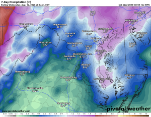
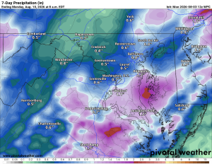
Good Wednesday to you! We're waking up to clouds and a few showers, with a rumble of thunder possible through the morning. Clouds stick around the rest of the day, with another shot at a shower or storm in the afternoon.

☀️🔥 Heating Up Thursday Through Sunday
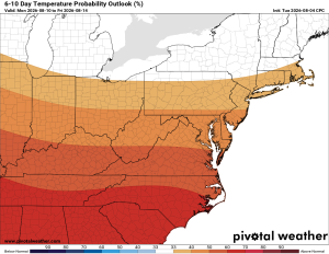
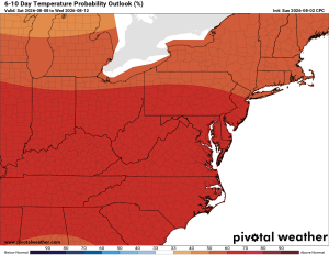
Thursday starts off sunny, but temps jump fast and kick off a hot stretch that carries through the weekend. Look for a good chance of afternoon and evening showers and storms Thursday, Friday and Saturday. Sunday turns mostly sunny again, but just as hot and humid.

🔥💦 Even Hotter Monday and Tuesday
The heat cranks up another notch to start next week, with afternoon and evening storm chances sticking around. Humidity will make it feel brutal, likely flirting with the century mark both days.

We're halfway through the week, hang in there!

The forecast:

Wednesday: Hi 85 🌦️70% Lo 70 🌧️30% – Showers and thunderstorms likely this morning with patchy fog early, then a chance of storms again in the afternoon and evening.

Thursday: Hi 90 🌦️40% Lo 70 🌧️60% – Mostly sunny with a chance of afternoon storms, then showers and thunderstorms likely in the evening.

Friday: Hi 89 🌦️70% Lo 69 🌧️60% – Partly sunny with showers and possible thunderstorms in the afternoon and evening.

Saturday: Hi 88 🌦️40% Lo 69 🌧️30% – Mostly sunny with a chance of afternoon and evening storms.

Sunday: Hi 89 ☀️ Lo 70 – Sunny and pleasant.

Monday: Hi 91 🥵20% Lo 71 🌧️20% – Mostly sunny with a slight chance of showers and thunderstorms.

Tuesday: Hi 90 🌤️30% Lo 72 – Mostly sunny with a chance of showers and thunderstorms.

Please support Tree of Life Ministries, an important organization to me! https://www.tolministries.org


Loudoun County Weather Outlook for Tuesday, August 4, 2026

🌞 Nice Tuesday Ahead
Tuesday's shaping up to be a pretty nice day, with warm temps in the mid to upper 80s and just a touch of humidity.

🌧️ Showers Likely Late Tonight
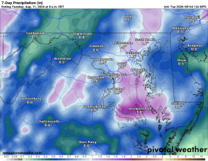
Clouds increase tonight, with showers becoming likely later on and maybe even a thunderstorm.

🌦️ Wet Stretch Wednesday Through Saturday
Wednesday brings a good chance of showers and a possible thunderstorm too. Daily shower and storm risks continue Thursday through Saturday, with the best chance arriving Friday evening into Saturday.

☀️ Quieter Sunday, Sunny Monday
Sunday looks a bit quieter with just a slight chance of showers and storms and highs near 90. Monday turns sunny with highs climbing into the low 90s.

🔥 Hot Conditions Possible Next Week
Heading into next week, hot conditions look possible, with a few days potentially running well above normal. We'll keep an eye on that as it gets closer.

The forecast:

Tuesday: Hi 85 🌤️ Lo 68 🌧️60% – Mostly sunny afternoon, then showers and thunderstorms likely overnight

Wednesday: Hi 84 🌧️70% Lo 70 🌧️30% – Showers and thunderstorms likely through the day, lingering into the night

Thursday: Hi 89 🌦️40% Lo 71 🌧️30% – Mostly sunny with a chance of afternoon showers and storms, lingering into the evening

Friday: Hi 89 🌦️60% Lo 69 🌧️60% – Partly sunny with showers and thunderstorms likely in the afternoon and evening

Saturday: Hi 88 🌦️60% Lo 69 🌧️60% – Partly sunny with showers and thunderstorms likely in the afternoon and evening

Sunday: Hi 89 🌤️20% Lo 70 – Mostly sunny with a slight chance of showers and thunderstorms

Monday: Hi 91 🥵🌤️ Lo 72 – Mostly sunny and hot

Please support Tree of Life Ministries, an important organization to me! https://www.tolministries.org


Loudoun County Weather Outlook for Monday, August 3, 2026

💦 A Sticky Start to the Week
Highs in the mid 80s with humidity making it feel like the upper 80s. A stray shower or storm is possible this afternoon or evening.

🌦️ Same Story Tomorrow
Tuesday looks a lot like today, mid-80s and humid with heat index in the upper 80s, plus another shot at an isolated shower or storm.

⛈️ Better Rain Chances Midweek
Wednesday and Thursday both bring a better shot at showers and storms, around 50%. Friday backs off a bit to around 40%.

🌧️ Saturday Looks Wetter
Saturday brings the best chance yet for showers and storms, with chances backing off some Sunday to around 40%. Exact timing and rainfall amounts are still tricky to pin down.

🌡️ Looking Further Out
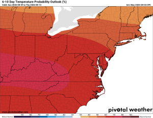
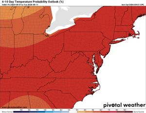
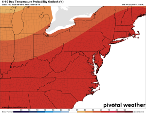
Long range still points to above normal temperatures and precipitation. There is also an area to watch in the Southeast US for possible tropical development, though it does not look likely to affect us here.

The forecast:

Today: Hi 84 🌦️20% Lo 65 – Slight chance of morning and afternoon showers and storms, patchy fog early, then clearing to mostly sunny

Tuesday: Hi 84 ⛅ Lo 67 🌧️30% – Partly sunny, with a chance of showers and storms overnight

Wednesday: Hi 86 🌦️50% Lo 70 🌧️30% – Chance of afternoon showers and storms, partly sunny

Thursday: Hi 88 🌦️50% Lo 71 🌧️30% – Chance of afternoon showers and storms, mostly sunny

Friday: Hi 88 🌦️40% Lo 70 🌧️30% – Chance of afternoon showers and storms, mostly sunny

Saturday: Hi 87 🌦️50% Lo 69 🌧️40% – Chance of showers and storms, mostly sunny

Sunday: Hi 88 🌦️40% Lo 69 🌧️ – Chance of showers and storms, mostly sunny

#loudoun #loudouncountyva #vawx #loudounweather #loudounva #virginiaweather

Please support Tree of Life Ministries, an important organization to me! https://www.tolministries.org


Loudoun County Weather Outlook for Sunday, August 2, 2026

🌧️ A Split County Today
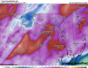
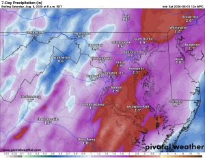
Rain has been moving through today, but it's a tale of two Loudouns. Eastern parts of the county have seen quite a bit more rain than we have out west. Still, showers have popped up countywide, with a few rumbles of thunder mixed in.

⛈️ Monday Brings More Storm Chances
Expect a break Monday morning before showers and thunderstorms return in the afternoon and evening. Chances sit around 40%, so not everyone will see it, but keep an eye to the sky.

☁️ Typical Summer Daily Chances of Afternoon Showers and Storms
Tuesday looks mostly cloudy with maybe a stray shower Tuesday night into Wednesday. From there we settle into a textbook summer pattern, with daily chances of showers and storms Wednesday through Sunday.

Our best rain chances come today into tonight, with another possible uptick on Friday, though we'll keep watching that one. Longer range, temperatures and rainfall both look close to normal.

The forecast:

Today: Hi 83 🌧️70% Lo 70 🌧️70% – Showers likely with possible thunderstorms, some could bring heavy rain.

Monday: Hi 85 🌦️50% Lo 67 🌧️30% – Chance of afternoon showers and storms, with a lower chance continuing into the evening.

Tuesday: Hi 84 🌦️40% Lo 68 🌧️30% – Chance of afternoon showers and storms, lingering into the evening.

Wednesday: Hi 86 🌦️40% Lo 70 🌧️30% – Chance of afternoon showers and storms, lingering into the evening.

Thursday: Hi 88 🌤️ Lo 70 🌧️30% – Mostly sunny with a chance of afternoon showers and storms later in the day.

Friday: Hi 88 🌦️50% Lo 70 🌧️30% – Chance of showers and storms through the day and evening.

Saturday: Hi 88 🌦️40% Lo 69 – Chance of showers and storms.

#loudoun #loudouncountyva #vawx #loudounweather #loudounva #virginiaweather

Please support Tree of Life Ministries, an important organization to me! https://www.tolministries.org


Loudoun County Weather Outlook for Saturday, August 1, 2026

☁️ Warm and Muggy Saturday
Today's staying humid with some clouds around and highs pushing toward 90.

🌧️ Showers and Storms Return Sunday
Clouds increase tonight, then Sunday brings a much-needed chance of showers and thunderstorms, especially in the afternoon and overnight.

⛈️ Wet Stretch Continues Into Next Week
Rain looks likely into Monday, and then a 50% chance of showers and storms Tuesday, which looks like another good chance for wet weather. Wednesday through Friday keep chances in play as well, generally around 30% to 40% of rain each day

🌡️ Warm and Humid All Week
Temperatures hold in the mid to upper 80s to near 90 by next Friday. Above-normal temps continue in the long range.

The forecast:

Today: Hi 88 ☁️ Lo 72 ☁️ – Mostly cloudy with south winds gusting to 21 mph, remaining cloudy overnight with southeast winds continuing

Sunday: Hi 84 ☁️⛈️50% Lo 70 🌧️70% – Chance of showers and thunderstorms during the day, then showers likely overnight with possible thunderstorms; some could be strong to severe.

Monday: Hi 86 ⛈️70% Lo 68 🌧️60% – Showers and thunderstorms likely in the afternoon and evening, chance of showers overnight

Tuesday: Hi 86 🌤️ ⛈️50% Lo 69 🌧️30% – Partly sunny with a chance of afternoon thunderstorms, chance of showers and thunderstorms overnight

Wednesday: Hi 87 🌤️ ⛈️30% Lo 70 🌧️30% – Partly sunny with a chance of afternoon thunderstorms, chance of showers and storms overnight

Thursday: Hi 89 🌤️ 🌦️40% Lo 70 🌧️30% – Chance of showers and thunderstorms, mostly sunny, with storms possible overnight

Friday: Hi 89 🌤️ 🌦️ 30% Lo 70 🌧️30% – Mostly sunny with a chance of showers and thunderstorms

#loudoun #loudouncountyva #vawx #loudounweather #loudounva #virginiaweather

Please support Tree of Life Ministries, an important organization to me! https://www.tolministries.org

Find some summer fun @ https://summer.joyinnova.com