Local weather. A little perspective.Loudoun County, VirginiaOfficial NWS alerts ↗
Loudoun County, Virginia

The local outlook

Forecasts, updates and a little local perspective.

Loudoun County Weather Outlook for Monday, August 10, 2026

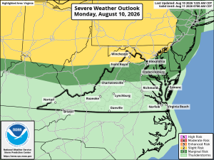
⚠️ Severe Storms Possible Later Today

🥵 Hot and Humid Today
Highs climb into the low 90s with heat index values near 100. Storms are possible this afternoon into evening, and some could turn strong to severe, with gusty winds the main risk.

⛈️ Storm Chances Continue Tomorrow
Tuesday looks cloudy on and off with another chance of showers and storms. Highs near 90.

🌦️ More Unsettled Days Ahead
Wednesday has a 30% chance of showers and storms, highs mid to upper 80s. Thursday and Friday both carry just a 20% chance, highs near 90 Thursday and low 80s Friday.

☀️ Nice Weekend Setting Up
Saturday looks beautiful with highs in the low 80s. Sunday warms into the mid 80s with a slight chance of a shower or storm.

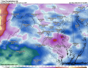
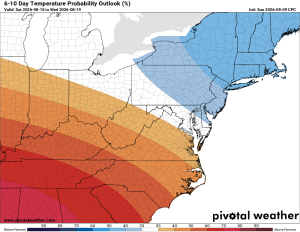
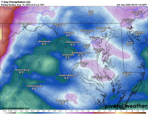
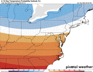
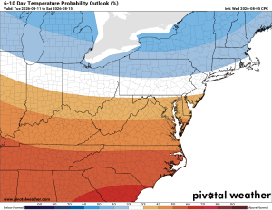
Looking ahead, temperatures should stay near normal with above normal chances of rain into early next week before a warming trend arrives.

The forecast:

Today: Hi 92🥵 🌦️40% Lo 72 🌧️20% – Mostly sunny with afternoon showers and thunderstorms possible; slight chance of storms overnight

Tuesday: Hi 88 🌦️40% Lo 68 🌧️60% – Partly sunny with afternoon showers and storms possible; showers and thunderstorms likely overnight

Wednesday: Hi 86 🌦️30% Lo 69 🌧️40% – Partly sunny with a chance of morning showers and afternoon storms; showers and storms possible overnight

Thursday: Hi 88 🌤️ Lo 69 🌧️20% – Mostly sunny with a slight chance of showers and storms; slight chance of overnight storms and late-night showers

Friday: Hi 82 🌦️20% Lo 63 🌧️20% – Partly sunny with a slight chance of showers and afternoon storms possible overnight

Saturday: Hi 82 🌞 Lo 64 🌧️30% – Mostly sunny; chance of overnight showers

Sunday: Hi 85 🌦️30% Lo 69 – Mostly sunny with a chance of showers and thunderstorms

Please support Tree of Life Ministries, an important organization to me! https://www.tolministries.org


Loudoun County Weather Outlook for Sunday, August 9, 2026

🥵 Hot and Hazy Today
Clouds mix with sun as highs push toward 91°F. Heat index near 100°F, so stay hydrated.

🔥 Heat Wave Peaks Tomorrow
Monday is the hottest day of this stretch, with highs in the mid-90s and heat index into the low 100s. A heat advisory wouldn't be surprising, mainly east of us.

⛈️ Storm Chances Return Tuesday
Increased risk of showers and thunderstorms Tuesday should keep highs a bit lower than they'd otherwise be.

⚠️ Wednesday Could Get Interesting
A storm complex may move through midweek, bringing gusty winds and a real pattern change.

🌡️ Still Warm Thursday
Highs stay in the upper 80s.

😌 Relief by Friday
Temperatures ease into the low 80s with just a slight chance of storms.

☀️ Beautiful Weekend Ahead
Highs in the low 80s Saturday with a good shot at staying dry into Sunday. Great weekend to get outside.

Stay cool today and tomorrow, and watch for severe weather midweek. Have a good one!

The forecast:

Sunday: Hi 91 🌤️ Lo 69. Mostly cloudy, clearing to sunny, then clear overnight.

Monday: Hi 93 ⛅30% Lo 72 🌧️30%. Increasing clouds, chance of afternoon storms continuing overnight.

Tuesday: Hi 89 🌦️60% Lo 69 🌧️60%. Storms likely in the afternoon and evening, chance of showers overnight.

Wednesday: Hi 86 🌦️40% Lo 68 🌧️50%. Slight chance of showers, then afternoon storms, chance overnight too.

Thursday: Hi 86 🌦️30% Lo 67 🌧️30%. Chance of afternoon storms lingering into early evening.

Friday: Hi 83 🌞20% Lo 63. Slight chance of storms, otherwise partly sunny.

Saturday: Hi 82 🌞 Lo 59. Mostly sunny.

Please support Tree of Life Ministries, an important organization to me! https://www.tolministries.org

Find something fun to do @ https://summer.joyinnova.com


Loudoun County Weather Outlook for Saturday, August 8, 2026

🌦️ Humid Saturday with Storm Chances
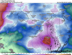
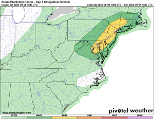
Today's humid with a strong chance of showers and thunderstorms. Any that fire up could bring heavy rain and turn locally severe, so keep an eye to the sky, though coverage shouldn't be too widespread.

🥵 Hot and Humid Sunday
More sunshine Sunday, but with the humidity it'll feel downright brutal out there.

🌦️ Midweek Storm Chances
Monday stays hot and humid, with just a chance of a stray thunderstorm Monday night into Tuesday. Wednesday looks like our best bet for storms, with a slight chance lingering into Thursday.

📉 Cooling Trend Later in the Week
Highs ease back Thursday into Friday, with a chance of storms returning by Friday.

🔭 Looking Further Out
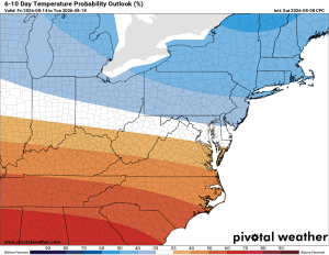
Long range guidance hints at temperatures near or even below normal, with a continued chance for above normal rainfall, something we could really use with the drought.

If you're looking for something fun to do this weekend or anything to do before summer runs out for the rest of the year, please check out https://summer.joyinnova.com

The forecast:

Saturday: Hi 90 🌦️30% Lo 71 – Chance of showers and thunderstorms mainly in the afternoon, patchy fog in the morning, otherwise mostly sunny

Sunday: Hi 90 ☀️ Lo 69 – Mostly sunny

Monday: Hi 92 🌤️ Lo 72 – Slight chance of afternoon showers and thunderstorms

Tuesday: Hi 92 🌦️40% Lo 70 🌧️40% – Chance of afternoon showers and thunderstorms, lingering chance overnight

Wednesday: Hi 86 🌦️50% Lo 68 🌧️40% – Slight chance of morning showers, chance of afternoon and evening thunderstorms

Thursday: Hi 87 🌤️20% Lo 67 🌧️20% – Slight chance of showers and thunderstorms day and night

Friday: Hi 82 ⛅30% Lo 65 – Chance of showers and thunderstorms

Please support Tree of Life Ministries, an important organization to me! https://www.tolministries.org


Weather Outlook

Loudoun County Weather Outlook for Friday, August 7, 2026

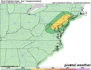
⚠️⚡ Severe Storms Possible

🥵 Muggy and Stormy Friday
Happy Friday Loudoun! Hot and very humid today, with heat index values well into the 90s. Risk for strong to severe storms, with damaging wind gusts the main concern.

🌧️ Storms Stick Around Saturday
Saturday stays hot and sticky with showers and storms likely again.

🥵 Dangerous Heat Sunday Into Monday
Sunday and Monday turn dry, but the heat cranks up in a big way, with heat indexes getting near and even above 100°F both days.

⚡ Storms Return Tuesday Night Into Wednesday
Tuesday stays hot and humid with high heat indexes, and storm chances increase overnight into Wednesday, with a good chance of storms continuing as temps ease back a bit.

☁️ Humid Pattern Continues
Humidity sticks around into the end of the week. Longer range, temps trend back toward normal with continued chances for above normal rainfall.

The forecast:

Friday: Hi 88 🌦️60% Lo 69 🌧️60% – Chance of showers and thunderstorms in the afternoon and evening, with patchy fog early

Saturday: Hi 89 🌦️60% Lo 71 🌧️30% – Showers and thunderstorms likely mainly in the morning and early afternoon, then a chance of storms in the evening

Sunday: Hi 89 🌤️ Lo 70 – Mostly sunny

Monday: Hi 91 🥵☀️ Lo 72 🌧️20% – Sunny with a slight chance of overnight showers and thunderstorms

Tuesday: Hi 92 🥵🌦️20% Lo 71 🌧️40% – Slight chance of afternoon showers and thunderstorms, with a chance of storms overnight

Wednesday: Hi 87 ⛅50% Lo 69 🌧️40% – Chance of showers and thunderstorms

Thursday: Hi 86 ⛅30% Lo 67 🌧️ – Chance of showers and thunderstorms, with showers possible overnight

#loudoun #loudouncountyva #vawx #loudounweather #loudounva #virginiaweather

Please support Tree of Life Ministries, an important organization to me! https://www.tolministries.org


Loudoun County Weather Outlook for Thursday, August 6, 2026

🥵 Hot with Storm Risk Today
A hot one, with a good chance of afternoon and evening storms, some possibly severe.

☀️ Hot Friday, Storms Return in the Evening
Friday stays hot, with storm chances arriving Friday evening.

🌩️ Storms Saturday, Drying Out Sunday
Saturday stays hot with a chance of storms, then dries out Sunday with highs still around ninety.

🥵 Hotter Start to Next Week
Monday and Tuesday turn hotter with highs in the low nineties, feeling closer to a hundred with the humidity. A slight storm chance returns Tuesday

🌧️ Clouds and Storms Midweek
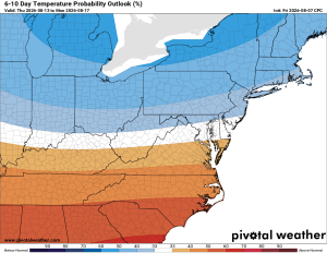
Wednesday brings more clouds with afternoon and evening storm risks, and highs ease back while staying humid. Longer range guidance points toward normal temperatures, then possibly below, with better than normal rain chances.

The forecast:

Today: Hi 89 🌦️60% Lo 70 🌧️30% – Patchy morning fog, then increasing clouds with showers and thunderstorms possible, mainly in the afternoon and evening

Friday: Hi 88 🌤️ Lo 70 🌧️60% – Mostly sunny during the day, then showers and thunderstorms likely in the evening and overnight

Saturday: Hi 89 🌦️60% Lo 70 🌧️60% – Mostly sunny with showers and thunderstorms possible in the afternoon, lingering into the evening

Sunday: Hi 89 🌤️ Lo 70 – Mostly sunny and pleasant

Monday: Hi 91 🥵 Lo 72 🌧️20% – Sunny, with a slight chance of overnight showers and thunderstorms

Tuesday: Hi 92 🥵20% Lo 70 🌧️50% – Mostly sunny with a slight chance of showers and thunderstorms, becoming more likely overnight

Wednesday: Hi 85 ⛅50% Lo 65 🌧️ – Partly sunny with a chance of showers and thunderstorms, then a chance of showers overnight

#loudoun #loudouncountyva #vawx #loudounweather #loudounva #virginiaweather

Please support Tree of Life Ministries, an important organization to me! https://www.tolministries.org

Looking for something fun to do this weekend? Check https://summer.joyinnova.com