6/4/2025 –
🌡️ Warmer with Some Humidity
Today will feel summer-like with highs in the mid to upper 80s and a touch of humidity. Wildfire smoke haze moves in this evening and overnight.
⛅ Clouds Thursday
Not quite as hot tomorrow — low to mid 80s expected as clouds increase. Rain should stay south, but the extra clouds will keep temps down.
🌦️ Storm Chances Friday & Saturday
Scattered showers and storms may develop late Friday and continue into the night. Saturday starts dry, but afternoon storms are possible. Some could be strong to severe — we’ll keep an eye on it.
☀️ Beautiful Sunday
Sunday looks great with sunshine and highs near 80°.
🌧️ Unsettled Early Next Week
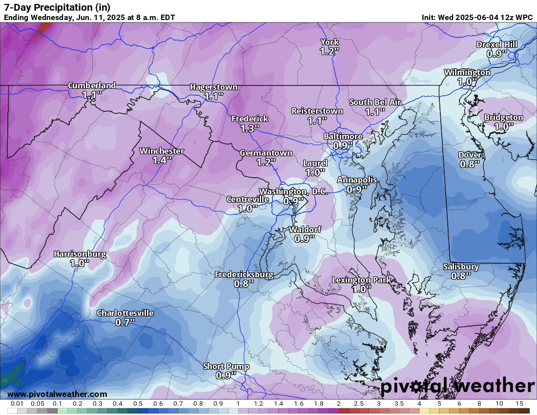
Temps hold around 80°, but the pattern turns more unsettled. We’ll monitor how wet it could get.
The forecast:
Today: Hi 85 🌤️ Lo 63 🌙 – Sunny with widespread haze developing late afternoon, becoming partly cloudy overnight
Thursday: Hi 84 ⛅ Lo 62 ☁️ – Partly sunny during the day, becoming mostly cloudy overnight
Friday: Hi 83 🌦️50% Lo 65 🌧️60% – Partly sunny with a chance of afternoon showers, showers and thunderstorms likely overnight
Saturday: Hi 79 🌧️70% Lo 61 🌧️30% – Mostly cloudy with showers likely and possible afternoon thunderstorms
Sunday: Hi 81 ☀️ Lo 62 🌙 – Sunny
Monday: Hi 79 🌦️50% Lo 64 🌧️40% – Mostly sunny with a chance of showers, continuing into the night with a chance of thunderstorms
Tuesday: Hi 82 🌦️50% Lo 63 🌧️ – Partly sunny with a chance of showers
#loudoun #loudouncountyva #vawx #loudounweather #loudounva #virginiaweather
Please support Tree of Life Ministries, an important organization to me! https://www.tolministries.org
Facebook: https://facebook.com/loudounwx
Twitter: https://twitter.com/loudounwx
Instagram: https://www.instagram.com/loudounweather/
On the Web @ https://loudounweather.com
un #loudouncountyva #vawx #loudounweather #loudounva #virginiaweather
Please support Tree of Life Ministries, an important organization to me! https://www.tolministries.org
Facebook: https://facebook.com/loudounwx
Twitter: https://twitter.com/loudounwx
Instagram: https://www.instagram.com/loudounweather/
On the Web @ https://loudounweather.com