🌤️ Beautiful and Warm Today
A lovely day with highs in the 70s. Hope you caught the rocket crossing the eastern sky this morning!
🔥 Summerlike Warmth Wednesday
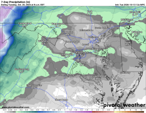
Highs could reach the upper 80s, with 90° possible. Showers move in Wednesday night, with a few more possible Thursday. Highs fall to the upper 60s.
🌬️ A Windy, Chilly Weekend
Friday brings highs in the 70s and a slight chance of an early shower. Strong winds arrive Friday night into Saturday, with highs only in the low to mid 50s. Wind advisories may be needed nearby.
❄️ First Frost Chance
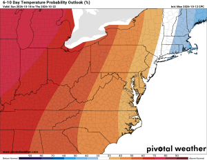
Saturday night could bring frost, with a few freezes possible in the far suburbs. Temperatures rebound into the mid to upper 50s Sunday, then the 60s early next week.
The extended outlook trends warmer and drier after the weekend chill.
The Forecast:
Tuesday: Hi 81 ☀️ Lo 63 🌙: Patchy fog early, then sunny
Wednesday: Hi 86 🌤️ Lo 61 🌧️30%: Sunny and warm, with showers and thunderstorms possible overnight
Thursday: Hi 66 🌦️40% Lo 57 🌧️30%: Mostly cloudy, with showers possible
Friday: Hi 77 🌦️30% Lo 44 🌧️30%: Partly sunny and breezy, with a chance of showers
Saturday: Hi 55 ☀️ Lo 35 🌙: Sunny and breezy
Sunday: Hi 59 ☀️ Lo 37 🌙: Sunny
Monday: Hi 64 ☀️ Lo 45 🌙: Sunny
#loudoun #loudouncountyva #vawx #loudounweather #loudounva #virginiaweather
Please support Tree of Life @tolministries , an important organization to me!