5/20/2025 –
☀️ Pleasant Tuesday
It’s shaping up to be a really nice day with highs near 70° and lighter winds.
🌧️ Rain Moves in Tonight
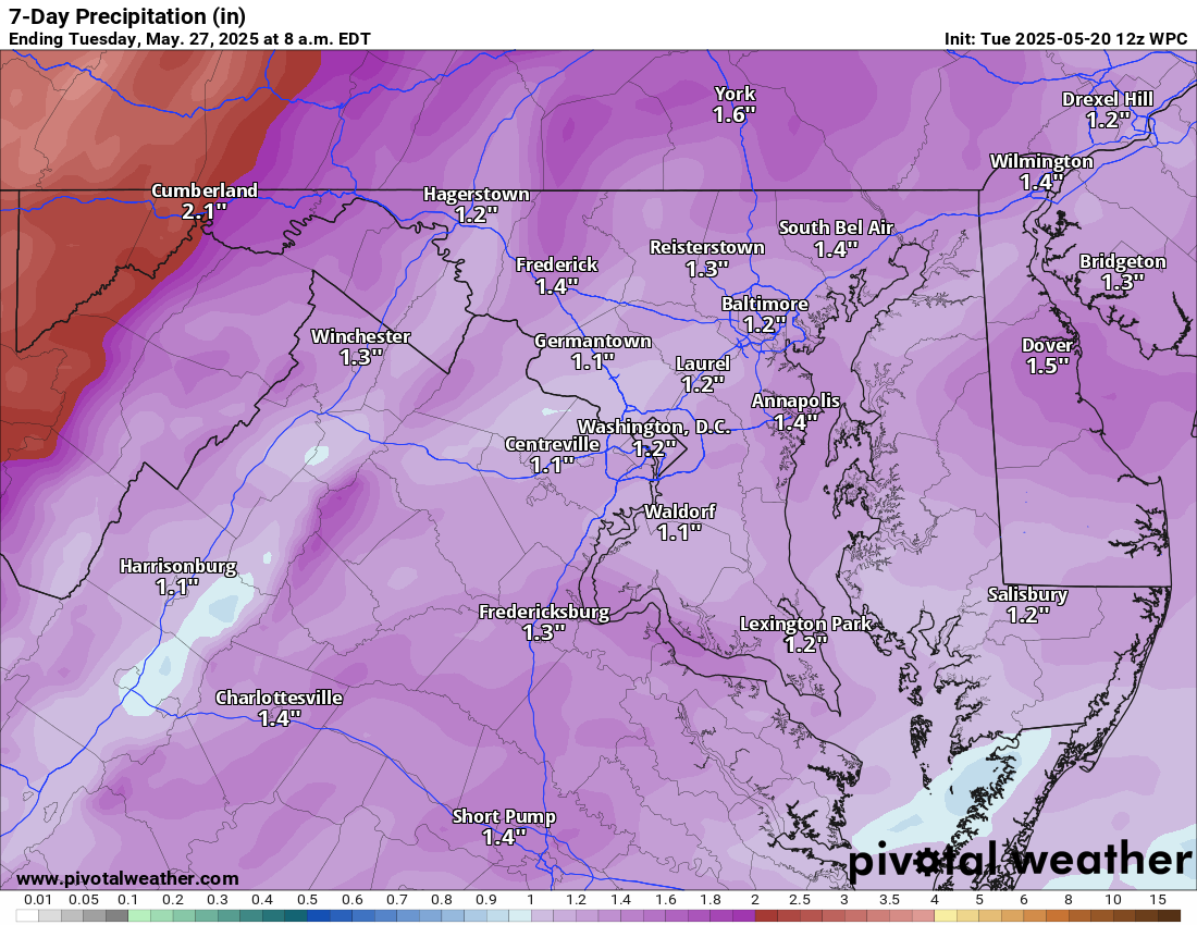
Clouds increase this evening with rain chances rising overnight and into Wednesday.
🌦️ Chilly, Unsettled Stretch
Wednesday will be very chilly — highs may not even reach 60°. We stay cool with highs in the low to mid-60s Thursday through Saturday. Scattered showers and storms are possible Wednesday and Thursday with just some showers Friday.
☀️ Warmer by Sunday
We’ll finally warm back into the 70s on Sunday and Memorial Day Monday. Until then, expect a chilly holiday weekend, and yes — pool temps will be very chilly! We could see some showers enter the picture again late Sunday and continue on Monday.
The forecast:
Today: Hi 69 🌤️ Lo 54 🌧️60% – Mostly sunny, becoming mostly cloudy with showers likely after 1am
Wednesday: Hi 59 🌧️100% Lo 53 🌧️90% – Showers through the day, with a chance of thunderstorms
Thursday: Hi 64 🌧️70% Lo 49 🌧️60% – Mostly cloudy with showers and a chance of afternoon thunderstorms, continuing into the evening
Friday: Hi 64 🌦️30% Lo 46 🌧️30% – Mostly sunny with a slight chance of afternoon showers, becoming partly cloudy with evening showers possible
Saturday: Hi 65 🌤️ Lo 47 🌙 – Mostly sunny during the day, mostly clear at night
Sunday: Hi 69 🌤️ Lo 51 🌧️30% – Mostly sunny, with a chance of showers at night
Monday (Memorial Day): Hi 72 🌦️40% Lo 52 🌧️ – Mostly sunny with a chance of showers
#loudoun #loudouncountyva #vawx #loudounweather #loudounva #virginiaweather
Please support Tree of Life Ministries, an important organization to me! https://www.tolministries.org
Facebook: https://facebook.com/loudounwx
Twitter: https://twitter.com/loudounwx
Instagram: https://www.instagram.com/loudounweather/
On the Web @ https://loudounweather.com
un #loudouncountyva #vawx #loudounweather #loudounva #virginiaweather
Please support Tree of Life Ministries, an important organization to me! https://www.tolministries.org
Facebook: https://facebook.com/loudounwx
Twitter: https://twitter.com/loudounwx
Instagram: https://www.instagram.com/loudounweather/
On the Web @ https://loudounweather.com