3/17/2026 – ☘️Chilly day and cold night! Seasonal and then cooler again
❄️ Chilly & Breezy Today
It’s been a cold day with scattered snow showers and a biting wind. Expect temperatures to dip into the low to mid 20s tonight as those breezes stick around.
☀️ Slow Warming Trend
Wednesday stays cool with highs near 40°F. On Thursday, we’ll see the 50s making things feel a bit more seasonable, and then this weekend, highs climb into the 60s for both Saturday and Sunday. Enjoy the warmth while it lasts, as a cold front arrives Sunday night, bringing our next chance for showers and then cooler temps.
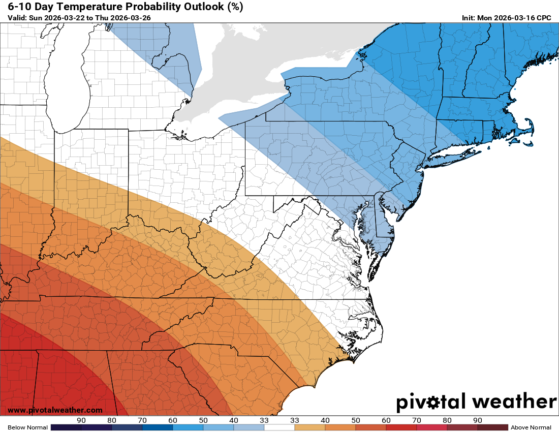
🆒 Cooler in the long range
Monday highs in the 50s and then 40s on Tuesday. Night lows will be below freezing!
The forecast:
Today: Hi 38 ❄️20% Lo 23 ❄️20% – Isolated snow showers and mostly cloudy, with snow showers continuing before 10pm then becoming partly cloudy
Wednesday: Hi 40 🌞 Lo 27 🌙 – Mostly sunny and calm, becoming partly cloudy overnight
Thursday: Hi 52 ⛅ Lo 37 🌧️30% – Partly sunny during the day, with a chance of rain mainly before 2am
Friday: Hi 57 ⛅ Lo 42 ☁️ – Partly sunny becoming mostly cloudy
Saturday: Hi 60 ⛅ Lo 44 ☁️ – Partly sunny through the day and mostly cloudy at night
Sunday: Hi 68 ⛅ Lo 43 🌧️30% – Partly sunny with a chance of rain overnight
Monday: Hi 55 🌞 Lo 30 🌙 – Mostly sunny and mostly clear at night
Tuesday: Hi 47 🌞 Lo 27 🌙 – Mostly sunny and clear
#loudoun #loudouncountyva #vawx #loudounweather #loudounva #virginiaweather
Please support Tree of Life Ministries, an important organization to me! https://www.tolministries.org
Facebook: https://facebook.com/loudounwx
Twitter: https://twitter.com/loudounwx
Instagram: https://www.instagram.com/loudounweather/
On the Web @ https://loudounweather.com