5/29/2025
🌤️ Warmer with a Storm Chance
Not a bad day ahead — warmer and a bit humid with highs in the upper 70s. A few showers or storms could pop up late this afternoon or evening. A couple could be strong, but widespread severe weather isn’t expected.
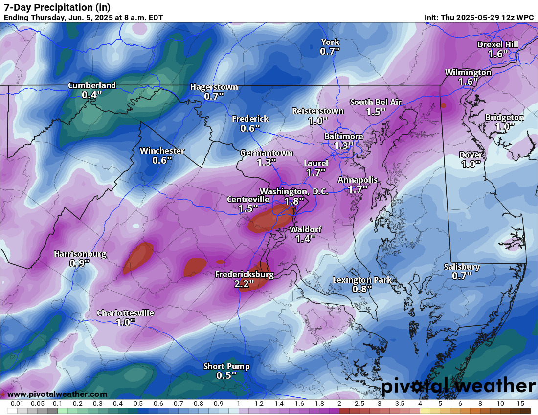
🌧️ More Rain Friday into Saturday
Rain returns Friday afternoon into the night, possibly lasting into early Saturday. Totals depend on how the system tracks, but we could see some helpful rainfall.
🌦️ Breezy with Scattered Storms Saturday
Saturday may bring some clearing, but scattered showers and storms are still possible. It turns breezy.
🌬️ Cool and Windy Sunday
Sunday looks cooler with highs around 70° and breezy conditions continuing.
🌡️ Warmer Next Week
We rebound into the 70s Monday, then 80s with humidity by mid to late week. Storm chances return late in the week.
The forecast:
Today: Hi 74 🌦️30% Lo 60 🌧️30% – Mostly cloudy with scattered afternoon showers, becoming mostly cloudy with isolated evening storms and patchy fog late
Friday: Hi 75 🌧️80% Lo 56 🌧️80% – Showers likely and possible thunderstorms
Saturday: Hi 71 🌦️70% Lo 47 🌙 – Partly sunny with showers likely and a chance of thunderstorms
Sunday: Hi 70 🌤️ Lo 50 ☁️ – Mostly sunny through the day, becoming partly cloudy overnight
Monday: Hi 75 ☀️ Lo 53 🌙 – Sunny and clear through the day and night
Tuesday: Hi 79 ☀️ Lo 56 🌙 – Sunny and clear throughout
Wednesday: Hi 82 ☀️ Lo 57 🌙 – Sunny during the day, remaining clear overnight
#loudoun #loudouncountyva #vawx #loudounweather #loudounva #virginiaweather
Please support Tree of Life Ministries, an important organization to me! https://www.tolministries.org
Facebook: https://facebook.com/loudounwx
Twitter: https://twitter.com/loudounwx
Instagram: https://www.instagram.com/loudounweather/
On the Web @ https://loudounweather.com
un #loudouncountyva #vawx #loudounweather #loudounva #virginiaweather
Please support Tree of Life Ministries, an important organization to me! https://www.tolministries.org
Facebook: https://facebook.com/loudounwx
Twitter: https://twitter.com/loudounwx
Instagram: https://www.instagram.com/loudounweather/
On the Web @ https://loudounweather.com