5/11/2025 – Happy Mother's Day!
🌤️ Beautiful Mother's Day Ahead!
We're looking at a gorgeous day with highs climbing into the upper 70s to near 80°F.
🌧️ Rain Returns Tomorrow
Showers are expected to move in late Monday, ushering in a wet pattern that could linger through the week.
🌦️ Unsettled Week Ahead
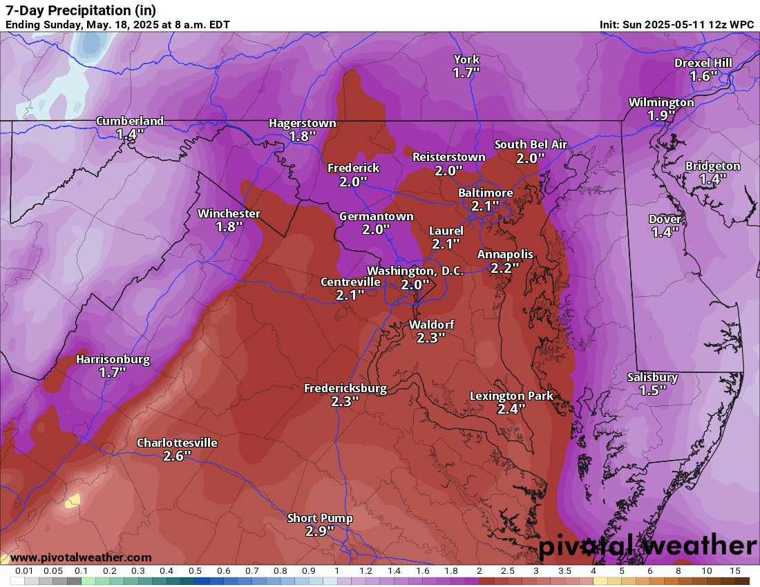
From Tuesday onward, daily chances of showers and thunderstorms are in the forecast. Total rainfall could reach over 2 inches by the end of the week.
As we approach the weekend, temperatures will rise, and humidity will increase, giving us a taste of early summer conditions.
📅 Extended Outlook
Temperatures are expected to remain near or slightly above normal, with precipitation chances decreasing.
The forecast:
Today: Hi 80 ⛅ Lo 53 ☁️ – Partly sunny during the day, becoming mostly cloudy overnight
Monday: Hi 71 🌧️40% Lo 60 🌧️90% – Mostly cloudy with a chance of afternoon showers, rain becoming likely in the evening
Tuesday: Hi 68 ⛈️100% Lo 61 🌧️90% – Showers with possible thunderstorms in the afternoon, continuing into the night
Wednesday: Hi 73 ⛈️90% Lo 61 🌧️80% – Rain likely early, then thunderstorms possible through the evening
Thursday: Hi 77 🌦️60% Lo 63 🌧️60% – Partly sunny with a chance of afternoon thunderstorms, continuing into the evening
Friday: Hi 86 🌦️50% Lo 63 🌧️30% – Partly sunny with scattered showers and thunderstorms through day and night
Saturday: Hi 82 🌦️40% Lo 60🌧️ – Mostly sunny with a chance of afternoon showers and storms
#loudoun #loudouncountyva #vawx #loudounweather #loudounva #virginiaweather
Please support Tree of Life Ministries, an important organization to me! https://www.tolministries.org
Facebook: https://facebook.com/loudounwx
Twitter: https://twitter.com/loudounwx
Instagram: https://www.instagram.com/loudounweather/
On the Web @ https://loudounweather.com
un #loudouncountyva #vawx #loudounweather #loudounva #virginiaweather
Please support Tree of Life Ministries, an important organization to me! https://www.tolministries.org
Facebook: https://facebook.com/loudounwx
Twitter: https://twitter.com/loudounwx
Instagram: https://www.instagram.com/loudounweather/
On the Web @ https://loudounweather.com