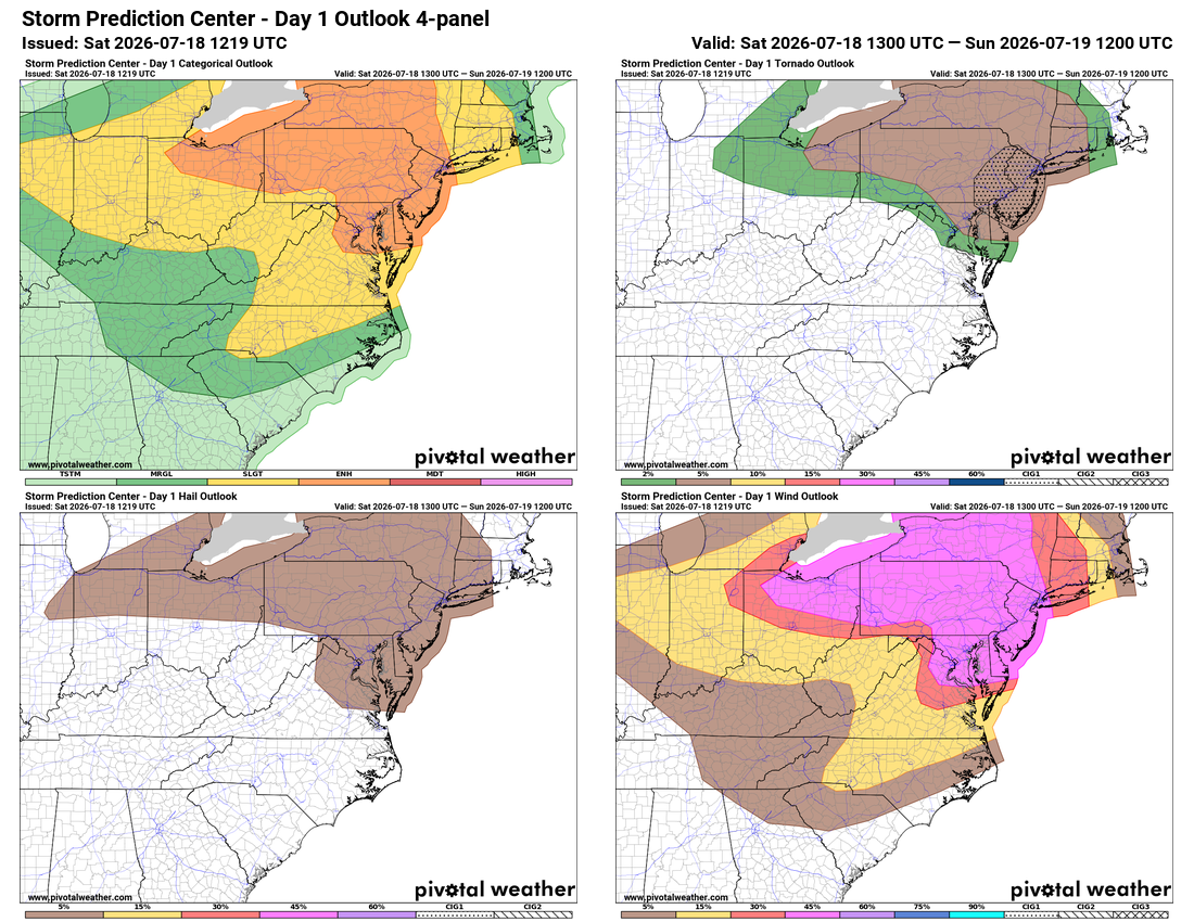
⚠️ ⚡ Severe Storms Possible
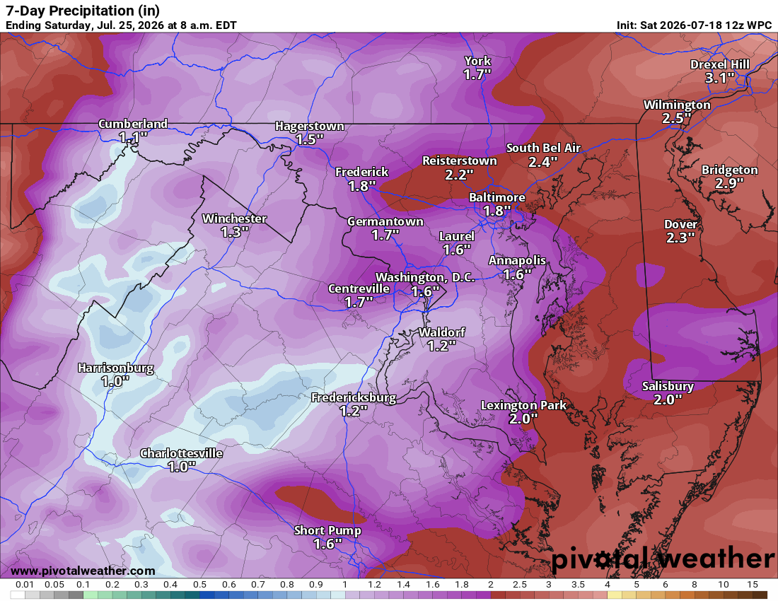
⚠️ 🌧️ Local Heavy Rain Possible
🌩️ Storms Possible Today
Humid and hazy with lingering smoke and cloud cover, which could help keep temps down and lower the severe threat a bit. Watching for strong to severe storms today, damaging wind the main concern. Hail and an isolated tornado can't be ruled out, along with locally heavy rain. Stay weather aware, especially if we clear out this afternoon.
🥵 Heat Building If Sun Breaks Through
If we see sunshine, temps climb fast and humidity will make it feel even hotter. Storms wrap up overnight.
☀️ Nice Sunday and Monday
Both days looking good to start the week.
🌧️ Storms Return Late Monday
Showers and storms possible late Monday.
⚡ Widespread Storms Tuesday, Wednesday
Tuesday brings a widespread severe threat, followed by more storms Wednesday as the front comes through.
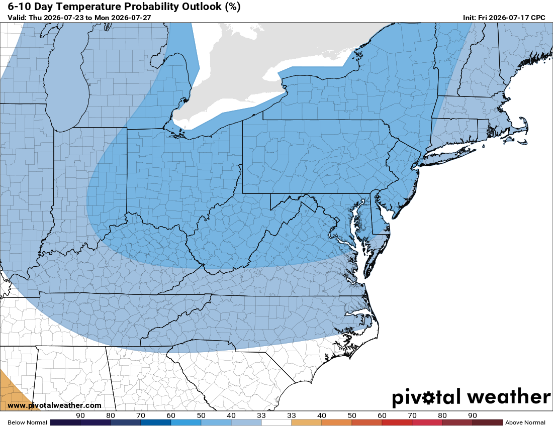
☀️ Gorgeous Stretch Behind It
Thursday looks great, low 80s and lower humidity. Next weekend nice too, mid 80s and lower humidity.
The forecast:
Today: Hi 92🥵 ⛈️70% Lo 71 🌧️30% – Mostly cloudy with scattered showers and storms, some could be severe; storms taper off overnight. Heat index up to 102°, with smoke early
Sunday: Hi 85 🌞 Lo 63 – Mostly sunny and pleasant
Monday: Hi 84 🌤️20% Lo 68 🌧️20% – Mostly sunny with a slight chance of afternoon and evening storms, continuing overnight
Tuesday: Hi 87 ⛈️70% Lo 69 🌧️80% – Mostly cloudy with a good chance of showers and storms, some could be severe
Wednesday: Hi 84 🌦️40% Lo 61 🌧️30% – Partly sunny with a chance of afternoon storms, continuing into the evening
Thursday: Hi 80 🌞 Lo 61 – Sunny and clear
Friday: Hi 84 🌤️ Lo 61 – Mostly sunny
#loudoun #loudouncountyva #vawx #loudounweather #loudounva #virginiaweather
Please support Tree of Life Ministries, an important organization to me! https://www.tolministries.org
Facebook: https://facebook.com/loudounwx
Twitter: https://twitter.com/loudounwx
Instagram: https://www.instagram.com/loudounweather/
On the Web @ https://loudounweather.com