6/27/2025 –
🌫️ Damp and Much Cooler Start to the Weekend
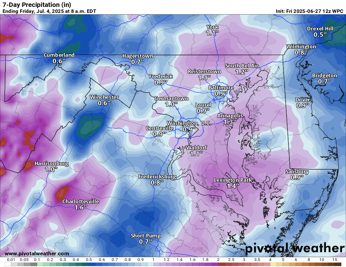
Easterly winds off the ocean are bringing in drizzle, fog, and a damp feel to the day. Showers and storms are likely later this evening. Some may contain locally heavy rain.
🌞 Foggy Start, Then Steamy Saturday
Saturday will turn sunny, but it will be very humid. Highs will reach near 90°F, with heat index values near 100°F. Scattered showers and thunderstorms are likely in the afternoon, with a few potentially strong to severe.
🔥 Hot and Humid Sunday
Highs will be in the low 90s, with heat index values near 100°F. An afternoon shower or storm is possible.
⛈️ Stormy Pattern Early Next Week
Monday and Tuesday bring highs in the low 90s, along with good chances of afternoon showers and storms. Relief arrives midweek.
🌤️ Turning More Comfortable Late Week
By Thursday and Friday, lower humidity with temps in the upper 80s.
The forecast:
Today: Hi 77 ⛈️70% Lo 70 🌧️40% – Showers and some thunderstorms likely this afternoon into the evening with heavy downpours possible
Saturday: Hi 91 🌦️60% Lo 70 🌧️60% – Partly sunny withafternoon showers and storms
Sunday: Hi 89 🌦️30% Lo 71 🌧️30% – Mostly sunny with isolated afternoon storms,
Monday: Hi 91 ⛈️60% Lo 71 🌧️60% – Sunny start with scattered afternoon thunderstorms
Tuesday: Hi 88 🌦️60% Lo 69 🌧️60% – Partly sunny and unsettled, with showers and storms possible late in the day and early night. Will watch for severe weather.
Wednesday: Hi 88 ☀️ Lo 66 🌙 – Warm and sunny, with lower humidity.
Thursday: Hi 88 ☀️ Lo 66 🌙 – Sunny
#loudoun #loudouncountyva #vawx #loudounweather #loudounva #virginiaweather
Please support Tree of Life Ministries, an important organization to me! https://www.tolministries.org
Facebook: https://facebook.com/loudounwx
Twitter: https://twitter.com/loudounwx
Instagram: https://www.instagram.com/loudounweather/
On the Web @ https://loudounweather.com
Please support Tree of Life Ministries, an important organization to me! https://www.tolministries.org
Facebook: https://facebook.com/loudounwx
Twitter: https://twitter.com/loudounwx
Instagram: https://www.instagram.com/loudounweather/
On the Web @ https://loudounweather.com