Local weather. A little perspective.Loudoun County, VirginiaOfficial NWS alerts ↗
Loudoun County, Virginia

Author: admin

Mid Say September 7,2023 update

9/7/2023 – Mid-day update!
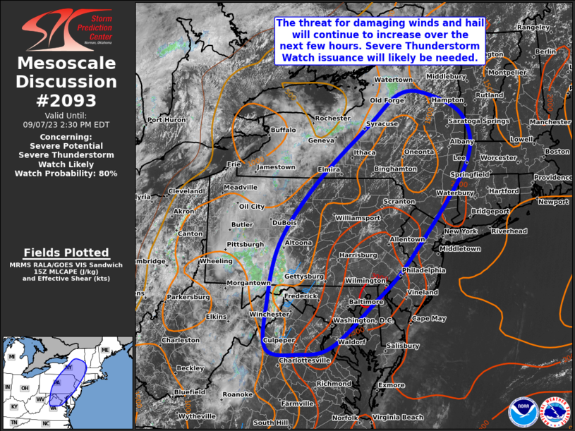
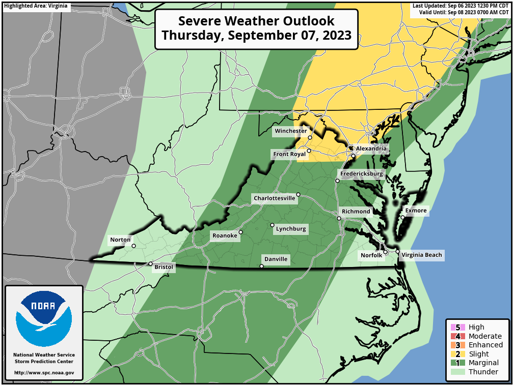
Severe Risk is still around for today. The risk for showers and storms has come up to 70% due to the ongoing showers and storms to the west! We will have to see if that helps us.. I still have concerns for our backyards, but radar is at least giving me some hope.

It is still dreadfully hot with temps in the 90s and heat index temperatures up into the lower 100s again!

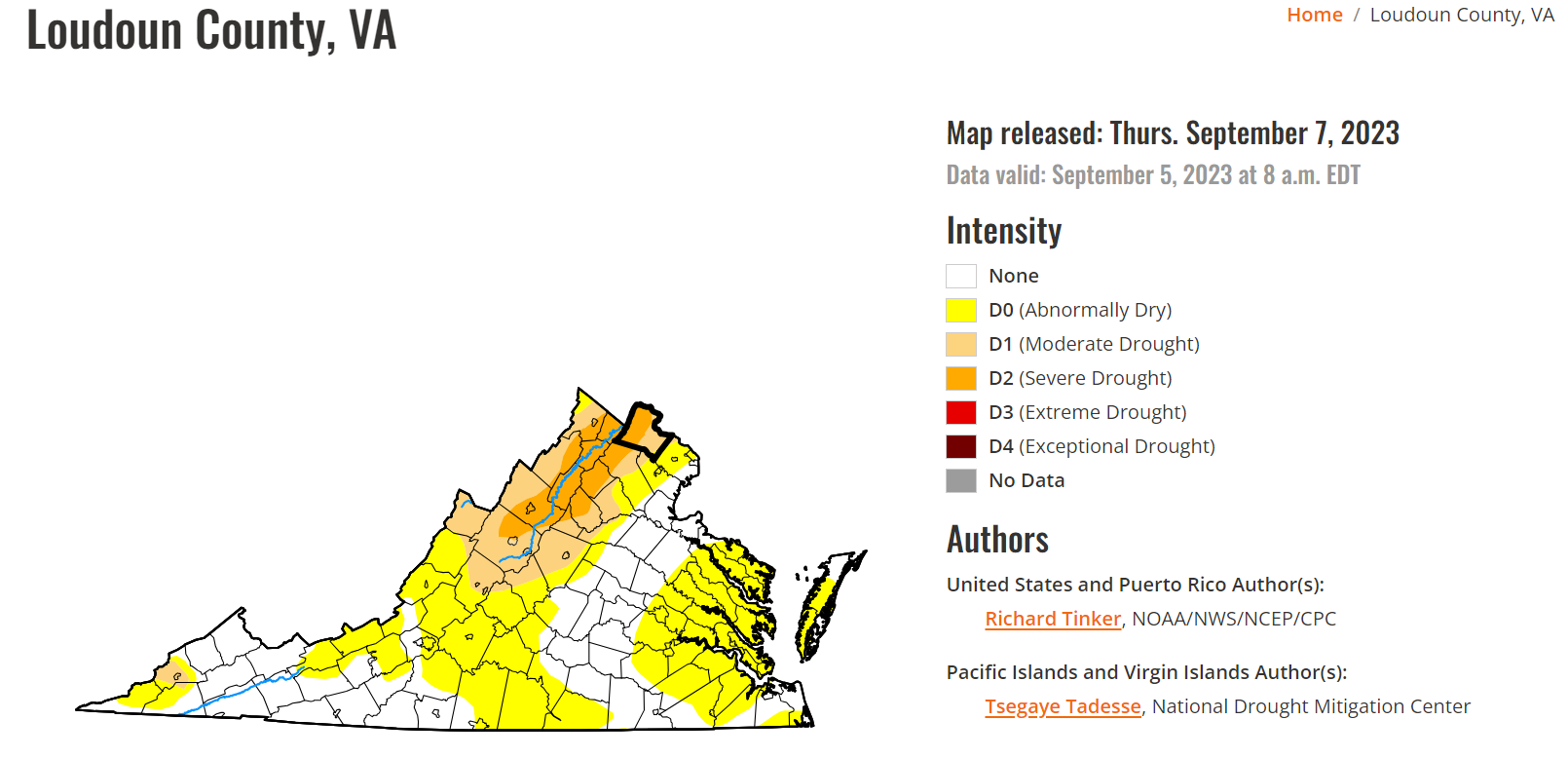
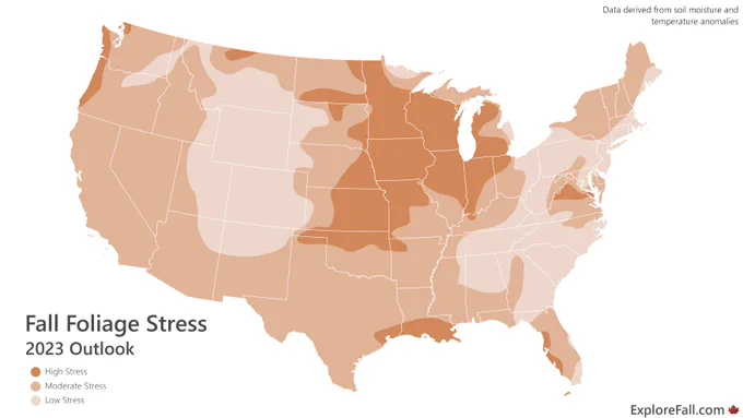
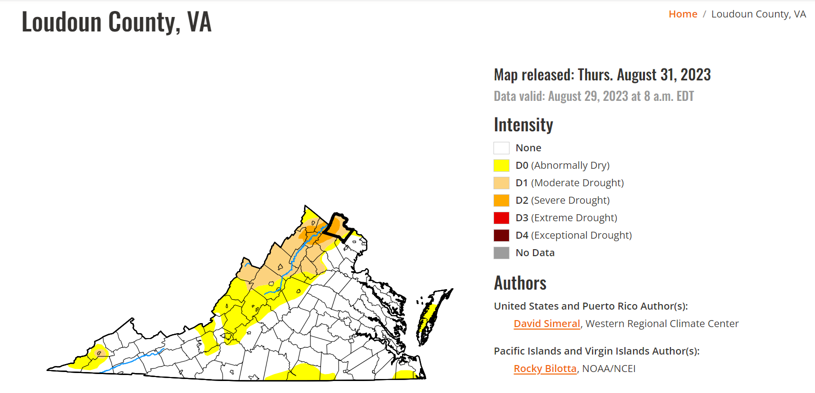
Drought update.. Things remain very bad! We are in a Severe Drought in western Loudoun and a drought area-wide. We will have a lot of opportunities for rain over the next week, and some models are showing between 1 and 3 inches possible. Let's hope that comes true. The regions in the drought have expanded. This really will mute the fall foliage this year, making me sad after last year's spectacular appearance!

More severe POSSIBLE tomorrow, and it is still rather hot with a high near 90!

Rain chances have really increased over the weekend! 70% Saturday and 80% Sunday! Temps will be in the 80s on Saturday and around 80 on Sunday!

Rain chances will continue now into next week, and temps will be in the upper 70s to low 80s!

More later as I watch radar and stay in touch with the Storm Prediction Center and the National Weather Service.

Stay weather-aware this afternoon.

#loudoun #loudouncountyva #vawx #loudounweather #loudounva #virginiaweather
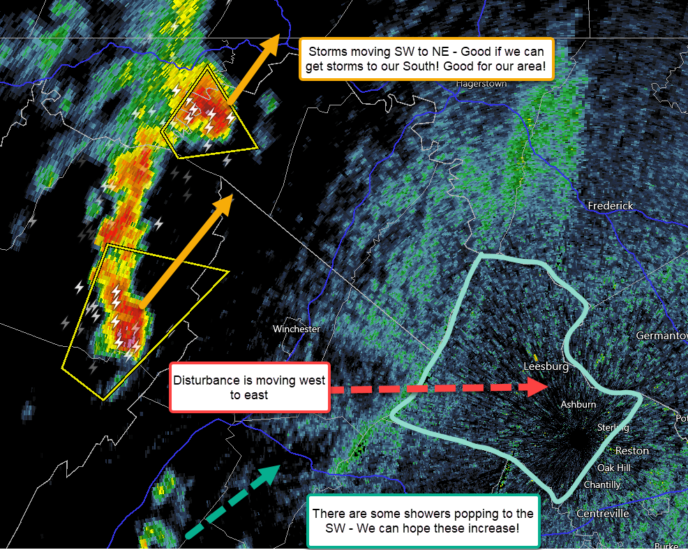
image.png
image.pngimage.png
image.png

Updates for Loudoun Weather 9/6/2023

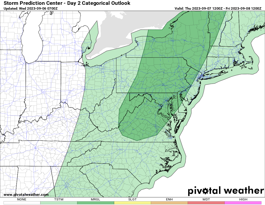
9/6/2023 – Slight Risk update for storms tomorrow. Afternoon update. We will still be hot the next 2 days, but a little less hot. Humidity will be higher so it will offset the less heat. This also will bring the possibility of strong to severe storms. This does not look like a widespread storm event, so we are back to the idea that some may get some good rain, but their close-by neighbors may not! Since there is a lot of energy in all this heat if a storm does form, some heavy downpours and downdrafts could cause some severe winds. These downbursts can be very destructive locally so it will just be something to watch, but very hard to predict.

We have to hope for rain!

I got up to 97.7 degrees out here southwest of Purcellville today. Temps did hit 99 and may have briefly hit 100 at Dulles Airport! We will have to see as that would be the first 100 in September for that station.

Hurricane Lee has formed in the Atlantic and should become an Extreme Category 4 Hurricane by Saturday. Of note, I am watching a lot of features over the next several days, and we will not have a great read on the future track of Lee until Sunday. I am looking for signs around that time if there are hints at any impacts or possible threats along the east coast. There IS a chance of it getting closer than I first thought based on a few factors, but anything that far off is just speculation. It will be a beast of a storm! I currently feel less than a 10% chance of it hitting the East Coast.

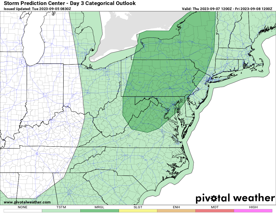
Attached is the updated Slight Risk for Severe Storms at this time.

image.png

Loudoun County Weather Outlook for Wednesday, September 6, 2023

Super HOT TODAY! Strong Storms are possible tomorrow and Friday. 
We could hit 100 as we are on track based on the time of day and current temperature near 90 at 11am.
* Today – Hi 99  Lo 71 
* Thursday – Hi 95  Lo 68 – 50% Chance Storms – some strong possible
* Friday – Hi 89  Lo 66 – 60% Showers & Storms – some strong possible
* Saturday – Hi 85  Lo 66 – 70% Chance of showers and storms
* Sunday – Hi 80  Lo 66 – 50% chance of showers
* Monday – Hi 83  Lo 62 – Nice! 
* Tuesday – Hi 82  Lo 60 – 30% chance of showers 
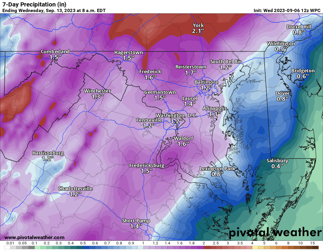
The amount of rain we get over the next 7 days is not certain. There were some drier trends on the models yesterday, but it seems we could see between 1 and 2 inches of rain, but thunderstorms could help locally. 
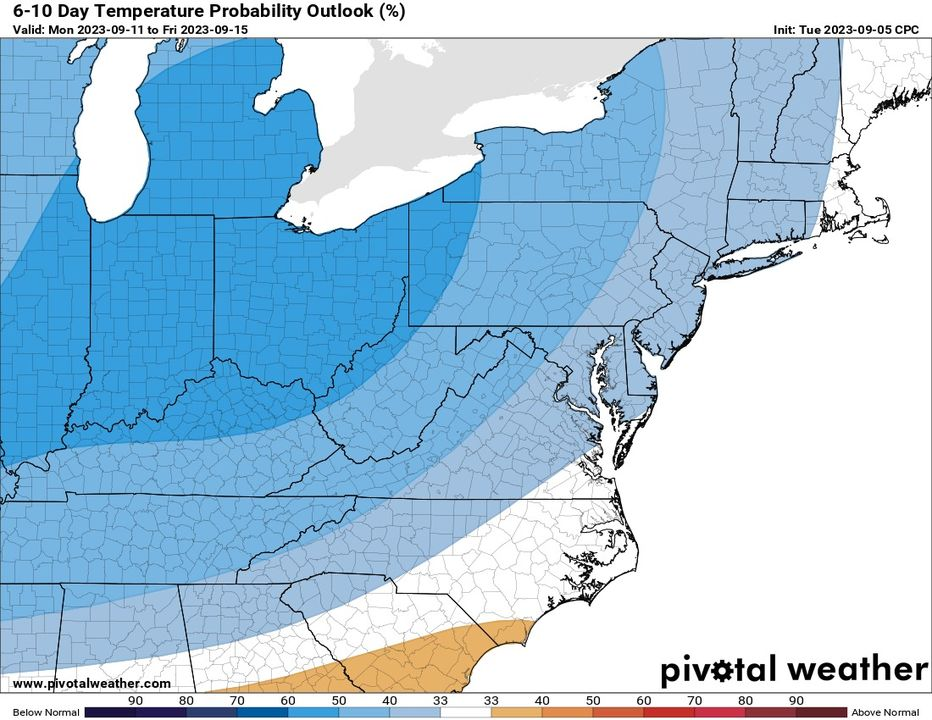
The trend in the longer range is better for rain chances and below-normal precipitation!
Attached
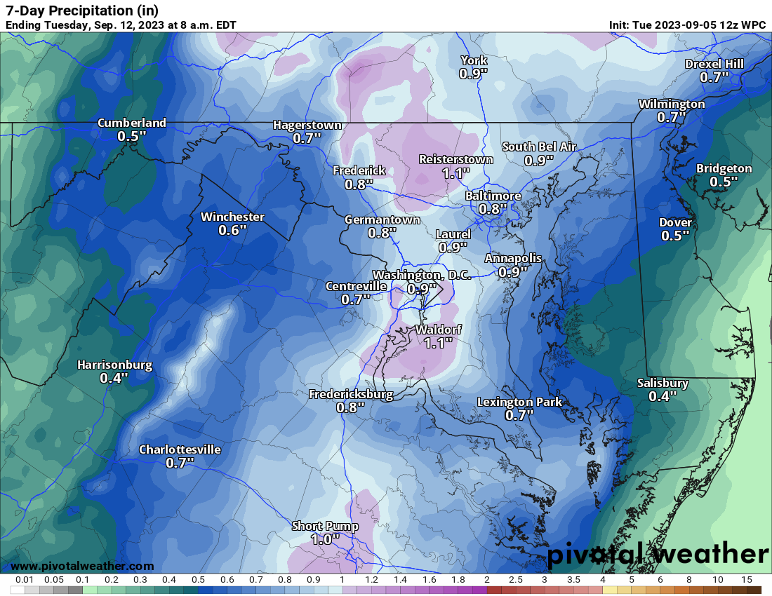
* Precip the next seven days
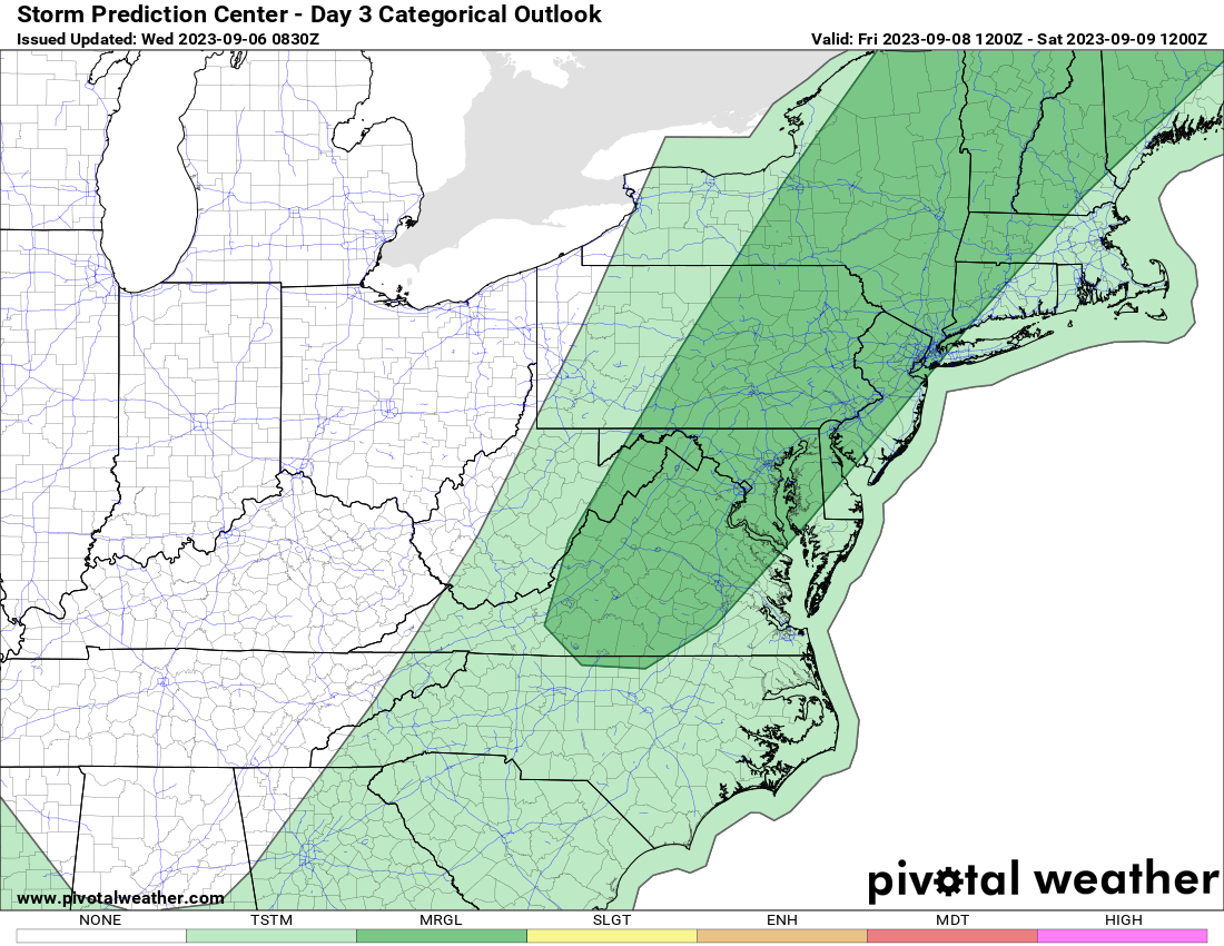
* Storm Prediction Center Storm Outlooks for Tomorrow and Friday
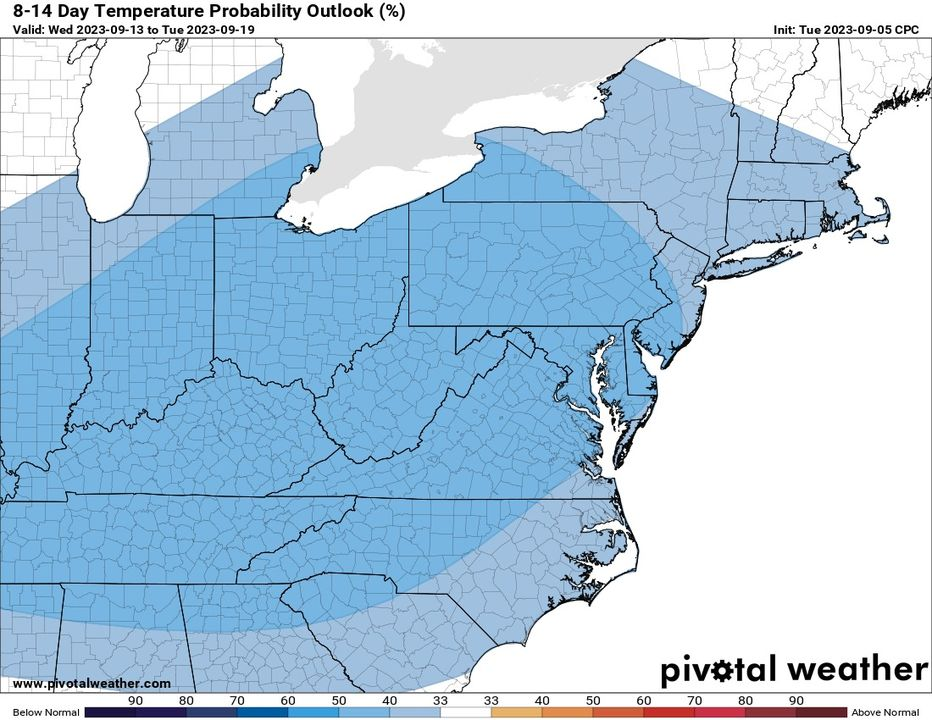
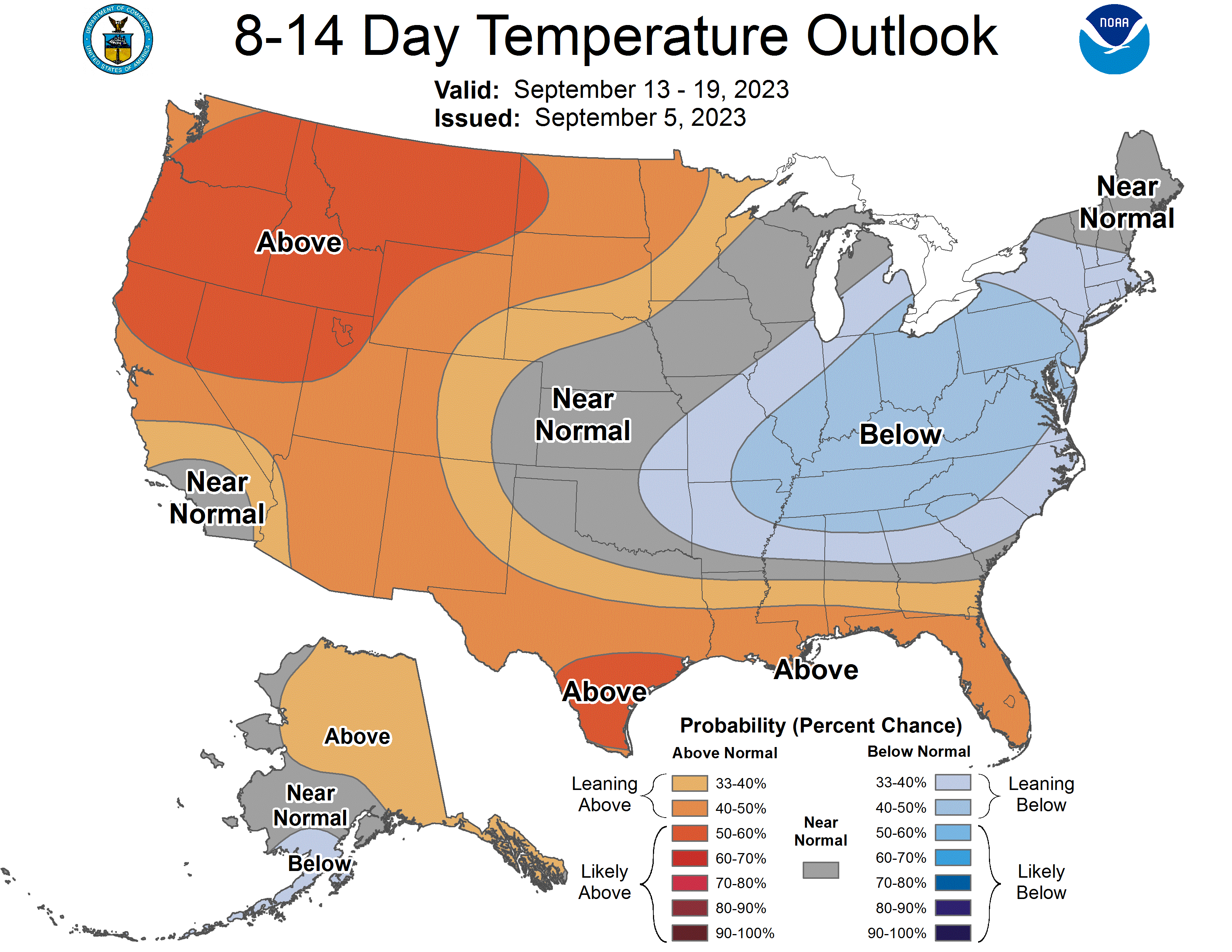
* Long Range temperatures for the 6 to 10 and 8 to 14-day periods
image.png
image.png
image.png
image.png
image.png

Loudoun County Weather Outlook for Tuesday, September 5, 2023

It will be hot today, tomorrow, and Thursday (though less so on Thursday). There is now some outlook for stronger storms on Thursday — The map is for Thursday!

We need rain. We really need it!

We MAY (and I want to re-emphasize MAY) see up to an inch, with some local spots seeing more if thunderstorms occur.

We can hope!

So far, my high here in my backyard is up to 95 degrees. Yesterday was the hottest of the year for me at 98.

The rain outlook for the next seven days is also posted.

Are cooler times coming? Models continue to hint at that, so the last graphic is the outlook for the 8 to 14-day period. They also point to multiple chances of some fronts passing through. I am still hoping for a fall-like storm to form along one of the fronts to give us some good rains.

As a reminder, check out https://Explorefall.com . They are noting that the dry conditions and stress on the trees are likely a problem for a good fall foliage season. Last year was absolutely stunning!

The last map is their map noting the tree stress. See the post on X (formerly twitter) and follow them there – https://twitter.com/ExploreFall/status/1699034566651195489?s=20

image.png
image.png
image.png
image.png

8/31/2023 – Drought Emergency and Drought Watches Hot week ahead!

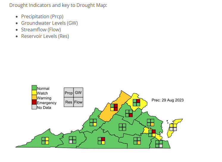
As expected, we have been put into a Severe Drought out in Western Loudoun and further west. A moderate drought for most of the rest of the area. 
We also have a drought emergency for the groundwater levels. 
So we are under a drought watch, but it could be an emergency soon!
The forecast is only getting worse for next week! 
* Thursday – Hi 78  Lo 51 
* Friday – Hi 82  Lo 53 
* Saturday – Hi 87  Lo 60  
* Sunday – Hi 95  Lo 68 
* Monday – Hi 98  Lo 68 
* Tuesday – Hi 98  Lo 69 
* Wednesday – Hi 96  Lo 68
Not a drop of rain the entire time! I would not be surprised at a few 100-degree temperatures next week! 
UGLY!! Wow! 
image.png
image.png