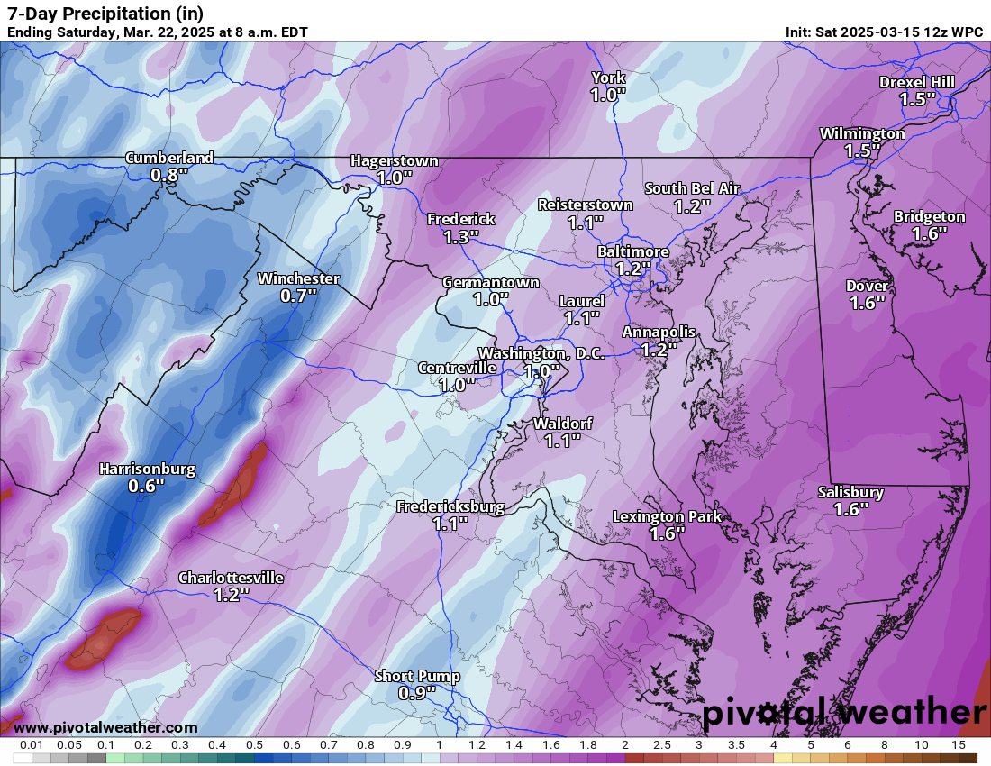
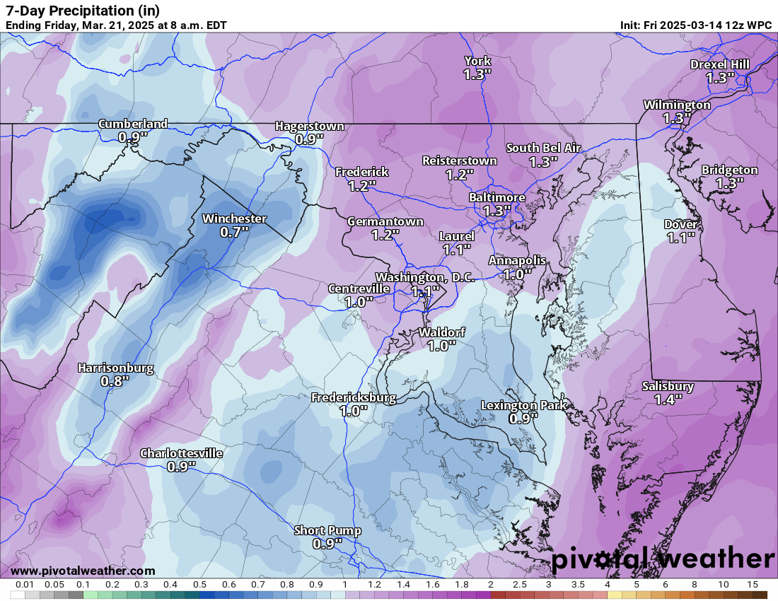
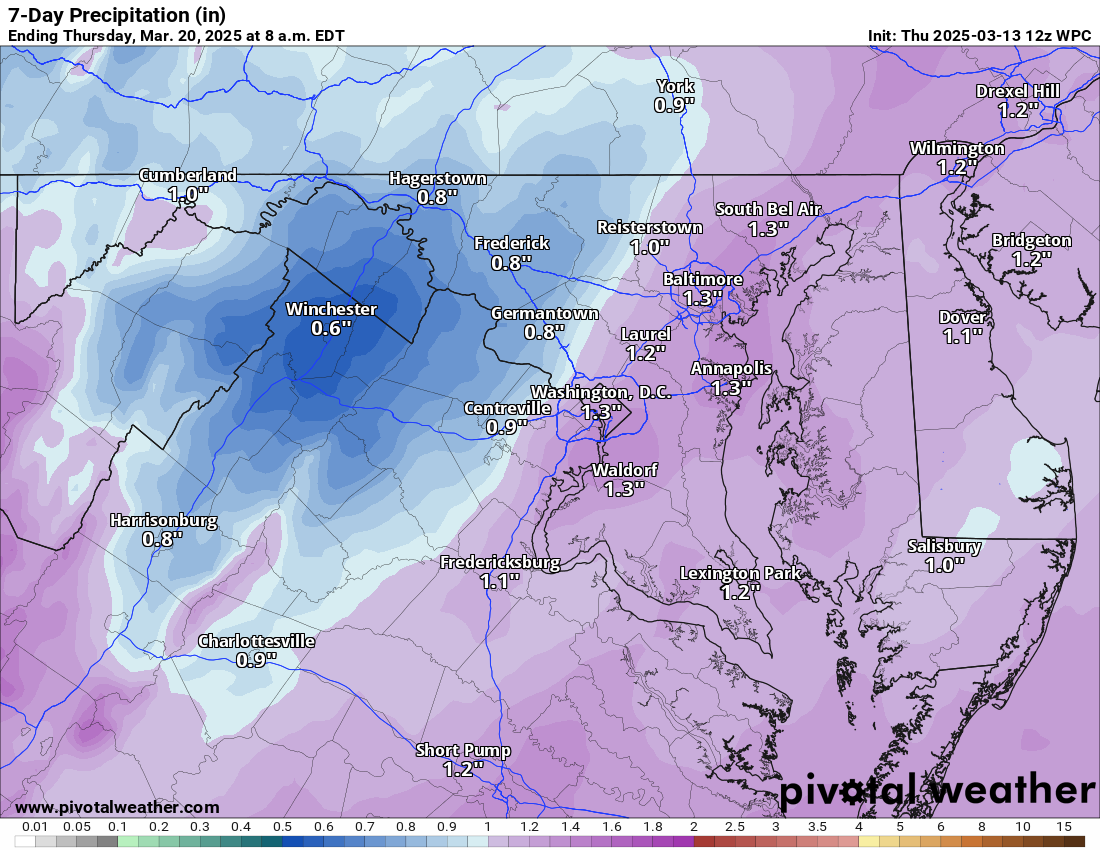
3/17/2025 – Cooler and breezy day ahead. Showers Thursday after a mild Wednesday.
The amount of rain last night really depended on the location! I saw most areas receive about .76 inches of rain. Far eastern areas did not get that much at all, which is bad as they are in an extreme drought.
We could hit 70 on Wednesday. More showers are possible on Thursday, and then it will be cooler on Friday. Next weekend, it will be in the 50s.
Today: Hi 55 🌤️ Lo 34 🌙 – Partly sunny and breezy with gusty northwest winds, becoming mostly clear and calmer overnight
Tuesday: Hi 65 ☀️ Lo 42 🌙 – Sunny with light winds, staying mostly clear at night
Wednesday: Hi 70 🌤️ Lo 51 ☁️ – Mostly sunny with increasing south winds, becoming mostly cloudy overnight
Thursday: Hi 63 🌤️🌧️70% Lo 34 🌧️60% – Partly sunny with showers likely in the afternoon, continuing into the evening before tapering off
Friday: Hi 52 ☀️ Lo 35 🌙 – Sunny and breezy, turning partly cloudy at night
Saturday: Hi 59 🌤️ Lo 41 ☁️ – Partly sunny during the day, becoming mostly cloudy overnight
Sunday: Hi 60 🌤️ Lo 42🌙 – Partly sunny throughout the day
#loudoun #loudouncountyva #vawx #loudounweather #loudounva #virginiaweather
3/16/2025 – Severe Risk Today – We will see a few rounds of showers and storms today. They could produce locally strong winds, possibly some hail, and even a chance of an isolated tornado. Do stay weather aware, though. The risk of a tornado is small (5%), but it is not impossible, and some models hint at the possibility.
It will be windy today, with gusts up to 40 mph.
It will be breezy and cooler tomorrow. Then we get mild mid-week with more showers possible on Thursday before a chilly day on Friday.
Today: Hi 69 ⛈️90% Lo 46 🌧️80% – Showers and thunderstorms likely with gusty winds up to 41 mph, then scattered showers overnight
Monday: Hi 53 ⛅ Lo 34 🌙 – Mostly cloudy, becoming sunny and breezy
Tuesday: Hi 65 ☀️ Lo 40 🌙 – Sunny and mostly clear
Wednesday: Hi 68 🌤️ Lo 48 🌙 – Mostly sunny and partly cloudy overnight
Thursday: Hi 60 🌦️50% Lo 32 🌙 – Partly sunny with a chance of showers
Friday: Hi 50 ☀️ Lo 34 🌙 – Sunny and partly cloudy overnight
Saturday: Hi 60 ⛅ Lo 39🌙 – Partly sunny
#loudoun #loudouncountyva #vawx #loudounweather #loudounva #virginiaweather
3/15/2025 – There is a severe Risk for Sunday. It will be cooler on Monday, and then it will get milder mid-week. It will be cooler and windy on Thursday and Friday.
The severe threat tomorrow will mainly be winds, but hail and an isolated tornado are possible. Storms could be there in the morning and then again later in the day, and a line of storms will come through.
It will be cooler and breezy on Monday. It will get milder Tuesday through Thursday before windy and cooler Friday into Saturday.
Today: Hi 57 ☁️ Lo 55 🌧️30% – Mostly cloudy and breezy with increasing winds, a chance of showers developing after 5am
Sunday: Hi 68 ⛈️100% Lo 47 ⛈️80% – Showers likely, then thunderstorms in the afternoon with patchy fog, breezy with strong gusts, showers tapering off at night
Monday: Hi 54 🌦️20% Lo 34 🌙 – Partly sunny with a slight chance of showers, becoming mostly clear and cooler at night
Tuesday: Hi 65 ☀️ Lo 42 🌙 – Sunny and mostly clear
Wednesday: Hi 71 🌤️ Lo 48 ☁️ – Mostly sunny, becoming mostly cloudy overnight
Thursday: Hi 62 🌦️50% Lo 35 🌧️30% – Partly sunny with a chance of showers, lingering chance of showers at night
Friday: Hi 50 🌤️💨 Lo 32🌙 – Mostly sunny and breezy
#loudoun #loudouncountyva #vawx #loudounweather #loudounva #virginiaweather
3.14.2025 – Happy Pi day! It will be pretty cool again today with the winds off the ocean, but, if we get sun, mid and upper 50s will be possible. If we get some sun, we will reach he 50s. Tomorrow will be pretty cloudy, with winds slowly increasing. It still looks like we will have an active Sunday with winds and a good chance for windy storms that may contain hail and have a chance for an isolated tornado. That will be watched, and the risk will be refined as we get more details from short-range models. Unfortunately, the Mississippi Valley and the south are in for a severe weather outbreak from this system. I am sure the news is trying to alert these people to be weather aware!
We cool slightly on Monday with breezy winds and then get milder. Another strong front late next week may bring strong storms and then a shot at some colder air for a few days.
Today: Hi 59 🌤️ Lo 43 ☁️ – Patchy fog early, then partly sunny. Temperatures will only reach this high if we get the sun! Increasing clouds tonight with patchy drizzle after 2am.
Saturday: Hi 65 ☁️ Lo 59 🌧️30% – Patchy drizzle and fog early, then mostly cloudy. A chance of showers late at night. Breezy.
Sunday: Hi 70 ⛈️90% Lo 46 ⛈️80% – Showers likely, then showers and a possible thunderstorm in the afternoon. Rain and storms continue into the night. Windy.
Monday: Hi 56 ☀️ Lo 38 🌙 – Mostly sunny and mostly clear.
Tuesday: Hi 68 ☀️ Lo 45 🌙 – Sunny and mostly clear.
Wednesday: Hi 74 🌤️ Lo 51 ☁️ – Mostly sunny, becoming mostly cloudy overnight.
Thursday: Hi 68 🌦️50% Lo 45 🌧️ – Partly sunny with a chance of showers.
#loudoun #loudouncountyva #vawx #loudounweather #loudounva #virginiaweather
3/13/2025 – It is a colder day than I had hoped for! The Severe Threat Sunday Increasing!
That backdoor cold front and easterly fetch off the ocean that the models were hinting at the last 2 days came true so it will keep us cool today and tomorrow!
The Southeast (Alabama, Mississippi, Georgia, Tennessee) faces a serious threat of severe weather on Saturday and Sunday. This does not mean we will see severe storms, but we have a better chance than usual on Sunday. Strong winds will be the biggest risk, but isolated tornadoes will also be possible. Details will need to be fine-tuned over the next two days.
We will cool slightly and then turn milder next week. Later next week, we could see more strong storms and rain before we have a quick cold shot.
Additionally, far eastern Loudoun is now in a Severe Drought!
Today: Hi 50 ☁️ Lo 39 ☁️ – Mostly cloudy with light east winds
Friday: Hi 59 ⛅ Lo 44 ☁️ – Cloudy becoming mostly sunny, then mostly cloudy with a slight chance of drizzle late
Saturday: Hi 68 🌧️20% Lo 60 🌧️60% – Mostly cloudy with a slight chance of drizzle or showers, then showers likely overnight and breezy
Sunday: Hi 72 🌧️⛈️100% Lo 45 🌧️ 50% – Showers and thunderstorms possible (watching for severe)!
Monday: Hi 56 ☀️ Lo 38 🌙 – Mostly sunny and mostly clear
Tuesday: Hi 68 ☀️ Lo 48 🌙 – Sunny and partly cloudy
Wednesday: Hi 74 🌤️ Lo 51 – Mostly sunny
#loudoun #loudouncountyva #vawx #loudounweather #loudounva #virginiaweather