Local weather. A little perspective.Loudoun County, VirginiaOfficial NWS alerts ↗
Loudoun County, Virginia

The local outlook

Forecasts, updates and a little local perspective.

Loudoun County Weather Outlook for Sunday, June 22, 2025

6/22/2025
☀️🔥 Heat Dome Begins – Dangerous Heat in Place! Heat Advisory and Extreme Heat watches in place.

Highs today will soar into the mid to upper 90s, with feels-like temps around 105°F. Expect more advisories and warnings to follow in the days ahead.

🌡️ Oppressive Heat Continues
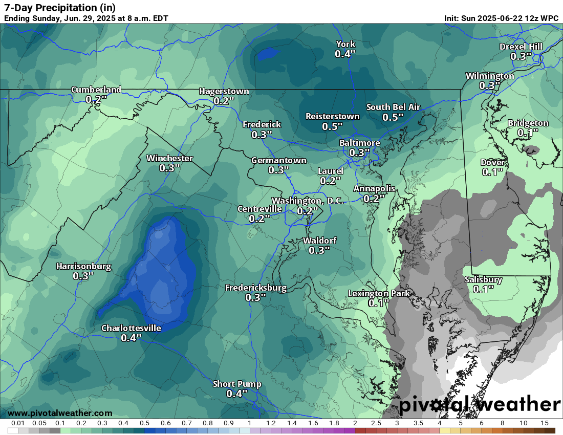
Hot and humid conditions are expected through midweek. While the chance for showers or storms is low (around 20% or less), a stray one isn't entirely off the table due to all the heat and moisture.

🌬️ Relief Possible Late Week
By Wednesday afternoon into Thursday and the weekend, we may catch a break thanks to a potential backdoor cold front. This could not only ease the heat slightly but also fire off strong to severe storms in spots.

🌞 Hotter Again Next Weekend before a real break?
Heat may build back in by Sunday, but there are hints of a real cool down just in time for the 4th of July! Fingers crossed!

Stay cool, hydrated, and safe out there!

The forecast:
Today: Hi 96 🌡️🌞 – 🥵🌡️ Dangerously hot with heat index values up to 105 °F

Monday: Hi 98 🌡️🌞 – 🥵🌡️ Scorching sunshine and extreme heat with heat index near 107 °F

Tuesday: Hi 99 🌡️🌞 – 🥵🌡️ Extremely hot, pushing near record heat levels

Wednesday: Hi 96 🌡️🌦️30% Lo 75 🌧️30% – 🥵🌡️ Mostly sunny with a few afternoon storms

Thursday: Hi 94 🌦️40% Lo 74 🌧️30% – Partly sunny with scattered afternoon storms

Friday: Hi 90 🌦️40% Lo 72 🌧️40% – Mostly sunny with a chance of storms

Saturday: Hi 86 🌦️40% Lo 70 🌧️ – Partly sunny with a chance of showers and storms

#loudoun #loudouncountyva #vawx #loudounweather #loudounva #virginiaweather

Please support Tree of Life Ministries, an important organization to me! https://www.tolministries.org


Please support Tree of Life Ministries, an important organization to me! https://www.tolministries.org

Loudoun County Weather Outlook for Saturday, June 21, 2025

6/21/2025
🔥🌞 Full-On Summer Heat Arrives!

Welcome to the first full day of summer, and it’s bringing the heat in a big way!

🌡️ Today: Hot and Humid
Highs near 90°F, but with thick humidity, it’ll feel more like the low to mid-90s.

🥵 Sunday Through Wednesday: Intense Heat Wave
We’re locked into a dangerous heat pattern:

Sunday: Highs in the mid-90s, with heat indices around 100–104°F

Monday–Wednesday: Actual highs could touch 100°F, with heat indices potentially 105°F or higher

🌦️ Thursday–Friday: Slight Rain Chances
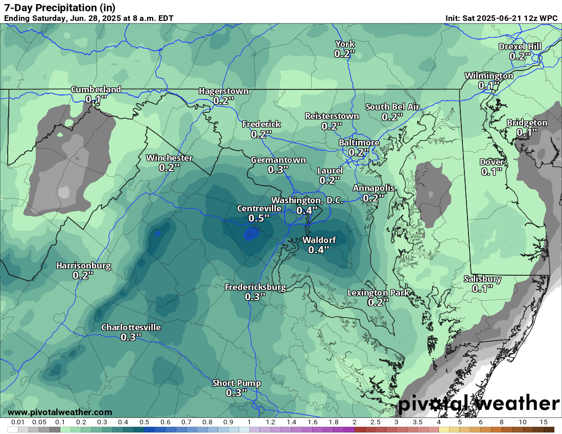
By Thursday, we may see some relief with scattered showers or storms as the ridge starts to break down. Highs drop slightly to the low to mid-90s, but it’ll still feel tropical with heat indices staying elevated.

📅 Long Range Outlook
Unfortunately, the heat looks to hang tough into the end of June. We're hoping for some sort of break by the 4th of July, but that’s not a sure thing just yet.

🔥 Stay safe and stay cool—this is a stretch of heat we need to take seriously!

The forecast:
Today: Hi 89 ⛅ Lo 70 🌙 – 🌡️ Hot and mostly sunny during the day, becoming pleasant and mostly clear tonight

Sunday: Hi 96 🥵 ☀️ Lo 74 🌙 – Sunny and very hot

Monday: Hi 97 🌡️ ☀️ Lo 76 🌙 – Sunny and hot

Tuesday: Hi 98 🌡️ ☀️ Lo 75 ☁️ – Sunny and extremely hot

Wednesday: Hi 96 🥵 ☀️ Lo 73 ☁️ – Mostly sunny and hot

Thursday: Hi 93 🌦️40% Lo 73 🌧️30% – Mostly sunny with scattered showers and storms

Friday: Hi 93 🌦️40% Lo 71 🌧️ – Mostly sunny with scattered showers and storms

#loudoun #loudouncountyva #vawx #loudounweather #loudounva #virginiaweather

Please support Tree of Life Ministries, an important organization to me! https://www.tolministries.org


Please support Tree of Life Ministries, an important organization to me! https://www.tolministries.org

Loudoun County Weather Outlook for Friday, June 20, 2025

7/20/2025
🔥 Here Comes the Heat Wave!
Today will be warm but comfortable with lower humidity and a light northerly breeze. Enjoy it while it lasts!

🌡️ Cranking Up the Heat Tomorrow
Saturday kicks off a stretch of really hot weather. Highs will jump into the low 90s with humidity building late in the day.

🥵 Hot, Humid, and Oppressive Next Week
Sunday through Wednesday will be brutal, with highs in the mid-to-upper 90s and heat index values reaching 100–105°F. Eastern areas might even flirt with 100°F actual temps.

⛈️ Storm Chances by Late Week
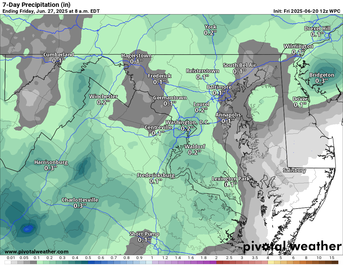
A few showers or storms are possible Wednesday through Friday, which could shave a few degrees off the highs down to the low 90s, but the humidity will hang on or even increase.

Bottom Line: A full-blown heat wave is on the way, so stay cool and hydrated! Check on neighbors and make sure their AC is working. Give outdoor animals shade and plenty of water!

The forecast:
Today: Hi 85 ☀️ Lo 65 🌙 – Sunny through the day, becoming partly cloudy tonight

Saturday: Hi 89 ☀️ Lo 71 🌙 – Sunny and warm during the day, mostly clear overnight

Sunday: Hi 96 ☀️ Lo 73 🌙 – 🥵 Sunny and very hot, mostly clear skies continue into the night

Monday: Hi 97 ☀️ Lo 76 🌙 – 🌡️ Sunny and extremely hot, with a mostly clear night

Tuesday: Hi 98 ☀️ Lo 75 ☁️ – 🌡️ Hot and sunny during the day, becoming partly cloudy overnight

Wednesday: Hi 96 🌤️ Lo 73 🌧️30% – 🥵 Mostly sunny and hot with increasing clouds, slight chance of showers at night

#loudoun #loudouncountyva #vawx #loudounweather #loudounva #virginiaweather

Please support Tree of Life Ministries, an important organization to me! https://www.tolministries.org


Please support Tree of Life Ministries, an important organization to me! https://www.tolministries.org

Loudoun County Weather Outlook for Wednesday, June 18, 2025

6/18/2025
⛈️ Stormy and Humid Today
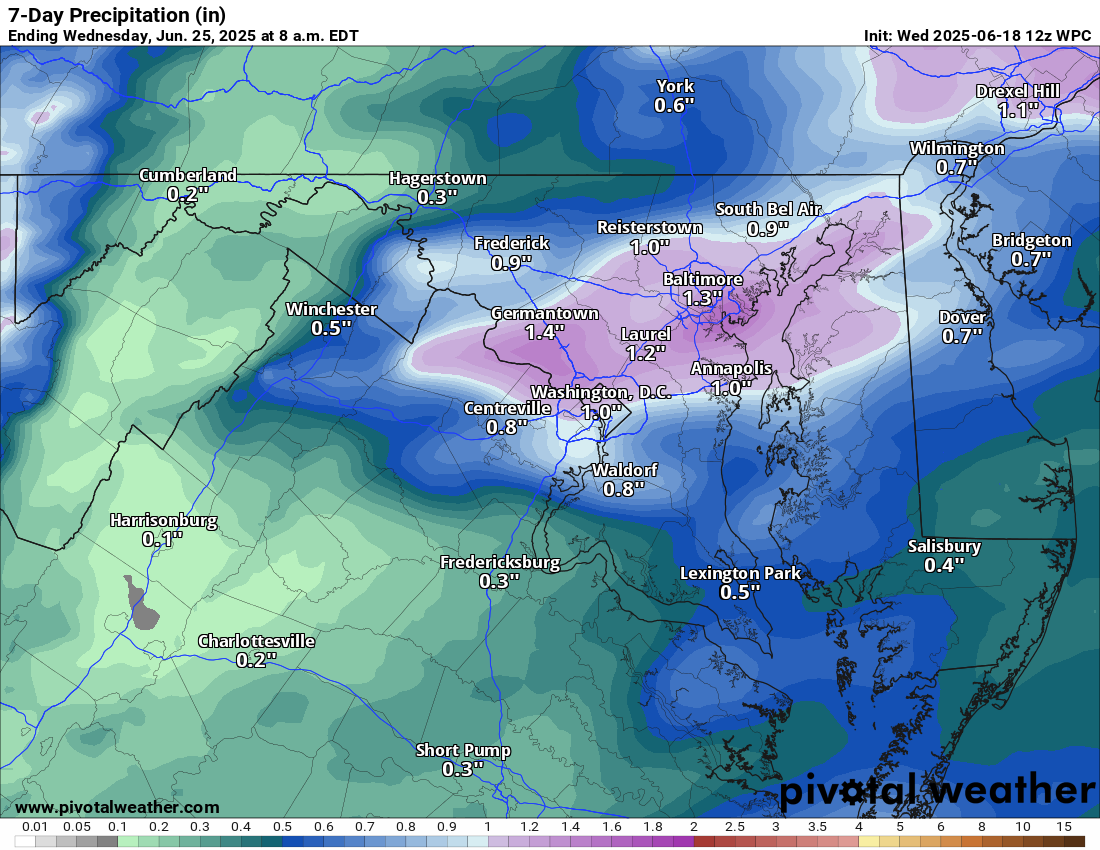
After a foggy start, things are warming up fast! Expect a warm and humid day with highs climbing into the mid to upper 80s. Scattered showers and thunderstorms are likely, especially through the middle part of the day. A few storms could be strong, but they’ll be more isolated.

🌩️ HOT with Strong Storms Possible Thursday
Thursday brings another round of showers and thunderstorms with a higher chance for strong to severe storms.

🌤️ Brief Break Friday
We catch a break on Friday with mostly sunny skies and highs in the low to mid 80s. A beautiful day before the heat cranks up again!

🔥 Turning Up the Heat This Weekend
Saturday starts the sizzle with highs in the low 90s and increasing humidity. By Sunday, we’re into the low to mid 90s, and the heat intensifies even further into next week.

🥵 Dangerous Heat Next Week
Monday through Wednesday look brutally hot with highs in the mid to upper 90s. With high humidity, it will feel downright oppressive. Be sure to stay cool and hydrated! The hot temperatures will continue through the week

The forecast:
Today: Hi 86 ⛈️70% Lo 71 🌙 – Afternoon thunderstorms

Juneteenth: Hi 91 ⛈️80% Lo 64 🌧️80% – Showers and storms in the afternoon. Some could be severe, with heavy rain.

Friday: Hi 84 ☀️ Lo 64 ☁️ – Sunny

Saturday: Hi 89 ☀️ Lo 69 🌙 – Sunny and hot

Sunday: Hi 93 🌤️ Lo 73 🌙 -🥵 Mostly sunny and hot

Monday: Hi 96 ☀️ Lo 75 🌙 – 🥵 Sunny and very hot

Tuesday: Hi 97 ☀️ Lo 75 🌙 – 🌡️🥵 Sunny and extremely hot

#loudoun #loudouncountyva #vawx #loudounweather #loudounva #virginiaweather

Please support Tree of Life Ministries, an important organization to me! https://www.tolministries.org


Please support Tree of Life Ministries, an important organization to me! https://www.tolministries.org

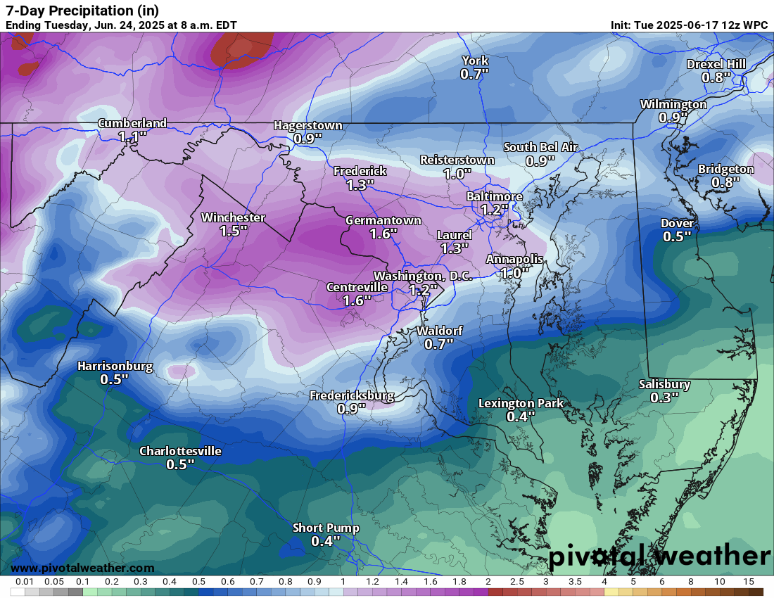
Loudoun County Weather Outlook for Tuesday, June 17, 2025

6/17/2025
🌥️ Mostly Cloudy with a Humid Feel Today
Expect mostly cloudy skies, but becoming sunny. It will feel more humid, and there’s a chance of scattered showers and storms. We're under a marginal risk for severe weather, mainly for gusty winds.

🌡️ Turning Hot and Stormy Wednesday
Temps jump to around 90°F with humidity. Look for afternoon and evening storms, some of which may be strong to severe. Another marginal risk is in place.

🔥 Hot Thursday
Cooler and a touch less humid with highs in the mid-80s. Heat index will push 100°F! We are under a slight risk (15%) for severe storms.

🌤️ Brief Break Friday
A bit cooler and slightly less humid, with highs in the mid-80s.

🌡️ Heat Builds Through the Weekend
Back to 90°F Saturday, then surging to the mid-90s Sunday

🥵 Extreme Heat Next Week
Monday's highs will be in the mid to upper 90s, with heat indices nearing 105°F. This dangerous heat looks to linger through much of next week.

The forecast:
Wednesday: Hi 89 ⛈️80% Lo 70 🌧️80% – Showers and thunderstorms with isolated severe storms possible

Wednesday: Hi 89 ⛈️80% Lo 70 🌧️80% – Showers and thunderstorms with isolated severe storms possible.

Thursday (Juneteenth): Hi 91 🌧️60% Lo 65 🌧️60% – Mostly sunny morning, then showers and thunderstorms likely developing in the afternoon and early evening. There could be strong to severe storms.

Friday: Hi 86 ☀️ Lo 66 🌙 – Sunny

Saturday: Hi 91 🌤️ Lo 71 🌙 – Hot and sunny.

Sunday: Hi 95 🥵☀️ Lo 74 🌙 – Hot and sunny

Monday: Hi 97 🌡️☀️ Lo 75 🌙 – Very hot

#loudoun #loudouncountyva #vawx #loudounweather #loudounva #virginiaweather

Please support Tree of Life Ministries, an important organization to me! https://www.tolministries.org


Please support Tree of Life Ministries, an important organization to me! https://www.tolministries.org