***** BEAUTIFUL WEEKEND ALERT ******
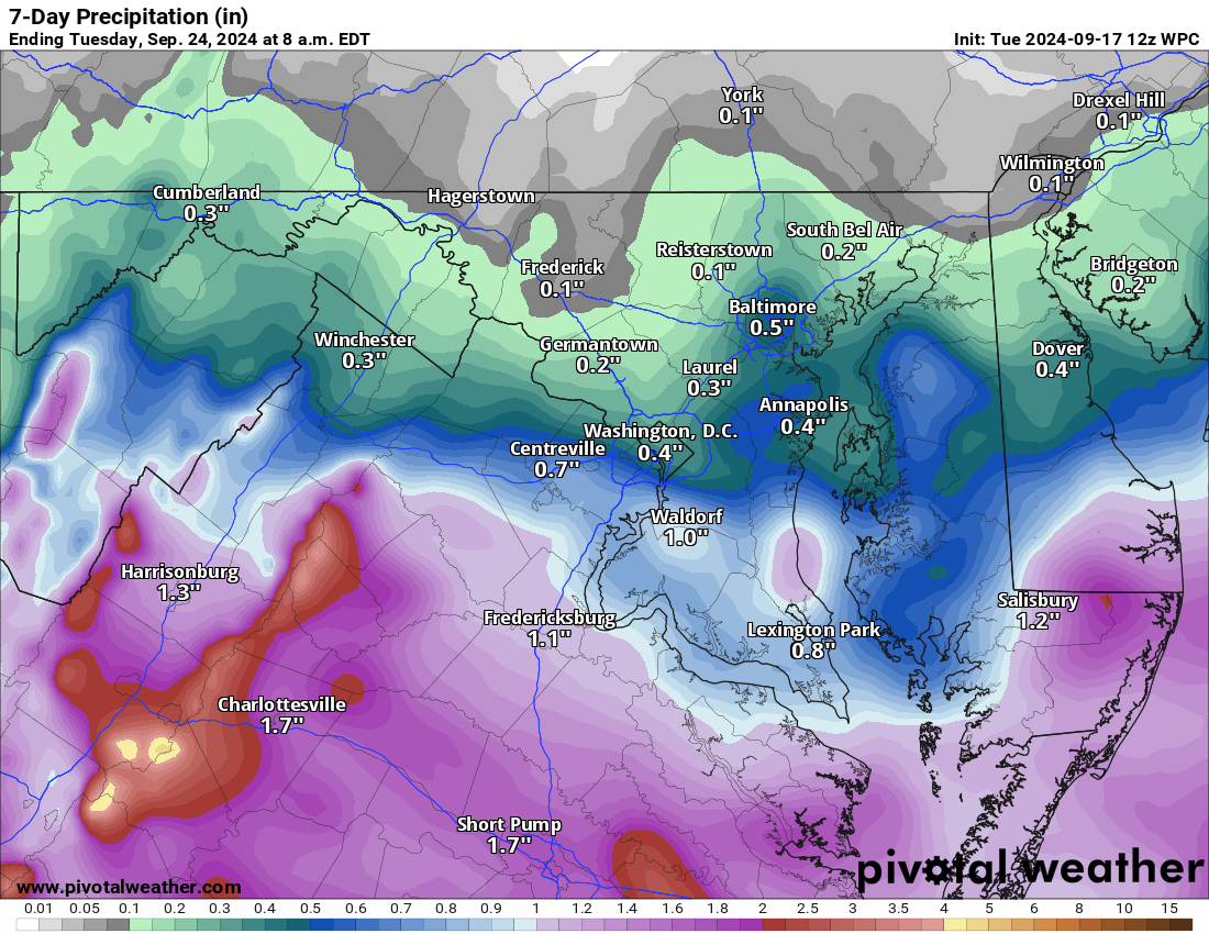
Talking about a rug pull on any chance of significant rain! I AM SORRY! Although we could see some heavier local amounts, the most amount of rain people may see from this event is three-quarters of an inch. If you happen to get a thunderstorm, there may be more. Many may see a quarter of an inch.. or less?? – The blocking high to the north was stronger than expected, and the remnants of the tropical system are not far enough north or strong enough to help overcome that drier air. I do not control the weather or the models, but seeing systems behave differently than forecasted is just not fun. I know plans were changed due to these forecasts! I put down grass seed in the hopes of some good rain, too! 🙁
It now looks dry Friday through Sunday with pleasant temperatures.
The long range shows warmer-than-normal temperatures and a chance of some above-average rainfall. We can hope for rain!
The forecast:
Today: Hi 76 🌧️30% Lo 64 🌧️70% – Cloudy with a chance of showers in the afternoon and likely showers late at night with patchy fog.
Wednesday: Hi 72 ⛈️70% Lo 62 ⛈️40% – Mostly cloudy with likely showers and possible thunderstorms in the afternoon.
Thursday: Hi 77 🌤️30% Lo 59 🌙30% – Partly sunny with a slight chance of afternoon showers, turning partly cloudy at night.
Friday: Hi 80 ☀️ Lo 59 🌙 – Mostly sunny during the day and partly cloudy at night.
Saturday: Hi 78 ☀️ Lo 56 🌙 – Mostly sunny and mostly clear.
Sunday: Hi 73 ☀️ Lo 54 🌙 – Mostly sunny and partly cloudy at night.
Monday: Hi 71 ☀️ Lo 54 🌙 – Mostly sunny during the day and mostly clear at night.
#loudoun #loudouncountyva #vawx #loudounweather #loudounva #virginiaweather
Please support Tree of Life Ministries, an important organization to me! https://www.tolministries.org