Local weather. A little perspective.Loudoun County, VirginiaOfficial NWS alerts ↗
Loudoun County, Virginia

Author: admin

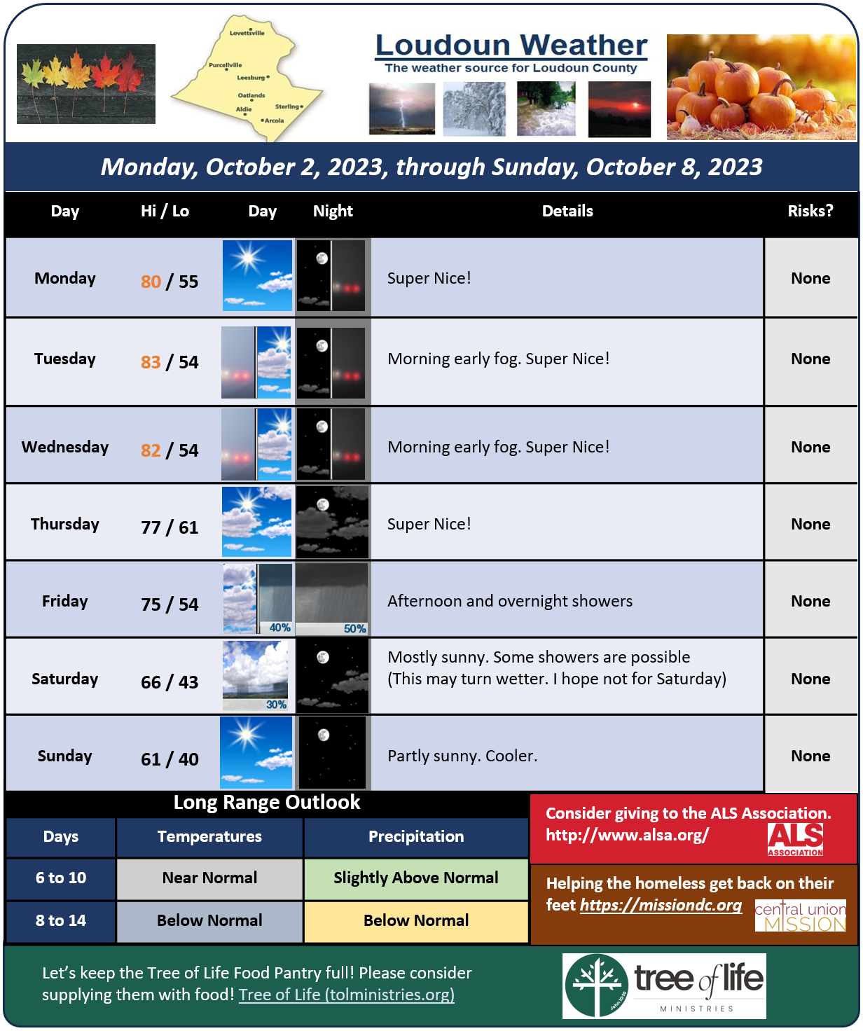
Loudoun County Weather Outlook for Monday, October 2, 2023

Hoping to get these out earlier in the day! This is the weekly outlook. Looks a bit warmer than I first thought the next few days. Overnight fog is common this time of year! It does help that new grass that you may have planted! 
I'm still seeing that trend towards more wet conditions Friday Night.. maybe into Saturday. I will keep watching. The front coming through may be slower to clear. We need the rain.. it just messes up outdoor events! Let's hope for a wet night and a dry Saturday! 
AN FYI… I saw some concern (and social media anger) because burn season has started, and people have had fires while we remain in a drought. Surface conditions are pretty wet these days. This week, we will have enough humidity around and low winds so that the fire risk will be low to very low (fog is an indicator of surface moisture). Groundwater and stream flow remain low, so we are not out of the drought! 
I was amazed by the recovery of the dormant grass last week!  I had to mow, and the grass was quite thick! 🙂 Anyways, when the humidity gets low, and we have a breeze or have not had rain for a longer period of time, that is when the fire danger will increase. It is not just because we are in a drought. So, no need to get angry!
It will be somewhat chilly on Sunday, and especially Sunday night! Sunday night may brush the upper 30s for some! 
image.png

Winter 2023 – 2024 – PRELIMINARY

Quick Summary

I said I would summarize and so here we go:

I think we will struggle again to keep it cold here in the Mid-Atlantic. The Oceans remain warm, and I seriously think they were a huge factor last year in messing up a few borderline events for the region. I think we have the same issue this year.
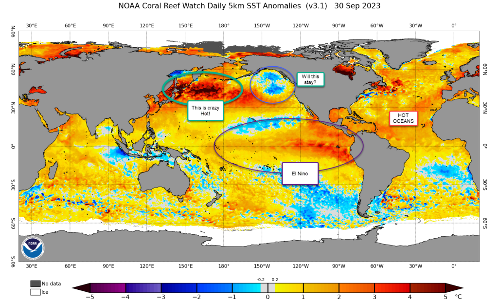
The biggest factor for this year, beyond the warm Atlantic Ocean, is El Nino (Warm Equatorial Pacific Ocean). This year looks to have a strong El Nino. NOW, there are types of El Nino’s and there are hints that this once could become better situated later in the season. This basically is a question of an east based verses a west based El Nino. There were signs that it would be east based, but I am seeing it forecast to become more west over time, and that could be great thing (for snow lovers)!

The Outlook

In general, my first outlook is super preliminary! So, I will do a better job after some additional data comes in.I am expecting average temperatures and average snow. That was a lot of words to get here. What does that mean exactly?

Our area sees snow totals close to 24 inches on average. Temp will average out with a few cold spells and some warmer spells.

Things I need more time to review!

  • Will El Nino set up more easterly?
  • Will we see a favorable Pacific Ocean? That could help us a lot for snow.
  • The Snow Advanced Index (measured in October) can help predict the way that the Atlantic blocking pattern works.

I am just too early trying to pinpoint this! What I have discovered is this year has many conflicting signals. I am sorry for the hype on the outlook to be boring in general! We will get a lot of data over the next several weeks and by the End of October, I will revise and have some better ideas!