🌤️ A Breezy but Beautiful Monday!
After a very wet weekend, clouds will gradually break up this morning, giving way to sunshine. Breezy, with highs in the mid-70s.
☀️ A Warm Start to the Week!
Temperatures will climb over the next couple of days! We'll approach 80°F on Tuesday, and Wednesday could reach the mid-80s!
🌦️ A Few Showers Possible Later This Week
Clouds will increase by Wednesday evening, with a chance of showers overnight and into Thursday. Temperatures will settle back into the 70s for Thursday and Friday before a much stronger cold front arrives.
🥶 A Dramatic Cooldown This Weekend!
Get ready for a big change! Saturday looks breezy and downright chilly, with highs only in the low to mid 50s!
Saturday night could bring temperatures down into the mid-30s, with some outlying areas, especially closer to the Blue Ridge, potentially approaching freezing. Frost is certainly possible, depending on how much the winds settle down overnight.
Sunday will remain chilly, with highs in the mid to upper 50s.
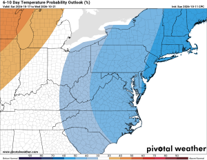
🍂 Below Normal Temperatures Next Week
The cooler pattern looks to continue for several days into next week before temperatures gradually return to near or above normal.
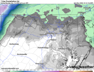
💧 Weekend Rainfall Should Help the Drought!
All that rain over the weekend should certainly put a dent in our ongoing drought conditions!
Have an excellent Monday!
The Forecast:
Monday: Hi 74 🌤️ 20% Lo 53 🌙 – Mostly cloudy with a slight chance of morning showers
Tuesday: Hi 80 🌞 Lo 62 🌙 – Sunny and pleasant
Wednesday: Hi 84 🌞 Lo 63 🌧️ 30% – Sunny with increasing clouds and a chance of overnight showers
Thursday: Hi 70 🌧️ 30% Lo 59 🌧️ 30% – Mostly cloudy with a chance of showers
Friday: Hi 76 🌦️ 30% Lo 44 🌙 – Breezy with a chance of showers, clearing overnight
Saturday: Hi 54 🌤️ Lo 35 🌙 – Mostly sunny and breezy, turning chilly overnight with possible frost in outlying areas
Sunday: Hi 57 ☀️ Lo 38 🌙 – Sunny and chilly