☀️ Chilly Start, Warm Afternoon
Good Tuesday! We woke up to temperatures in the mid to upper 50s, but we'll quickly rebound with sunny skies and highs in the mid 80s today.
🌡️ Near 90 Wednesday
Temperatures jump into the upper 80s to around 90 Wednesday, with plenty of warmth continuing into Thursday.
⛈️ Storm Chances Thursday
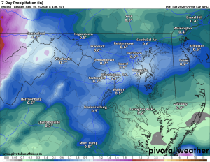
Thursday brings a good chance of afternoon and evening showers and thunderstorms, which will help cool us down for Friday. Highs Friday should be around 81.
🌦️ A Few Weekend Showers
A slight chance of showers arrives late Friday night, with around a 30 percent chance Saturday. Highs stay in the low to mid 80s through Monday, with additional shower and thunderstorm chances.
🌡️ Warmer Longer Range
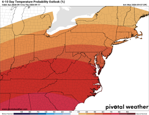
The longer range outlook continues to favor above normal temperatures with near to below normal precipitation.
The Forecast:
Tuesday: Hi 85 🌤️ Lo 63 ⛅ Mostly sunny with a partly cloudy night, south winds 5 to 7 mph
Wednesday: Hi 88 🌤️ Lo 68 🌙 Mostly sunny with south winds 5 to 11 mph, gusts up to 18 mph
Thursday: Hi 87 🌦️ 60% Lo 65 🌧️ 70% Mostly sunny with showers and possible thunderstorms mainly after 5pm, continuing into the night before tapering off around 2am
Friday: Hi 81 🌤️ Lo 61 🌧️ 20% Mostly sunny with a slight chance of showers after 2am
Saturday: Hi 82 ⛅ 30% Lo 66 🌧️ 30% Partly sunny with a chance of showers and thunderstorms in the afternoon and evening
Sunday: Hi 85 🌤️ 20% Lo 65 ⛅ Mostly sunny with a slight chance of showers and thunderstorms
Monday: Hi 85 🌤️ 20% Lo 64 Mostly sunny with a slight chance of showers
#loudoun #loudouncountyva #vawx #loudounweather #loudounva #virginiaweather
Please support Tree of Life Ministries, an important organization to me! https://www.tolministries.org
Find something fun to do @ https://fall.joyinnova.com
Facebook: https://facebook.com/loudounwx
Twitter: https://twitter.com/loudounwx
Instagram: https://www.instagram.com/loudounweather/
On the Web @ https://loudounweather.com