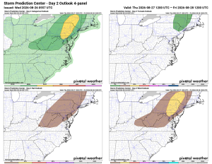
⚠️⚡ Severe Storms Possible Thursday
🌤️ Getting Warmer Today
Today's highs will be in the mid to upper 80s, with winds shifting from the south.
⛈️ Storm Chances Thursday
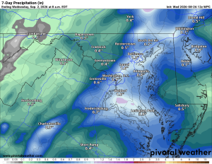
Highs Thursday will also be in the mid to upper 80s, with afternoon and evening showers and thunderstorms, some possibly turning strong to severe. Storms may linger into Thursday night.
🌦️ Friday Slight Chance
Friday highs stay in the mid to upper 80s, with a 20% chance of a shower or storm before things start to dry out.
☀️ Dry Weekend Ahead
Saturday looks sunny and pleasant with highs in the mid to upper 80s, and Sunday warms up into the upper 80s.
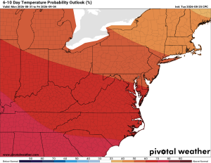
🥵 Heat Building Next Week
Monday and Tuesday bring highs in the low 90s as we head into next week. More proof summer isn't done with us yet!
Hope you have an awesome Wednesday!
The forecast:
Today: Hi 85 🌤️ Lo 68 ☁️ – Mostly sunny with winds turning south, becoming partly cloudy overnight
Thursday: Hi 88 🌦️60% Lo 65 🌧️60% – Chance of storms developing; some could be severe, likely through the evening and clearing by early morning
Friday: Hi 84 🌦️20% Lo 64 ☁️ – Slight chance of afternoon storms, mostly cloudy overnight
Saturday: Hi 84 🌤️ Lo 65 – Mostly sunny and pleasant
Sunday: Hi 87 🌤️ Lo 68 – Mostly sunny
Monday: Hi 91 🥵 Lo 70 – Sunny and warm
Tuesday: Hi 92 🥵 Lo 68 – Mostly sunny and hot
#loudoun #loudouncountyva #vawx #loudounweather #loudounva #virginiaweather
Please support Tree of Life Ministries, an organization that matters to me! https://www.tolministries.org
Facebook: https://facebook.com/loudounwx
Twitter: https://twitter.com/loudounwx
Instagram: https://www.instagram.com/loudounweather/
On the Web @ https://loudounweather.com