12/1/2025 – Quick update
🌧️ Cold Air Gets Pushed Out Tonight – Sleet and Snow Stay Minor
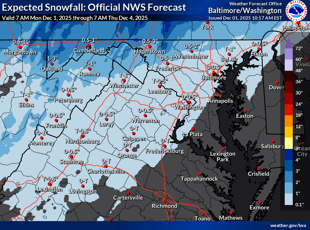
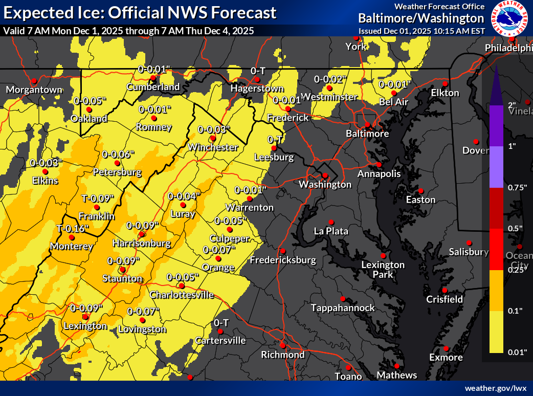
Southerly winds will quickly erode the cold air tonight, cutting down snow chances. A wintry mix will move in overnight into tomorrow morning. With colder temps on elevated surfaces, a light glaze will be possible.
Some sleet and a few snowflakes may mix in, but they won’t amount to much. Slick spots are possible on shaded or elevated surfaces, and a thin glaze could develop on trees.
🌡️ Chilly Tuesday Ahead
Temperatures will likely stay in the mid-30s through the day tomorrow. With lingering warmth from fall, early winter is off to a tricky start.
I will update later on the frozen chances for Friday night.
The forecast:
oday: Hi 41 🌤️ Lo 28 ❄️🌧️60% – Mostly sunny, becoming cloudy with sleet possible overnight
Tuesday: Hi 38 ❄️🌧️100% Lo 24 🌙 – Snow, sleet, and freezing rain changing to all rain by late morning, then clearing late
Wednesday: Hi 39 ☀️ Lo 23 🌙 – Sunny during the day, remaining mostly clear at night
Thursday: Hi 41 ⛅ Lo 18 🌙 – Partly sunny during the day and mostly clear overnight
Friday: Hi 32 ❄️ Lo 27 ❄️🌧️60% – Mostly cloudy with a chance of afternoon snow, becoming freezing rain overnight
Saturday: Hi 42 ❄️🌦️30% Lo 28 ☁️ – Mostly cloudy with a chance of rain during the day
Sunday: Hi 42 ⛅ Lo 27 🌙 – Partly sunny
#loudoun #loudouncountyva #vawx #loudounweather #loudounva #virginiaweather
Please support Tree of Life Ministries, an important organization to me! https://www.tolministries.org
Facebook: https://facebook.com/loudounwx
Twitter: https://twitter.com/loudounwx
Instagram: https://www.instagram.com/loudounweather/
On the Web @ https://loudounweather.com