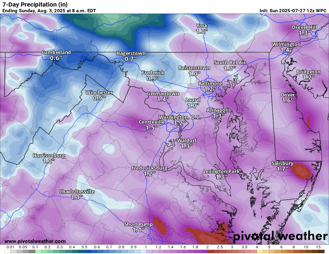
7/27/2025 –
🌡️ Steamy Sunday with Storm Chances
Another hot and humid day with highs in the low 90s, but feeling more like the low 100s thanks to the steamy air.
⛈️ Afternoon Storms Possible
Watch for scattered showers and thunderstorms mid-afternoon. Some storms could be locally heavy.
🌡️ Heat Builds This Week
Monday brings a slight chance of storms again, along with hot weather. However, the real heat builds for Tuesday and Wednesday, when highs soar into the upper 90s. Some spots may flirt with 100°F on Wednesday!
🌩️ Pattern Change Ahead
A front slides through Thursday, bringing storm chances and knocking temps down into the upper 80s.
😎 Taste of Fall This Weekend
Highs Friday in the upper 70s and maybe a shower! Friday night dips into the 50s, and highs hover near 80°F both Saturday and Sunday. This should stick around into the next week!
The forecast:
Today: Hi 91 🌦️60% Lo 73 🌧️30% – Partly sunny with scattered afternoon showers and storms
Monday: Hi 93 🌞 Lo 72 🌙 – 🥵Mostly sunny and hot
Tuesday: Hi 95 🌞 Lo 73 🌙 – 🥵Sunny and hot
Wednesday: Hi 97🥵 🌞 Lo 73 🌧️30% – 🌡️Mostly sunny and very hot, becoming mostly cloudy overnight with a slight chance of showers and storms
Thursday: Hi 86 🌦️70% Lo 66 🌧️60% – Cooler with partly sunny with showers and thunderstorms likely in the afternoon
Friday: Hi 78 🌦️30% Lo 60 ☁️30% – Partly sunny with a slight chance of showers, partly cloudy overnight with isolated showers
Saturday: Hi 80 🌞 Lo 59 🌙 – Mostly sunny and pleasant during the day, clear and cool at night
#loudoun #loudouncountyva #vawx #loudounweather #loudounva #virginiaweather
Please support Tree of Life Ministries, an important organization to me! https://www.tolministries.org
Facebook: https://facebook.com/loudounwx
Twitter: https://twitter.com/loudounwx
Instagram: https://www.instagram.com/loudounweather/
On the Web @ https://loudounweather.com
Please support Tree of Life Ministries, an important organization to me! https://www.tolministries.org
Facebook: https://facebook.com/loudounwx
Twitter: https://twitter.com/loudounwx
Instagram: https://www.instagram.com/loudounweather/
On the Web @ https://loudounweather.com