7/9/2025
Flood Watch and Slight Risk for Severe Storms today
⛈️ Hot, Steamy, and Stormy Today
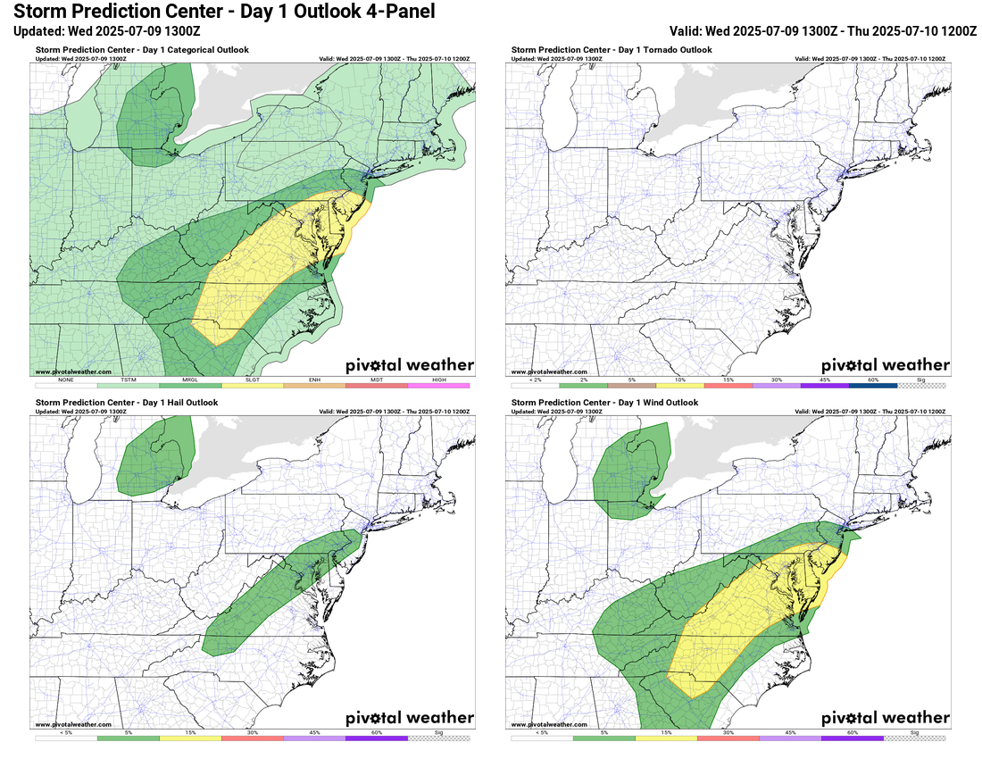
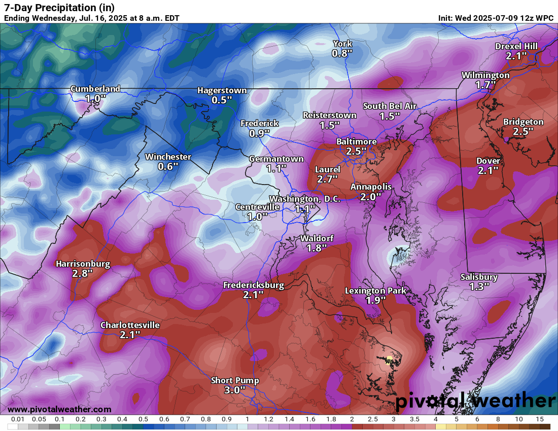
Another day with highs near 90°F and high humidity. Expect showers and thunderstorms to develop this afternoon and evening, which could be strong to severe, with gusty winds and isolated hail. A flood watch is up for heavy rainfall, with rates possibly exceeding 2 inches per hour.
🌡️ Muggy Pattern Continues
The very warm and humid weather sticks around, carrying a marginal risk for severe storms and the potential for locally heavy rainfall.
🌦️ Unsettled Into the Weekend
More storm chances linger into the weekend with hot and humid conditions.
🔥 Heat Surge Next Week
Looking ahead, the heat will rebound again next week. With high humidity still in place, it will feel quite oppressive. However, a potential cool-down could arrive mid to late month, so stay tuned!
The forecast:
Today: Hi 89 ⛈️60% Lo 69 🌧️60% – Partly sunny early, with showers and thunderstorms likely. Some could be severe with heavy rain.
Thursday: Hi 85 ⛈️70% Lo 70 🌧️60% – Mostly cloudy with storms likely
Friday: Hi 87 ⛈️60% Lo 70 🌧️60% – Partly sunny with showers and storms likely by afternoon; lingering storms into the night
Saturday: Hi 89 🌧️40% Lo 71 🌧️30% – Mostly sunny turning to scattered afternoon and evening storms
Sunday: Hi 89 🌧️50% Lo 69 🌧️40% – Partly sunny with showers and storms after 2 pm
Monday: Hi 87 🌧️50% Lo 69 🌧️30% – Mostly sunny with a chance of showers and storms
Tuesday: Hi 89 🌧️40% Lo 68 🌧️30% – Mostly sunny with a chance of showers and storms
#loudoun #loudouncountyva #vawx #loudounweather #loudounva #virginiaweather
Please support Tree of Life Ministries, an important organization to me! https://www.tolministries.org
Facebook: https://facebook.com/loudounwx
Twitter: https://twitter.com/loudounwx
Instagram: https://www.instagram.com/loudounweather/
On the Web @ https://loudounweather.com
Please support Tree of Life Ministries, an important organization to me! https://www.tolministries.org
Facebook: https://facebook.com/loudounwx
Twitter: https://twitter.com/loudounwx
Instagram: https://www.instagram.com/loudounweather/