6/7/2025 –
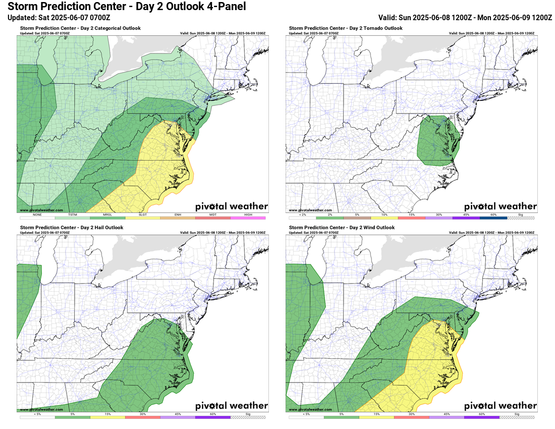
Sunday now falls under a Slight Risk for severe storms. All risks are on the table: damaging winds are the most likely risk, with a 5% hail risk and even a 2% tornado chance. Localized heavy rain is also possible.
Rain and storm chances linger Monday and Tuesday.
Wednesday brings sunshine and highs in the low 80s. By late week, we’re talking upper 80s and full summer vibes with dry, sunny skies.
The forecast
Today: Hi 81  40% Lo 62
  – Partly sunny with scattered afternoon showers and thunderstorms, becoming mostly cloudy overnight
Sunday: Hi 74  80% Lo 63
  80% – Scattered morning showers turning into thunderstorms by midday, continuing through the evening
Monday: Hi 81 40% Lo 64 70% – Partly sunny with a chance of afternoon showers and storms, becoming mostly cloudy with likely evening thunderstorms
Tuesday: Hi 81 50% Lo 59  – Partly sunny with scattered showers, clearing overnight
Wednesday: Hi 83  Lo 60 – Sunny and pleasant during the day, mostly clear at night
Thursday: Hi 88 Lo 65 – Sunny and warmer, remaining clear overnight
Friday: Hi 88  Lo 65 – Mostly sunny and continued warm, clear overnight
Please support Tree of Life Ministries, an important organization to me! https://www.tolministries.org
Facebook: https://facebook.com/loudounwx
Twitter: https://twitter.com/loudounwx
Instagram: https://www.instagram.com/loudounweather/
On the Web @ https://loudounweather.com
Please support Tree of Life Ministries, an important organization to me! https://www.tolministries.org
Facebook: https://facebook.com/loudounwx
Twitter: https://twitter.com/loudounwx
Instagram: https://www.instagram.com/loudounweather/
On the Web @ https://loudounweather.com