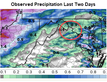
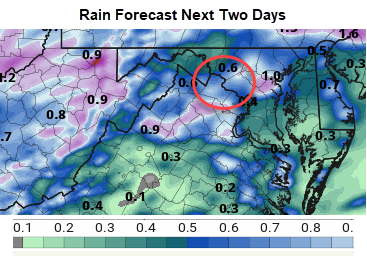
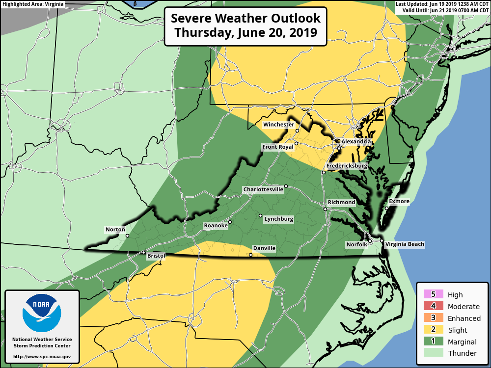
The coverage of rain should not be as great today for the region. Ironically, it has been very spotty in Loudoun the last several days so you may have not been as wet as many others have been around us! (See observed precip below) – More showers and storms expected today. High in the mid-80s. A Slight Risk for severe returns tomorrow.
...FLASH FLOOD WATCH IN EFFECT FROM 2 PM EDT THIS AFTERNOON
THROUGH THIS EVENING...

The National Weather Service in Sterling Virginia has issued a

* Flash Flood Watch for portions of Maryland, The District of
  Columbia, and northern Virginia, including the following
  areas, in Maryland, Anne Arundel, Carroll, Central and Eastern
  Allegany, Central and Southeast Howard, Central and Southeast
  Montgomery, Charles, Extreme Western Allegany, Frederick MD,
  Northern Baltimore, Northwest Harford, Northwest Howard,
  Northwest Montgomery, Prince Georges, Southeast Harford,
  Southern Baltimore, and Washington. The District of Columbia.
  In northern Virginia, Arlington/Falls Church/Alexandria,
  Eastern Loudoun, Fairfax, Northern Fauquier, Prince
  William/Manassas/Manassas Park, Southern Fauquier, Stafford,
  and Western Loudoun.

* From 2 PM EDT this afternoon through this evening

* Thunderstorms with heavy rainfall are expected to develop across
  the watch area this afternoon and linger into the evening.
  Localized rainfall totals of several inches are possible. This
  could lead to flash flooding, especially in the urban areas.

PRECAUTIONARY/PREPAREDNESS ACTIONS...

A Flash Flood Watch means that conditions may develop that lead
to flash flooding. Flash flooding is a very dangerous situation.

You should monitor later forecasts and be prepared to take action
should Flash Flood Warnings be issued.

&&
Today has a better chance of rain especially this afternoon. Flash Flood Watches are up from 2 pm to 11 pm. There is a marginal risk for severe weather today, but it is not like the last two days as storms will be slow movers with lower winds. The 80s for highs
🌦🌧⛈🌧 Today: Rain, Showers, Storms – 80s
🌦⛈🌧☁️ Tomorrow: Showers, Storms – 80s
🌦⛅️🌧⛈ Thursday: Showers, Storms, Potential Severe – Upper 80s
☀️☀️☀️☀️ Friday – Sunny with high near 80
☀️⛅️☀️⛅️ Saturday – Sunny – highs low 80s
☀️☀️⛅️🌦 Sunday – Increasing Clouds – More Humidity -MAYBE some showers – Highs in the 80s
Longer Range is showing a chance of sustained hotter weather for a bit. Rain chances should continue.